Note: Descriptions are shown in the official language in which they were submitted.
CA 02431152 2006-09-12
TITLE: WELL-BORE SENSOR APPARATUS AND METHOD
BACKGROUND OF INVENTION
1. Field of the Invention
[0001] The present invention relates generally to the discovery and production
of
hydrocarbons, and more particularly, to the monitoring of downhole formation
properties
during drilling and production.
2. Background Art
(0002] Wells for the production of hydrocarbons such as oil and natural gas
must be
carefully monitored to prevent catastrophic mishaps that are not only
potentially
dangerous but also that have severe environmental impacts. In general, the
control of the
production of oil and gas wells includes many competing issues and interests
including
economic efficiency, recapture of investment, safety and environmental
preservation.
[0003] On one hand, to drill and establish a working well at a drill site
involves
significant cost. Given that many "dry holes" are drilled, the wells that
produce
must pay for the exploration and digging costs for the dry holes and the
producing
wells. Accordingly, there is a strong desire to produce at a maximum rate to
recoup investment costs.
[0004] On the other hand, the production of a producing well must be monitored
and
controlled to maximize the production over time. Production levels depend on
reservoir
formation characteristics such as pressure, porosity, permeability,
temperature and
physical layout of the reservoir a.nd also the nature of the hydrocarbon (or
other material)
extracted .from the formation. Additional characteristics of a producing
formation must
also be considered, such characteristics include the hydrocarbon/water
interface, the
hydrocarbon/gas interface and/or oil-water interface, among others.
[0005] Producing hydrocarbons too quickly from one well in a producing
formation
relative to other wells in the producing fornlation (of a single reservoir)
may result in
stranding hydrocarbons in the formation. For example, improper production may
1
CA 02431152 2006-09-12
separate an oil pool into multiple portions. In such cases, additional wells
must be drilled
to produce the oil from the separate pools. Unfortunately, either legal
restrictions or
economic considerations may not allow another well to be dug thereby stranding
the pool
of oil and, economically wasting its potential for revenue.
[0006) Besides monitoring certain field and production parameters to prevent
economic
waste of an oilfield, an oilfield's production efficiencies may be maximized
by
monitoring the production parameters of multiple wells for a given field. For
example, if
field pressure is dropping for one well in an oil field more quickly than for
other wells,
the production rate of that one well might be reduced. Alternatively, the
production rate
of the other wells might be increased. The manner of controlling production
rates for
different wells for one field is generally known. At issue, however, is
obtaining the oil
field parameters while the well is being formed and also while it is
producing.
[0007) In general, control of production of oil wells is a significant concern
in the
petroleum industry due to the enormous expense involved. As drilling
techniques
become more sophisticated, monitoring and controlling production even from a
specified
zone or depth within a zone is an important part of modern production
processes.
[0008) Consequently, sophisticated computerized controllers have been
positioned at the
surface of production wells for control of uphole and downhole devices such as
motor
valves and hydro-mechanical safety valves. Typically, microprocessor
(localized)
control systems are used to control production from the zones of a well.- For
example,
these controllers are used to actuate sliding sleeves or packers by the
transmission of a
command from the surface to downhole electronics (e.g., microprocessor
controllers) or
even to electro-mechanical control devices placed downhole.
[0009) While it is recognized that producing wells will have increased
production
efficiencies and lower operating costs if surface computer based controllers
or downhole
microprocessor based controllers are used, their ability to control production
from wells
and from the zones served by multilateral wells is limited to the ability to
obtain a.nd to
assimilate the oilfield parameters. For example, there is a great need for
realtime oilf eld
la
CA 02431152 2003-06-05
parameters while an oil well is producing. Unfortunately, current systems for
reliably
providing realtime oilfield parameters during production are not readily
available.
[0010] Moreover, many prior art systems may require a surface platform at each
well for
monitoring and controlling the production at a well. The associated equipment,
however,
is expensive. The combined costs of the equipment and the surface platform
often
discourage oil field producers from installing a system to monitor and control
production
properly. Additionally, current technologies often fail to reliably producing
real time
data. Often, production of a well must be interrupted so that a tool may be
deployed into
the well to take the desired measurements. Accordingly, the data obtained is
expensive in
that it has high opportunity costs because of the cessation of production. It
also suffers
from the fact that the data is not true realtime data.
[0011 ] Some prior art systems measure the electrical resistivity of the
ground in a known
manner to estimate the characteristics of the reservoir. Because the
resistivity of
hydrocarbons is higher than water, the measured resistivity in various
locations can be of
assistance in mapping out the reservoir. For example, the resistivity of
hydrocarbons to
water may be about 100 to 1 because the formation wavter contains salt and,
generally, is
much more conductive.
[0012] Systems that map out reservoir parameters by measuring resistivity of
the
reservoir for a given location are not always reliable, however, because they
depend upon
the assumption that any present water has a salinity level that renders it
more conductive
that the hydrocarbons. In those situations where the salinity of the water is
law, systems
that measure resistivity are not as reliable indicators of hydrocarbons.
[0013] Some prior art systems for measuring resistivity include placing an
antenna within
the ground for generating relatively high power signals that are transmitted
through the
formation to antennas at the earth surface. The amount of the received current
serves to
provide an indication of ground resistivity and therefore a suggestion of the
formation
characteristics in the path formed from the transmitting to the receiving
antennas.
[0014] Other prior art systems include placing a sensor at the bottom of the
~~ell in which
the sensor is electrically connected through cabling to equipment on the
surface. For
2
CA 02431152 2003-06-05
example, a pressure sensor may be placed within the well at the bottom to
attempt to
measure reservoir pressure. One shortfall of this approach, however, is that
the sensor
does not read reservoir pressure that is unaffected by drilling equipment and
formations
since the sensor is placed within the well itself.
[0015] Other prior art systems include hardwired sensors placed next to or
within the
well casing in an attempt to reduce the effect that the well equipment has on
the reservoir
pressure. While such systems perhaps provide better pressure information than
those in
which the sensor is placed within the well itself, they may not provide
accurate pressure
information that is unaffected by the well or its equipment.
[0016] Alternatives to the above systems include sensors deployed temporarily
in a
wireline tool system. In some prior art systems, a wireline tool is lowered to
a specified
location (depth), secured, and deploys a probe into engagement with the
formation to
obtain samples from which formation parameters may be estimated. One problem
with
using such wireline tools, however, is that drilling and/or production must be
stopped
while the wireline tool is deployed and while samples are being taken or while
tests are
being performed. While such wireline tools provide valuable information,
significant
expense results from "tripping" the well, if during drilling, or stopping
production.
[0017] Various techniques have been developed to obtain information concerning
downhole conditions using sensors positioned about the well-bore. For example,
PCT
Application No. WO 02/06628 Al published on 24 January 2002 to Shultz et al.
(priority
based on U.S. Patent App. No. 09/617,212 filed on 17 July 2000) discloses
sensors
placed in cement slurry about the well-bore and inten-ogating the sensors.
U.S. Patent
No. 6,131,658 filed on March 1, 1999 by Minear discloses sensors on an
umbilical cable
attached to tubing. Australian Patent Application No. 200027759 Al published
on
October 26, 2000 to Schultz et al. (priority based on U.;;. Patent App. No.
09298725 filed
April 23, 1999) discloses sensor modules positioned within a formation or the
well
annulus and capable of sending signals to a well receiver.
3
CA 02431152 2003-06-05
[0018) Various techniques have also been developed for positioning plugs in
casing. For example, U.S. Patent No. 5,692,565 to lVIacl~ougall et al.
discloses a
device for plugging and resealing the perforation with a solid plug.
(0019] Despite these new techniques, there exists a need in the art for a well-
bore system
that efficiently senses downhole parameters and/or conditions so that
decisions can be
made concerning the drilling and production process so that such activities
may be
performed in a controlled manner that avoids waste of the hydrocarbon
resources or other
resources produced from it. It is further desirable for the system to be
capable of
deploying the sensors about the well-bore and/or plug perforations.
SUMMARY ~F TIDE INVENTIt~N
[0020] To overcome the shortcomings of the prior systems and their operations,
the present invention contemplates a system for ohtainin.g data from a
subsurface
formation penetrated by a well-bore. The system includes at least one sensor
plug
for sensing downhole parameters, the at least one sensor plug positionable
adjacent the sidewall of a well-bore. The system also includes a downhole tool
disposable in the well-bore, the downhole tool carrying the at least one
sensor plug
for deployment into the sidewall of the well-bore.
[0021] In some embodiments, the sensor plug is deplayed in to the sidewall of
an
openhole well-bore. In other embodiments, the sensor plug is deployed into the
sidewall of a cased well-bore. The downhole tool may optionally be utilized as
a
communication link between the sensor plug and the central control unit.
Alternatively, an antenna may be positioned adjacent the well-bore to act as
the
communication link between the sensor plug and the central control unit. The
downhole tool may also -be equipped to perform a variety of downhole functions
such as sampling, measuring and/or drilling operations.
4
CA 02431152 2005-12-15
79350-70
[0022] Because the sensor plugs are already deployed, the
downtime associated with gathering sensor plug information
via a wireline tool is minimized. Because the invention may
be implemented through MWD tool, there is no downtime
associated with gathering sensor plug information during
drilling. Accordingly, formation information may be
obtained more efficiently, and more frequently thereby
assisting in the efficient depletion of the reservoir.
[0023] In an embodiment of the described embodiment, a
system for obtaining downhole data from a subsurface
formation penetrated by a well-bore is provided. The system
comprises a downhole tool disposable in the well-bore, the
downhole tool carrying at least one sensor plug for
deployment into the sidewall of the well-bore, a surface
control unit and a communication link capable of operatively
coupling the at least one sensor plug to the surface control
unit for communication therewith. The sensor plug is
capable of sensing downhole parameters and filling a
perforation in the sidewall of the well-bore.
[0024] A central control center may be provided to
communicate with a plurality of well control units deployed
at each well for which sensor plugs have been deployed.
Some wells include a drilling tool that is in communication
with at least one sensor plug while other wells include a
wireline tool that is communication with at least one sensor
plug. Other wells include permanently installed downhole
electronics and antennas for communicating with the sensor
plugs. Each of the wells that have sensor plugs deployed
therein include circuitry for receiving formation data
received from the sensor plugs. In some embodiments, a well
control unit serves to transpond the formation data to the
central control unit. In other embodiments, an oilfield
service vehicle includes transceiver circuitry for
5
CA 02431152 2005-12-15
79350-70
transmitting the formation data to the central control
system. In an alternate embodiment, a surface unit, by way
of example, a well control unit merely stores the formation
data until the data is collected through a conventional
method.
[0025] Some of the methods for producing the format_Lon
data to the central control center for analysis include
conventional wireline links such as public switched
5a
CA 02431152 2003-06-05
telephone networks, computer data networks, celllular communication networks,
satellite based cellular communication networks, and other radio based
communication systems. Other methods include physical transportation of the
formation data in a stored medium.
[0026] The central control center receives the formation data and analyzes the
formation data for a plurality of wells to determine; depletion rates for each
of the
wells so that the field may be depleted in an economic and efficient manner.
In
the preferred embodiment, the central control center generates control
commands
to the well control units. Responsive thereto, the well control units modify
production according to the received control com:rnands. Additionally, the
well
control units, wherever installed, continue to periodically produce formation
data
to the central control center so that local depletion rates may be modified if
necessary.
[0027] The remote sensor plug is, in the preferred embodiment of the
invention, is
deployed into the sidewall of the well-bore. The internal circuitry of the
sensor
plug includes data acquisition circuitry, communication circuitry, control
circuitry
and a power supply. The data acquisition circuitry can include many different
types of sensors that are commonly used to acquire; formation data. For
example,
the data acquisition circuitry can include temperature sensors, pressure
sensors,
and resistivity sensors. The communication circuitry, in the preferred
embodiment, includes demodulation circuitry for demodulating received control
commands and modulation circuitry for modulating formation data. Additionally,
the communication circuitry includes an RF oscillator for producing a carrier
for
the formation data. Finally, the power supply includes circuitry to convert
received RF power to a direct current that is used to charge a capacitor or an
energy charge component such as a rechargeable battery. The capacitor, in
turn, is
used to provide power for the operation of the sensor plug..
6
CA 02431152 2005-12-15
79350-70
[0028] In another aspect, the present invention relates
to a method for obtaining downhole data from a well-bore and
its surrounding subterranean formation. The method
comprises positioning a downhole tool in a well-bore,
deploying at least one sensor plug from the downhole tool
into the sidewall of the well-bore, the sensor plug adapted
to fill a perforation in the sidewall of the well-bore,
collecting downhole data from the well-bore via the at least
one sensor plug and communicating the downhole data from the
at least one sensor plug uphole via a communication link.
The downhole tool contains at least one sensor plug adapted
for deployment.
[0029] In yet another aspect, the present invention
relates to a method for controlling downhole operations from
a surface control center. The method comprises positioning
a downhole tool in a well-bore, deploying at least one
sensor plug from the downhole tool into the sidewall of the
well-bore, collecting downhole data from the well-bore via
the at least one sensor plug, communicating the downhole
data from the at least one sensor plug uphole to a surface
control center via a communication link, making decisions
based on the downhole data and communicating commands to a
downhole tool via the communication link. The downhole tool
contains at least one sensor plug adapted for deployment.
[0030] Other aspects of the present invention will become
apparent with further reference to the drawings and
specification that follow.
BRIEF DESCRIPTION OF THE DRAWINGS
[0031] A better understanding of the present invention as
depicted in Figures 39-41B can be obtained when the
7
CA 02431152 2005-12-15
79350-70
following detailed description of the preferred embodiment
is considered with the following drawings, in which:
[0032] Figure 1 is a diagrammatic sectional side view of
a drilling rig, a well-bore made in the earth by the
drilling rig, and a plurality of remote sensing units that
have been deployed from the well-bore into various
formations of interest;
7a
CA 02431152 2003-06-05
[0033] Figure 2A is a diagrammatic sectional side view of a drilling rig, a
well-bore
made in the earth by the drilling rig, a remote sensing unit that has been
deployed from a
tool in the well-bore into a subsurface formation, and a drill string that
includes a
measurement while drilling tool having a downhole communication unit that
retrieves
subsurface formation data collected by the remote sensing unit;
[0034] Figure 2B is a diagrammatic sectional side view of a drilling rig, a
well-bore
made in the earth by the drilling rig, a remote sensing unit that has been
deployed from a
tool in the well-bore into a subsurface formation, and a wireline truck and
open-hole
wireline tool that includes a downhole communication unii that retrieves
subsurface
formation data collected by the remote sensing unit;
[0035] Figure 3A is a diagrammatic sectional side view of a well-bore made in
the earth
that has been cased, a remote sensing unit that has been deployed from a tool
in the well-
bore into a subsurface formation and a wireline truck and cased hole wireline
tool that
includes a downhole communication unit that retrieves subsurface formation
data
collected by the remote sensing unit;
[0036] Figure 3B is a diagrammatic sectional side view of a well-bore made in
the earth
that has been cased, a remote sensing unit that has been deployed from a tool
in the well-
bore into a subsurface formation and a retractable downhole communication unit
and well
control unit that operate in conjunction with the rem~te sensing unit to
retrieve data
collected by the remote sensing unit;
[0037] Figure 3C is a diagrammatic sectional side view of' a well-bore made in
the
earth that has been cased, a remote sensing unit that has been deployed from a
tool
in the well-bore into a subsurface formation and a permanently affixed
downhole
communication unit and well control unit that operate in conjunction with the
remote sensing unit to retrieve data collected by the remote sensing unit;
[0038] Figure 4 is a system diagram illustrating a plurality of installations
and a
data center used to receive and process data collected by remote sensing units
a
CA 02431152 2003-06-05
deployed at the plurality of installations, the system used to manage the
development and depletion of downhole formations that form a reservoir;
[0039] Figure 5 is a diagram of a drill collar positioned in a borehole and
equipped
with a downhole communication unit ;
[0040] Figure 6 is schematic illustration of the downhole communication unit
of a
drill collar that also has a hydraulically energized system for forcibly
inserting a
remote sensing unit from the borehole into a selected subsurface formati~n;
(0041] Figure 7 is a diagram schematically representing a drill collar having
a
downhole communication unit therein for receiving formation data signals from
a
remote sensing unit;
[0042] Figure 8 is an electronic block diagram schematically showing a remote
sensing unit which is positioned within a selected subsurface formation from
the
well bore being drilled and which senses one or more formation data parameters
such as pressure, temperature and rock permeability, places the data in
memory,
and, as instructed, transmits the stored data to a downhole communication
unit;
[0043] Figure 9 is an electronic block diagram schematically illustrating the
receiver coil circuit of a remote sensing unit;
[0044] Figure 10 is a transmission timing diagram showing pulse duration
modulation used in communications between a downhole communication unit and
a remote sensing unit;
[0045] Figure 11 is a sectional view of the subsurface formation after casing
has
been installed in the well-bore, with an antenna installed in an opening
through the
wall of the casing and cement layer in close proximity to the remote sensing
unit;
[0046] Figure 12 is a schematic of a wireline tool positioned within the
casing and
having upper and lower rotation tools and an intermediate antenna installation
tool;
g
CA 02431152 2005-12-15
79350-70
[0047] Figure 13 is a schematic of the lower rotation
tool taken along section line 13-13 in Figure 12;
[0048] Figure 14 is a lateral radiation profile taken at
a selected well-bore depth to contrast the gamma-ray
signature of a data sensor pip-tag with the subsurface
formation background gamma-ray signature;
[0049] Figure 15 is a sectional schematic of a tool for
creating a perforation in the casing and installing an
antenna in the perforation for communication with the remote
sensing unit;
[0050] Figure 15A is one of a pair of guide plates
utilized in the antenna installation tool for conveying a
flexible shaft that is used to perforate the casing;
[0051] Figure 16 is a flow chart of the operational
sequence for the tool shown in Figure 15;
[0052] Figure 17 is a sectional view of an alternative
tool for perforating casing;
[0053] Figs. 18A-18C are sequential sectional views
showing the installation of one embodiment of the antenna in
the casing perforation;
[0054] Figure 18D is a sectional view of a second
embodiment of the antenna installed in the casing
perforation;
[0055] Figure 19 is a detailed sectional view of the
lower portion of the antenna installation tool, particularly
the antenna magazine and installation mechanism for the
antenna embodiment shown in Figs. 18A-18C;
CA 02431152 2005-12-15
79350-70
[0056] Figure 20 is a schematic of the data receiver
positioned within the casing for communication with the
remote sensing unit via an antenna installed through the
perforation in the casing wall, and illustrates the
electrical and magnetic fields within a microwave cavity of
the data receiver;
[0057] Figure 21 is a plot of the data receiver resonant
frequency versus microwave cavity length;
10a
CA 02431152 2003-06-05
[0058] Figure 22 is a schematic of the data receiver communicating with the
remote sensing unit, and includes a block diagram of the data receiver
electronics;
[0059) Figure 23 is a block diagram of the remote sensing unit electronics;
[0060] Figure 24 is a functional block diagram of a downhole subsurface
formation remote sensing unit according to a preferred embodiment of the
invention;
[0061) Figure 25 is a functional diagram illustrating an antenna arrangement
to
according to a preferred embodiment of the invention;
[0062) Figure 26 is a functional diagram of a wireline tool including an
antenna
arrangement according to a preferred embodiment of the invention;
[0063] Figure 27 is a functional diagram of a logging tool and an integrally
formed
antenna within a well-bore according to one aspect of the described invention;
[0064] Figure 27A is a functional diagram of a logging tool and another
embodiment of an integrally formed antenna within a well-bore according to an
aspect of the described invention;
[0065) Figure 2~ is a functional diagram of a drill collar including an
integrally
formed antenna for communicating with a remote sensing unit;
[0066) Figure 29 is a functional diagram of a slotted casing section formed
between two standard casing portions for allowing transmissions between a
wireline tool and a remote sensing unit according to a preferred embodiment of
the
invention;
[0067) Figure 30 is a functional diagram of a casing section having a
communication module formed between two standard casing portions for
communicating with a remote sensing unit according to an alternate embodiment
of the invention;
11
CA 02431152 2003-06-05
[0068] Figure 31 is a frontal perspective view of a casing section having a
communication module formed between two standard casing portions for
communicating with a remote sensing unit according to an alternate embodiment
of the invention;
[0069] Figure 32 is a functional block diagr<~m illustrating a system far
transmitting superimposed power and communication signals to a remote sensing
unit and for receiving communication signals .from ~Nhe remote sensing unit
according to a preferred embodiment of the invention;
[0070] Figure 33 is a functional block diagram illustrating a system within a
remote sensing unit for receiving superimposed power and communication signals
and for transmitting communication signals according to a preferred embodiment
of the invention;
[0071] Figure 34 is a timing diagram that illustrates operation of the remote
sensing unit according to a preferred embodiment of the invention;
[0072] Figure 35 is a flow chart illustrating a method for communicating with
a
remote sensing unit according to a preferred embodiment of the inventive
method;
[0073] Figure 36 is a flow chart illustrating a method within a remote sensing
unit
for communicating with a downhole communication unit according to a preferred
embodiment of the inventive method;
[0074] Figure 37 is a functional block diagram illustrating a plurality of
oilfield
communication networks for controlling oilfield production; and
[0075) Figure 38 is a flow chart demonstrating a method of synchronizing two
communication networks to control oilfield production according to a preferred
embodiment of the invention.
[0076] Figure 39 is a diagrammatic sectional side view of a drilling rig, an
open hole
well-bore extending below the drilling rig, a downhole tool in the well-bore
and a
12
CA 02431152 2003-06-05
plurality of plugs that have been deployed from the well-bore into the
sidewall of the
well-bore in accordance with the present invention;
[0077] Figure 40A is a diagrammatic sectional side view of a drilling rig, a
cased well-
bore extending below the drilling rig, a downhole drilling tool in the well-
bore and a plug
that has been deployed from the well-bore into the sidewall of the cased well-
bore in
accordance with the present invention;
[0078] Figure 40B is a diagrammatic sectional side vif;w of a drilling rig, an
open hole
well-bore extending below the drilling rig, a downhole wireline tool in the
well-bore and
a plug that has been deployed from the well-bore into the sidewall of the well-
bore in
accordance with the present invention;
[0079] Figure 41A is a detailed view of the sensor plug of Figure 40A in
accordance
with the present invention; and
[0080] Figure 41B is a detailed view of the sensor plug of Figure 40B in
accordance
with the present invention.
DE'I'AIL.ED DE~CRIPTI(~N
[0081] Figure 1 is a diagrammatic sectional side view of a drilling rig 106, a
well-bore
104 made in the earth by the drilling rig 106, and a plurality of remote
sensing units 120,
124 and 128 that have been deployed from a tool in the well-bore 104 into
various
formations of interest, 122, 126 and 130, respectively. The well-bore 104 was
drilled by
the drilling rig 106 which includes a drilling rig superstructure 108 and
additional
components.
[0082] It is generally known in the art of drilling wells to use a drilling
rig 106 that
employs rotary drilling techniques to form a well-bore 104 in the earth 1 I2.
The drilling
rig superstructure 108 supports elevators used to lift the drill string,
temporarily stores
drilling pipe when it is removed from the hole, and is otherwise employed to
service the
well-bore 104 during drilling operations. Other structures also service the
drilling rig 106
13
CA 02431152 2003-06-05
and include covered storage 110 (e.g., a dog house), mud tanks, drill pipe
storage, and
various other facilities.
[0083] Drilling for the discovery and production of oil and gas may be onshore
(as
illustrated) or may be off shore ar otherwise upon water. When offshore
drilling is
performed, a platform or floating structure is used to service the drilling
rig. The present
invention applies equally as well to both onshore and off shore operations.
For simplicity
in description, onshore installations will be described.
[0084] When drilling operations commence, a casing 114 is set and attached to
the earth
I 12 in cementing operations. A blow-out-preventer stack 116 is mounted onto
the casing
114 and serves as a safety device to prevent formation pressure from
overcoming the
pressure exerted upon the formation by a drilling mud column. Within the well-
bore 104
below the casing 114 is an uncased portion of well-bone l04 that has been
drilled in the
earth 112 in the drilling operations. This encased portion of the well-bore or
borehole, or
a well-bore or borehole without any casing, is often referred to as "open-
hole."
[0085] In typical drilling operations, drilling commences from the earth's
surface to a
surface casing depth. Thereafter, the surface casing is set and drilling
continues to a next
depth where a second casing is set. The process is repeated until casing has
been set to a
desired depth. Figure 1 illustrates the structure of a well after one or more
casing strings
have been set and an open-hole segment of a well has been drilled and remains
encased.
[0086] Remote sensing units are deployed into formations of interest from the
well-bore
104. For example, remote sensing unit 120 is deployed into subsurface
formation 122,
remote sensing unit 124 is deployed into subsurface formatian 126 and remote
sensing
unit I28 is deployed into subsurface formation I30. The remote sensing units
I20, 124
and 128 measure properties of their respective subsurface formations. These
properties
include, for example, formation pressure, formation temperature, formation
porosity,
formation permeability and formation bulk resistivity, among other properties.
This
information enables reservoir engineers and geologists. to characterize and
quantify the
characteristics and properties of the subsurface formations 122, 126 and 130.
Upon
receipt, the formation data regarding the subsurface formation may be employed
in
14
CA 02431152 2005-12-15
79350-70
computer models and other calculations to adjust production
levels and to determine where additional wells should be
drilled.
[0087] As contrasted to other measurements that may be
made upon the formation using measurement while drilling
(MWD) tools, mud logging, seismic measurements, well
logging, formation samples, surface pressure and temperature
measurements and other prior techniques, the remote sensing
units 120, 124 and 128 remain in the subsurface formations.
The remote sensing units 120, 124 and 128 therefore may be
used to continually collect formation information not only
during drilling but also after completion of the well and
during production. Because the information collected is
current and accurately reflects formation conditions, it may
be used to better develop and deplete the reservoir in which
the remote sensing units are deployed.
[0088] As is discussed in detail in U.S. Patent 6,028,534
and U.S. Patent 6,070,662, the remote sensing units 120, 124
and 128 are preferably set during open-hole operations. In
one embodiment, the remote sensing units are deployed from a
drill string tool that forms part of the collars of the
drill string. In another embodiment, the remote sensing
units are deployed from an open-hole logging tool. For'
particular details to the manner in which the remote sensing
units are deployed.
[0089] Figure 2A is a diagrammatic sectional side view of
a drilling rig 106, a well-bore 104 made in the earth 112 by
the drilling rig 106, a remote sensing unit 204 that has
been deployed from a tool in the well-bore 104 into a
subsurface formation, and a drill string that includes a
measurement while drilling (MWD) tool 208 that operates in
conjunction with the remote sensing unit 204 to retrieve
CA 02431152 2005-12-15
79350-70
data collected by the remote sensing unit 204. Those
elements illustrated in Figure 2A that have numbering
consistent with Figure 1 are the same elements and will not
be described further with reference to Figure 2A (or
subsequent Figures). These elements are also used later in
Figures 39, 40A and 40B.
[0090] The MWD tool 208 forms a portion of the drill
string that also includes drill pipe 212. MWD tools 208 are
generally known in the art to collect data during drilling
15a
CA 02431152 2003-06-05
operations. The MWD tool 208 shown forms a portion of a drill collar that
resides
adjacent the drill 216. As is known, the drill bit erodes the formation to
form the well-
bore 104. Drilling mud circulates down through the center of the drill string,
exits the
drill string through nozzles or openings in the bit, and returns up through
the annulus
along the sides of the drill string to remove the eroded f~rmation pieces.
[0091) The MWD tool 208 is preferably used to deploy the remote sensing unit
204 into
the subsurface formation. For this embodiment, the MWD tool 208 includes both
a
deployment structure and a downhole communication unit. The down-hole
communication unit communicates with the remote sensing unit 204 and provides
power
to the remote sensing unit 204 during such communications, in a manner
discussed
further below. The MWD tool 208 also includes an uphole interface 220 that
communicates with the down-hole communication unit. The uphole interface 220,
in the
described embodiment, is coupled to a satellite dish 224 that enables
communication
between the MWD tool 208 and a remote site. The MWD tool 208 also preferably
communicates with a remote site via a radio interface, a telephone interface,
a cellular
telephone interface or a combination of these so that data captured by the MWD
tool 208
will be available at a remote location.
[0092) As will be further described herein, the remote sensing units may be
constructed
to be solely battery powered, or may be constructed to be remotely powered
from a
down-hole communication unit in the well-bore, or to have a combination of
both (as in
the described embodiments). Because no physical connection exists between the
remote
sensing unit 204 and the MWD tool 208, however,, an electromagnetic (e.g.,
Radio
Frequency "RF") link is established between the MWD tool 208 and the remote
sensing
unit 204 for the purpose of communicating with the remote sensing unit. In
some
embodiments, an electromagnetic link also is established to provide power to
the remote
sensing unit. In a typical operation, the coupling of an electromagnetic
signal having a
frequency of between 1 and 10 Megahertz will most ef:ficientKy allow the MWD
tool 208
(or another downhole communication unit) to communicate with, and to provide
power to
the remote sensing unit 204.
16
CA 02431152 2003-06-05
[0093] With the remote sensing unit 204 lacated in a :>ubsurface formation
adjacent the
well-bore 104, the MWD tool 208 is located in close proximity to the remote
sensing unit
204. Then, power-up and/or communication operations are begun. When the remote
sensing unit 204 is not battery powered or the battery is at least partially
depleted, power
from the MWD tool 208 that is electromagnetically coupled to the remote
sensing unit
204 is used to power up the remote sensing unit 204. More specifically, the
remote
sensing unit 204 receives the power, charges a capacitor that will serve as
its power
source and commences power-up operations. Once the remote sensing Unit 204 has
received a specified or sufficient amount of power, it performs self
calibration operations
and then makes formation measurements. These formation measurements are
recorded
and then communicated back to the MWD tool 208 via the electromagnetic
coupling.
[0094) Figure 2B is a diagrammatic sectional side view of a drilling rig 106
including a
drilling rig superstructure 108, a well-bore 104 made in the earth 112 by the
drilling rig
106, a remote sensing unit 204 that has been deployed. from a tool in the well-
bore 104
into a subsurface formation, and a wireline truck 252 anal open-hole wireline
tool 256 that
operate in conjunction with the remote sensing unit 204 to retrieve data
collected by the
remote sensing unit 204.
(0095] As is generally known, wireline operations are often performed during
the drilling
of wells to collect information regarding formations penetrated by well-bore
204. In such
wireline operations, a wireline truck 252 couples to a wireline tool 256 via
an armored
cable 260 that includes a conduit for conducting communication signals and
power
signals. Armored cable 260 serves both to physically couple the wireline tool
256 to the
wireline truck 252 and to allow electronics contained withirs the wireline
truck 252 to
communicate with the wireline tool 256.
[0096] Measurements takers during wireline operations include formation
resistivity (or
conductivity) logs, natural radiation logs, electrical potential logs, density
logs (gamma
ray and neutron), micro-resistivity logs, electromagnetic propagation logs,
diameter logs,
formation tests, formation sampling and other measurements. The data collected
in these
wireline operations may be coupled to a remote location via an antenna 254
that employs
RF communications (e.g., two-way radio, cellular communications, etc.)
m
CA 02431152 2003-06-05
[0097) The remote sensing unit 204 may be deployed from the wireline tool 256.
Further, after deployment, data may be retrieved from the remote sensing unit
204 via the
wireline tool 256. In such embodiments, the wireline tool 2S6 is constructed
so that it
couples electro-magnetically with the remote sensing unit 204.. In such case,
the wireline
tool 256 is lowered into the well-bore 104 until it is proximate to the remote
sensing unit
204. The remote sensing unit 204 will typically have a radioactive signature
that allows
the wireline tool 2S6 to sense its location in the well-bore 104.
[0098] With remote sensing unit 204 located within well-bore 104, wireline
tool 2S6 is
placed adjacent remote sensing unit 204. Then, power-up and/or communication
operations proceed. When remote sensing unit 204 is not battery powered or the
battery
is at least partially depleted, power from wireline tool 2S6 is
electromagnetically
transmitted to remote sensing unit 204. Remote sensing unit 204 receives the
power,
charges a capacitor that will serve as its power source and commences power-up
operations. When remote sensing unit 204 has been powered, it performs self
calibration
operations and then makes subsurface formation measurements.
[0099] The subsurface formation measurements are stored and then transmitted
to
wireline tool 256. Wireline tool 256 transmits this data back to wireline
truck 2S2 via
armored cable 260. The data may be stored for future use or it may be
immediately
transmitted to a remote location for use.
[00100] FIGS. 3A, 3B and 3C illustrate three different techniques for
retrieving data from
remote sensing units after the well-bore has been cased. The casing is formed
of
conductive metal, which effectively blocks electromagnetic radiation. Because
communications with the remote sensing unit are accomplished using
electromagnetic
radiation, modifications to casing must be made so that the electromagnetic
radiation may
be transmitted from within the casing to the region approximate the remote
sensing unit
outside of the casing. Alternately, an external communication device may be
placed
between the casing and the well-bore that communicates with the remote sensing
unit. In
such case, the device must be placed into its location when the casing is set.
is
CA 02431152 2003-06-05
[00101] Figure 3A is a diagrammatic sectional side view of a well-bore made in
the earth
that has been cased, a wireline truck 302 for operating wirehne tools, a
remote sensing
unit 304 that has been deployed from a tool in the well.-bore into a
subsurface formation
and a cased hole wireline tool 308. Wireline truck 302 and wireline tool 308
operate in
conjunction with remote sensing unit 304 to retrieve data collected by remote
sensing
unit 304.
[00102] Once the well has been fully drilled, casing 312 is set in place and
cemented to
the formation. A production stack 316 is attached to the top of casing 312,
the well is
perforated in at least one producing zone and production commences. The
production of
the well is monitored (as are other wells in the reservoir) to manage
depletion of the
reservoir.
[00103] During drilling of the well, or during subsequent open-hole wireline
operations,
the remote sensing unit 304 is deployed into a subsurface formation that
becomes a
producing zone. Thus, the properties of this formation are of interest
throughout the life
of the well and also throughout the life of the reservoir. By monitoring the
properties of
the producing zone at the location of the well and the properties of the
producing zone in
other wells within the field, production may be managed so that the reservoir
is more
efficiently depleted.
(00104] As illustrated in Figure 3A, wireline operations are employed to
retrieve data
from the remote sensing unit 304 during the production of t:he well. In such
case, the
wireline truck 302 couples to the wireline tool 308 via an armored cable 260.
A crane
truck 320 is required to support a shieve wheel 324 for the armored cable 260.
The
wireline tool 308 is lowered into the casing 312 through a production stack
that seals in
the pressure of the well. The wireline tool 308 is then lowered into the
casing 312 until it
resides proximate to the remote sensing unit 304.
[00I05] When the casing 312 is set, special casing sections are set adjacent
the remote
sensing unit 304. As will be described further with reference to Figures 29,
30 and 31,
one embodiment of this special casing includes windows formed of a material
that passes
electromagnetic radiation. In another embodiment oiP this special casing, the
casing is
19
CA 02431152 2003-06-05
fully formed of a material that passes electromagnetic radiation. In either
case, the
material may be a fiberglass, a ceramic, an epoxy, or another type of material
that has
sufficient strength and durability to form a portion of the casing 312 but
that will permit
the passage of electromagnetic radiation.
(00I06] Referring back to FIG. 3A, with the wireline tool 308 in place near
remote
sensing unit 304, powering and/or communication operations commence to allow
formation properties to be measured and recorded. This information is
collected by
equipment within wireline truck 302 and may be relayed to a remote location
via the
antenna 328.
[00107] Figure 3B is a diagrammatic sectional side vievr of a well-bore made
in the earth
that has been cased, a remote sensing unit 304 that has been deployed from a
tool in the
well-bore into a subsurface formation and a downhole communication unit 354
and well
control unit 358 that operate in conjunction with remote sensing unit 304 to
retrieve data
collected by remote sensing unit 304. The well control unit: 358 may also
control the
production levels from the subsurface formation. In this operation, a special
casing is
employed that allows downhole communication unit :354 to communicate with
remote
sensing unit 304.
(00108] As compared to the wireline operations, however, downhole
communication unit
354 remains downhole within the casing 312 for a long period of time (e.g.,
time between
maintenance operations or while the data being collected is of value in
reservoir
management). Communication coupling and physical coupling to downhole
communication unit 354 is performed via an armored cable 362. The well control
unit
358 communicatively couples to the downhole communication unit 354 to collect
and
store data. This data may then be relayed to a remote location via antenna 360
over a
supported wireless Iink.
[00109) Figure 3C is a diagrammatic sectional side view of a well-bore made in
the earth
that has been cased, a remote sensing unit 304 that has been deployed from a
tool in the
well-bore into a subsurface formation and a permanently affixed downhole
communication unit 370 and well control unit 374 that operate in conjunction
with the
CA 02431152 2003-06-05
remote sensing unit 304 to retrieve data collected by the remote sensing unit
304. As
compared to the installations of Figure 3A and. 3B, however, the downhole
communication unit 370 is mounted external to the casiing 312. Thus, the
casing may be
of standard construction, e.g., metal, since it is not required to pass
electromagnetic
radiation. The downhole communication unit 370 couples to a well control unit
374 via a
well-bore communication link 378, described further below. The well control
unit 374
collects the data and may relay the data to a remote location via antenna 382
and a
supported wireless link. Additionally, communication link 378 is, in the
described
embodiment, formed to be able to conduct high power signals for transmitting
high
power electromagnetic signals to the remote sensing uni.~t 304.
[00110] Figure 4 is a system diagram illustrating a plurality of installations
deployed and a
data (central control) center 402 used to receive and process data collected
by remote
sensing units 304 deployed at the plurality of installations, the system used
to manage the
development and depletion of downhole formations (reservoirs). The
installations may
be installed and monitored using the various techniques previously described,
or others in
which a remote sensing unit is placed in a subsurface formation and at least
periodically
interrogated to receive formation measurements.
[00111] For example, installations 406, 410 and 414 are shown to reside in
producing
wells. In such installations 406, 410 and 414, data is at least periodically
measured and
collected for use at the central control center 402. In contrast,
installations 416 and 418
are shown to be at newly drilled wells that have not yet been cased.
(00112] In the management of a large reservoir, literally hundreds of
installations may be
used to monitor formation properties across the reservoir. Thus, while some
wells are
within a range that allows the use of ordinary RF equipment for uploading
remote sensing
unit 404 data, other wells are a great distance away. Satellite based
installation 418
illustrates such a well where a satellite dish is required to upload data from
remote
sensing unit 404 to satellite 422. Additionally, central control center 402
also includes a
satellite dish 424 for downloading remote sensing unit 402 data from satellite
422.
21
CA 02431152 2003-06-05
[00113] Data that is collected from the installations 406-418 may be relayed
to the central
control center 402 via wireless links, via wired links and via physical
delivery of the data.
To support wireless links, the central control center 402 includes an RF tower
426, as
well as the satellite dish 424, for communicating with the installations. RF
tower 426
may employ antennas for any known communication networl~ fox transceiving data
and
control commands including any of the cellular communication systems (AMPS,
TDMA,
CDMA, etc.) or RF communications.
[00114] Central control center 402 includes circuitry for transceiving data
and control
commands to and from the installations 406-418. Additionally, central control
center 402
also includes processing equipment for storing and analyzing the subsurface
formation
property measurements collected at the installations by the remote sensing
units 404.
This data may be used as input to computer programs that model the reservoir.
Other
inputs to the computer programs may include seismic data, well logs (from
wireline
operations), and production data, among other inputs. With the additional data
input, the
computer programs may more accurately model the reservoir.
[00115] Accurate computer modeling of the reservoir, that is made possible by
accurate
and real time remote sensing unit 404 data in conjunction with a reservoir
management
system as described herein, allow field operators to manage the reservoir more
effectively
so that it may be depleted efficiently thereby providing a better return on
investment. For
example, by using the more accurate computer models to manage production
levels of
existing wells, to determine the placement of new wells, to control water
flooding and
other production events, the reservoir may be more fully depleted of its
valuable oil and
gas.
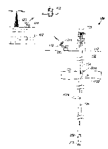
[00116] Referring now to Figures 5-7, a drill collar being a component of a
drill string for
drilling a well bore is shown generally at 510 and represents one aspect of
the invention.
The drill collar is provided with an instrumentation section 512 having a
power cartridge
514 incorporating the transmitter/receiver circuitry of Figure 7. The drill
collar 510 is
also provided with a pressure gauge 516 having its pressure remote sensing
unit 518
exposed to borehole pressure via a drill collar passage 520. The pressure
gauge 516
senses ambient pressure at a depth of a selected subsurface formation and is
used to
22
CA 02431152 2005-12-15
79350-70
verify pressure calibration of remote sensing units.
Electronic signals representing ambient well bore pressure
are transmitted via the pressure gauge 516 to the circuitry
of the power cartridge 514 which, in turn, accomplishes
pressure calibration of the remote sensing unit being
deployed at that particular well bore depth. The drill
collar 510 is also provided with one or more remote sensing
unit receptacles 522 each containing a remote sensing unit
524 for positioning within a selected subsurface formation
which is intercepted by the well bore being drilled.
[00117] The remote sensing units 524 are encapsulated
"intelligent" remote sensing units which are moved from the
drill collar to a position in the formation surrounding the
borehole for sensing formation parameters such as pressure,
temperature, rock permeability, porosity, conductivity and
dielectric constant, among others. The remote sensing units
524 are appropriately encapsulated in a remote sensing unit
housing of sufficient structural integrity to withstand
damage during movement from the drill collar into laterally
embedded relation with the subsurface formation surrounding
the well bore. By way of example, the remote sensing units
are partially formed of a tungsten-nickel-iron alloy with a
zirconium end plate. The zirconium end plate specifically
is formed of a non-metallic material so that electromagnetic
signals may be transmitted through it. U.S. Patent
6,234,257 fully describes the mechanical aspects of the
remote sensing units 524.
[00118] Those skilled in the art will appreciate that such
lateral imbedding movement need not be perpendicular to the
borehole, but may be accomplished through numerous angles of
attack into the desired formation position. Remote sensing
unit deployment can be achieved by utilizing one or a
combination of the following: (1) drilling into the
23
CA 02431152 2005-12-15
79350-70
borehole wall and placing the remote sensing unit into the
formation; (2) punching/pressing the encapsulated remote
sensing unit into the formation with a hydraulic press or
mechanical penetration assembly; or (3) shooting the
encapsulated remote sensing units into the formation by
utilizing propellant charges.
[00119] As shown in Figure 6, a hydraulically energized
ram 530 is employed to deploy the remote sensing unit 524
and to cause its penetration into the subsurface formation
to a
23a
CA 02431152 2003-06-05
sufficient position outwardly from the borehole that it senses selected
parameters of the
formation. For remote sensing unit 524 deployment, the drill collar is
provided with an
internal cylindrical bore 526 within which is positioned a piston element 528
having a
ram 530 that is disposed in driving relation with the encapsulated remote
intelligent
remote sensing unit 524. The piston 528 is exposed to hydraulic pressure that
is
communicated to piston chamber 532 from a hydraulic system 534 via a hydraulic
supply
passage 536. The hydraulic system is selectively activated by the power
cartridge 514 so
that the remote sensing unit can be calibrated with respect to ambient
borehole pressure at
formation depth, as described above, and can then be moved from the receptacle
522 into
the formation beyond the borehole wall so that the formation pressure
parameters will be
free from borehole effects.
[00120] Referring now to Figure 7, the power cartridge 514 of the drill collar
510
incorporates at least one transmitter/receiver coil 538 having a transmitter
power drive
540 in a form of a power amplifier having its frequency F determined by
oscillator 542.
The drill collar instrumentation section is also provided with a tuned
receiver amplifier
543 that is set to receive signals at a frequency 2F which will be transmitted
to the
instrumentation section of the drill collar by the remote sensing unit 524 as
will be
explained herein below.
[00121] With reference to Figure 8,the electronic circuil:ry of tlh.e remote
sensing unit 524
is shown by block diagram generally at 844 and includes at least one
transmitter/receiver
coil 846, or RF antenna, with the receiver thereof providing an output 850
from a detector
848 to a controller circuit 852. The controller circuit is provided with one
of its
controlling outputs 854 being fed to a pressure gauge 856 so that gauge output
signals
will be conducted to an analog-to-digital converter ("ADC")/memory 858, which
receives
signals from the pressure gauge via a conductor 862 and also receives controls
signals
from the controller circuit 8S2 via a conductor 864.
[00122] A battery 866 also is provided within the remote sensing unit
circuitry 844 and is
coupled with the various circuitry components of the remote sensing unit by
power
conductors 868, 870 and 872. While the described embodiment of Figure 8
illustrates
only a battery as a power supply, other embodiments of the invention include
circuitry for
24
CA 02431152 2003-06-05
receiving and converting RF power to DC power to charge a charge storage
device such
as a capacitor. A memory output 874 of the ADC/memory circuit 858 is fed to a
receiver
coil control circuit 876. The receiver coil control circuit 876 functions as a
driver circuit
via conductor 878 for the transmitter/receiver coil 846 t:o transmit data to
instrumentation
section 512 of drill collar 510.
[00123] Referring now to Figure 9, a low threshold diode 980 is connected
across the Rx
coil control circuit 976. lJnder normal conditions, and especially in the
dormant or
"sleep" mode, the electronic switch 982 is open, minimizing xaower
consumption. When
the receiver coil control circuit 976 is activated by the drill collar's
transmitted
electromagnetic field, a voltage and a current is induced in the receiver coil
control
circuit. At this point, however, the diode 980 will allow the current the flow
only in one
direction. This non-linearity changes the fundamental frequency F of the
induced current
shown at 1084 in Figure 10 into a current having the fundamental frequency 2F,
i.e.,
twice the frequency of the electromagnetic wave 1084 as shown at 1086.
[00124] Throughout the complete transmission sequence, the
tr,~nsmitter/receiver coil 538,
shown in Figure 7, is also used as a receiver and is connected to a receiver
amplifier 543
which is tuned at the 2F frequency. When the amplitude of the received signal
is at a
maximum, the remote sensing unit 524 is located iin close proximity for
optimum
transmission between drill collar and remote sensing unit.
[00125] Assuming that the remote sensing unit 524 is in place inside the
formation to be
monitored, the sequence in which the tr°ansmission and the acquisition
electronics
function in conjunction with drilling operations is as follows:
[00126] The drill collar with its acquisition sensors is pcssitioned in close
proximity of the
remote sensing unit 524. An electromagnetic wave having a frequency F, as
shown at
1084 in Figure 10, is transmitted from the drill collar transmitter/receiver
coil 538 to
"switch on" the remote sensing unit, also referred to as the target, and to
induce the
remote sensing unit to send back an identifying coded signal. The
electromagnetic wave
initiates the remote sensing unit's electronics to go into the acquisition and
transmission
mode, and pressure data and other data representing s~clected formation
parameters, as
CA 02431152 2003-06-05
well as the remote sensing unit's identification codes, are obtained at the
remote sensing
unit's level. The presence of the target, i.e., the remol:e sensing unit, is
detected by the
reflected wave scattered back from the target at a frequency of 2F as shown at
1086 in the
transmission timing diagram of Figure 10. At the same time, pressure gauge
data
(pressure and temperature) and other selected formation parameters are
acquired and the
electronics of the remote sensing unit converts the data into one or more
serial digital
signals. This digital signal or signals, as the case may be, is transmitted
from the remote
sensing unit back to the drill collar via the transmitter/rf;ceiver coil 846.
This is achieved
by synchronizing and coding each individual bit of data into a specific time
sequence
during which the scattered frequency will be switched between F and 2F. Data
acquisition and transmission is terminated after stable pressure and
temperature readings
have been obtained and successfully transmitted to the on-board circuitry of
the drill
collar 510.
[00127) Whenever the sequence above is initiated, the transmitter/receiver
coil 538
located within the instrumentation section of the drill collar is powered by
the transmitter
power drive or amplifier 540. And electromagnetic wave is transmitted from the
drill
collar at a frequency F determined by the oscillator 542, a.s indicated in the
timing
diagram of Figure 10 at 1084. The frequency F can be selected within the range
100 kHz
up to 500 MHz. As soon as the target comes within the zone: of influence of
the collar
transmitter, the receiver coil 846 located within the remote sensing unit will
radiate back
an electromagnetic wave at twice the original frequency by means of the
receiver coil
control circuit 876 and the transmitter/receiver coil 846.
[00128] In contrast to present-day operations, pressure data and other
formation
parameters can be made available while drilling, and, as such, allows well
drilling
personnel to make decisions concerning drilling mud weight and composition as
well as
other parameters at a much earlier time in the drilling process without
necessitating the
tripping of the drill string for the purpose of running a formation tester
instrument. This
requires very little time to gather the formation data measurements. Once a
remote
sensing unit 524 is deployed, data can be obtained while drilling, a feature
that is not
possible according to known well drilling techniques.
26
CA 02431152 2003-06-05
[00129] Time dependent pressure monitoring of penetrated well bore formations
can also
be achieved as long as pressured data from the pressure sensor 518 is
available. This
feature is dependent of course on the communication link between the
transmitter/receiver circuitry within the power cartriidge of the drill collar
and any
deployed intelligent remote sensing units 524.
[00130] The remote sensing unit output can also be read vc~ith wireline
logging tools
during standard logging operations. This feature of tl:~e invention permits
varying data
conditions of the subsurface formation to be acquired by the electronics of
logging tools
in addition to the real time formation data that is now obtainable while
drilling.
[00131] By positioning be intelligent remote sensing units 524 beyond the
immediate
borehole environment, at least in the initial data acquisition period there
will be very little
borehole effects on the noticeable pressure measurements that are taken. As
extremely
small liquid movement is necessary to obtain formation pressures with in-situ
sensors, it
will be possible to measure formation pressure in fluid bearing non-permeable
formations. Those skilled in the art will appreciate thavt this system is
equally adaptable
for measurements of several formation parameters, such as permeability,
conductivity,
dielectric constant, rocks strength, and others, and is not limited to
formation pressured
measurement.
[00132] As indicated previously, deployment of a desired number of such remote
sensing
units 524 occurs at various well-bore depths as det~;,rmined by the desired
level of
formation data. As long as the well-bore remains open, or uncased, the
deployed remote
sensing units may communicate directly with the drill collar, sonde, or
wireline tool
containing a data receiver, also described in the '466 application, to
transmit data
indicative of formation parameters to a memory module on the data receiver for
temporary storage or directly to the surface via the data :receiver.
[00133] At some point during the completion of the well, the well-bore is
completely
cased and, typically, the casing is cemented in place. From this point, normal
communication with deployed remote sensing units 524. that lie in formation
506 beyond
the well-bore is no longer possible. Thus, communication must be reestablished
with the
27
CA 02431152 2003-06-05
deployed remote sensing units through the casing wall, and cement layer, if
the latter is
present, that line the well-bore.
[00134] Furthermore, it is contemplated that the remote sensing units, once
deployed, may
provide a source of formation data for a substantial period of time. For this
purpose, it is
necessary that the positions of the respective remote sensing units be
identifiable. Thus,
in one embodiment, the remote sensing units will contain radioactive "pip-
tags" that are
identifiable by a gamma ray sensing tool or sonde together with a gyroscopic
device in a
tool string that enhances the location and individual spatial identification
of each
deployed remote sensing unit in the formation.
(00135] Referring again to Figure 5, the present invention relates to the
drilling of a well-
bore WB with a drill string DS having drill collar S 12 and drill bit 508. The
drill collar
includes a plurality of intelligent remote sensing units 524 which are carried
thereon for
insertion into the well-bore during drilling operations. As described further
below,
remote sensing units 524 have electronic instrumentation and circuitry
integrated therein
for sensing selected formation parameters, and electrordic circuitry for
receiving selected
command signals and providing data output signals representing the sense
formation
parameters.
[00136] Each remote sensing unit 524 is adapted for ~deploytnent from its
retracted or
stowed position within receptacle 522 on drill collar '_~ 12 to a remote
position within a
selected subsurface formation 506 intersected by well-bore WB to sense and
transmit
data signals representative of various parameters, such as formation pressure,
temperature, and permeability, of the formation of interest. Thus, when drill
collar 512 is
positioned by drill string DS at a desired location relative to subsurface
formation 506,
remote sensing unit 524 is moved to a deployed position within subsurface
formation 506
outwardly of well-bore WB under the force of a propellant or a hydraulic ram,
on other
equivalent force originating at the drill collar and acting on the remote
sensing unit. Such
forced movement is described in detail in U.S. Patent Application No.
09/019,466 in the
context of a drill collar having a deployment system, which application is
included herein
in its entirety for all purposes.
28
CA 02431152 2003-06-05
00137 With reference now to Figure 11, communication is reestablished by
creating an
opening 1122 in casing wall 1124 and cement layer 1126, and then installing
and sealing
antenna 1128 in opening 1122 in the casing wall. Howc;ver, for optimum
communication
in this described embodiment, antenna 1128 should be positioned in a location
near or
proximate the deployed remote sensing unit 524. To enable effective
electromagnetic
communication, it is preferred that the antenna be positioned within 10-15 cm
of the
respective remote sensing unit 524 or sensors in the formation. Thus, the
location of the
remote sensing units 524 relative to the cased well-bore must be identified.
[00138] Identification of Remote sensing unit Location
[00139] To permit the location of the remote sensing units 524 to be
identified, the remote
sensing units 524 are equipped with a radiation source for transmitting
respective
identifying signature signals. More specifically, the remote sensing units 524
are
equipped with a gamma-ray pip-tag 1121 for transmitting a pip-tag signature
signal. The
pip-tag is a small strip of paper-like material that is saturated with a
radioactive solution
and positioned within remote sensing unit 524, so as to radiate gamma rays.
[00140] The location of each remote sensing unit is then identified through a
two-step
process. First, the depth of the remote sensing unit is determined using a
gamma-ray open
hole log, which is created for the well-bore after the deployment of remote
sensing units
524, and the known pip-tag signature signal of the remote sensing unit. 'The
remote
sensing unit will be identifiable on the open-hole log because the radioactive
emission of
pip-tag 1121 will cause the local ambient gamma-ray background to be increased
in the
region of the remote sensing unit. Thus, background gamma-rays will be
distinctive on
the log at the remote sensing unit location, compared to the formation zones
above and
below the remote sensing unit. This will help to identify the vertical depth
and position of
the remote sensing unit.
[00141] The azimuth of the remote sensing unit relative to the well-bore is
determined
using a gamma-ray detector and the remote sensing unit's pip-tag signature
signal. The
azimuth is determined using a collimated gamma-ray detector, as described
further below
in the context of a mufti-functional wireline tool.
29
CA 02431152 2003-06-05
[00142] Antenna 1128 is preferably installed and sealed in opening 1122 in the
casing
using a wireline tool. The wireline tool, generally referred to as 1230 in
Figs. 12 and 13,
is a complex apparatus which performs a number of i:unctions, and includes
upper and
lower rotation tools 1234 and 1236 and an intermediavte antenna installation
tool 1238.
Those skilled in the art will appreciate that tool 1230 could equally be
effective for at
least some of its intended purposes as a drill string sub or tool, even though
its
description herein is limited to a wireline tool embodiment.
[00143] Wireline tool 1230 is lowered on a wireline or cable 1231, the length
of which
determines the depth of tool 1230 in the well-bore. Depth gauges may be used
to measure
displacement of the cable over a support mechanism, such as a sheave wheel,
and thus
indicate the depth of the wireline tool in a manner that is well known in the
art. In this
manner, wireline tool 1230 is positioned at the depth of remote sensing unit
524. The
depth of wireline tool 1230 may also be measured by electrical, nuclear, or
other sensors
that correlate depth to previous measurements made in the wek.l-bore or to the
well casing
length.
[00144] Cable 1231 also provides cable strands for communicating with control
and
processing equipment positioned at the surface via circuitry carried in the
cable. In the
described embodiment, the cable strands of cable 1231 comprise metallic
wiring. Any
known medium for conducting communication sign<~ls to underground equipment is
specifically included herein.
[00145] The wireline tool further includes the upper avd lower rotation tools
1234 and
1236 for rotating wireline tool 1230 to the identified a.~imuth., after having
been lowered
to the proper remote sensing unit depth as determined from the first step of
the remote
sensing unit location identification process. One embodLiment of a simple
rotation tool, as
illustrated by lower rotation tool 1236 in Figs. 12 and 1.3, includes
cylindrical body 1340
with a set of two coplanar drive wheels 1342 and 1344 extending through one
side of the
body. The drive wheels are pressed against the casing by actuating hydraulic
back-up
piston 1346 in a conventional manner. Thus, extension of hydraulic piston 1346
causes
pressing wheel 1348 to contact the inner casing wall. Because casing 1124 is
cemented in
well-bore WB, and thus fixed to formation 506, continued extension of piston
1346 after
CA 02431152 2003-06-05
pressing wheel 1348 has contacted the inner casing wall forces drive wheels
1342 and
1344 against the inner casing wall opposite the pressing wheel.
[00146] The two drive wheels of each rotation tool arcs driven, respectively?
via a gear
train, such as gears 1345a and 1345b, by electric servo motor 1250. Primary
gear 1345a
is connected to the motor output shaft for rotation therewith. The rotating
force is
transmitted to drive wheels 1342, 1344 via secondary gears 1345b, and friction
between
the drive wheels and the inner casing wall induces wireline tool 1230 to
rotate as drive
wheels 1342 and 1344 "crawl" about the inner wall of casing 1224. This driving
action is
performed by both the upper and lower rotation tools 1234 and 1236 to enable
rotation of
the entire wireline tool assembly 1230 within casing 1124 about the
longitudinal axis of
the casing.
[00147] Antenna installation tool 1238 includes circuit..°y for
identifying the azimuth of
remote sensing unit 524 relative to well-bore WB in the forrr~ of collimated
gamma-ray
detector 1332, thereby providing for the second step oj~ the remote sensing
unit location
identification process. As indicated previously, collimated gamma-ray detector
1332 is
useful for detecting the radiation signature of anything; placed in its zone
of detection.
The collimated gamma-ray detector, which is well known i.n the drilling
industry, is
equipped with shielding material positioned about a thallium-activated sodium
iodide
crystal except for a small open area at the detector window. 'The open area is
accurate,
and is narrowly defined for precise identification of the :remote sensing unit
azimuth.
[0014] Thus, a rotation of 3~b0 degrees by wireline tool 1230, under the
output torque of
motor 1250, within casing 1124 reveals a lateral radiation pattern at any
particular depth
where the wireline tool, or more particularly the collimated gamma-ray
detector, is
positioned. By positioning the gamma-ray detector at the depth of remote
sensing unit
524, the lateral radiation pattern will include the rf;mote sensing unit's
gamma-ray
signature against a measured baseline. The measured baseline is related to the
amount of
detected gamma-rays corresponding to the respective local formation
background. The
pip-tag of each remote sensing unit 524 will give a strong signal on top of
this baseline
and identify the azimuth at which the remote sensing ~znit is located, as
represented in
31
CA 02431152 2003-06-05
Figure 14. In this manner, antenna installation tool 1238 can be
"pointed°' very closely to
the remote sensing unit of interest.
OOlj 491 Further operation of tool 1230 is highlighted by the flow chart
sequence of Figure
16, as will now be described. At this point, wireline tool 1230 is positioned
at the proper
depth and oriented to the proper azimuth and is properly placed for drilling
or otherwise
creating lateral opening 1122 through casing 1124 and cement layer 1126
proximate the
identified remote sensing unit 524 (step 1600). For this purpose, this system
utilizes a
modified version of the formation sampling tool descrihed in ~U.S. Patent No.
5,692,565,
also assigned to the assignee of the present invention.
[00150] Casing Perforation and Antenna Installation
[00151] Figure 15 shows one embodiment of perforating; tool 1238 for creating
the lateral
opening in casing 1124 and installing an antenna therein. Tool 1238 is
positioned within
wireline tool 1230 between upper and lower rotation tools 1234 and 1236 and
has a
cylindrical body 1517 enclosing inner housing 1514 and associated components.
Anchor
pistons 1515 are hydraulically actuated in a conventional manner to force
inflatable tool
packer 1517b against the inner wall of casing 1124, fornning a pressure-tight
seal between
antenna installation tool 1238 and casing 1124 and stabilizing tool 1230 (step
1601 of
Figure 16).
[00152] Figure 12 illustrates, schematically, an alternative to packer 1517b,
in the form of
hydraulic packer assembly 1241, which includes a sealing pad on a support
plate movable
by hydraulic pistons into sealed engagement with casing 1124. Those skilled in
the art
will appreciate that other equivalent means are equally auited for creating a
scat between
antenna installation tool 1238 and the casing about the area to be perforated.
[00153] Referring back to Figure 15, inner housing 1514 is supported for
movement
within body 1517 along the axis of the body by housing translation piston
1516, as will
be described further below. Housing 1514 contains three subsystems for
perforating the
casing, for testing the pressure seal at the casing and for installing an
antenna in the
perforation as will be explained in greater detail below. The movement of
inner housing
32
CA 02431152 2003-06-05
1514 via translation piston 1516 positions the components of each of inner
housing°s the
three subsystems over the sealed casing perforation.
[00154] The first subsystem of inner housing 1514 includes flexible shaft 1518
conveyed
through mating guide plates 1542, one of which is shown in Figure 15A. Drill
bit 1519 is
rotated via flexible shaft 1518 by drive motor 1520, which is held by motor
bracket 1521.
Motor bracket 1521 is attached to translation motor 1522 by way of threaded
shaft 1523
which engages nut 1521 a connected to motor bracket 1:521. Tlms, translation
motor 1522
rotates threaded shaft 1523 to move drive motor 1520 up and down relative to
inner
housing 1514 and casing 1224. Downward movement of drive motor 1520 applies a
downward force on flexible shaft 1518, increasing the penetration rate of bit
1519
through casing 1124. J-shaped conduit 1543 formed in guide plates 1542
translates the
downward force applied to shaft 1518 into a lateral force at bit 1519, and
also prevents
shaft 1518 from buckling under the thrust load it applies to the bit.
[00155] As the bit penetrates the casing, it makes a clean, uniform
perforation that is much
preferred to that obtainable with shaped charges. The drilling operation is
represented by
step 1603 in Figure 16. After the casing perforation has been drilled, drill
bit 1519 is
withdrawn by reversing the direction of translation motor 1522. It is
understood, of
course, that prior to the drilling step that packer setting piston 1524b is
actuated to force
packer 1517c against the inner wall of housing 1517, forming a sealed
passageway
between the casing perforation and flowline 1524 (step 1602).
[00156] Figure 17 shows an alternative device for drilling a perforation in
the casing,
including a right angle gearbox 1730 which translates torque provided by
jointed drive
shaft 1732 into torque at drill bit 1731. Thrust is applied to bit 1731 by a
hydraulic piston
(not shown) energized by fluid delivered through flowline 1733. The hydraulic
piston is
actuated in a conventional manner to move gearbox 1730 in the direction of bit
1731 via
support member 1734 which is adapted for sliding movement along channel 1735.
Once
the casing perforation is completed, gearbox 1730 and bit 1731 are withdrawn
from the
perforation using the hydraulic piston.
33
CA 02431152 2003-06-05
[00157) The second subsystem of inner housing 1514 relates to the testing of
the pressure
seal at the casing. For this purpose, housing translation piston 1516 is
energized from
surface control equipment via circuitry passing through cable 1231 to shift
inner housing
1514 upwardly so as to move packer 1517c about th.e opening in housing 1517.
The
formation pressure can then be measured in a conventional manner, and a fluid
sample
can be obtained if so desired (step 1604). Once the proper measurements and
samples
have been taken, piston 224b is withdrawn to retract packer 217c (step 1605).
[00158] Housing translation piston 1516 is then actuated to shift inner
housing 1514
upwardly even further to align antenna magazine 1.526 in position over the
casing
perforation (step 1606). Antenna setting piston 1525 is then actuated t~ force
one
antenna 1128 from magazine 1526 into the casing perforation. The sequence of
setting
the antenna is shown more particularly in Figs. 18A-18t:, and 19.
[00159) With reference first to FIGS. 18A-18C, antenna 1128 includes two
secondary
components designed for full assembly within the casing perforation: tubular
socket 1876
and tapered body 1877. Tubular socket 1876 is formed of an elastomeric
material
designed to withstand the harsh environment of the well-bore., and contains a
cylindrical
opening through the trailing end thereof and a small-diameter tapered opening
through
the leading end thereof. The tubular socket is also provided with a trailing
lip 1878 for
limiting the extent of travel by the antenna into the casing perforation, and
an
intermediate rib 1879 between grooved regions for assisting in creating a
pressure tight
seal at the perforation.
[00160] Figure 19 shows a detailed section of the antenna setting assembly
adjacent to
antenna magazine 1526. Setting piston 1525 includes outer piston 1971 and
inner piston
1980. Setting the antenna in the casing perforation is a l:wo-stage process.
Initially during
the setting process, both pistons 1971 and 1980 are actuated to move across
cavity 1981
and press one antenna 1128 into the casing perforation. This action causes
both tapered
antenna body 1877, which is already partially inserted into the opening at the
trailing end
of tubular socket 1876 within magazine 1526, and tubular socket 1876 to move
towards
casing perforation 1822 as indicated in Figure 18A. When trailing lip 1878
engages the
inner wall of casing 1824, as shown in Figure 18B, outer piston 1971 stops,
but the
34
CA 02431152 2003-06-05
continued application of hydraulic pressure upon the pi;>ton assembly causes
inner piston
1980 to overcome the force of spring assembly 1982 and advance through the
cylindrical
opening at the trailing end of tubular socket 1876. In this manner, tapered
body 1877 is
fully inserted into tubular socket 1876, as shown in Figure 18C.
[00161] Tapered antenna body 1877 is equipped with elongated antenna pin
1877a,
tapered insulating sleeve 1877b, and outer insulating layer 1877c, as shown in
Figure
18C. Antenna pin 1877a extends beyond the width of casing perforation 1822 on
each
end of the pin to receive data signals from remote sensing unit 524 and
communicate the
signals to a data receiver ;positioned in the well-bore, as described in
detail below.
Insulating sleeve 1877b is tapered near the leading end of the antenna pin to
form an
interference wedge-like fit within the tapered opening a1; the leading end of
tubular socket
1876, thereby providing a pressure-tight seal at the antenna/perforation
interface.
[00162] Magazine 1526, as shown in Figures 15 and 19, stores multiple antennas
1128 and
feeds the antennas during the installation process. After one antenna 1128 is
installed in a
casing perforation, piston assembly 1525 is fully retracted and another
antenna is forced
upwardly by spring 1986 of pusher assembly 1983. In this manner, a plurality
of antennas
can be installed in casing 1824.
[00163] An alternative antenna structure is shown in Figure 18D. In this
embodiment,
antenna pin 1812 is permanently set in insulating sleeve 1814, which in turn
is
permanently set in setting cone 1816. Insulating sleeve 1814 is cylindrical in
shape, and
setting cone 1816 has a conical outer surface and a cylindrical bore therein
sized for
receiving the outer diameter of sleeve 1814. Setting slecwe 181.8 has a
conical inner bore
therein that is sized to receive the outer conical surface of setting cone
1816, and the
outer surface of sleeve 1818 is slightly tapered so as to facilitate its
insertion into casing
perforation 1822. By the application of opposing forces to cone 1816 and
sleeve 1818, a
metal-to-metal interference fit is achieved to seal antenna assembly 1810 in
perforation
1822. The application of force via opposing hydraulically actuated pistons in
the
direction of the arrows shown in Figure 18D will force the outer surface of
sleeve 1818 to
expand and the inner surface of cone 1816 to contract, resulting in a metal-to-
metal seal
at perforation or opening 1122 for the antenna assembly.,
CA 02431152 2003-06-05
001[ 641 The integrity of the installed antenna, whether it be the
configuration of FIGS.
18A-18C, the configuration of Figure 18D, or some other equally adaptable
configuration, can be tested by again shifting inner housing 1514 with
translation piston
1516 so as to move measurement packer I517c over the lateral opening in
housing 1517
and resetting the packer with piston 1524b, as indicated at step 1608 in
Figure 16.
Pressure through flowline 1524 can then be monitored for leaks, as indicated
at step
1609, using a drawdown piston or the like to reduce: the flowline pressure.
Where a
drawdown piston is used, a leak will be indicated by the rise of flowline
pressure above
the drawdown pressure after the drawdown piston is deactivated. Once pressure
testing is
complete, anchor pistons 1515 are retracted to release tool 12;38 and wireline
tool 1230
from the casing wall, as indicated at step 1610. At this point, tool 1230 can
be
repositioned in the casing for the installation of other antennas, or removed
from the
well-bore.
[00165] Data Receiver
[00166] Referring now to FIG. 20, after antenna 1128 is installed and properly
sealed in
place, a wireline tool containing data receiver 2060 is inserted into the
cased well-bore
for communicating with remote sensing unit 524 via antenna 1128. Data receiver
2060
includes transmitting and receiving circuitry for transmitting command signals
via
antenna 1128 to remote sensing unit 524 and receiving formation data signals
via the
antenna from the remote sensing unit 524.
[00167] More particularly, communication between data receiver 2060 inside
casing 1124
and remote sensing unit 524 located outside the casing is; achieved in a
preferred
embodiment via two small loop antennas 2014a and 2014b. T'he antennas ara
imbedded
in antenna assembly 1128 that has been placed inside opening 1122 by antenna
installation tool 1238. A plane formed by first antenna loop 2014a is
positioned parallel
to a longitudinal axis of the casing and produces a magnetic dipole that is
perpendicular
to the longitudinal axis of the casing. The second antenna loop 2014b is
positioned to
produce a magnetic dipole that is perpendicular to the longitudinal axis of
the casing as
well as the magnetic dipole produced by the first antenna loop 2014a.
Consequently, first
36
CA 02431152 2003-06-05
antenna 2014a is sensitive to electromagnetic fields perpendicular to the
casing axis and
second antenna 2014b is sensitive to magnetic fields parallel to the axis of
the casing.
[00168] Remote sensing unit 524, contains in a preferred embodiment, two
similar loop
antennas 2015a and 2015b therein. The loop antennas have the same relative
orientation
to one another as loop antennas 2014a and 2014b. However, loop antennas 2015a
and
2015b are connected in series, as indicated in Figure 20, so that the
combination of these
two antennas is sensitive to both directions of the electromagnetic field
radiated by loop
antennas 2014a and 2014b.
(00169] The data receiver in the tool inside the casing utilizes a microwave
cavity 2062
having a window 2064 adapted for close positioning against the inner face of
casing wall
2024. The radius of curvature of the cavity is identical or very close to the
casing inner
radius so that a large portion of the window surface area is in contact with
the inner
casing wall. The casing effectively closes microwave cavity 2062, except for
drilled
opening 1122 against which the front of window 2064 is positioned. Such
positioning can
be achieved through the use of components similar to those described above in
regard to
wireline tool 1230, such as the rotation tools, gamma-ray detector, and anchor
pistons.
(No further description of such data receiver positioning will be provided
herein.)
Through the alignment of window 2064 with perforation 1122, energy such as
microwave energy can be radiated in and out via the antenna through the
opening in the
casing, providing a means for two-way communication between sensing microwave
cavity 2062 and the remote sensing unit antennas 2015a and 2015b.
[00170] Communication from the microwave cavity is provided at one frequency F
corresponding to one specific resonant mode, while communication from the
remote
sensing unit is achieved at twice the frequency, or :?F. Dimensions of the
cavity are
chosen to have resonant frequencies close to 1F and 2F. Those skilled in the
art can
appreciate to formation of cavities to have such specified resonant frequency
characteristics. Relevant electrical fields 2066, 2068 and magnetic fields
2070, 2062 are
illustrated in Figure 20 to help visualize the cavity field patterns. In a
preferred
embodiment, cylindrical cavity 2062 has a radius of 5 cm and a vertical
extension of
approximately 30 cm. A cylindrical coordinate system is used to represent any
physical
37
CA 02431152 2003-06-05
location inside the cavity . The electromagnetic (EM) field excited inside the
cavity has
an electric field with components EZ, EP, and E~ and a magnetic field with
components
HZ, HP and H~.
(00171] In transmitting mode, cavity 2062 is excited by microwave energy fed
from the
transmitter oscillator 2074 and power amplifier 2076 tl:~rough connection
2078, a coaxial
line connected to a small electrical dipole located a1: the top of cavity 2062
of data
receiver 2060. In a receiving mode, microwave energy excited in cavity 2062 at
a
frequency 2F is sensed by the vertical magnetic dipole 2080 connected to a
receiver
amplifier 2082 tuned at 2F.
[00172] It is a well known fact that microwave cavities have two fundamental
modes of
resonance. The first one is called transverse magnetic or '°TM" ( Hz =
0), and the second
mode is called transverse electric or "TE" in short (Ez = 0). These two modes
are
therefore orthogonal and can be distinguished not only by frequency
discrimination but
also by the physical orientation of an electric or magnetic dipole located
inside the cavity
to either excite or detect them, a feature that is used to separate signals
excited at
frequency F from signals excited at 2F.
[00173] At resonance, the cavity displays a high Q, or dampening loss effect,
when the
frequency of the EM field inside the cavity is close to the resonant
frequency, and a very
low Q when the frequency of the EM field inside the cavity is different from
the resonant
frequency of the cavity, providing additional amplification of each mode and
isolation
between different modes.
(00174] Mathematical expressions for the electrical (E) and magnetic (H) field
components of the TM and TE modes are given by the :Following terms:
For TM Modes
EZ = ~,";2/R2 Jn(~,n;/R p) cos (nc~) cos (m~z/L)
Ep = -m~ ~,"; / LR J"' (7~";/R p) cos (n~) sin (m~z/L)
E~ = nm~t/Lp J" (~,n;/R p) sin (n~) sin (m~tz/L )
HZ = 0
38
CA 02431152 2003-06-05
HP = jnk/ p ( c/~) n2 J" (~,n;/R p) sin (n~) cos (m~z/L)
H~ _ -jnk ~,,,;/ R( s/p.) I~2 Jn' (fin; /R p) cos (n~) cos (m~z/L )
with resonant frequency fTMn;m = c/2 ( (~n;/~R) 2 + (m / L) 2 ) v2
and TE Modes
EZ=0
EP = -jnk / p ( p/E) 1~2 J" (o.";/R p) sin (n~) sin (m~ziL)
E~= jk ~"; / R ( ~/s) 1z J"' (cr";/R p) cos (n~) sin (m;~z/L )
HZ = 6";2/R2 J" (a";/R p) cos (n~) sin (m~z/L)
HP = m~ a"; / LR Jp' (a";/R p) cos (n~) cos (m~cz/L)
H~ _ -nm~/Lp J" (~ni/R p) sin (n~) cos (mxz/L )
with resonant frequency
fTEn;m = cl2 ( (an;/~tR) Z + (m / L) Z ) vz
where
Q coefficient of dampening;
n, m integers that characterize the infinite series of resonant frequencies
for azimuthal (~) and
vertical (z) components;
T root order of the equation;
c speed of light in vacuum
p,, s magnetic and dielectric property of the medium inside the cavity
f frequency
w 2rcf
Ic wave number = ( caps + ic~p,s)'~2
R, L radius and length of cavity
Jn Bessel function of order n
J"' 8J" / 8 p
7v,,,; root of Jn (7~,";) = 0
6"; root of J"'(a";) = 0
[00175] Dimensions of the cavity (R and L) have been chosen such that
fTEp~m = c/2 ( (~ni/~cR) 2 + (m / L) 2 ) a2 _ 2 fTM"~m = c ( (~.r~;/~R) Z + (m
/ L) Z ) na
One of the solution for f~"im is to select the TM mode corresponding to n=0,
i=1, m=0 and ~,ol
= 2.40483 which corresponds to the lowest TM frequency mode. 'This selection
produces the
39
CA 02431152 2003-06-05
following results:
Ez = ~01z~2 JO(~Oi~ P)
EP=0
E~=0
HZ=0
HP=O
H~ _ -jk 701 I R ( s/~) liz Jo~(~ol~ P)
with fT;~olo = c/2 ~ot/~R
[00176] One solution for FTFn~m is to select the TE mode corresponding to n =
2, i
= 1, m = 1 and Gzl = 3.0542. This selection is orthogonal to the TMO10 mode
selection
above, and produces a frequency for the TE mode that is twice the TMO10
.frequency.
The following results are produced by this TE mode selection:
EZ=0
EP = -j2k/ p ( ~/E) l~z Jz(6211R p) sin (2~) sin (nz/L)
E~= jk ~zl / R ( ~/s) lz Jz,(~21/R p) cos (2~) sin (nz/L ) (12)
HZ = azlz/Rz Jz {6zW p) cos (2c~) sin (~z/L) (13)
HP = ~c azl / LR Jz' (crzl/R p) cos (2c~) cos (~z/L)
H~ _ -2~/Lp Jz (~zl/R p) sin (2~) cos (~z/L
Wlth fTE211 = C/2 { {621/7LR) z + (1 / L) Z ) 1/2
(00177] The TM mode can be excited either by a vertical electric dipole {Ez)
or a
horizontal magnetic dipole (vertical loop H~), while 'the TE mode can be
excited by a
vertical magnetic dipole (horizontal loop Hz).
[00178] In Figure 21, 2FTM010 ~d FTE211 ~e plotted as a function of cavity
length L for a
cavity radius R = 5 cm. For L=28 cm, the 'TE mode resonates at twice the TM
mode, and
given the cavity dimensions, the following resonant frequencies are
determined:
(00179] F-rMOlo = 494 MHz and FTFnzI l = g88 MHz.
(00I80] Those of ordinary skill in the related art given the benefit of this
disclosure will
appreciate that with change in cavity shape, dimensions and filling material,
the exact
values of the resonant frequencies may differ from those stated above. It
should also be
CA 02431152 2003-06-05
understood that the two modes described earlier are just one possible set of
resonant
modes and that there is, in principle, an infinite set one might choose from.
In any case,
the preferable frequency range for this invention falls in the 100 MHz to 10
GHz range.
It should also be understood that the frequency range could be extended
outside this
preferred range.
[00181) It is also well known that a cavity can be excited by proper placement
of an
electrical dipole, magnetic dipole, an aperture (i.e., an insulated slot on a
conductive
surface) or a combination of these inside the cavity or on the outer surface
of the cavity.
For instance, coupling loop antennas 2014a and 20141b could be replaced by
electrical
dipoles or by a simple aperture. The remote sensing unit loop antennas could
also be
replaced by a single or combination of electrical and/or ;magnetic dipoles)
and/or
aperture(s).
[00182] Figure 22 shows a schematic, including a block diagram of the data
receiver
electronics. As stated above, tunable microwave oscillator 2074 operates at
frequency F
to drive microwave power amplifier 2076 connected to electrical dipole 2078
located
near the center of one side of data receiver 2060. The dipole is aligned with
the z axis to
provide maximum coupling to the E~ component of motile TMO10 (equation (1)
below (EZ
is a maximum for p = 0.))
[00183] In order to determine if oscillator frequency F is tuned to the TMO10
resonant
frequency of cavity 2062, horizontal magnetic dipole 2288, a small vertical
Loop sensitive
to H~TMIOI (equation. (2) below), is connected through a coaxial cable to
switch 2281 and,
via switch 2281, to a microwave receiver amplifier 2290 tuned at F. The
frequency F is
adjusted until a maximum signal is received in tuned receiver 2290 by means of
feedback.
EZTMOIO = ~zoi / Rz3 (~aip~) (1)
HTMOIO = Jk~.oi / R (E/~)'iz Jo~(~olP/R) (2)
F = c~,ol / 2~R (2)
HzTEZi I = azzl / Rz Jz (6z~ p/R) sin(2~) cos(~z/L) (4)
41
CA 02431152 2003-06-05
2F = c/2 ((~2~p~)2 + (1/1_,)2)2
[00184] It should be clear from the previous description that with change in
cavity shape,
dimensions and filling material, the exact values of the resonant frequencies
may differ
from those stated above. It should be also understood that the two modes
described
earlier are just one possible set of resonant modes and that there is in
principle an infinite
set one might choose from. In any case the preferable :frequency range for
this invention
would fall in the 100 MHz to 10 CiHz. It should also be understood that the
frequency
range could be extended outside this preferred range.
[00185] Finally it is well known that a cavity can be excited by proper
placement of
electrical, magnetic dipole and aperture or a combination of these inside the
cavity or on
its outer surface. For instance coupling antennas (lay) and (1b) could be
replaced by
electrical dipoles or by a simple aperture. T he remote sensing: unit antenna
could also be
replaced by a single or combination of electrical awd/or magnetic dipoles)
and/or
aperture(s).
[00186] Those of ordinary skill in the related art given the benefit of this
disclosure will
appreciate that with change in cavity shape, dimensions and filling material,
the exact
values of the resonant frequencies may differ from those stated above. It
should also be
understood that the two modes described earlier are ,just one possible set of
resonant
modes and that there is, in principle, an infinite set one might choose from.
In any case,
the preferable frequency range for this invention falls in the 100 MHz to L 0
GHz range.
It should also be understood that the frequency range could be extended
outside this
preferred range.
[00187) It is also well known that a cavity can be excited by proper placement
of an
electrical dipole, magnetic dipole, an aperture (i.e., an insux:ated slot on a
conductive
surface) or a combination of these inside the cavity or on the outer surface
of the cavity.
For instance, coupling loop antennas 2014a and 2014b could be replaced by
electrical
dipoles or by a simple aperture. The remote sensing unit loop antennas could
also be
42
CA 02431152 2003-06-05
replaced by a single or combination of electrical and/or magnetic dipoles)
and/or
aperture(s).
[0018$] In order to tune the cavity to TE211 mode frequency 2F, a 2F tuning
signal is
generated in tuner circuit 2284 by rectifying a signal at frequency F coming
from
oscillator 2274 through switch 2285 by means of a diode similar to diode 2019
used with
remote sensing unit 524. The output of tuner 2284 is coupled through a coaxial
cable to
a vertical magnetic dipole, a small horizontal loop sensitive to Hz of TE211
{equation (4)
above), to excite the TE2I 1 mode at frequency 2F. A similar horizontal
magnetic dipole
is created by a small horizontal loop also sensitive to Hz of TE211 (equation
(4) ), that is
connected to a microwave receiver circuit 2282 tuned at 2F. The output of
receiver 2282
is connected to motor control 2292 which drives an electrical motor 2294
moving a
piston 2296 in order to change the length I, of the caviity, in a manner that
is known for
tunable microwave cavities, until a maximum signal is received. It will be
apparent to
those of ordinary skill in the art that a single loop antenna could replace
the pair of loop
antennas connected to both circuits 2282 and 2284.
001 89] Once both TM frequency F and TE frequency 2F are tuned, the
measurement
cycle can begin, assuming that the window 2264 of cavity 2262 has been
positioned in
the direction of remote sensing unit 524 and that antenna 1128 containing loop
antennas
2014a and 2014b, or other equivalent means of communication, has been properly
installed in casing opening 1122. Maximum coupling can be achieved for the
TE211
mode if remote sensing unit 524 is positioned such that antenna 1128 is
approximately
level with the vertical center' of microwave cavity 2262. In this regard, it
should be noted
that H~TMOio is independent of z, but HzT~zl l is at a maximum for z = L/2.
[00190] Formation Data Measurement and Acquisition
[00191] With continuing reference to Figure 22, the formation data measurement
and
acquisition sequence is initiated by exciting microwave energy into cavity
2262 using
oscillator 2074, power amplifier 2076 and the electric dipole located near the
center of
the cavity. The microwave energy is coupied to the remote sensing unit loop
antennas
2215a and 2215b through coupling loop antennas 2214a and 2214b in the antenna
43
CA 02431152 2003-06-05
assembly of remote sensing unit 524. In this fashion, microwave energy is
beamed
outside the casing at the frequency F determined by the oscillator frequency
and shown
on the timing diagram of Figure 34 at 3410. The frequency F can be selected
within the
range of 100 MHz up to 10 GHz, as described above.
[00192] As soon as remote sensing unit 524 is energized by the transmitted
microwave
energy, the receiver loop antennas 2215a and 2215b located inside the remote
sensing
unit radiate back an electromagnetic wave at 2F or twice the original
frequency, as
indicated at 1086 in Figure 10. A low threshold diode ;219 is connected across
the loop
antennas 2215a and 2215b. Under normal conditions, and especially in "sleep"
mode,
electronic switch 2217 is open to minimize power consumption. When Ioop
antennas
2215a and 2215b become activated by the transmitted electromagnetic microwave
field, a
voltage is induced into loop antennas 2215a and 2215b and as a result a
current flows
through the antennas. However, diode 2219 only allows current to flow in one
direction.
This non-linearity eliminates induced current at fundamental frequency F and
generates a
current with the fundamental frequency of 2F. During; this time, the microwave
cavity
2262 is also used as a receiver and is connected to receiver amplifier 2282
that is tuned at
2F.
[00193] More specifically, and with reference now to Fi~;tzre 23, when a
signal is detected
by the remote sensing unit detector circuit 2300 tuned at 2F which exceeds a
fixed
threshold, remote sensing unit 524 goes from a sleep state to an active state.
Its
electronics are switched into acquisition and transmission mode and controller
2302 is
triggered. Following the command of controller 2302, pressure information
detected by
pressure gage 2304, or other information detected by su~.itable detectors, is
converted into
a digital form and is stored by the analog-to-digital converter (ADC) memory
circuit
2306. Controller 2302 then triggers the transmission sequence by converting
the pressure
gage digital information into a serial digital signal inducing the switching
on and off of
switch 2317 by means of a receiver coil control circuit 2308.
[00194] Referring again to Figure 10, various schemes fir data transmission
are possible.
For illustration purposes, a Pulse Width Modulation Transmission scheme is
shown in
Figure 10. A transmission sequence starts by sending a synchronization pattern
through
44
CA 02431152 2003-06-05
the switching off and on of switch 2317 during a predetermined time, Ts. Bit 1
and 0
correspond to a similar pattern, but with a different "on/off time sequence
(T1 and TO).
The signal scattered back by the remote sensing unit at 2F is only emitted
when switch
2317 is off. As a result, some unique time patterns are received and decoded
by the
digital decoder 2210 in the tool electronics shown on Figure 22 . These
patterns are shown
under reference numerals 1088, 1090, and 1092 in Figure 10. Pattern 1088 is
interpreted
as a synchronization command; 1090 as Bit I; and 1092 as Bit 0.
[00195] After the pressure gauge or other digital information has been
detected and stored
in the data receiver electronics, the tool power transmitter is shut off. The
target remote
sensing unit is no longer energized and is switched back to its "sleep" mode
until the next
acquisition is initiated by the data receiver tool. A small battery 2312
located inside the
remote sensing unit powers the associated electronics during acquisition and
transmission.
[00196] Figure 24 is a functional block diagram of a remote sensing unit for
obtaining
subsurface formation data according to a preferred embodiment of the
invention.
Referring now to Figure 24, a remote sensing unit 2400 includes at least one
fluid port
shown generally at 2404 for fluidly communicating with a subsurface formation
in which
the remote sensing unit 2400 has been inserted. The remote sensing unit 2400
further
includes data acquisition circuitry 2410 for taking samples of formation
characteristics.
(00197] In the described embodiment, the data acquisition circuitry 2410
includes
temperature sampling circuitry 2412 for determining the temperature of the
subsurface
formation and pressure sampling circuitry 2414 for determining the fluid
pressure of the
subsurface formation. Such temperature and pressure ;sampling circuitry 2412
and 2414
are well known. In alternate embodiments of the invention, the downhole
subsurface
formation remote sensing unit 2400 data acquisition circuitry 2410 may include
only one
of the temperature or pressure sampling circuitry 2412 or 2414, respectively,
or may
include an alternate type of data sampling circuitry. What data sampling
circuitry is
included is dependant upon design choices and all variations are specifically
included
herein.
CA 02431152 2003-06-05
[00198] Remote sensing unit 2400 also includes communication circuitry 2420.
In the
described embodiment of the invention, the communiication circuitry 2420
transceives
electromagnetic signals via an antenna 2422 Communication circuitry 2420
includes a
demodulator 2424 coupled to receive and demodulate communication signals
received on
antenna 2422, an RF oscillator 2426 for defining the frequency transmission
characteristics of a transmitted signal, and a modulator 2428 coupled to the
RF oscillator
2426 and to the antenna 2422 for transmitting modulated data signals having a
frequency
characteristic determined by the RF oscillator 2426.
[00199] While the described embodiment of remote sensing unit 2400 includes
demodulation circuitry fox receiving and interpreting control commands from an
external
transceiver, an alternate embodiment of remote sensing unit 2400 does not
include such a
demodulator. The alternate embodiment merely includes logic to transmit all
types of
remote sensing unit data acquisition data whenever the remote sensing unit is
in a data
sampling and transmitting mode of operation. More specifically, when a power
supply
2430 of the remote sensing unit 2400 has sufficient: charge and there is data
to be
transmitted and RF power is not being received from an external source, the
communication circuitry merely transmits acquired subsurface formation data.
(00200] As may be seen from examining Figure 24, the downhole subsurface
formation
remote sensing unit 2400 further includes a controller 2440 for containing
operating logic
of the remote sensing unit 2400 and for controlling the ciircuitry within the
remote
sensing unit 2400 responsive to operational mode in relation to the stored
program logic
within controller 2440.
[00201] Those skilled in the art will appreciate that, once remote sensing
units have been
deployed into the well-bore formation and have provided data acquisition
capabilities
through measurements such as pressure measurements while drilling in an open
well-
bore, it will be desirable to continue using the remote sensing units after
casing has been
installed into the well-bore. The invention disclosed herein describes a
method and
apparatus for communicating with the remote sensing units behind the casing,
permitting
such remote sensing units to be used for continued monitoring of formation
parameters
such as pressure, temperature, and permeability during I>roduction of the
well.
46
CA 02431152 2003-06-05
[00202] It will be further appreciated by those skilled in the art that the
most common use
will likely be within 8'/2 inch (215.9 mm) well-bores in association with 63/4
inch (165.1
mm) drill collars. For optimization and ensured success in the deployment of
remote
sensing units 2400, several interrelating parameters must be modeled and
evaluated.
These include: formation penetration resistance versus required formation
penetration
depth; deployment '°gun" system parameters and requirements versus
available space in
the drill collar; remote sensing unit ("bullet") velocity versus impact
deceleration; and
others.
[00203] Many well-bores are smaller than or equal to 8'/2 inches (21 S.9 mm)
in diameter.
For well-bores larger than 81/2 inches (215.9 mm), larger remote sensing units
can be
utilized in the deployment system, particularly at shallower depths where the
penetration
resistance of the formation is reduced. Thus, it is conceivable that for well-
bore sizes
above 8%2 inches (215.9 mm), that remote sensing units will: be larger in
size;
accommodate more electrical features; be capable of communication at a greater
distance
from the well-bore; be capable of performing multiple measurements, such as
resistivity,
nuclear magnetic resonance probe, accelerometer funcl:ions; and be capable of
acting as
data relay stations for remote sensing units located even further from the
well-bore.
However, it is contemplated that future development of miniaturized components
will
likely reduce or eliminate such limitations related to well-bore size.
[00204] Figure 25 is a functional diagram illustrating an antenna arrangement
according to
one embodiment of the invention. In general, it is preferred that an antenna
for
communicating with a remote sensing unit 2400 be able to communicate
regardless of the
roll angle of the remote sensing unit 2400 or of the rotation of the tool
carrying the
antenna for communicating with the remote sensing unit 240Q. Stated
differently, a tool
antenna will preferably be rotationally invariant about the vertical axis of
the tool as its
rotational positioning can vary as the tool is lowered into a well bore.
Similarly, the
remote sensing unit 2400 will preferably be rotationally invariant since its
roll angle is
difficult to control during its placement into a subsurface formation.
[00205) Referring now to Figure 25, a tool antenna system 2510 that is
rotationally
invariant with respect to the tool roll angle includes a first antenna portion
2514 that is
CA 02431152 2003-06-05
separated from a second antenna portion 2518 by a distance characterized as
dl. First
antenna portion 2514 is connected to transceiver circuitry (not shown) that
conducts
current in the direction represented by curved line 2522. The current in the
second
antenna portion 2518 is conducted in the opposite direction represented by
curved line
2526. The described combination and operation produces magnetic field
components that
propagate radially from antenna coils 2514 and 2518 to antenna 2530.
[00206] Antenna 2530 is arranged in a plane that is sub stantially
perpendicular compared
with the planes defined by antennas 2514 and 2518. Anterma 2530 represents a
coil
antenna of a remote sensing unit 2400. While antenna 2530 is illustrated as a
single coil,
it is understood that the diagram is merely illustrative of a plurality of
coils about a core
and that the location of antenna 2530 is a representative location of the
coils of the
antenna of the remote sensing unit 2400. As may also t>e seen, antenna 2530 is
separated
from a vertical axis 2534 passing through the radial center of antennas 2514
and 2518 by
a distance d2. Generally speaking, it is desirable for distance d2 to be less
than twice the
distance dl. Accordingly, antennas 2514 and 2518 <~re for.~ned to be separated
by a
distance dl that is roughly greater than or equal to the expected distance d2.
[00207] Moreover, for optimal communication signal and power transfer from
antennas
2514 and 2518, antenna 2530 of the remote sensing unit should be placed
equidistant
from antennas 2514 and 2518. The reason for this is that the
electromagnetically
transmitted signals are strangest in the plane that is coplanar and
equidistant from
antennas 2514 and 2518. T he principle that the highest transmission power
occurs an
equidistant coplanar plane is illustrated by the loops shown generally at
2538. H~~ is the
magnetic field generated by antenna 2514; H~2 is the magnetic field generated
by antenna
2518. In this configuration an optimal zone for couplin;' the antenna coils 25
t 4 and 2518
to antenna coil 2530 exists when d2 is less than or equal to dl. Once d2
exceeds dl, the
coupling between the antenna coils 2514 and 2518 and antenna coil 2530 drops
of
rapidly.
[00208] The antennas 2514, 2518 and 2530 of the preferred embodiment are
constructed
to include windings about a ferrite core. The ferrite core enhances the
electromagnetic
g8
CA 02431152 2003-06-05
radiation from the antennas. More specifically, the ferrite improves the
sensitivity of the
antennas by a factor of 2 to 3 by reducing the magnetic reluctance of the flux
path
through the coil.
[00209] The described antenna arrangement is similar to a Helmholtz coil in
that it
includes a pair of antenna elements arranged in a planarly parallel fashion.
Contrary to
Helmholtz coil arrangements, however, the current in each antenna portion is
conducted
in opposite directions. While only two antennas axe described herein,
alternate
embodiments include having multiple antenna turns. In these alternate
embodiments,
however, the multiple antenna turns are formed in even pairs that are axially
separated.
[00210] Figure 26 is a schematic of a wireline tool including an antenna
arrangement
according to another embodiment of the invention. It may be seen that a
wireline tool
2600 includes an antenna for communicating with remote sensing unit 254 or
2400
(hereinafter, "2400"). The antenna includes one conductive element shown
generally at
2610 shaped to form two planarly parallel coils 2614 and 2618. Current is
input into the
antenna at 2622 and is output at 2626. The current is conducted around coil
2614 in
direction 2630 and around coil 2618 in direction 2634. As may be seen,
directions 2630
and 2634 are opposite thereby creating the previously described desirable
electromagnetic propagation effects.
[00211] Continuing to examine Figure 26, an antenna coil 2530 of remote
sensing unit
2400 is placed in an approximately optimal position relative to the wireline
tool 2600,
and, more specifically, relative to antenna 2610. It is understood, of course,
that wireline
tool 2600 is lowered into the well-bore to a specified depth wherein the
specified depth is
one that places the remote sensing unit in an approximately optimal position
relative to
the antenna 2610 of the wireline tool 2600.
[00212] Figure 27 is a perspective view of a logging tooll and an integrally
formed antenna
within a well-bore according to another aspect of the described invention.
Referring now
to Figure 27,a tool with an integrally formed antenna is shown generally at
2714 and
includes an integrally formed antenna 2718 for communication with a remote
sensing
unit 2400. The tool may be, by way of example, a logging tool, a wireline tool
or a
49
CA 02431152 2003-06-05
drilling tool. As may be seen, remote sensing unit 2400 includes a plurality
of antenna
windings formed about a core. In the preferred embodiment, the core is a
ferrite core.
An alternative embodiment to antenna 2718 is shown ia~ Figure 27A as antenna
2718a of
tool 2714a.
[00213] The antenna formed by the ferrite core and the windings is
functionally illustrated
by a dashed line 2530 that represents the antenna. Antenna 2530 functionally
illustrates
that it is to be oriented perpendicularly to antenna 2718 to efficiently
receive
electromagnetic radiation therefrom. As may also be seen, antenna 2530 is
approximately equidistant from the plurality of coils of antenna 2718 of the
tool 2714.
As is described in further detail elsewhere in this application., tool 2714 is
lowered to a
depth within well-bore 2734 to optimize communications with and power transfer
to
remote sensing unit 2400. This optimum depth is one that results in antenna
2530 being
approximately equidistant from the coils of antenna 2718.
[00214) Figure 28 is a schematic of another embodiment of the invention in the
form of a
drill collar including an integrally formed antenna for communicating with a
remote
sensing unit 2400. Referring now to Figure 28, a drill collar 2800 includes a
mud
channel shown generally at 2814 for conducting "mud'' during drilling
operations as is
known by those skilled in the art. Such mud channels are commonly found in
drill
collars. Additionally, drill collar 2800 includes an ani:enna 2818 that is
similar to the
previously described tool antennas including antennas 2:510, 2610 and 2718.
[00215] In the embodiment of the invention shown here in Figure 28, the coil
windings of
antenna 2818 are wound or formed over a ferrite core:. Additionally, as may be
seen,
antenna 2818 is located within a recess 2822 partially filled with ferrite
2821 and
partially filled with insulative potting 2823. As with the ferrite core,
having a partially-
filled ferrite recess 2822 improves the transmission <~nd reception of
communication
signals and also the transmission of power signals to power the remote sensing
unit.
[00216] Continuing to refer to Figure 28, an insulating and nonmagnetic cover
or shield
2826 is formed over the recess 2822. In general, cover 2826 is provided for
containing
and protecting the antenna windings 2818 and the ferrite and potting materials
in recess
CA 02431152 2003-06-05
2822. Cover 2826 must be made of a material that allows it to pass
electromagnetic
signals transmitted by antenna 2818 and by the remote sensing unit antenna
2730. In
summary, cover 2826 should be nonconductive, nonmagnetic and abrasion and
impact
resistant. In the described embodiment, cover 2826 is formed of high strength
ceramic
tiles.
[00217] While the described embodiment of Figure 28 is that of a drill collar
with an
integrally formed antenna 2818, the structure of the 'tool and the manner in
which it
houses antenna 2818 may be duplicated in other type;> of downhole tools. By
way of
example, the structure of Figure 28 may readily be duplicated in a logging
while drilling
tool. Elements of a tool and an integrally formed antenna in the preferred
embodiment of
the invention include the antenna being integrally foamed within the tool so
that the
exterior surface of the tool remains flush. Additionally, the antenna 2818 of
the tool is
protected by a cover that allows electromagnetic radiation to pass through it.
Finally, the
antenna configuration is one that generally includes the configuration
described in
relation to Figure 25. Specifically, the antenna configuration includes at
least two planar
antenna portions formed to conduct current in opposite directions.
[00218] Figure 29 is a schematic of a slotted casing section funned between
two standard
casing portions for allowing transmissions between a wireline tool and a
remote sensing
unit according to another embodiment of the invention. Referring now to Figure
29, a
casing within a cemented well-bore is shown generally at 2900. Casing 2900
includes a
short slotted casing section 2910 that is integrally formed between two
standard casing
sections 2914. A remote sensing unit 2400 is shown proximate to the slotted
casing
section 2910.
(00219] Ordinarily, remote sensing units 2400 will be de;ployedL during open
hole drilling
operations. After drilling operations, however, the well-bore is ordinarily
cased and
cemented. Because casing is typically formed of a metal, high frequency
electromagnetic
radiation cannot be transmitted through the casing. Accordingly, the casing
employs at
least one casing section or joint to allow a wireline tool ~,vithin the casing
to communicate
with a remote sensing unit through a wireless electroma~metic medium.
51
CA 02431152 2003-06-05
[00220] Casing section 2910 includes at least one elecl:romagnetic window 2922
formed
of an insulative material that can pass electromagnetic signals. The at least
one
electromagnetic window 2922 is formed within a "short" casing joint (12 feet
(3.66 m) in
the described embodiment). The non-conductive or insulative material from
which the at
least one window, is formed , in the described embodiment, out of an epoxy
compound
combined with carbon fibers (for added strength) or of a fiberglass.
Experiments show
that electromagnetic signals may be successfully transmitted from within a
metal casing
to an external receiver if the casing includes at least one: non-conductive
window.
[00221) Figure 30 is a schematic view of a casing section having a
communication module
formed between two standard casing portions for communicating with a remote
sensing
unit according to another alternate embodiment of the invention. A casing
section 3010
is formed between two casing sections 2914. Casing section 3010 includes a
communication module 3014 for communication with a remote sensing unit 2400.
Communication module 3014 includes a pair of horizontal antenna sections 3022
for
transmitting and receiving communication signals to and from remote sensing
unit 2400.
Antenna sections 3022 also are for transmitting power to remote sensing unit
2400.
[00222] The embodiment of Figure 30 also includes a wiring bundle 3026
attached to the
exterior of the casing sections 2914 and 3010 for tr<~nsrnitting power from a
ground
surface power source to the communication module. Additionally, wiring bundle
3026 is
for transmitting communication signals between a ground surface communication
device
and the communication module 3014. Wiring bundle 3026 may be formed in many
different configurations. In one configuration, wiring bundle 3026 includes
two power
lines and two communication lines. In another configuration, wiring bundle
3026
includes only two lines wherein the power and communication signals are
superimposed.
[00223] In yet another configuration, wiring bundle 3026 consists of only one
wire for
transmitting power and superimposed communication signals to the communication
module 3014. In this embodiment, the return path is the ground itself This
embodiment
of the invention is not preferred, however, because of power transfer
inefficiencies.
52
CA 02431152 2003-06-05
[00224] As may be seen, similar to other embodiments, casing section 3010 is
positioned
proximate to remote sensing unit 2400. Additionally, each of the antenna
sections 3022
are approximately equidistant from the antenna (not shown) o:f remote sensing
unit 2400.
As with other antenna configurations, current is conducted in the antenna
sections in
opposite directions relative to each other.
[00225] Figure 31 is a schematic view of a casing section having a
communication module
formed between two standard casing portions for communicating with a remote
sensing
unit according to an alternate embodiment of the invention. Referring now to
Figure 31,
a casing section 3110 is formed between two casing sections 2914. Casing
section 3110
includes an external coil 3114 for communicating with a remote sensing unit
2400. As
may be seen, in this alternate embodiment, external coil 3114 is formed within
a channel
formed within casing section 3110 thereby allowing coil 3114 to be flush with
the outer
section of casing section 3110. The external casing coil may be inclined at
angles
between 0° and 90°, as indicated by the dotted Mine at 3115
which is inclined
approximately 45°. Similarly, the coil 3130 of remote :>ensing unit
2400 may be inclined
at angles between 0° and 90°.
(00226] Continuing to refer to Figure 31, a wire 3122 is installed on the
interior of casing
3114 and 2914 to conduct power and communication signals from the surface to
the coil
3114. Wire 3122 is connected to casing section 3110 at 3121. Additionally,
casing
section 3110 is electrically insulated from casing sections 2914. Accordingly,
power and
communication signals are conducted from the surface down wiring 3122, and
then down
casing section 3110 to coil 3114. Coil 3114 then transmits power and
communication
signals to remote sensing unit 2400. Coil 3114 also is operable to receive
communication
signals from remote sensing unit 2400 and to transmit the communication signal
up
casing section 3110 and up wiring 3122 to the surface.
(00227] As may be seen, because there is only one wire 3122 for transmitting
power and
superimposed communication signals to the communication module 3014, the
return path
is established by a short lead 3123 connecting coil 3114 to casing section
2914 at 2915
53
CA 02431152 2003-06-05
above casing section 3110. This embodiment of the invention is not preferred,
however,
because of power transfer inefficiencies.
[00228] As may be seen, similar to other embodiments, casing section 3110 is
formed
proximate to remote sensing unit 2400. This embodiment of the invention, as
may be
seen from examining Figure 31, is the only described embodiment that does not
include
at least a pair of planarly parallel antenna sections for generating
electromagnetic signals
for transmission to the remote sensing unit 2400. While most of the described
embodiments include at least one pair of antenna sections, 'this embodiment
illustrates
that other antenna configurations may be used for delivering power to and for
communicating with the remote sensing unit 2400.
(00229) Figure 32 is a functional block diagram illustrating a system for
transmitting
superimposed power and communication signals to a remote sensing unit and for
receiving communication signals from the remote sensing unit according to one
embodiment of the invention. Referring now to Figure 32, a power and
communication
signal transceiver system 3200 includes a ]modulator 3204 for receiving
communication
signals that are to be transmitted to a remote sensing unit, by way of
example, to remote
sensing unit 2400. Modulator 3204 is connected to transmit modulated signals
to a
transmitter power drive 3208. An RF oscillator 3212 is connected to produce
carrier frequency signal components to transmitter power drive 3208.
Transmitter power
drive 3208 is operable, therefore, to produce a modulated signal having a
specified
frequency characteristic according to the signals received from modulator 3204
and RF
oscillator 3212.
[00230] The output of transmitter power drive 3208 is connected to a first
port of a switch
3216. A second port of switch 3216 is connected to an input of a tuned
receiver 3220.
Tuned receiver 3220 includes an output connected to a demodulator 3224. A
third port of
switch 3216 is connected to an antenna 3228 that is provided for communicating
with and
delivering power to remote sensing unit 2400. Switch 3216 also includes a
control port
for receiving a control signal from a logic device 3232. Logic device 3232
generates
control signals to switch 3216 to prompt switch 3216 to switch into one of a
plurality of
switch positions. In the described embodiment, a control signal having a first
state that
54
CA 02431152 2003-06-05
causes switch 3216 to connect transmitter power drive 3208 to antenna 3228. A
control
signal having a second state causes switch 3216 to connect tuned receiver 3220
to
antenna 3228. Accordingly, logic device 3232 controls whether power and
communication signal transceiver system 3200 is in a transmit or in a receive
mode of
operation. Finally, power and communication signal transceiver system 3200
includes an
input port 3236 for receiving communication signals that are to be transmitted
to the
remote sensing unit 2400 and an output port 3240 fear outputting demodulated
signals
received from remote sensing unit 2400.
[00231] Figure 33 is a functional block diagram illustrating a system within a
remote
sensing unit 2400 for receiving superimposed power aaad communication signals
and for
transmitting communication signals according to a preferred embodiment of the
invention. Referring now to Figure 33, a remote sensing unit communication
system
3300 includes a power supply 3304 coupled to receive communication signals
from
antenna 3308. The power supply 3308 being adapted for converting the received
RF
signals to DC power to charge a capacitor to provide power to the circuitry
ovf the remote
sensing unit. Circuitry for converting an RF signal to a DC signal is well
known in the
art. The DC signal is then used to charge an internal power storage device. In
the
preferred embodiment, the internal power storage device is a capacitor.
Accordingly,
once a specified amount of charge is stored in the capacitor, it provides
power for the
remaining circuitry of the remote sensing unit. Once charge levels are reduced
to a
specified amount, the remote sensing unit mode of operatian reverts to a power
and
communication signal receiving mode until specified charge levels are obtained
again.
Operation of the circuitry of the remote sensing unit in relation to stored
power will be
explained in greater detail below.
[00232] The circuitry of the remote sensing unit shown in Figure 33 further
includes a
logic device 3318 that controls the operation of the remote sensing unit
according to the
power supply charge levels. While not specifically shown in Figure 33, logic
device
3318 is connected to each of the described circuits to control their
operation. As may
readily be understood by those skilled in the art, however, the control logic
programmed
CA 02431152 2003-06-05
into logic device 3318 may alternatively be distributed among the described
circuits
thereby avoiding the need for one central logic device.
[00233] Continuing to refer to Figure 339 demodulator 3312 is coupled to
transmit
demodulated signals to data acquisition circuitry 3322 that is provided for
interpreting
communication signals received from an external transmitter at antenna 3308.
Data
acquisition circuitry 3322 also is connected to provide communication signals
to
modulator 3314 that are to be transmitted from antenna 3308 to an external
communication device. Finally, RF oscillator 3328 is coupled to modulator 3314
to
provide a specified carrier frequency for modulated signals that are
transmitted from the
remote sensing unit via antenna 3308.
[00234] In operation, signal received at antenna 3308 is converted from RF to
DC to
charge a capacitor within power supply 3304 in a manner that is known by those
skilled
in the art of power supplies. Once the capacitor is charged to a specified
level, power
supply 3304 provides power to demodulator 3312 and data acquisition circuitry
3322 to
allow them to demodulate and interpret the communication signal received over
antenna
3308. If, by way of example, the communication signal requests pressure
information,
data acquisition circuitry interprets the request for pressure information,
acquires pressure
data from one of a plurality of coupled sensors 3330, stores the acquired
pressure data,
and provides it to modulator 3314 so that the data can 'be transmitted over
antenna 3308
to the remote system requesting the information.
[00235] While the foregoing description is for an overall process, the actual
process may
vary some. By way of example, if the charge levels of the power supply drop
below a
specified threshold before the modulator is through tr~.nsmitting the
requested pressure
information, the logic device 3318 will cause transmission to cease and will
cause the
remote sensing unit to go back from a data acquisition and transmission mode
of
operation into a power acquisition mode of operation. Then, when specified
charge
levels are obtained again, the data acquisition and transmission resumes.
[00236] As previously discussed, the signals transmitted by a power and
communication
signal transceiver system 3200 include communication signals superimposed with
a high
56
CA 02431152 2003-06-05
power carrier signal. The high power carrier signal being ~;or delivering
power to the
remote sensing unit to allow the remote sensing unit to charge an internal
capacitor to
provide power for its internal circuitry.
(00237] Power supply 3304 also is connected to provide power to a demodulator
3312, to
a modulator 3314, to logic device 3318, to data acqoaisition circuitry 3322
and to RF
Oscillator 3328. The connections for conducting power to these devices are not
shown
herein for simplicity. As may be seen, power supply 3304 is coupled to antenna
3308
through a switch 3318.
[00238] Figure 34 is a timing diagram that illustrates operation of the remote
sensing unit
of Figure 33. Referring now to Figure 34, RF power is transmitted from an
external
source to the remote sensing unit for a time period 3410. During at least a
portion of time
period 3410, superimposed communication signals are transmitted from the
external
source to the remote sensing unit during a time period 3414. Once the RF power
and the
communication signals are no longer being transmitted, in other words, periods
3410 and
3414 are expired, the remote sensing unit responds by going into a data
acquisition mode
of operation for a time period 3418 to acquire a specified type of data or
information.
[00239] Once the remote sensing unit has acquired the specified data or
information, the
remote sensing unit transmits communication signal back to the external source
during
time period 3422. As may be seen, once time period 3422 is expired, the
external source
resumes transmitting RF power for time period 3426. The termination of time
period
3422 can be from one of several different situations. First, if the capacitor
charge levels
are reduced to specified charge levels, internal logic circuitry will cause
the remote
sensing unit to stop transmitting data and to go into a communication signal
and RF
power acquisition mode of operation so that the capacitor may be recharge.
Once a
remote sensing unit ceases transmitting communication signals, the external
source
resumes transmitting RF power and perhaps communication signals to the remote
sensing
unit so that it may recharge its capacitor.
(00240) A second reason that a remote sensing unit may cease transmitting
thereby ending
time period 3422 is that the external source may merely resume transmitting RF
power.
57
CA 02431152 2003-06-05
In this scenario, the remote sensing unit transitions into a communication
signal and RF
power acquisition mode of operation upon determining that the external source
is
transmitting RF power. Accordingly, there may actually be some overlap between
time
periods 3422 and the 3426.
[00241] A third reason a remote sensing unit may cease transmitting thereby
ending
timing period 3422 is that it has completed transmitting data it acquired
during the data
acquisition mode of operation. Finally, as may be seen, time periods 3430,
3434 and
3438 illustrate repeated transmission of control signals to the remote sensing
unit,
repeated data acquisition steps by the remote sensing unit, and repeated
transmission of
data by the remote sensing unit.
[00242] Figure 35 is a flow chart illustrating a method for communicating with
a remote
sensing unit according to a preferred embodiment of the inventive method.
Referring
now to Figure 35, the method shown therein assumes that a remote sensing unit
has
already been placed in a subsurface formation in the vicinity of a well bore.
The first step
is to lower a tool having a transceiver and an antenna into the well-bore to a
specified
depth (step 3504). Typically, subsurface formation radiation signatures are
mapped
during logging procedures. Additionally, once a remote sensing unit 2400
having a pip-
tag emitting capability is deployed into the formation, the radioactive
signatures of the
formation as well as the remote sensing unit are logged. Accordingly, an
identifiable
signature that is detectable by downhole tools is mapped. A tool is lowered
into the well-
bore, therefore, until the identifiable signature is detected.
[00243) By way of example, the detected signature in the described embodiment
is a
gamma ray pip-tag signal emitted from a radioactive ;source within the remote
sensing
unit in addition to the radiation signals produced naturally in the subsurface
formation.
Thus, when the tool detects the signature, it transmits a signal to a ground
based control
unit indicating that the specified signature has been df;tected and that the
tool is at the
desired depth.
[00244] In the method illustrated herein, the well-bore can be either an open
hole or a
cased hole. The tool can be any known type of wireline tool modified to
include
58
CA 02431152 2003-06-05
transceiver circuitry and an antenna for communicating with a~ remote sensing
unit. The
tool can also be any known type of drilling tool including an MWD (measure
while
drilling tool). The primary requirement for the tool being that it preferably
should be
capable of transmitting and receiving wireless commmnication signals with a
remote
sensing unit and it preferably should be capable of transmitting an l~F signal
with
sufficient strength to provide power to the remote sensing unit as will be
described in
greater detail below.
[00245] Once the tool has detected the specified signature, the tool position
is adjusted to
maximize the signature signal strength (step 3508). Presumably, maximum signal
strength indicates that the position of the tool with relation to the remote
sensing unit is
optimal as described elsewhere herein.
[00246] Once the tool has been lowered to an optimal position, an RF power
signal is
transmitted from the tool to the remote sensing unit to cause to charge it
capacitor and to
"wake up" (step 3512). Typically, the transmitted signal must be of sufficient
strength
for IOmW - 50mW of power to be delivered through inductive coupling to the
remote
sensing unit. By way of example, the RF signal might he transmitted for a
period of one
minute.
[00247] There are several different factors to consider that affect the amount
of power that
can be inductively delivered to the remote sensing unit. First, for formations
having a
resistivity ranging from 0.2 to 2000 ohms, a signal having a fixed frequency
of 4.5 MHz
typically is best for power transfer to the remote sensing unit. Accordingly,
it is
advantageous to transmit an RF signal that is substantially near the 4.5 MHz
frequency
range. In the preferred embodiment, the RF power is transmitted at a frequency
of 2.0
MHz. The invention herein contemplates, however, transmitted RF power anywhere
in
the range of 1MH to 50 MHz. This accounts for high-resistivity formations (>
200
ohms), wherein the optimum RF transmission frequency would be greater than 4.5
MHz.
[00248] In addition to transmitting RF power to the remote sensing unit, the
tool also
transmits control commands that are superimposed on tlhe RF ~oower signals
(step 3516).
One reason for superimposing the control commands and transmitting them while
the RF
59
CA 02431152 2003-06-05
power signal is being transmitted is simplicity and to reduce the required
amount of time
for communicating with and delivering power to the remote sensing unit. The
control
commands, in the described embodiment, merely indicate what formation
parameters
(e.g., temperature or pressure) are selected. As will be described below, the
remote
sensing unit then acquires sample measurements and transmits signals
reflecting the
measured samples responsive to the received control commands.
[00249] The control commands are superimposed on the RlF power signal in a
modulated
format. While any known modulation scheme may be used, one that is used in the
described embodiment is DPSK (differential phase shift keying). In DPSK
modulation
schemes, a phase shift is introduced into the carrier to represent a logic
state. By way of
example, the phase of a carrier frequency is shifted by 180° when
transmitting a logic
"1," and remains unchanged when transmitting a logic; "0." Other modulation
schemes
that may be used include true amplitude modulation (~~), trrue frequency shift
keying,
pulse position and pulse width modulation.
[00250] Control signals are not always transmitted, however, while the RF
power signals
are being transmitted. Thus, only RF power is transmitted at: times and, at
other times,
control signals superimposed upon the RF power signals are transmitted.
Additionally,
depending upon the charge levels of the remote sensing; unit, only control
signals may be
transmitted during some periods.
[00251] Once RF power has been transmitted to the remote sensing unit for a
specified
amount of time, the tool ceases transmitting RF power and attempts to receive
wireless
communication signals from the remote sensing unit (step 3520). A typical
specified
amount of the time to wake up a remote sensing unit an:d to fully charge a
charge storage
device within the remote sensing unit is one minute. After RF power
transmission are
stopped, the tool continues to listen and receive communication signals until
the remote
sensing unit stops transmitting.
[00252) After the remote sensing unit stops transmitting, the tool transmits
power signals
for a second specified time period to recharge the capacitor within the remote
sensing
unit and then listens for additional transmissions from t:he remote sensing
unit. A typical
6D
CA 02431152 2003-06-05
second period of time to charge the charge storage device within the remote
sensing unit
is significantly less than the first specified period of time that is required
to "wake up" the
remote sensing unit and to charge its capacitor. One reason is that a remote
sensing unit
stop transmitting to the tool whenever its charge is depleted by approximately
10 percent
of being fully charged. Accordingly, to ensure that: the charge on the
capacitor is
restored, a typical second specified period of time for transmitting RF power
to the
remote sensing unit is 15 seconds.
[00253] This process of charging and then listening is repeated until the
communication
signals transmitted by the remote sensing unit reflect data samples whose
values are
stable (step 3524). The reason the process is continued until stable data
sample values
are received is that it is likely that an awakened remote sensing unit may not
initially
transmit accurate data samples but that the samples will become accurate after
some
operation. It is understood that stable values means that the change of
magnitude from
one data sample to another is very small thereby indicating a, constant
reading within a
specified error value.
[00254] Figure 36 is a flow chart illustrating a method within a remote
sensing unit for
communicating with downhole communication unit according to a preferred
embodiment
of the inventive method. Referring now to Figure 36, a "sleeping" remote
sensing unit
receives RF power from the tool and converts the received RF signal to DC
(step 3604).
The DC signal is then used to charge a charge storage device (step 3608). In
the
described embodiment, the charge storage device includes a capacitor. The
charge
storage device also includes, in an alternate embodiment, a battery. A battery
is
advantageous in that more power can be stored within the remote sensing unit
thereby
allowing it to transmit data for longer periods of timf;. A battery is
disadvantageous,
however, in that once discharged, the wake up time for a remote sensing unit
may be
significantly increased if the internal battery is a rechargeable type of
battery. If it is not
rechargeable, then internal circuitry must switch it out of electrical contact
to prevent it
from potentially becoming damaged and resultantly, damaging other circuit
components.
[00255] Once the remote sensing unit has been "woken up" by the RF power being
transmitted to it, the remote sensing unit begins sampling and storing data
representative
61
CA 02431152 2003-06-05
of measured subsurface formation characteristics (step 3612). In the described
embodiment, the remote sensing unit takes samples responsive to received
control signals
from the well-bore tool. As described before, the received control signals are
received in
a modulated form superimposed on top of the RF power signals. Accordingly, the
remote
sensing unit must demodulate and interpret the contrc>l signals to know what
types of
samples it is being asked to take and to transmit back to the tool.
[00256] In an alternate embodiment, the remote sensing unit merely takes
samples of all
types of formation characteristics that it is designed to sample. For example,
one remote
sensing unit may be formed to only take pressure measurements while another is
designed to take pressure and temperature. For this alternate embodiment, the
remote
sensing unit merely modulates and transmits whatever l;ype of sample data it
is designed
to take. One advantage of this alternate embodiment is that remote sensing
unit
electronics may be simplified in that demodulation circuitry is no longer
required. Tool
circuitry is also simplified in that it no longer requires modulation
circuitry and, more
generally, the ability to transmit communication signals to the remote sensing
unit.
[00257] Periodically, the remote sensing unit determines if the well-bore tool
is still
transmitting RF power (step 3616). If the remote sensing unit continues to
receive RF
power, it continues taking samples and storing data representative of the
measured
sample values while also charging the capacitor (or at least applying a IBC
voltage across
the terminals of the capacitor) (step 3608). If the remote sensing unit
determines that the
well-bore tool is no longer transmitting RF power, the remote sensing unit
modulates and
transmits a data value representing a measured sample (step 3620). For
example, the
remote sensing unit may modulate and transmit a number reflective of a
measured
formation pressure or temperature.
[00258] The remote sensing unit continues to monitor the charge level of its
capacitor
(step 3624). In the described embodiment, internal logic circuitry
periodically measures
the charge. For example, the remaining charge is measured after each
transmission of a
measured subsurface formation sample data value. In an alternate embodiment,
an
internal switch changes state once the charge drops below a specified charge
level.
62
CA 02431152 2003-06-05
[00259] If the charge level is above the specified charge level, the remote
sensing unit
determines if there are more stored sample data values to transmit (step
3628). If so, the
remote sensing unit transmits the next stored sample data value (step 3632).
Once it
transmits the next stored sample data value, it again determines the capacitor
charge
value as described in step 3624. If there are no more stored sample data
values, or if it
determines in step 3624 that the charge has dropped below the specified value,
the remote
sensing unit stops transmitting (step 3636). Once the remote sensing unit
stops
transmitting, the well-bore tool determines whether more data samples are
required and,
if so, transmits RF power to fully recharge the capacitovr of the remote
sensing unit. This
serves to start the process over again resulting in the remote sensing unit
acquiring more
subsurface formation samples.
[00260) Figure 37 is a functional block diagram illustrating a plurality of
oilfield
communication networks for controlling oilfield production. Deferring now to
Figure 37,
a first oilfield communication network 3704 is a downhole network for taking
subsurface
formation measurement samples, the downhole network including a well-bore tool
transceiver system 3706 formed on a well-bore tool 3708, a remote sensing unit
transceiver system 3718, and a communication link 3710 there between.
Communication
link 3710 is formed between an antenna 3712 of the; remol:e sensing unit
transceiver
system and an antenna 3716 of the well-bore tool transceiver system 3706 and
is for, in
part, transmitting data values from the antenna 3712 to the antenna 3716.
[00261] While the described embodiment herein Figure a7 shows only one remote
sensing
unit in the subsurface formation, it is understood that a. plurality of remote
sensing units
may be placed in a given subsurface formation. By way of example, a given
subsurface
formation may have two remote sensing units placed therein. In one example,
the two
remote sensing units include both temperature and pressure measuring circuitry
and
equipment. One reason f~r inserting two or more remote sensing units in one
subsurface
formation is redundancy, in the event either remote ;9ensing unit should
experience a
partial or complete failure.
[00262] In another example, one remote sensing unit includes only temperature
measuring
circuitry and equipment while the second remote sensing unit includes only
pressure
63
CA 02431152 2003-06-05
measuring circuitry and equipment. For simplicity sake, the network shown in
Figure 37
shows only one remote sensing unit although the network rnay include more than
one
remote sensing unit.
[00263] In the described embodiment, antenna 3716 includes a first and a
second antenna
section, each antenna section being characterized by a plane that is
substantially
perpendicular to a primary axis of the well-bore tool. Antenna 3712 is
characterized by a
plane that is substantially perpendicular to the planes. of the first and
second antenna
sections of antenna 3716. Further, antenna 3716 is formed so that a current
travels in
circularly opposite directions in the first and second antenna sections
relative to each
other.
[00264] Antenna 3712 is coupled to remote sensing unit circuitry 3718, the
circuitry 3718
including a power supply having a charge storage device for storing induced
power, a
tranceiver unit for receiving induced power signals and for transmitting data
values, a
sampling unit for taking subsurface formation samples and a logic unit for
controlling the
circuitry of the remote sensing unit.
[00265] The well-bore tool transceiver system includE;s transceiver circuitry
3706 and
antenna 3716. In the described embodiment, well-bore 1;001 transceiver
circuitry is formed
within the well-bore tool 3708. In an alternate embodiment, however,
transceiver
circuitry 3706 can be formed external to well-bore tool 3708.
[00266] First oilfield communication network 3704 is electrically coupled to a
second
oilfield communication network 3750 by way of cabling 3754 (well-bore
communication
link). Second oilfield communication network 3750 includes a well control unit
3758
that is connected to cabling 3754 and is therefore capable of sending and
receiving
communication signals to and from first oilfield communication network 3704.
Well
control unit 3758 includes transceiver circuitry 3762 that is connected to an
antenna. The
well control unit 3758 may also be capable of controlling production equipment
for the
well.
[00267] Second oilfield communication network 3750 further includes an
oilfield control
unit 3764 that includes transceiver circuitry that is connected to an antenna
3768.
64
CA 02431152 2003-06-05
Accordingly, oilfield control unit 3764 is operable to communicate to receive
data from
well control unit 3758 and to transmit control commands to the well control
unit 3758
over a communication link 3772.
(00268] Typical control commands transmitted from the oilfield control unit
3764 over
communication link 3772 include not only parameters that define production
rates from
the well, but also requests for subsurface formation data. By way of example,
oilfield
control unit 3764 may request pressure and temperature data for each of the
formations
of interest within the well controlled by well control unit 3758. In ;9uch a
scenario, well
control unit 3758 transmits signals reflecting the desired information to well-
bore tool
3708 over cabling 3754. Upon receiving the request for information, the well-
bore
transceiver 3706 initiates the processes described herein to obtain th.e
desired subsurface
formation data.
(00269] The described embodiment of second oilfield communication network 3750
includes a base station transceiver system at the oilfield control unit 3764
and a fixed
wireless local loop system at the well control unit 3758. Any type of wireless
communication network, and any type of wired communication :network is
included
herein as part of the invention. Accordingly, satellite, all types of cellular
communication
systems including, AMPS, TDMA, CDMA, etc., and older form of r;~,dio and radio
phone
technologies are included. Among wireline technologies, Internet networks,
copper and
fiberoptic communication networks, coaxial cable networks and other known
network
types may be used to form communication link 3772 between well control unit
3758 and
oilfield control unit 3764.
(00270] Figure 38 is a flow chart demonstrating a method of synchronizing two
communication networks to control oilfield production according to a preferred
embodiment of the invention. Refezring now to Figure 38, a first communication
link is
established in a first oilfield communication network to receive jFormation
data (step
3810). Step 3810 includes the step of transmitting power from a first
transceiver of the
first network to a second transceiver of the first network to "wake up" and
charge the
internal power supply of the second transceiver system (step 3812). According
to
specific implementation, an optional step is to also transmit control commands
requesting
CA 02431152 2003-06-05
specified types of formation data (step 3814). Finally, step 3810 includes the
step of
transmitting formation data signals from the second transceiver of the first
network to the
first transceiver of the first network (step 3816).
[00271] l7nce the first transceiver of the first network receives formation
data, it transmits
the formation data to a well control unit of a second oilfield network, the
well control unit
including a first transceiver of the second network (step 3820). Approximately
at the
time the well control unit receives or anticipates receiving formation data
from the first
network, a second communication link is established within the second oilfield
network
(step 3830). More specifically, the well control unit transceiver establishes
a
communication link with a central oilfield control unit transceiver.
Establishing the
second communication link allows formation data to be transmitted :from the
well control
unit transceiver to the oilfield control unit (step 3832) and, optionally,
control commands
from the oilfield control unit (step 3834).
[00272) The method of Figure 38 specifically allows a central location to
obtain real time
formation data to monitor and control oilfield depletion in an efficient
manner.
Accordingly, if a central oilfield control unit is in communication with a
plurality of well
control units scattered over an oilfield that is under development, the
central oilfield
control unit may transmit control commands to obtain subsurface formation data
parameters including pressure and temperature, may process the iEormation data
using
known algorithms, and may transmit control commands to the well control units
to
reduce or increase (by way of example) the production from a particular well.
Additionally, the method of Figure 38 allows a central control unit to control
the number
of data samples taken from each of the wells to establish consistency and
comparable
information from well to well.
66
CA 02431152 2003-06-05
[00273] Referring now to Figure 39, an embodiment of the present invention is
depicted.
Figure 39 shows a diagrammatic sectional side view of a drilling rig 106 over
a well-bore
104 made in the earth 102 using a downhole drilling tool 208 having a bit 216.
The well-
bore 104 penetrates one or more subterranean formations 122. Sensor plugs 4120
and
4124 are positioned in the earth 122 adj scent the well-bore 104.
[00274] The well-bore 104 of Figure 39 is an open hole well-bore with no
casing.
However, it will be appreciated by one of skill in the art that the well-bore
may be
provided with casing as shown in Figure 40A. In the well-bore of Figure 39,
sensor plugs
4120 and 4124 have been deployed from a tool in the well-bore 104 into the
sidewall of
the well-bore. Downhole drilling tool 208 is depicted in the well-bore 104 for
performing downhole operations, such as drilling the well-bore 104, deploying
the sensor
plugs, communicating with the sensor plugs and/or powering the sensor plugs.
[00275] While Figure 39 depicts two sensor plugs positioned in a well-bore, it
will be
appreciated that an unlimited number of sensor plugs may be deployed into the
sidewall
of the well-bore. One or more sensor plugs may be deployed into the sidewall
of the
well-bore using any downhole tool capable of setting the sensor plug in the
desired
position, such as the drill collar previously described with respect to
Figures 5-7, the
wireline tool of Figures 12-13, the perforating tool of Figures 15 and. 15A,
the perforating
tool of Figure 17 and/or the antenna installation tool of Figure 19. The
downhole tool
may deploy the sensor plug into an existing hole or drive the sensor plug into
the
formation and casing (if present). Desirably, the downhole tool is capable of
pre-drilling
or punching a hole in the sidewall of the well-bore for placement of a sensor
plug therein.
U.S. Patent No. 5,692,565 to MacDougall et al., discloses a device for
plugging and
resealing the perforation with a solid plug.
[00276] The stroke, or driving force, of the downhole tool may be adjusted for
deployment
of the sensor a specified distance into the sidewall of the well-bore.
Preferably, as shown
in Figure 39, the sensor plug is positioned adjacent the sidewall of the well-
bore. A
portion of the sensor plug may remain in the well-bore, if desired. For
example, sensor
plug 4120 of Figure 39 has a trailing lip 4220 adapted to prevent rthe sensor
plug 4120
67
CA 02431152 2003-06-05
from advancing into the formation. Optionally, the lip may be hammered against
the
sidewall of the well-bore or released or cut from the sensor plug by the
downhole tool to
better conform to the sidewall of the well-bore. Alternatively, it may be
desirable to
advance the sensor plug into the sidewall of the well-bore so that it does not
extend into
the well-bore where it may interfere with downhole operations as shown with
respect to
sensor plug 4124 of Figure 39.
[00277] Sensor plugs 4120 and 4124 are deployed into the sidewall of the well-
bore to
measure properties of the well-bore, the contents of the well-booze and/or
subsurface
formations around the well-bore, such as formation 122. The sensor plugs may
be
provided with any number of sensors capable of taking such property
measurements.
These properties include, for example, formation pressure, formation
temperature,
formation porosity, formation permeability and formation bulk resistivity,
among other
properties. This information enables reservoir engineers and geologists to
characterize
and quantify the characteristics and properties of the well-bore and its
surrounding
subsurface formations. Upon receipt, the formation data regarding the
subsurface
formation may be employed in computer models and other calculations to adjust
production levels and to determine where additional wells should be drilled.
[00278] Desirably, the sensor plugs are also capable of plugging the
perforations in the
well-bore, such as those created by the downhole tool. In this manner, the
sensor plugs
may seal perforations to prevent the flow of formation fluid into the well-
bore and/or
prevent the flow of well-bore fluids into the formation.
[00279] In addition to other measurements that may be made upon the formation
using
measurement while drilling (MWD} tools, mud logging, seismic measurements,
well
logging, formation samples, surface pressure and temperature measurements and
other
techniques, the sensor plugs 4120 and 4124 may remain in the sidewall of the
well-bore
for additional measurements. The sensor plug 4120 and 4124 may be used to
continually
collect formation information not only during drilling but also after
completion of the
well and during production. Because the information collected is current and
accurately
reflects formation conditions, it may be used to better develop and df;plete
the reservoir in
which the sensor plugs are deployed.
ss
CA 02431152 2003-06-05
[00280] The sensor plugs are adapted to transfer power and communication
signals to the
surface via a variety of techniques. The sensor plug may interact with the
downhole tool,
the casing (if present), other sensor plugs and/or various surface units.
During well-bore
operations, more than one downhole tool is often positioned in the well-bore
at various
times. The sensor plug may be adapted to send and receive signals from various
downhole tools, including the downhole tool that deploys the sensor plug.
[00281] The sensor plug is positioned in the sidewall of the well-bore for
communication
with the formation. The sensor plug is adapted to communicate ~rith the
subterranean
formation penetrated by the well-bore while preventing formation fluids from
escaping
into the well-bore. Optionally, the sensor plug may also be adapted to collect
data
concerning well-bore parameters. At least a portion of the sensor plug may
remain
exposed to the well-bore whereby the sensor plug may take data readings
concerning the
well-bore. The sensor plug may be adapted to collect information from the well-
bore
and/or the subterranean formation. Such information may includE;, among
others, the
following parameters: pressure, temperature, rock permeability, porosity,
conductivity,
permeability, nuclear magnetic resonance, resistivity, acoustic velocity,
density, neutron
capture cross-section, spectroscopy and/or dielectric constant.
[00282] The information collected by the sensor plug is transmitted uphole as
heretofore
described for data analysis. As previously described with respect to the
remote sensing
units, the data may be transmitted to a central processor for analysis.
Optionally, the data
from one or more sensor plugs and/or one or more well-bores may be; analyzed
separately
or in combination. This information may be used to make decisions concerning
downhole operations. For example, the information from the sen:>ors may be
used to
determine the location of formation fluids and to plot a desired well-bore
path. The
downhole tool may then be directed to advance along the calculated well-bore
path.
Additional downhole decisions may also be made, such as when or where to
sample,
when or where to take downhole measurements, when or where to drill, etc.
[00283) The downhole tool 208 is preferably used to interact with the sensor
plug. As set
forth with respect to at least Figures 7-11, 20-28 and 32-38, the dowrihole
tool 208 and/or
the sensor plug may be provided with circuitry to transmit signals
therebetween. Various
69
CA 02431152 2003-06-05
information, control signals and/or power may be transmitted to and from the
sensor plug
for interaction with the formation and/or well-bore. These signals may be sent
and/or
received uphole via the downhole tool and/or antennas in and/or around the
well-bore.
The sensor plug may be electronically coupled with the downhole; tool, the
casing (if
present), the uphole interface, other sensor plugs and/or the central control
tower for
communication therewith. An electronic chain may be created throughout the
tool to
pass signals from one device to another.
[00284] As depicted in Figure 39, the well-bore 104 is preferably provided
with a storage
unit 110 housing an uphole interface 220 and a satellite dish 224. 7,he
satellite dish 224
is preferably linked to a central control tower 402 via satellite 422. The
central control
tower 402 has an RF tower 426 and a satellite dish 424 operatively linked to
the satellite
dish 224 as previously described with respect to at least Figure 4. One or
more well-
bores may be linked to the central control tower for individual and/or
cooperative control
across one or more formations as previously described with respect to at least
Figures 37
and 3 8.
[00285) The sensor plug may be constructed to be solely battery powered, or
may be
constructed to be remotely powered from a down-hole communication unit in the
well-
bore, or to have a combination of both and provided with an electromagnetic
(e.g., RF)
link with the downhole tool 208.
(00286] Figure 40A is a diagrammatic sectional side view of a drilling rig 106
and well-
bore 104 having a sensor plug 4120 deployed from a tool 208 i.n the well-bore
104
through the casing I I4 and into the sidewall of the well.-bore 104. Figure
40A depicts the
operation of the sensor plug in a cased well-bare. The tool 208 operates in
conjunction
with the sensor plug 4120 to retrieve data collected by the sensor plug 4120.
As with
Figure 39, the sensor plug may be operatively coupled with the downhole tool
208, an
uphole interface 220 and/or central control tower 402 (Figure 39).
[00287) Because the casing 114 may interfere with the transfer of signals
between various
components, the casing may be provided with a window as depicted in Figure 39,
or
antennas as depicted in at least Figures 3B, 3C, 4 and 30. By positioning the
sensor plug
~o
CA 02431152 2003-06-05
adjacent to and/or through the casing, the antenna in the sensor plug may be
positioned to
circumvent the casing and facilitate transmission of signals to and/or from
the sensor
plug. As shown in Figure 40A, sensor plug 4120 is provided with an antenna
4210 that
extends from the well-bore, through the casing and into the surrounding
formation. In
this manner, the sensor plug is capable of collecting data from the well-bore
and/or
surrounding formation and transmitting signals to andlor from the downhole
tool 208
with the downhole tool at various positions in the well-bore 208.
[00288] Figure 40B is a diagrammatic sectional side view of a drilling rig 106
with a
sensor plug 4124 that has been deployed from a downhole wireline tool 256 in
the well-
bore 104 into a subsurface formation. A wireline truck 252 and wireline tool
256 operate
in conjunction with the sensor plug 4124 to retrieve data collected by the
sensor plug
4124. The truck 252 is provided with an antenna 254 capable of communicating
via
satellite to the central control tower (Figure 39). The sensor plug 4124 may
be deployed,
communicated with and/or powered by the wireline tool 256 in the same manner
as
described with respect to the downhole tool of Figures 39 and 40A.
[00289) Figure 40B demonstrates that other downhole tools may be, used in
connection
with the sensor plugs. It will be appreciated that the downhole wireline tool
256 of
Figure 40B may also be used in a cased well-bore. One or more downhole tools
may be
used in connection with the sensor plugs, including wireline, drilling, MWD,
LWD and
combinations thereof. A first downhole tool may deploy the sensor and other
downhole
tools may then interact with the deployed sensor plug(s). The well-bores of
Figure 40A
and 40B depict various options, such as cased and open hole well-bores and
drilling
and/or wireline tools with various downhole tools and surface links. However,
the sensor
plug may be used in systems with numerous other variations, such casing links,
uphole
interface systems, surface links to remote locations and/or communication
networks, as
well as other variations.
[00290] The sensor plug is shown in greater detail in Figures 41 A and 41 B.
The sensor
plug 4120 of Figure 41A has a generally cylindrical body portion 4200
terminating at a
tip end 4210. Opposite the tip end 4210, the sensor plug 4120 is provided with
a lip 4220
having a diameter d2 larger than the diameter d~ of the body portion.
Preferably, the
71
CA 02431152 2003-06-05
diameter dl of the body portion is approximately the size of the perforation
in the
sidewall of the well-bore. The lip acts as a mechanical stop that permits the
body portion
4200 to extend into the sidewall of the well-bore with the lip 4220 while
preventing the
entire sensor plug 4120 from passing into the well-bore (Figures 39, 40A).
[00291] Preferably, the body portion 4100 has an outer surface adapted to
operatively fit
within an existing perforation in the well-bore, or has an outer surface
drivable into the
sidewall of the well-bore. The tip portion 4210 may be tapered, sharpened, or
otherwise
dimensioned to facilitate penetration of the sensor plug into the sidewall of
the well-bore
and casing, if present. The body portion may be of any dimension, cylindrical
or
otherwise, but desirably fits into the perforation to seal the perforation and
prevent the
flow of fluid between the well-bore and the surrounding formation.
[00292] The sensor plug 4120 is provided with an antenna 4230 therein. The
antenna
preferably extends the length of the sensor plug to allow communication in the
well-bore
and data or sampling collection from the tip end. The sensor plug is also
provided with
electronics, such as those previously described with respect to Figures 8-10
and 20-24 for
operation with a communication system as described in Figures 2,5-38. As shown
in
Figures 40A and B, the antenna is unitary with the body portion. of the sensor
plug.
However, the antenna may be separate from the body portion as depicted in
Figures 18A-
C.
[00293] The sensor is also provided with circuitry adapted to receive, store
and/or transmit
power and/or communication signals. The sensor plug 4124 is also preferably
provided
with an antenna 4430 therein and electronics, such as those previously
described with
respect to Figures 8-10 and 20-24 for operation with a communication system as
described in Figures 25-38. An embodiment of an optional circuitry for the
remote
sensing plug is set forth in Figure 24. The circuitry for the sensor plug
and/or related
links may be the circuitry set forth with respect to the remote sensing units.
The antenna
and/or sensors of the sensing plug may be positioned for optimum communication
with
the formation, well-bore and/or other links. For example, formation sensors
may be
positioned toward the tip 4210 of the sensor plug 4120 for collection of
formation data,
72
CA 02431152 2003-06-05
and well-bore sensors may be positioned near the lip 4220 for collection of
well-bore
data.
[00294) The downhole tools of Figures 39 and 40 may be provided with circuitry
for
communication with the sensor plug. As the sensor plug collect s downhole
data, the
information may be passed to the downhole tool along a wirf;less communication
coupling as previously described with respect to Figures 20-26. The downhole
tool may
then communicate uphole as previously described with respect to Figures 2-4.
[00295] Alternatively, as shown in Figure 42, an antenna may be positioned
adjacent the
well-bore for communication with the sensor plug. As the sensor plug collects
downhole
data, the information may be passed from the sensor plug to the surface along
the antenna
as previously described with respect to Figures 3B and 3C. The antenna may
then
communicate uphole as previously described with respect to Figures 3-4.
[00296] An alternate sensor plug 4124 is depicted in Figure 41B. As shown in
Figure
418, the sensor plug 4124 has a generally cylindrical body portion 4400
terminating at an
tip end 4410. Opposite the tip end 4410, the sensor plug 4124 is provided with
an end
4420. In this embodiment, the sensor plug is of uniform, or increasing
diameter, to
permit the sensor plug to advance into the sidewall of the well-bore as
desired. In some
instances, it is desirable for the entire sensor plug to extend into the
sidewall of the well-
bore to prevent interference with well-bore operations. Alternatively, the end
4420 may
extend into the well-bore or remain flush with the sidewall of the well-bore
Figures 39,
40B).
(00297] As will be readily apparent to those skilled in the art, the present
invention may
easily be produced in other specific forms without departing from its spirit
or essential
characteristics. The present embodiment is, therefore, to be considered as
merely
illustrative and not restrictive. The scope of the invention is indicated by
the claims that
follow rather than the foregoing description, and all changes which come
within the
meaning and range of equivalence of the claims are therefore intended to be
embraced
therein.
73