Note: Descriptions are shown in the official language in which they were submitted.
CA 02795219 2014-11-25
PROCESSING AND GEOSTEERING WITH A ROTATING TOOL
Technical Field
The present invention relates generally to systems having well logging
capability.
Background
In drilling wells for oil and gas exploration, understanding the structure and
properties of
the geological formation surrounding a borehole provides information to aid
such exploration.
However, the environment in which the drilling tools operate is at significant
distances below the
surface and measurements to manage operation of such equipment are made at
these locations.
Further, the usefulness of such measurements may be related to the precision
or quality of the
information derived from such measurements.
Summary
Apparatus and methods of processing and geosteering with respect to well
logging are
provided. More specifically, the present apparatus and methods include
acquiring signals generated
from operating a tool rotating in a borehole of a well within a formation, the
tool including at least
one receiver antenna tilted with respect to the longitudinal axis of the tool
and at least two
transmitter antennas, to determine properties associated with a formation
and/or to determine a
geosignal for geosteering a drilling operation.
Brief Description of the Drawings
Figure I shows features of a method of determining properties associated with
operating a
tool in a borehole of a well, according to various embodiments.
Figure 2 shows an antenna configuration for a multi-component electromagnetic
logging
tool, according to various embodiments.
Figures 3A-B illustrate two kinds of antenna structures that can be used in a
logging tool,
according to various embodiments.
Figure 3C shows quadrants for the tilt angles of antenna structures of Figures
3A-B,
according to various embodiments.
Figures 3D-E illustrate multiple sets of antennas tilted with respect to the
axis of the tool
in which they are configured, according to various embodiments.
Figure 4 shows a configuration of tool bin positions and corresponding
azimuthal angles,
according to various embodiments.
Figure 5 shows a tool with two transmitters tilted at +45 and -45 degrees and
central
receivers tilted at an angle of 45 degrees with respect to a longitudinal
axis, according to various
embodiments.
Figure 6 shows an example flow chart of performing a rotating logging tool,
according to
various embodiments.
1
CA 02795219 2012-10-02
WO 2011/129828
PCT/US2010/031243
Figure 7 A-B shows inversion results using the responses of the antenna
configuration for a tool shown in Figure 5 for a particular formation model,
in
accordance with various embodiments.
Figure 8 A-B shows inversion results using the responses of the antenna
configuration for a tool shown in Figure 5 for another formation model, in
accordance with various embodiments.
Figure 9 illustrates an example response of a complex voltage referenced
to the cross-coupling measurements for the upper transmitter-receiver pair of
Figure 5 when drilling in a three-layer isotropic formation, in accordance
with
various embodiments.
Figure 10 illustrates an example response of a complex voltage referenced
to the cross-coupling measurements for the lower transmitter-receiver pair of
Figure 5 when drilling in the three-layer isotropic formation of Figure 9, in
accordance with various embodiments.
Figure 11 illustrates an example response of a complex voltage referenced
to the cross-coupling measurements for the upper transmitter-receiver pair of
Figure 5 when drilling in a three-layer anisotropic formation, in accordance
with
various embodiments.
Figure 12 illustrates an example response of a complex voltage referenced
to the cross-coupling measurements for the lower transmitter-receiver pair of
Figure 5 when drilling in the three-layer anisotropic formation of Figure 11,
in
accordance with various embodiments.
Figure 13 illustrates an example a geosignal phase for a three-layer
isotropic formation, according to various embodiments.
Figure 14 illustrates an example a geosignal attenuation for the three-layer
isotropic formation of Figure 13, according to various embodiments.
Figure 15 illustrates an example a geosignal phase for a three-layer
anisotropic formation, according to various embodiments.
Figure 16 illustrates an example a geosignal attenuation for the three-layer
anisotropic formation of Figure 15, according to various embodiments.
Figure 17 depicts a block diagram of features of an embodiment of a
system to process signals, from a tilted receiver in response to firing
multiple
antennas independently, to directly determine a coupling matrix, according to
2
CA 02795219 2012-10-02
WO 2011/129828
PCT/US2010/031243
various embodiments.
Figure 18 depicts an embodiment of a system at a drilling site, according
to various embodiments.
Detailed Description
The following detailed description refers to the accompanying drawings
that show, by way of illustration and not limitation, various embodiments in
which
the invention may be practiced. These embodiments are described in sufficient
detail to enable those skilled in the art to practice these and other
embodiments.
Other embodiments may be utilized, and structural, logical, and electrical
changes
may be made to these embodiments. The various embodiments are not
necessarily mutually exclusive, as some embodiments can be combined with one
or more other embodiments to form new embodiments. The following detailed
description is, therefore, not to be taken in a limiting sense.
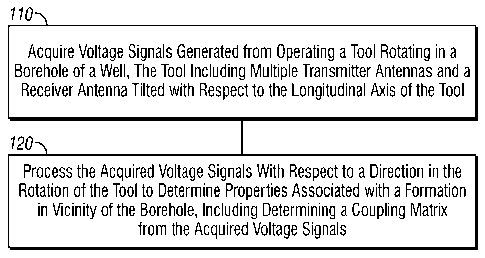
Figure 1 shows features of an embodiment of a method of determining
properties associated with operating a tool in a borehole of a well. At 110,
voltage
signals generated from operating a tool rotating in a borehole of a well are
acquired, where the tool includes multiple transmitter antennas and a receiver
antenna tilted with respect to the longitudinal axis of the tool. The acquired
voltage signals can include voltage signals received at the tilted receiver
antenna
in response to firing separately the transmitter antennas associated with the
tilted
receiver antenna. The receiver and transmitter antennas of the tool can have
various configurations. For example, two transmitter antennas can be placed
essentially at the same location with different orientations. These
transmitter
antennas can be located on the tool above or below the tilted receiver antenna
with
respect to the longitudinal axis of the tool. In various embodiments, the
tilted
receiver antenna can be placed between the two transmitters with the two
transmitters having different orientations. In various embodiments, in
addition to
the tilted receiver antenna, another tilted receiver antenna may be used. The
two
receiver antennas can placed between two transmitter antennas, where the two
transmitter antennas have different orientations. Alternatively, two
transmitter
antennas can be used disposed between two titled receiver antennas. In each of
these configurations, one or more of the transmitter antennas used can be
tilted
3
CA 02795219 2012-10-02
WO 2011/129828
PCT/US2010/031243
with respect to the longitudinal axis of the tool.
At 120, the acquired voltage signals are processed with respect to a
direction in the rotation of the tool to determine properties associated with
a
formation in vicinity of the borehole, where the processing includes
determining a
coupling matrix from the acquired voltage signals. Such voltage signals can be
generated from firing one of the transmitters and measuring a response at a
tilted
receiver with respect to the firing and firing another transmitter and
measuring a
response at a tilted receiver with respect to the firing of the other
transmitter. The
term firing is used to visualize transmitting a signal into a formation in the
vicinity
of the tool in the well. The transmitters are fired independent of one another
such
that a response a receiver can be correlated to the firing transmitter. This
correlation can be realized by a processing unit keeping track of the
measurement
activities and their timing. The firing can include transmitting pulses from a
transmitter such that each pulse is emitted from the transmitter while the
other
transmitters are in a period during which no pulses are emitted. In various
embodiments, current measurements can be used to acquire signals to generate a
coupling matrix.
Processing can include directly calculating coupling voltage components
for a coupling matrix from the measured responses received in response to the
set
of transmitter firings. Direct calculation can include multiplication and
addition
related operations. However, such direct calculations can be conducted without
more processing such as associated with solving a set of equations. Since the
measured responses are related to electromagnetic propagation in the formation
in
the vicinity of the tool, one or more inversion operations can be performed to
generate formation parameters from the determined coupling matrix. Inversion
operations can include a comparison of measurements to predictions of a model
such that a value or spatial variation of a physical property can be
determined. A
conventional inversion operation can include determining a variation of
electrical
conductivity in a formation, in the vicinity of the borehole that is being
operated
upon, from measurements of induced electric and magnetic fields.
The tool with its oriented antennas can be configured with an
implementation in the borehole of a well as a measurements-while-drilling
(MWD) system such as a logging-while-drilling (LWD) system or as a wireline
4
CA 02795219 2012-10-02
WO 2011/129828
PCT/US2010/031243
system. A processing unit and/or a control unit can be configured downhole
with
the measuring antennas. Alternatively, one or more of a processing unit and a
control unit can be configured at the surface of a well with a communication
network to acquire information and/or to generate control signals with respect
to
the antennas of the tool. The communications can use wired or wireless
communication mechanism associated with known downhole communication
techniques.
In various embodiments, apparatus and processing schemes provide for
electromagnetic logging with rotating tilted antenna systems with enhanced
direct
processing that use the measured signals when the tool is rotating in a
borehole.
Such processing schemes allow the solution of the coupling voltage matrix.
Processing techniques can be based on a rotating LWD or wireline tool equipped
with at least two tilted transmitter antennas and one tilted receiver antenna.
This
configuration along with processing schemes, discussed herein, allows the
calculation of anisotropy, as exhibited by a horizontal resistivity Rh and a
vertical
resistivity Rv, and the relative dip angle at any borehole deviation from the
solution of the coupling voltage matrix determined form the measured signals.
The relative dip angle is an angle between a planar feature such as a
formation and
a horizontal plane.
In various embodiments, apparatus and processing schemes, as discussed
herein, can be used for geosteering operations. Geosteering is an intentional
control to adjust drilling direction. The control can be based on downhole
logging
measurements to increase the borehole's exposure to a hydrocarbon-bearing
formation (the "payzone"). Such geosteering can be used to maintain a wellbore
within a region that provides a material that is a source of economic value. A
geosignal is a signal or representation that can be used for geosteering.
Geosignals are indicative of the direction of drilling tools downhole as well
as
capable of detecting boundaries. Capabilities of geosignals are useful in
geosteering to optimize well placement for maximum oil recovery. Apparatus and
processing schemes, as discussed herein, allow for the generation of a
geosignal.
A geosignal may be based one or more properties of earth formations as a
function
of distance from a reference point. The geosignals defined herein have a
variety
of applications. Geosignals also provide azimuthal orientation information of
5
CA 02795219 2012-10-02
WO 2011/129828
PCT/US2010/031243
rotary tools. In addition, the geosignal can be used for the calculation of
distance
to bed boundaries. Processing techniques for the geosignal can be based on a
rotating LWD or wireline tool equipped with at least two tilted transmitter
antennas and one tilted receiver antenna. A configuration of one tilted
transmitter
antenna and one tilted receiver antenna can also be implemented to generate a
geosignal.
Figure 2 shows an embodiment of an antenna configuration for a multi-
component electromagnetic logging tool. The magnetic field H in the receiver
coils can be represented in terms of the magnetic moments Mat the transmitters
and a coupling matrix C as:
H=CM (1)
Equation (1) can be expressed as:
C, _
H x C C C mx
xx xxz
H = C C y (2)
y yx yy C M yz
_ _ C C C M _z zx zy zz z
_
where Mz My, and Mz are the magnetic moments of the transmitted signal emitted
by transmitters Tz Ty, and Tz respectively. Hx, Hy, and Hz are the magnetic
fields, which are proportional to the received signal at the receiver antennas
Rx,
Ry, and Rz, respectively. For the antenna configuration of Figure 2, nine
absolute
or differential measurements can be obtained when each antenna is fired and a
signal is measured at each of the three receivers, respectively. These nine
measurements enable the determination of a complete coupling matrix C. The
components, Cu, can be defined as CH =au =V1 , where us the index of receiver
Rx, Ry, and Rz, J is the index of receiver Tx, Ty, and Tz, a is a constant
coefficient determined by the tool design, and is a complex value representing
the signal amplitude and phase shift measured by receiver lin response to the
firing of transmitter J. In various embodiments, current measurements can be
used to acquire signals to generate a coupling matrix.
Figures 3A-B show a titled transmitter antenna and a tilted receiver
antenna for a measuring tool. Such antennas can be equipped in a rotating LWD
or wireline tool. While firing the transmitter antenna, the signal measured at
the
6
CA 02795219 2012-10-02
WO 2011/129828
PCT/US2010/031243
titled receiver of Figure 3 can be expressed in terms of the signal voltage
VRT
where T represents the firing transmitter antenna and R represents the
receiving
antenna. With both transmitter and receiver coils are oriented at the same
azimuth
angle ,8, the measured signal at the titled receiver is expressed as,
sin 0, cos p vxx vyx v.: sin Or cos /3
V; (0) = sin 0, sin /3 VxY VyY V,' sin Or sin p , (3)
cos 0, V' x V z Vz y z COS Or
_
where 0, is the tilt angle of the transmitter antenna relative to the z-axis
(z-axis
301-A in Figure 3A and z-axis 301-B in Figure 3B) and Or is the tilt angle of
the
receiver related to the z-axis direction. Herein, 0, and Or only range between
-90
degree and 90 degree shown in Figures 3A-B. Based on equation (3), the
measured signal can be also expressed as
v;(6)=Cx, cos2 + Cxy cosi sin )0 + Cxz cos/3 + Cyx cos fisin p + Cy,, sin2 +
Cy, sin /3
+ Czx cos /3+ Czy sin /3+C
(4)
where
= V: sin 0, sin Or ; Cxy = Vyx sin 0, sin Or ; Cxz = V,' sin 0, cos Or
Cyx = VxY sin O, sin Or ; Cyy = V; sin 0, sin Or ; C y z = V.: sin 0, cos Or .
Czx = V: cos 0, sin Or ; Czy = Vyz cos0, sin Or ; C. = Vzz cosO, cos Or
Solving each component (V/) of the coupling complex voltage matrix defined in
equation (3) allows for the performance of one or more accurate inversion
process
that can generate formation properties for the well in which the tool is
operating.
Figures 3A-B illustrate two kinds of antenna structures that can be used to
achieve direct solutions of coupling complex voltage matrix according to
embodiments of processes discussed herein. The first type of structure, shown
in
Figure 3A, includes two tilted transmitters placed at the same location with
different orientations and a tilted receiver at a distance d from the
transmitters.
The tilt of these antennas is with respect to longitudinal axis 301-A. The
second
type of structure, shown in Figure 3B, has a configuration with a tilted
receiver
placed at the center of two tilted transmitters with different orientations.
To
directly solve the coupling complex voltage matrix of either configuration in
7
CA 02795219 2012-10-02
WO 2011/129828
PCT/US2010/031243
Figures 3A-B, two criteria are used. The first criterion is that the
orientation of
the receiver antenna cannot have a tilt angle of zero degrees and the
orientation of
the two transmitters cannot both be zero at the same time. The other criterion
is
that the orientations of the two transmitters are in adjacent quadrants.
Figure 3C
shows an example of the quadrants with respect to tilt relative to the z-axis.
In an
embodiment, the tilt angles can be limited in either the first quadrant or the
forth
quadrant shown in Figure 3C. Consequently, if the tilt angle of one
transmitter,
Of, of T1, for example, of Figures 3A-B is in the first quadrant, the
orientation of
the other transmitter, 61,2 of T2, for example, is in the forth quadrant. For
simplicity, the orientation of one transmitter to the other transmitter is
reversed in
Figures 3A-B, that is, Ofi equals¨ 19,2. With these parameters for orientation
of
tilted receiver and transmitters and using either one of the structures shown
in
Figures 3A-B, each component of the coupling complex voltage matrix can be
directly derived from following equations (5a) to (5h).
1
_______________ V: = E + - 1) x + E vi,T2 + - 1) x )6, )1
(5a)
2N cos Or, cos 0õ=1 -
-1
[cos 2 &n ¨ sin2
2(&2: )1
V: = ________________________ {I [V; (AL') + V; + 7r) + V; (27c ¨
2 sin sin Or 2 2 2
2
v; (7r _ fim _ T2 ( \ R 2 / R 2 =-
2 2
R
sin2`22-n
2 / v7;(fim) vritfim
, fl 71- ( T,
RT. n _ y T2 2 2 ( M / VRT2 ( PM + 7.1.) VRT2 ( 13M
.4_ _ rii7;2( 37r )1 2 2 2 R 2 2 2 2 2
(5b)
8
CA 02795219 2012-10-02
WO 2011/129828 PCT/US2010/031243
T 71" T __ 37r
VRT1 + VR1VRT1
1 2 2 2 2 2 2
VYY 2 sin 0 I sin 0 x 2
+ ) + ( + )
2
(5c)
V,Y +V;
VxY =Vyx 2
2fi
+ 2V: cos2(¨'¨n ) + 2V; sin'()
¨ 2 sin On sin Or 2 2
fl
¨4 cos(-) sin(--9
2 2
(5d)
VRT' ( fim ) + VRT (27r fin'
2 2 - 2 2 V; cot 0õ
(5e)
4 sin On cos , cos(fim ) cos( f3 )
2 2
T fim 71- 7 T 37c 371. /3
vzco to
V! = 2 2 2 2 z tl
fi
4 sin Ott cos Or cos(¨&3 ) cos(i )
2 2
(50
,6 T
v.;(--n)+VRi(27r ;)+vR2k 2"' )-ErR2kzir 2m) v-,z cotOr
= ______________________________________________________________ (5g)
V: 2
13
4 cos On sin Or cos(-) )
2 2
;
V(. 7r)+ vT (9r fi )+vr (fin, ic)+vr (71"2mi R2µ 2 2'
R2µ2 2 V" cot Or (5h)
1313
4 cos On sin Or cos( m ) cos(¨)
2 2
where V; and VRT2 are measured voltages at the receiver (R) when emitting
9
CA 02795219 2012-10-02
WO 2011/129828
PCT/US2010/031243
transmitter T1 and transmitter T2, respectively, are independently firing.
While the tool is rotating, the value of Vi:1 or Ill;2 varies with respect to
azimuth angle fl defined in equation (3). The rotation of the tool can be
partitioned into N segments, called bins, in which completion of the N bins is
one
complete rotation of the tool, N where N is the total number of bins. Each
bin has an associated azimuthal angle O. With the tool rotation partitioned
into
equal amounts of angular rotation, each bin has an equal angle of rotation,
/3m. As
shown in Figure 4, /m isan evenly-divided azimuthal angle given by an = 271-
/N,
where m demotes that the azimuthal angle considered is for the mth bin. Thus,
equations 5(a)-5(h) provide the components of the coupling complex voltage
matrix from measured responses in a selected bin, which corresponds to a
particular direction as shown in Figure 4. In various applications, N can be
equal
to 32. However, N can be set to other values.
In various embodiments, sets of transmitting and receiving antennas can be
arranged in a tilted transmitter-receiver (Tx-Rx) antenna system to provide
responses from probing formations in a well hole to be used to provide a
coupling
complex voltage matrix that can be used to determine properties associated
with
the formations. Figure 3D illustrates an embodiment of multiple sets of
antennas
tilted with respect to axis 301-D. One set includes two tilted transmitters,
T1 and
T2, placed at the same location with different orientations and a tilted
receiver, RI,
at a distance di from the transmitters T1 and T2. Another set includes two
tilted
transmitters, T3 and T4, placed at the same location with different
orientations and
a tilted receiver, R2, at a distance di from the transmitters T3 and T4. In
this
configuration, two matrices of coupling complex voltages can be obtained with
one matrix related to the configuration relative to distance d1 and the other
matrix
utilized with regards to structures with a distance d2 taking into account
upper
transmitters, Ti and T2, with lower receiver R2 and lower transmitters T3 and
T4
with upper receiver RI.
Figure 3E illustrates an embodiment of multiple sets of antennas tilted
with respect to axis 301-E. One set includes one tilted transmitter, T1,
placed
above two tilted receivers, R1 and R2, at the same location with different
orientations at a distance d1 from the transmitter T1. Another set includes
one
CA 02795219 2012-10-02
WO 2011/129828
PCT/US2010/031243
tilted transmitter, T2, placed below two tilted receivers, R3 and R4, at the
same
location with different orientations at a distance d1 from the transmitter T2.
In this
configuration, two matrices of coupling complex voltages can be obtained with
one matrix related to the configuration relative to distance di and the other
matrix
utilized with regards to structures with a distance d2 taking into account
upper
transmitter, T1, with lower receivers R3 and R4 and lower transmitter T2 with
upper receivers R1 and R2. Other configurations of transmitter and receiver
antennas can be used to provide response signals for processing to determine
properties associated with formations around a well hole in accordance with
various embodiments discussed herein.
With the orientations of the antennas fixed by the criteria discussed above
and with On equals ¨ 0,2, equations 5(a) ¨ 5(h) can be further simplified by
choosing a particular tilt angle. Figure 5 shows an embodiment of a tool with
two
transmitters tilted at +45 and -45 degrees and central receivers tilted at an
angle of
45 degrees with respect to longitudinal axis 501. This configuration provides
a
perpendicularly tilted transmitter-receiver (Tx-Rx) antenna system. In this
configuration, two matrices of coupling complex voltages can be obtained. As
shown in Figure 5, one voltage matrix is related to the configuration of
antenna
structures with a distance d1 between a signal transmitter antenna and a
signal
receiver antenna, in which acquired responses include the signals of VRT: and
ra" with respect to Tv, Rup,TrIn, and Rd, shown in Figure 5. The other voltage
Raõ
matrix is utilized with regards to structures with a distance d2 between a
signal
transmitter and a signal receiver, which involves the signals of VRT:P and
VRTud; with
respect to Tup, Rup, TA, and Rd n shown in Figure 5. Then, each component of
either
coupling complex voltage matrix can be directly processed as follows.
1 1 ,
V: = LVR- + (i ¨1)x ¨ LV; (i ¨ 1) X A) (6a)
11
CA 02795219 2012-10-02
WO 2011/129828 PCT/US2010/031243
V:
fi fim
37c
fl L sin(-) x
2
VRL(27/- ) VR (71- ;) 2 __
-11(A2)- VRL (A- + VRL (A' +-71)- + _32_51} x [sin2(1-2n )-
cos2(P2)1
2 2 2 2 2 2
(6b)
u u fin,u fim 37c
)+VR (¨s+z)+VR (-2+-2)+ VR (T+ -2)
V; = 2 2
2 (6c)
VRL ( fl2m ) + VRL 71") VRL 08-1-; + 7i) d-VRL C1-2n )
2
vxY vyx
17xY vyx = ____ 2
5fi m fi L flm
[VRu ( ¨n V Ru P2 +7r) Vif'( 2"' ) VR 2 +701+ 2V: cos' ( fl2'n )+ 2V:
sin2(132'n )
fl
- 4 cos(--n ) sin(fl m )
2 2
(6d)
V:
V: = 2 2 2 2
fi fl
-2 cos() ) (6e)
2 2
VRu(-Pln +5)+V:T-2 67-,n-i) v.,
vy 2 2 2 2 2 2 + ___ (6f)
fl fi
- 2cos(' ) cos(-)
2 2
u fi Lfi
VRU ( _______ in)+VR (27r ______ +VR ( +VR (27r 2m )
V: = ________________________________________ fi
2 (6g)
2 cos(13'n ) cos(fl'n )
2 2
12
CA 02795219 2012-10-02
WO 2011/129828
PCT/US2010/031243
u z u z L fin, ir L 71"
VR (- -)+VR (---9 VR -1--)+VR( m)
Vz = 2 2 2 2 2 2 2 2 v:
(6h)
2cos( ___________________________ ) cos(--)
2 2
where VRu is a measured voltage at receivers (Rup or Rd) when the upper
transmitter (Tup) is used and V: is measured voltage at receivers (Rup or Rd)
when
the lower transmitter (TA) is used. The nomenclature VRu ( ) means the
measured
voltage VRu at the bin corresponding to the azimuthal angle listed within Q.
For
instance, VRu (0õ,/2) means the measured voltage VRu at the selected bin,
which is
bin 1 shown in Figure 4 if the azimuthal angle of high side is defined as
zero, and
VRu (0õ,/2 + 7r/2) means the measured voltage VRu at the bin that is a
positive 90
degrees in the rotation from the selected bin. In addition, VRu (3,n/2 + (i-1)
(3i)
means the measured voltage VRu at the bin that is (i-1) bins in the rotation
from the
selected bin.
According to the principle of reciprocity, one should expect that one
antenna may be applied as a transmitter in one implementation and as a
receiver at
another. The configurations of transmitters-receivers antenna system disclosed
herein can be interchangeable, i.e., transmitters can be used as receivers and
receivers can be used as transmitters.
Once the coupling voltages matrix is obtained using the above described
processing, formation parameters can be obtained using standard inversion
techniques, such as a least squares method. A flow chart of an embodiment of a
method implementing the configuration of tilted antennas as shown in Figure 5
is
presented in Figure 6. At 610, initial upper and lower transmitters are
selected for
firing. At 620, the selected transmitters are fired separately and receiver
responses
are measured. At 630, the measured signals at the receivers responsive to the
firing of the upper and lower transmitters are processed. At 640, the tool
position
and orientation are collected. The tool position is correlated to a specific
bin for
the measured signals. The tool may include a sensor or other mechanism to
determine tool position and tool orientation including with respect to
azimuthal
angle. For a bin, nine coupling voltage components are calculated in
accordance
with equations 5(a)-5(h). At 650, from the nine coupling voltage components,
13
CA 02795219 2012-10-02
WO 2011/129828
PCT/US2010/031243
inversion operations can be performed to determine formation properties. These
formation properties may be determined essentially in real-time or as a post-
process operation. At 660, from the nine coupling voltage components, a
geosignal may be determined. The geosignal may used in a geosteering operation
in the well. The geosignal determination and subsequent geo steering may be
performed essentially in real-time or as a post-process operation. At 670, a
determination is made as to whether additional measurements are to be taken.
These additional measurements may be conducted for one or more other bins.
Several modeling cases were evaluated with respect to the processes
described above under a wide range of dip angle, Rh values, and Rv values.
Figures 7A-B shows inversion results using the responses of the antenna
configuration for a tool shown in Figure 5 for a particular formation model.
The
formation model includes a horizontal resistivity Rh of 0.7 SZ =m and a
vertical
resistivity Rv of 5.0 fl =m at arbitrary relative dip angle from 0 degrees to
90.
Curve 707 in Figure 7A shows the inversion results for Rv from the tool and
curve
709 shows the inversion results for Rh from the tool. Figure 7B shows the dip
angle from the inversion results that matches the dip angle from the model.
Figure 8 shows inversion results using the responses of the antenna
configuration for a tool shown in Figure 5 for another formation model. This
formation model includes a horizontal resistivity Rh of 2.5 SI = m and a
vertical
resistivity Rv of 5.0 SI = m at arbitrary relative dip angle from 0 degrees to
90
degrees. Curve 807 in Figure 8A shows the inversion results for Rv from the
tool
and curve 809 shows the inversion results for Rh from the tool. Figure 8B
shows
the dip angle from the inversion results that matches the dip angle from the
model.
These inversion results for bin 1 shown in Figures 7A-B and 8A-B produce good
solutions and compare well with modeled data, which demonstrates the
robustness
of the techniques of the various embodiments at all hole deviations.
In various embodiments, geosignal responses can be determined using
tools equipped with tilted transmitter and tilted receiver structures as
discussed
herein. The determined geosignal responses can be used for geosteering
applications. Such geosteering applications can be conducted with, but are not
limited to, rotating LWD tools equipped with tilted transmitter and tilted
receiver
structures. Geosignal responses can be calculated by processing the measured
14
CA 02795219 2012-10-02
WO 2011/129828
PCT/US2010/031243
signal at the receivers. For a rotating tilted transmitter and tilted receiver
tool with
azimuthal angle fi , a complex voltage Vcz (fl) referenced to the cross-
coupling
measurements (for example, ZX and XZ measurements with the z-axis oriented as
in Figures 1-5 and x-axis orthogonal to the z-axis as in Figure 1) is defined
as:
VCZ(fi) ___________ I¨ VT (fi ) VT (fl371-)+VRT(fi+-71")¨VT(fl+)1
4\12 4 4 4 R 4 (7)
Figure 9 illustrates an example response of Vcz (fi) for the upper
transmitter-receiver pair (Tup and R) of Figure 5 when drilling in a three-
layer
isotropic formation. Transmitter Tv is fired and the voltage at Rup is
measured for
the azimuthal direction defined by bin 1 of Figure 4. Vcz (fi) has a real part
917
and an imaginary part 919, where both parts show significant changes at
boundaries 901 and 903. Figure 10 illustrates an example response of Vcz (fl)
for
the lower transmitter-receiver pair (TA and RA) of Figure 5 when drilling in
the
three-layer isotropic formation. Transmitter Td n is fired and the voltage at
Rd n is
measured for the azimuthal direction defined by bin 1 of Figure 4. Vcz (fi)
has a
real part 1017 and an imaginary part 1019, where both parts show changes at
boundaries 901 and 903. The drilling for the examples of Figures 9 and 10 is
at a
relative dip angle of 85 degrees. The first layer has a resistivity of 1 ohm-
m, the
middle layer has a resistivity of 10 ohm-m, and the last layer has a
resistivity of 1
ohm-m.
Figure 11 illustrates an example response of Vcz (13) for the upper
transmitter-receiver pair (Tup and R) of Figure 5 when drilling in a three-
layer
anisotropic formation. Transmitter 711, is fired and the voltage at Rup is
measured
for the azimuthal direction defined by bin 1 of Figure 4. Ilcz (/3) has a real
part
1117 and an imaginary part 1119, where both parts show significant changes at
boundaries 1101 and 1103. Figure 10 illustrates an example response of Vcz (6)
for the lower transmitter-receiver pair (Td, and RA) of Figure 5 when drilling
in
the three-layer anisotropic formation of Figure 11. Transmitter Td n is fired
and the
voltage at Rd n is measured for the azimuthal direction defined by bin 1 of
Figure 4.
CA 02795219 2012-10-02
WO 2011/129828
PCT/US2010/031243
Vcz (fl) has a real part 1217 and an imaginary part 1219, where both parts
show
changes at boundaries 1101 and 1103. The drilling for the examples of Figures
11
and 12 is also at a relative dip angle of 85 degrees. The first layer of this
anisotropic formation has a horizontal resistivity Rh of 1 ohm-m and a
vertical
resistivity Rv of 4 ohm-m, the middle layer has a horizontal resistivity Rh of
10
ohm-m and a vertical resistivity Rv of 50 ohm-m, and the last layer has a
horizontal resistivity Rh of 1 ohm-m and a vertical resistivity Rv of 4 ohm-m.
From Figures 9 to 12, it can be concluded that a perpendicularly tilted
transmitter-receiver antenna system is capable of providing geosteering
information and detecting boundary positions. If both tilt transmitter and
tilt
receiver are oriented in different adjacent quadrants (depicted in Figure 3C),
the
measured signals at the receiver will be proportional to the subtraction of
coupling
voltage components V; and V: such that the measured signals are only sensitive
to
boundary effects. These measured signals are available to present geosignal
responses, according to various embodiments. However, if tilt transmitter and
tilt
receiver are oriented in the same quadrant or diagonal quadrants, such as
1st_3rd
quadrants or 2nd-4th quadrants, the measured signals effectively in part
contain a
summation effect of coupling voltage components V; and V2. Such summation
effect is sensitive to intertwined effects among anisotropy, relative dip
angle, and
boundary. As a result, the corresponding geosignal responses with tilt
transmitter
and tilt receiver oriented in the same quadrant or diagonal quadrants do not
provide responses that are as good for geosteering as those provided with both
tilt
transmitter and tilt receiver are oriented in different adjacent quadrants.
In various embodiments, an antenna system equipped with the upper
transmitter and central receivers of Figure 5, in which both tilt transmitter
and tilt
receiver are oriented in different adjacent quadrants, can be used in
geosteering
applications. A geosignal response can be obtained as:
VRT (fi)
VG.G. (/3) = VRT (fi + 7r) , (8)
which is the measured signal VRT in a current bin, which is one bin direction
of the
N bin directions as shown in Figure 4, divided by the measured signal V: in
the
bin 180 degrees from the current bin. The geosignal responses can be expressed
16
CA 02795219 2012-10-02
WO 2011/129828
PCT/US2010/031243
in terms of geosignal phase 0Geo and geosignal attenuation AGeo as follows:
0Geo(16)= phase{V; (fl)}¨ phase{V: (fi + r)} (9a)
AGe0(/8)= logIvRT(fl)1¨ logIVRT (fl + (9b)
Figure 13 illustrates an example a geosignal phase for a three-layer
isotropic formation. The geosignal phase 6
r Geo of equation (9a) shown in Figure
13 is for a perpendicular Tx-Rx pair of Figure 5 in the direction of bin one
of
Figure 4. Figure 14 illustrates an example a geosignal attenuation for the
three-
layer isotropic formation of Figure 13. The geosignal attenuation AGeo of
equation
(9b) shown in Figure 14 is for a perpendicular Tx-Rx pair of Figure 5 in the
direction of bin one of Figure 4. Figures 13 and 14 are geosignals generated
from
operating the tool of Figure 5 with a transmitter-to-receiver spacing of 32
inch and
frequency of 500 kHz at a relative dip angle of 85 degrees. The first layer of
this
isotropic formation has a resistivity of 1 ohm-m, the middle layer has a
resistivity
of 10 ohm-m, and the last layer has a resistivity of 1 ohm-m. These geosignals
calculated from the measured voltage signal VRT show the detection of
boundaries
1301 and 1303 as a function of depth.
Figure 15 illustrates an example a geosignal phase for a three-layer
anisotropic formation. The geosignal phase 0Geo of equation (9a) shown in
Figure
15 is for a perpendicular Tx-Rx pair of Figure 5 in the direction of bin one
of
Figure 4. Figure 16 illustrates an example a geosignal attenuation for the
three-
layer anisotropic formation of Figure 15. The geosignal attenuation AGeo of
equation (9b) shown in Figure 16 is for a perpendicular Tx-Rx pair of Figure 5
in
the direction of bin one of Figure 4. Figures 15 and 16 are geosignals
generated
from operating the tool of Figure 5 also with a transmitter-to-receiver
spacing of
32 inch and frequency of 500 kHz at a relative dip angle of 85 degrees. The
first
layer of this anisotropic formation has a horizontal resistivity Rh of 1 ohm-m
and a
vertical resistivity Rv of 4 ohm-m, the middle layer has a horizontal
resistivity Rh
of 10 ohm-m and a vertical resistivity Rv of 50 ohm-m, and the last layer has
a
horizontal resistivity Rh of 1 ohm-m and a vertical resistivity Rv of 4 ohm-m.
These geosignals calculated from the measured voltage signal VRT show the
detection of boundaries 1501 and 1503 as a function of depth.
17
CA 02795219 2012-10-02
WO 2011/129828
PCT/US2010/031243
In various embodiments, other geosignal responses Vfeo and Vfeo can be
defined that are applicable to drilling operations. Two geosignal responses
based
on the antenna structure in Figure 5 are defined as:
VRu ( fl) + VRL ( /3 + z )
life (fl) (10a)
¨1E [vuAi (i_Dx+
(flijv+(i_Dx A)]
N R 2 R 2
VR (fl + 20-1-VR(fl +2r
rifeo 66) (10b)
R
¨1 E [Tipu¨ 1) X Aj+ V RI' n ¨ 1) X
2 2
where Vfec, refers to the signals involved with ZX measurements and V:zeo
refers to
the signals involved with XZ measurements. Both of geosignals are suitable for
geosteering operations. In addition, for different antenna structures, the
azimuthal
angle )6 of the numerator in equations (10a) and (10b) may plus or minus 180
degrees from the selected bin.
In various embodiments, several processing schemes employ the features
of rotating electromagnetic (EM) logging tools. A coupling voltage matrix can
be
solved directly from the processing of responses of the rotating tool.
Furthermore,
using the solved coupling voltage matrix, formation parameters can be
calculated.
These parameters can include formation anisotropy, Rh and Rv, and the relative
dip angle at any borehole deviation. In addition, geosignal responses are
defined
that can be generated from the responses of the rotating tool. These
geosignals
can be used for geosteering and for calculating the distance to bed boundary
(DTBB) using standard inversion techniques. Processing measured voltages as
discussed herein allows for the solution of a coupling voltage matrix from
which
formation parameters such as anisotropy, Rh and Rv, and the relative dip angle
can
be derived. Unlike conventional processes, these formation parameters can be
determined at any borehole deviation. In various embodiments, for deep water
situations, processing measured signals, as taught herein, can be used to
calculate
structure dip and anisotropy in vertical as well as deviated hole, providing
structure dip in LWD.
Various components of a measurement tool having a processing unit that
determines a complete coupling matrix from direct measurements using tilted
18
CA 02795219 2012-10-02
WO 2011/129828
PCT/US2010/031243
transmitter and receiver antennas, as described herein or in a similar manner,
can
be realized in hardware implementations, software implementations, and
combinations of hardware and software implementations. These implementations
may include a machine-readable medium having machine-executable instructions,
such as a computer-readable medium having computer-executable instructions,
for
operating the system to acquire voltage signals generated from operating a
tool
rotating in a borehole, where the tool includes multiple transmitter antennas
and a
receiver antenna tilted with respect to the longitudinal axis of the tool and
the
acquired voltage signals are measured at the tilted receiver antenna in
response to
firing separately the multiple transmitter antennas associated with the tilted
receiver antenna, and to process the acquired voltage signals with respect to
a
direction in the rotation of the tool to determine properties associated with
a
formation in vicinity of the borehole, including determining a coupling matrix
directly from the acquired voltage signals. The machine-readable medium can
also store parameters used in execution of the instructions and can also store
results from execution of the instructions. The machine-readable medium can
include instructions to generate geosignals from the acquired voltage signals.
The
machine-readable medium can also include instructions to conduct geosteering
based on the geosignals generated from the acquired voltage signals. In
various
embodiments, current measurements can be used to acquire signals to generate a
coupling matrix. The form of machine-readable medium is not limited to any one
type of machine-readable medium, but can be any machine-readable medium. For
example, machine-readable medium can include a data storage medium that can
be implemented in a housing disposed in a collar of a drill string or in a
wireline
configuration and/or in a system control center.
Figure 17 depicts a block diagram of features of an embodiment of a
system 1700 having a processing unit 1705, one or more tilted receiver
antennas
1710, and multiple transmitter antennas 1715. Processing unit 1705 is
configured
to process signals received at one or more tilted receiver antennas 1710 in
response to firing multiple transmitter antennas 1715 independently to
directly
determine a coupling matrix relative to propagation of electromagnetic signals
in a
formation in the vicinity of a well hole due to the firing of multiple
transmitter
antennas 1715. Processing unit 1705 can process signals acquired from one or
19
CA 02795219 2012-10-02
WO 2011/129828
PCT/US2010/031243
more tilted receiver antennas 1710 based on the direction relative to rotation
of the
tool on which one or more tilted receiver antennas 1710 and multiple
transmitter
antennas 1715 are mounted. Processing unit 1705 can perform processing
identical to or similar to the processing schemes discussed with respect to
various
embodiments herein.
System 1700 can also include a controller 1702, a memory 1725, an
electronic apparatus 1735, and a communications unit 1755. Controller 1702,
memory 1725, and communications unit 1755 can be arranged to operate one or
more tilted receiver antennas 1710 and multiple transmitter antennas 1715 with
acquired voltage signals provided to processing unit 105 for the determination
of
coupling matrices, formation properties, geosignals, and geosteering
operations.
Processing unit 105 can be located on the surface to a well hole. Processing
unit
105 can be located downhole. Processing unit can be integrated with one or
more
of controller 1702, memory 1725, and communications unit 1755. Processing unit
1705 can be realized to include processing schemes in accordance processing
and
measurement tools described herein. Communications unit 1755 can include
downhole communications in a drilling operation. Such downhole
communications can include a telemetry system.
System 1700 can also include a bus 1707, where bus 1707 provides
electrical conductivity among the components of system 1700. Bus 1707 can
include an address bus, a data bus, and a control bus, each independently
configured. Bus 1707 can also use common conductive lines for providing one or
more of address, data, or control, the use of which is regulated by controller
1702.
Bus 1707 can be configured such that the components of system 1700 are
distributed. Such distribution can be arranged between downhole components
such as one or more tilted receiver antennas 1710 and multiple transmitter
antennas 1715 and surface components such as processing unit 1705.
Alternatively, the components can be co-located such as on one or more collars
of
a drill string or on a wireline structure.
In various embodiments, peripheral.devices 1745 include displays,
additional storage memory, and/or other control devices that may operate in
conjunction with controller 1702 and/or memory 1725. In an embodiment,
controller 1702 is a processor. A peripheral device arranged as a display can
be
CA 02795219 2012-10-02
WO 2011/129828
PCT/US2010/031243
used with instructions stored in memory 1725 to implement a user interface to
manage the operation of processing unit 1705, one or more tilted receiver
antennas 1710, multiple transmitter antennas 1715 in system 1700 and/or
components distributed within system 1700.
Figure 18 depicts an embodiment of a system 1800 at a drilling site, where
system 1800 includes a measurement tool 1810 and electronics to determine
formation properties in the vicinity of a well and/or geosignals that can be
used for
geosteering a drilling operation. Measurement tool 1810 can include one or
more
tilted receiver antennas and multiple transmitter antennas, where the
transmitter
antennas are fired independently such that measured signals received at the
tilted
receiver antennas are processed to directly determine a coupling matrix
relative to
propagation of electromagnetic signals in the formation in the vicinity of a
borehole. The coupling matrix can be used to determine formation properties
such as horizontal resistivity, vertical resistivity, and relative dip angle
at any
borehole deviation from the solution of the coupling voltage matrix determined
form the measured signals, along with generating geosignals that can be used
conduct geosteering with respect to the borehole.
System 1800 can include a drilling rig 1802 located at a surface 1804 of a
well 1806 and a string of drill pipes, that is, drill string 1808, connected
together
so as to form a drilling string that is lowered through a rotary table 1807
into a
wellbore or borehole 1812. The drilling rig 1802 can provide support for drill
string 1808. The drill string 1808 can operate to penetrate rotary table 1807
for
drilling a borehole 1812 through subsurface formations 1814. The drill string
1808 can include drill pipe 1818 and a bottom hole assembly 1820 located at
the
lower portion of the drill pipe 1818.
The bottom hole assembly 1820 can include drill collar 1815, a measuring
tool 1810 attached to drill collar 1815, and a drill bit 1826. The drill bit
1826 can
operate to create a borehole 1812 by penetrating the surface 1804 and
subsurface
formations 1814.
During drilling operations, the drill string 1808 can be rotated by the rotary
table 1807. In addition to, or alternatively, the bottom hole assembly 1820
can
also be rotated by a motor (e.g., a mud motor) that is located downhole. The
drill
collars 1815 can be used to add weight to the drill bit 1826. The drill
collars 1815
21
CA 02795219 2012-10-02
WO 2011/129828
PCT/US2010/031243
also can stiffen the bottom hole assembly 1820 to allow the bottom hole
assembly
1820 to transfer the added weight to the drill bit 1826, and in turn, assist
the drill
bit 1826 in penetrating the surface 1804 and subsurface formations 1814.
During drilling operations, a mud pump 1832 can pump drilling fluid
(sometimes known by those of skill in the art as "drilling mud") from a mud
pit
1834 through a hose 1836 into the drill pipe 1818 and down to the drill bit
1826.
The drilling fluid can flow out from the drill bit 1826 and be returned to the
surface 1804 through an annular area 1840 between the drill pipe 1818 and the
sides of the borehole 1812. The drilling fluid may then be returned to the mud
pit
1834, where such fluid is filtered. In some embodiments, the drilling fluid
can be
used to cool the drill bit 1826, as well as to provide lubrication for the
drill bit
1826 during drilling operations. Additionally, the drilling fluid may be used
to
remove subsurface formation 1814 cuttings created by operating the drill bit
1826.
Various embodiments of techniques described herein process measured
signals received at one or more tilted receiver antennas in response to firing
multiple transmitter antennas independently to directly determine a coupling
matrix relative to propagation of electromagnetic signals in the formation in
the
vicinity of a well hole due to the firing of multiple transmitter antennas. A
processing unit can process signals acquired from one or more tilted receiver
antennas based on the direction relative to rotation of the tool on which one
or
more tilted receiver antennas and multiple transmitter antennas are mounted.
Processing unit can perform processing identical to or similar to the
processing
schemes discussed with respect to various embodiments herein.
Although specific embodiments have been illustrated and described herein,
it will be appreciated by those of ordinary skill in the art that any
arrangement that
is calculated to achieve the same purpose may be substituted for the specific
embodiments shown. Various embodiments use permutations and/or
combinations of embodiments described herein. It is to be understood that the
above description is intended to be illustrative, and not restrictive, and
that the
phraseology or terminology employed herein is for the purpose of description.
Combinations of the above embodiments and other embodiments will be apparent
to those of skill in the art upon studying the above description.
22