Note: Descriptions are shown in the official language in which they were submitted.
CA 02911502 2015-11-05
WO 2014/151398 PCT/US2014/025649
1
TICKET-BASED HARVEST MANAGEMENT SYSTEM AND METHOD
Field of the Invention
[0001] The present application relates to the field of automated
harvest management. More particularly, the described embodiments relate to a
system and method for tracking planting, field processing, and harvesting in
mining, agricultural, and forestry industries through manual or automated data
ticket processing.
Summary
[0002] The presented embodiments disclose a flexible, cloud-based
tool that provides an automated method to record the harvest and distribution
process, and tools to meet unique requirements of farming operations. The
system integrates with a farm's existing infrastructure to capture and record
data necessary in order to secure harvested crops from the field to the point
of
delivery. The system further tracks and manages the inputs used to grow the
crops, including seed, fertilizer, and herbicides. The system also integrates
with
forestry and mining inventory to secure harvested wood or mining products
from the point of origination to the point of delivery.
[0003] The disclosed embodiments provide unprecedented control
over harvest security, updating critical data on a daily or even real-time
basis.
Issues are identified. Compounding problems are prevented. Workers are held
accountable. Accurate accounting is possible. All of which translates into
improved transparency for stakeholders: bankers, investors, insurance agents
and most importantly, the farmer, forester, or miner.
[0004] Through use of the disclosed system and method, farmers,
foresters, and miners accurately track and trace key harvest and distribution
activities. This is accomplished by:
= recording weights and quality levels for material harvested at the field
or forest level, or mined at the mine level.
CA 02911502 2015-11-05
WO 2014/151398 PCT/US2014/025649
2
= recording and tracking product stored in point of origin storage.
= recording product transportation activities on a per load basis.
= recording product loads delivered to internal storage facilities.
= recording product weights and quality levels for loads delivered to
customers.
= extracting information about field processing (e.g., seeding,
fertilizing,
cutting, baling) from a bus (e.g., 1SOBUS) over which implements in a
vehicle (e.g., tractor) communicate task-specific information.
= reconciling all activities and view product data in real time.
[0005] The system records tickets during various stages of the input
or harvest process. The tickets generally represent the transfer of an input
or a
harvest from one machine or location to another. Tickets can be generated
manually. Workers record the data and time of the transfer, and the amount of
input or harvest transferred. These tickets are gathered at a cloud-based
server
for processing. Tickets can be generated automatically through the use of
beacons and electronic sensors.
[0006] In one environment, breadcrumb trails are generated by a
variety of machines or locations involved in the input or harvest process.
These
trails are transmitted to a central server, which compares trails and looks
for
touch-points in the trails. Touch-points may generate one or more tickets,
with
data submitted within the breadcrumb trail being used to populate the data
within the ticket. Manually generated tickets can be compared and merged with
automated tickets. Trails can be compared with geo-fences in order to trigger
the
creation of tickets and to populate data within the tickets.
Brief Description of the Drawings
[0007] Figure 1 is a schematic diagram showing locations that can be
used to source, store, process, or receive the goods from a farm, forest, or
mine.
[0008] Figure 2 is a schematic diagram showing the components of a
system that gathers, stores, and processes data in accordance with one
embodiment of the present invention.
CA 02911502 2015-11-05
WO 2014/151398 PCT/US2014/025649
3
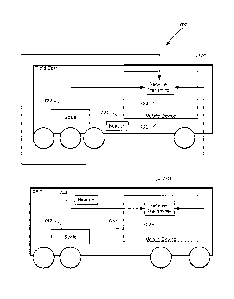
[0009] Figure 3 is a schematic diagram showing a three-ticket process
that takes goods from a field, stores the goods in local storage, and then
delivers
the goods from storage to a customer.
[0010] Figure 4 is a schematic diagram showing a two-ticket process
that takes goods from a field to a customer.
[0011] Figure 5 is a schematic diagram showing a five-ticket process
including a processing step.
[0012] Figures 6A through 6F show screen shots from a ticket creation
software application running on a mobile device, with Fig. 6A showing a home
screen shot, Fig. 6B showing a cart ticket entry screen, Fig. 6C showing a
field-to-
storage ticket entry screen, Fig. 6D showing a field-to-customer ticket
screen, Fig.
6E showing a storage-to-customer entry screen, and Fig. 6F showing additional
data entry fields that form the storage-to-customer ticket entry screen of
Fig. 6E.
[0013] Figure 7 is a schematic diagram showing system capable of
ticket generation without human interaction.
[0014] Figure 8 is a schematic diagram showing data movements for
input materials for farming.
[0015] Figure 9 is a schematic diagram illustrating a communication
bus (e.g., an ISOBUS), on a vehicle such as a tractor, wherefrom data about
implements used by the vehicle in the field may be extracted.
[0016] Figure 10 is a flowchart illustrating a process for
preparation of
a data ticket using information from a communication bus (e.g., an ISO BUS),
on a
vehicle such as a tractor.
[0017] Figure 11 is a schematic diagram illustrating possible
components of a harvest data extractor on the communication bus.
[0018] Figure 12 is a schematic diagram illustrating a complete life-
cycle¨from seed supplier to consumer of the harvest¨that may be tracked,
verified, and analyzed using a ticket-based system.
[0019] Figure 13 is a schematic diagram illustrating a second
embodiment of a communications bus on a tractor in communication with a
tablet computer and a remote server.
CA 02911502 2015-11-05
WO 2014/151398 PCT/US2014/025649
4
[0020] Figure 14 is a schematic diagram showing the data elements in
a breadcrumb trail.
[0021] Figure 15 is a schematic diagram showing the geographic path
of two vehicles and the related touch-points.
[0022] Figure 16 is a schematic diagram showing the geographic paths
of Figure 15 with the addition of the geographic path of a third vehicle.
[0023] Figure 17 is a flow chart showing one method for
implementing ticket generation through breadcrumb trails.
[0024] Figure 18 is a schematic diagram showing the geographic path
of a first vehicle of Figure 15 overlaid with a geo-fence for two farm fields.
[0025] Figure 19 is a schematic diagram showing the geographic path
of a first vehicle of Figure 18 overlaid with the geo-fence defining the two
farm
fields differently.
[0026] Figure 20 is a flow chart showing a method for populating data
in related tickets.
[0027] Figure 21 is a flow chart showing a method for assigning data
within tickets to fields based on geo-fence definitions of the fields.
[0028] Figure 22 is a flow chart showing a method for utilizing
breadcrumb trails to automate to do list completions.
Detailed Description
Overview
[0029] The present invention can be used to track goods that are
obtained through farming, forestry, mining, drilling, and similar processes.
For
instance, agricultural crops such as corn or cotton are ideal candidates for
tracking through the disclosed embodiments of the present invention. In
addition, lumber obtained through harvesting forests can also be tracked, as
can
coal or other materials that are removed from the earth through mining, and
oil,
natural gas, and other hydrocarbonic materials removed from the earth through
drilling. The current description will describe the use of the present
invention in
CA 02911502 2015-11-05
WO 2014/151398 PCT/US2014/025649
connection with farming. Nonetheless, it should be clear that the same systems
and processes can be used in these other contexts as well.
[0030] Figure 1 shows four key locations where the harvest data is to
be obtained. In particular, data is to be obtained at the field 110 (or forest
or
mine) where the product to be tracked originates. In addition, data is to be
obtained at local storage facilities 120 where the crop (or other product) can
be
stored temporarily after being collected. Data is also obtained at processing
facilities 130, such a cotton gin or crop drying facility that processes or
transforms the crop in some way. Finally, data is obtained when products or
crops are delivered to a customer 140 that pays the farmer for their crop.
These
different locations 110-140 are shown connected by some type of transport 150.
The transport 150 may be a truck, train, barge, pipeline, or any other
transportation mechanism.
[0031] By tracking data about a crop at various locations, it is
possible
to accumulate comprehensive data about a farmer's harvest in a way that has
not
been previously possible. It is important to track this data at the locations
110-
140 specified in Figure 1 because it is at these locations that a crop must be
carefully monitored for potential loss or other events. For instance, it is
important for a farmer to confirm that the amount of crop taken off the field
and
delivered to a trucking firm is the same as the amount of crop received and
paid
for by the farmer's customer. In addition, monitoring the crop at these
locations
also allows the farmer to analyze their business for profitability. For
example, by
tracking the crop that comes off each field 110, the farmer can determine the
comparative yield for each field. These results can be compared to the inputs
(such as seed, fertilizer, pesticides, labor) that created that crop in each
field to
determine whether changes in procedures might increase the profitability of a
farm.
[0032] Figure 2 shows one system 200 that can be used to track this
harvest data. In this system, a plurality of handheld devices 210, 212, 214
are
used by the farmer to obtain data about the harvest. For instance, a worker
operating a field cart can record on handheld device 210 information about
each
CA 02911502 2015-11-05
WO 2014/151398 PCT/US2014/025649
6
cartload of a crop that is delivered to a semi truck for transportation. This
information can include the field where the crop was harvested, the time and
date of that harvest, an identifier for the field cart being operated by that
worker,
the weight of the crop that was delivered to the semi, the particular semi
that
received the crop, and the driver of that semi. Additional information could
also
be collected, such as descriptors about the weather (sunny, cold, etc.) and
descriptions about the crop (healthy, wet, etc.). Similarly, another worker
can
use handheld device 212 to receive information about the delivery of the crop
from that semi to the farmer's local storage facility 120, while a third
worker can
use handheld device 214 to record information about deliveries made directly
to
customers 140.
[0033] Data relating to the receipt of crops at the various data
gathering locations 110-140 is recorded on the handheld devices 210-214 as
data "tickets." Data tickets contain data, typically in a plurality of
structured data
fields, concerning a transfer of a crop from one location to another. The
devices
210-214 then transmit these data tickets over a network 220 to a remote server
230, which then stores the data in a database 240. In one embodiment, the
network 220 is a wide area network such as the Internet. The handhelds 210-
214 can access the Internet 220 through a WiFi network. Frequently, the
handhelds 210-214 will be gathering data in locations that do not have WiFi
access easily available, such as in a farmer's field. In one embodiment, the
handhelds 210-214 allow input of data even when the device does not have
network access. This data is cached in local storage on the device. The
handhelds
210-214 then periodically determine whether access to the network 220 is
available. If so, data cached in the local storage is then sent to the server
230
over the network 220.
[0034] In another embodiment, the handheld devices 210-214 include
cellular capabilities, such as smart phones or tablet computers using Apple's
iOS
(from Apple Inc., Cupertino CA) or the Android operating system (from Google
Inc., Mountain View, CA). These types of devices contain processors, such as
those defined by ARM Holdings plc (Cambridge, England, UK), and non-
CA 02911502 2015-11-05
WO 201411M398 PCT/US2014/025649
7
transitory memory such as flash memory that contains data and programming
for the processors. These devices may also be able to transmit data over the
Internet 220 using cellular data networks. With such capabilities, data can be
transmitted to the server 230 immediately upon data entry as long as the
device
210 is within range of a cellular tower with data capabilities. Even with this
embodiment, the devices 210-214 are preferably designed to cache data when
the network 220 is not immediately available.
[0035] The data is accumulated in database 240, and then made
available to the farmer through a back office computer 250 operating over the
same network 220 and server 230 that was used to collect the data from the
remote handheld devices 210-214. In other embodiments, different or multiple
physical servers could perform the function of the server 230 shown in Figure
2
without altering the scope of the present invention.
[0036] The back office computer 250 accesses the database 240
through programming provided by the server 230, ideally through a web
browser or other thin client operating on the computer 250. In effect, data
collection and data analysis for the farmer are provided using a software-as-a-
service model. The farmer pays the operator of the server 230 and database 240
for the right to store data in the database 240 and to use software operating
on
the server 230 to analyze this data. This frees the farmer from the headaches
of
maintaining the network and server needed to store and backup the data.
Meanwhile, the operator of the server 230 and database 240 offers the same
service to multiple farmers.
[0037] The data analysis software provided to the back office
computer 250 allows the farmer to compare payments received from a customer
(as evidenced through settlement documents and delivery receipts from the
customer) with data tickets specifying the amount of crop that was delivered
to
that customer. Furthermore, the farmer can verify that the amount of crop
taken
from the fields is equivalent to the crop that was either delivered to a
customer
or is otherwise in storage. This type of reconciliation is extremely valuable
for
farmers, especially since this data is almost immediately available given the
CA 02911502 2015-11-05
WO 2014/151398 PCT/US2014/025649
8
nature of the data ticket submission described herein. Reconciliation errors
that
indicate missing crop can be immediately tracked down to a particular worker,
piece of equipment, date, and time. In addition, the analysis software
available
through the back office computer can also give the farmer the ability to
analyze
the productivity of individual fields in a way that was not otherwise possible
for
most farmers.
[0038] The server computer 230 and the back office computer 250
includes a set of software instructions or interfaces stored on a non-
volatile, non-
transitory, computer readable medium such as a hard drive or flash memory
device. A digital processor, such as a general purpose CPU manufactured by
Intel
Corporation (Mountain View, CA) or Advanced Micro Devices, Inc. (Sunnyvale,
CA) accesses and performs the software. To improve efficiency, processor may
load software stored in its non-volatile memory into faster, but volatile RAM.
The
database 240 can be stored on the same non-volatile memory used by the server
computer 230 for its operating system, or on a different memory accessible by
its process such as an external direct access storage device (or DASD). The
database 240 consists of both data and software instructions informing the
server computer 230 how to access, analyze, and report on the data in the
database 240.
[0039] The computers 230, 250 further include a network interface to
communicate with other computerized devices across a digital data network
such as network 220. In one embodiment, the network is the Internet, and the
network interfaces on the computers 230, 250 include TCP/IP protocol stacks
for communicating over the network 220. The network interface may connect to
the network wirelessly or through a physical wired connection. Instead of
being
a single computer with a single processor, the server 230 could also
implemented using a network of computers all operating according to the
instructions of the software.
CA 02911502 2015-11-05
WO 2014/151398 PCT/US2014/025649
9
Ticket Generation
[0040] Figure 3 shows a typical process 300 used by a farmer to track
crops coming off a field 110. In this process, a combine 112 in the field 110
takes
the crop off the field 110. Periodically, the combine 112 transfers its load
to a
field cart 114, which then takes its load to one or more waiting semi trucks
152
for transport 150. In this embodiment, a data ticket 310 is created when the
crop
is transferred from the cart 114 to the semi 152. This first data ticket 310
is
referred to as a cart-to-truck ticket (or simply "cart ticket") 310.1n this
embodiment, the cart ticket 310 is created by a worker operating the field
cart
114. Using their handheld device 210, the worker opens an application (or app)
that operates on the device 210. The worker logs into the app, so that the app
knows the worker's identifier, the particular field being worked by the
worker,
as well as an identifier for the cart 114 being operated by the worker. When
the
transfer is made to the semi 152, the worker tells the app to create a cart
ticket
310. The worker must input or verify the crop, identify the semi 152 and the
driver of the semi, and then input the amount of crop transferred to the semi
152. In most embodiments, the cart 114 has an integrated scale. The app
requests that the worker input the weight on the scale before and after the
transfer to the semi, with the calculated difference being the amount of the
crop
transferred to the semi. The worker may also include descriptors about the
current weather conditions or the condition of the crop (i.e., "wet") with the
data
transmitted in the cart ticket 310.
[0041] In Figure 3, the cart ticket 310 is the first ticket
created, and is
also called ticket 1.1n some embodiments, the driver of the semi also has a
handheld device 212, and the semi truck also contains a scale. In these
embodiments, the semi driver will also create a cart ticket 310 (i.e., ticket
lb)
indicated the amount of crop received from the cart 114, and the identifier of
the
cart and the cart operator. While these two cart tickets 310 contain
essentially
the same information, the creation of two tickets allows comparisons between
the tickets and the ability to detect and correct faulty data from one of the
CA 02911502 2015-11-05
WO 2014/151398 PCT/US2014/025649
tickets. Because the data is mostly duplicative, however, some embodiments
would create only a single cart ticket 310.
[0042] In the process 300 shown in Figure 3, the semi driver delivers
their load to a local storage facility 120 on the farm. This storage facility
may
include a plurality of storage bins, including storage bin 122. When the load
from
the semi truck 152 is transferred to the storage bin 122, a second ticket
(known
as a field-to-storage ticket) 320 is created. This ticket 320 can be created
by the
operator of the truck 152 using the app running on their handheld device 112.
Like the cart ticket 310, the field-to-storage ticket 320 contains information
about the delivery equipment (semi 152 and the driver) as well as the
receiving
equipment (storage bin 122). A bin operator may have their own handheld
device 114, and therefore may create their own version of the field-to-storage
ticket 320 (ticket 2b in Figure 3). Note that since the storage capabilities
of the
field carts 114 and the semi trucks 152 are not identical, there is not a one-
to-
one correspondence between the cart tickets 310 and the field-to-storage
tickets
320.
[0043] A different semi truck 154 may then be used at a later date to
take the crop from the storage bin 122 and deliver the crop to the customer
140.
To track this transaction, the truck driver will create a storage-to-customer
ticket 330 to track details about the delivery, including date, time,
identifiers for
the semi 154 and the driver, the originating location (storage bin 122), the
receiving location (grain elevator 142 at the customer location 140), and the
condition of the crop ("dry"). The crop condition may be based merely on
general
observations ("dry"), or may be made upon scientific tests establishing
various
characteristics of the crop (i.e., moisture content). These tests may be
conducted
at the farmer's storage facilities 120, at the customer's facilities 140, or
at both
locations.
[0044] If the customer participates in the system 200 with the farmer,
the customer 140 could create a corresponding ticket 330. In most cases,
however, the customer 140 does not participate, and instead presents the
driver
with a written delivery receipt 340. When payment is made to the famer, the
CA 02911502 2015-11-05
WO 2014/151398 PCT/US2014/025649
11
payment will likely include a settlement document 350 that includes the
delivery
information found on the delivery receipts 340. Payment associated with the
settlement document 350 will relate to a specific contract 360 between the
customer 140 and the farmer. Consequently, to complete the data in the
database
240 for proper tracking and reconciliation, it is contemplated that the
interface
provided by the server 230 to the back office computer 250 includes the
ability
for the farmer to enter information about written delivery receipts 340,
settlement documents 350, and contracts 360.
[0045] Figure 4 shows a simplified process 400, where the farmer
delivers their crop directly to a customer 140 without storing the grain at a
local
storage facility 120. In this case, the transfer from the field cart 114 to
the semi
truck 152 creates one or two first tickets (the cart ticket) 410. This cart
ticket
410 is effectively the same as the cart ticket 310 created in process 300.
Rather
than transporting the crop to storage 120, the semi 152 in process 400
delivers
the crop directly the customer elevator 142. When this delivery is made, the
truck driver creates a second ticket known as a field-to-customer ticket 420.
[0046] The process 500 shown in Figure 5 is similar to the processes
300, 400 shown in Figures 3 and 4, respectively, although process 500 contains
more steps. In this case, the field cart 114 delivers the crop to semi 152,
and in
the process the operator or operators of these machines create a cart ticket
510.
The semi 152 delivers the crop to the local storage bin 122, and a field-to-
storage
ticket is created 520 that is much like ticket 320 described above. In process
500,
the farmer must pay a third party to process the crop. For instance, if the
farmer
were growing cotton, the farmer would pay a cotton gin facility to gin the
cotton.
A semi 154 is used to transfer to crop to the processor 130. When the crop is
delivered to the processor, a storage-to-processor ticket 530 is created with
details about the semi 154, the semi driver, the amount of crop delivered, the
condition of the crop, the originating storage bin 122, and the specific
processing
facility of the processor 130 that received the crop.
[0047] After the processing is complete, a new semi 156 accepts the
processed crop and delivers the crop back to local storage 120 on the farm. In
CA 02911502 2015-11-05
WO 2014/151398 PCT/US2014/025649
12
this case, the crop is stored in storage bin 124. A processor-to storage
ticket 540
is created detailing this transaction. Finally, the processed crop is taken
from
storage bin 124 by semi 158 and delivered to customer elevator 142, and a
storage-to-customer ticket 550 is created.
[0048] In this embodiment, a data ticket is created every time the crop
is received at the field 110, local storage 120, processor 130, or the
customer
140. The field related ticket (cart ticket 310, 410, or 510) is created when
harvesting the crop (effectively receiving the crop at the field). By ensuring
that a
data ticket is created when the crop is received at each of these locations,
the
harvest is effectively tracked and monitored through each movement, storage,
processing, and customer delivery step. It would be possible to create
additional
data tickets and still be within the scope of the present invention. However,
additional tickets are not necessary to ensure the minimal level of tracking
as
exemplified in processes 300, 400, and 500.
[0049] Figure 6a shows a mobile device 600 that could be used by an
operator of a field cart 112 or semi truck 152, or an individual working at a
storage location 120, processing location 130, or customer site 140. The
mobile
device 600 includes a processor (such as those created under the ARM
architecture developed by ARM Holdings, Cambridge, UK) and tangible, non-
transitory memory that contains both computing instructions (software) and
data. The computing instructions include an application or "app" that allows
the
user to create data for the database 240. As explained above, this data is
created
in the form of tickets that contain data about a particular event relating to
the
receipt of product at one of the key locations 110-140. In the preferred
embodiment, this app runs on a general purpose operating system, such as
Apple's iOS or Google's Android operating system. Furthermore, the preferred
mobile device 600 includes network capabilities to allow the device 600 to
communicate with the server 230 over the network 220. This could be provided
by a WiFi or cellular network interface (or both) located within the device.
Finally, the preferred device 600 includes location detection capabilities
that can
identify the location of the device 600. This helps in numerous situations,
CA 02911502 2015-11-05
WO 2014/151398 PCT/US2014/025649
13
including the automated identification of a farmer's field in a cart ticket
310, 410,
or 510. The device 600 is preferably a smart phone, a tablet computer, or any
other similar device.
[0050] The app operating on the mobile device 600 creates a home
screen 610, which provides the user with the ability to change information
about
the user by selecting change button 620. Information about the user, including
the equipment or location being managed by the user can be entered into the
app at this stage so that it doesn't need to be separately entered for each
ticket
created by the app.
[0051] The home screen 610 also includes a cart ticket button 630, a
field-to-storage ticket button 640, a field-to-customer ticket button 650, and
a
storage-to-customer ticket button 660. Each of these ticket creation buttons
630-
660 bring up an entry screen for the user to enter the necessary data to
create
the desired ticket. The entry screen 632 for the cart ticket is shown in
Figure 6b,
and can be reached by pressing the cart ticket button 630 on the home screen
610. Similarly, the field-to-storage ticket entry screen 642 (Figure 6c), the
field-
to-customer ticket screen 652 (Figure 6d), and the storage-to-customer entry
screen 662 (Figure 6e) can be reached by selecting buttons 640, 650 and 660,
respectively. The ticket entry screens 632, 642, 652, and 662 allow the user
to
enter the data necessary to complete the data ticket. To the extent possible,
permissible data has been predefined in the database 240, preferably through
the back office computer 250. This permissible data is downloaded by the app
running on the mobile device 600, allowing many of the fields in the ticket
entry
screens 632-662 to be filled in through pull down selection menus. In most
cases,
the entry screens 632-662 contain more data than can be viewed at once on the
mobile device. Consequently, the entry screens 632-662 preferably scroll up
and
down to allow the user to access all of the data fields. Figure 6f, for
example,
shows the additional data entry fields that form the storage-to-customer
ticket
entry screen 662 that were not shown in Figure 6e.
CA 02911502 2015-11-05
WO 2014/151398 PCT/US2014/025649
14
Automatic Ticket Generation
[0052] Figure 7 shows an alternative embodiment system 700 that
allows the automatic generation of data tickets. This system 700 takes
advantage
of the fact that the tickets created in the previously described embodiment
are
generated when product is received at a location. In the case ticket
generation
scenarios described above, a piece of equipment that contains the product is
brought into proximity with another piece of equipment that will receive the
product. The equipment might be the field cart 114, the semi 152, the storage
bin
122, the grain elevator 142, or equipment at a processing location 130. System
700 takes advantage of this fact by detecting the proximity of another piece
of
equipment, and using that detection to generate a ticket and to determine the
data necessary to complete the ticket.
[0053] This is accomplished by using beacons in field equipment to
broadcast equipment location so that when two pieces of equipment are within
sufficient range, the beacon in either piece of equipment can broadcast a
signal
unique to the piece of equipment that can be recognized by a mobile device
(e.g.
an Android phone or tablet) in the other piece of equipment. In terms of
uniqueness, all that is necessary is that the beacon be unique in the context
in
which the equipment is used. In the context of a farm utilizing 25 different
pieces
of farm equipment, the beacons must be unique to that farm. A beacon would be
considered unique even if the beacon utilizes the same signal as a different
but
remote beacon not used on the farm. In Figure 7, a field cart 720 loaded with
crop from the field approaches a semi truck 740, which is waiting for the cart
720 on a road proximate to the field. The field cart 720 contains a scale 722
that
weighs the current load on the cart. Preferably, this scale 722 can be
wirelessly
queried by other devices, which causes the scale to return the current weight
of
the load carried by the cart 720.
[0054] The field cart 720 also contains a mobile device 730 operating
an application designed to automatically generate data tickets. A beacon 744
on
the semi truck 740 continuously or periodically transmits a signal that can be
received by a receiver or receiver/transmitter 732 on the mobile device 730.
The
CA 02911502 2015-11-05
WO 2014/151398 PCT/US2014/025649
app running on the mobile device 730 recognizes the beacon as belonging to a
particular semi 740. Alternatively the receiver 732 can be located separately
from the mobile device elsewhere on the field cart 720. For instance, a beacon
device 724 that transmits a beacon for the field card 720 may also include a
receiver that detects the presence of the beacon 744 from semi 740. This would
allow the manufacturer of the beacon technology to sell a combination beacon
transmitter and beacon detector. When this beacon detector detects the beacon
744, the detector will signal the mobile device 730 with information about the
beacon 744.
[0055] In yet another embodiment, the semi 740 does not have a
beacon device 744 to signal its presence. Instead, a mobile device 750 on the
semi 740 has its own transmitter and receiver device 752. The transceiver
could
be, for instance, a WiFi transceiver sending and receiving signals according
to
one of the IEEE 802.11 standards. A similar transceiver 732 in the mobile
device
730 riding in the field cart 720 would detect the presence of the signal from
the
mobile device 750. The presence of this signal could inform the mobile device
730 in the field cart of the presence of the semi's mobile device 750. At this
point,
field cart mobile device 730 could consult an internal or external database to
learn information about whether the semi mobile device 750 is currently
operating. Alternatively, the field cart mobile device 730 could establish a
network or other data connection with the semi mobile device 750 after that
device 750 is detected. The two mobile devices 730, 750 could then exchange
data stored in each device 730, 750 about how each device, 730, 750 is
currently
being used.
[0056] For example, the mobile device 730 could monitor its WiFi
receiver to detect the presence of another mobile device transmitting a WiFi
signal. The strength of the signal received can be used to determine the
nearest
machine. Once the signal from the semi's mobile device 750 is received, the
two
devices 730, 750 establish a communication interface or link. In this way, the
field cart mobile device 730 learns that the field cart 720 has approached a
particular semi 740 currently being driven by a particular operator.
CA 02911502 2015-11-05
WO 2014/151398 PCT/US2014/025649
16
[0057] When the semi's beacon 744 is detected, or the signal from the
semi's mobile device 750 is received and understood, the field cart mobile
device
730 then begins to query and monitor the scale 722 operating on the field cart
720. Alternatively, the mobile device 730 may be capable of extracting and
reading other equipment related data streams, such as speed, acceleration,
braking, and dumping from the field cart 720. The app on the mobile device 730
can interpret the mechanical activity data generated from the equipment in
which the smart device is located (i.e., that the cart is unloading its load)
or can
monitor changes in the scale 722 to see that the load in the cart has
lessened. By
intelligently monitoring these on-cart devices, the mobile device 730 will be
able
to tell when a transfer of the product has completed, and also will be able to
tell
the amount of product that has been transferred. By combining this information
with the beacon data (which other equipment 740 is near or nearest the cart
720), the mobile device can detect the need to generate a ticket, complete the
data in the ticket, and transmit the ticket to the server 230, all without any
user
intervention.
[0058] In Figure 7, the field cart 720 and the semi truck 740 each have
beacons 724, 744 and each have smart devices 730, 750, respectively. The semi
740 may be parked next to the field currently being harvested, such as on an
access road. The semi 740 remains on the road waiting to be filled, and might
be
located next to other semi trucks (not shown in Figure 7). When the field cart
720 is full, the operator drives to the side of the field and approaches the
trucks.
The field cart 720 stops closest to the first semi truck 740 in line to
unload.
[0059] The smart device 730 in the cart 720 may receive a data stream
from devices on the cart 720 indicating that the cart 720 is stopped. The
mobile
device 730 will sense the beacon data from beacon 744 and determine which
semi truck 740 is closest to the device 730. The device 730 will next sense
that
the cart 720 is unloading from the data stream from the monitoring equipment
on the cart 720 (such as scale 722). As a result the smart device will have
the
capability to generate an activity record (a cart ticket) that documents the
following:
CA 02911502 2015-11-05
WO 2014/151398 PCT/US2014/025649
17
= Activity date
= Activity time
= Activity type
= Initiating equipment (grain cart id - signed into the device)
= Initiating operator (grain cart driver - signed into the device)
= Receiving equipment (truck id - recognized from the truck beacon
= Receiving operator (recognized from the truck beacon)
= Activity location (from the smart device and or device GPS)
= Truck weight (from scale data collected by smart device)
[0060] Similarly, a smart device 750 in the truck 740 will be able
to
create data tickets as well. If the system 700 was so set up, the truck's
device 750
could create a corresponding cart ticket based on readings from its own scale
742, and information obtained from the beacon 724 operating on the cart 720.
If
the truck had no internal scale 742, it is possible that the device could
obtain this
information directly from the scale 722 on the cart 720, or the weight data
could
be simple left blank and extracted from the cart ticket created by the cart
720
when the tickets are received and analyzed by the server 230.
[0061] When the truck 740 then delivers its load to the farmer's
storage facility or to a customer, a new ticket could be created (a field-to-
customer or a field-to-storage ticket), also without operator intervention. A
beacon could be set up at either location, thereby allowing the process to
repeat
much as when the cart 720 approached the semi truck 740. Alternatively, there
may be no beacon at the destination (which may be likely when delivering the
load to a customer). To allow the automatic creation of a ticket in these
locations,
the device 750 on the truck would know that the load was now to be delivered
to
some location after it detected the loading of the semi 740 from the field
cart
720. Since the device 750 cannot rely upon beacon information to determine its
delivery location, the device 750 instead relies on GPS location. This GPS
location
can be determined from a GPS or other locating technology that is internal to
the
device 750 (such technology is commonly found in phones and tablet computers
running the Android operating system or Apple's i0S) or by reading a GPS
device
CA 02911502 2015-11-05
WO 2014/151398
PCT/US2014/025649
18
on the truck 740 itself. This generated ticket could include the following
information:
= Activity date (from smart device)
= Activity time (from smart device)
= Activity type (internal storage location or customer delivery, as
determined from the GPS on a smart device or from a beacon at
the delivery location)
= Supplying equipment (from the Grain Cart Beacon)
= Supplying operator (from the Grain Cart Beacon and system)
= Activity locations (field and dump location) from GPS in smart
device
= Weight data (from the GC ticket matched by the system or read by
the device at the scale house via Bluetooth)
[0062] This type of
scenario applies to all of the activity ticket-based
data creation and collection in harvest processes as well as in input
management
processes. The ability to sense and record related equipment and equipment
proximity in a new and unique way enables smart devices in field equipment to
auto generate activity tickets without user intervention. Importantly, this
type of
scenario applies broadly to a host of harvest or input management activities
across a multitude of similar industries including: forestry (harvesting and
planting of lumber and trees), mining (harvesting minerals), energy
(harvesting
oil and natural gas), or any agricultural sector.
Inputs
[0063] The system described above is used to track crops or similar
goods that are harvested from a location. As described in the above-identified
priority provisional application, one embodiment of the current invention can
also be used to track inputs at farmer fields. These "inputs" may constitute
seeds
for planting the crop in the field. Other inputs include fertilizers,
pesticides, or
herbicides that are sprayed or spread on a field to improve crop yields. As
shown
in Figure 8, data tickets are created when input materials are moved between
CA 02911502 2015-11-05
WO 2014/151398 PCT/US2014/025649
19
different locations 810, 820, 822, and 830. More particular, input related
data
tickets are created when inputs are received in inventory 820 or 822 after
purchase from a source or store 810, are taken from inventory 820, 822 to be
used in the field 830, are returned unused from the field 830 and placed back
into inventory 820, 822, are moved from one inventory location 820 to another
822, and are returned from inventory 820, 822 to the store 810. Transport and
other farm vehicles and equipment 840 provide the ability to move the inputs
between these locations 810, 820, 822, and 830. In some embodiments, the
transporting equipment 840 has weights, scales, and other measuring devices to
help determine the quantity of inputs that are moved or applied by the
vehicles
840.
[0064] As was the case in managing and tracking harvests, the tickets
that are created to manage and track inputs have a different name and contain
different data depending upon the movement being tracked. A "contract delivery
ticket" is used to record the input (i.e., the product) and quantity that is
received
from the store 810 and put into inventory 820, 822 after purchase. This ticket
would record the date of delivery and the inventory location 820, 822 that
received the input. A contract delivery ticket can be created using a remote
handheld (such as device 210 shown in Figure 2) by the worker that received
the
input into inventory, or by back office personnel using the back office
computer
(such as computer 250 of Figure 2).
[0065] A "load out ticket" is created when an input is taken out of
inventory 820, 822. This ticket records the input product, the quantity of
product, the originating inventory location 820, 822 of the input, the
equipment
that received in the input, and the equipment operator. The "field application
ticket" is used to recording planting, spraying, or spreading an input on a
field
830. The field 830 on which an input is used, and the time at which the input
was
applied, is recorded in the field application ticket. In some embodiments, the
field application ticket is submitted to the remote server 230 when the field
application is completed, which allows the worker that completes the ticket to
indicate whether the application to that entire field 830 has been completed.
CA 02911502 2015-11-05
WO 2014/151398 PCT/US2014/025649
This allows the system 200 to track the completion of input application tasks
on
a field-by-field basis. A "field return ticket" is used to indicate that some
of the
inputs that were taken out of inventory 820, 822 through a load out ticket
were
not used on the field 830 (as indicated in the field application ticket) and
are
therefore returned into inventory 820, 822.
[0066] If inputs can be stored in multiple storage or inventory
locations 820, 822, transfer tickets track the movement of inputs between
these
locations. A "transfer out ticket" indicates that the input has been removed
from
one location 820, and a "transfer in ticket" indicates that the input as been
received at a second location 822. "Supplier return tickets" are used to
indicate
that input in inventory 820. 822 has been returned to the originating supplier
810 for a refund.
[0067] These input related tickets can be generated in the same
manner as the harvest tickets. In other words, the tickets can be created
manually in the field by workers using remote handheld devices 210-214, or can
be created automatically using beacons and scales that are detectable and
accessible to the devices 210-214 as described above. The tickets can be
designed to refer to only one type of input at a time. If multiple types of
inputs
are removed from inventory 820, 822 for application on field 830, multiple
input
tickets would be used to track this movement. Alternatively, and preferably,
tickets can be designed to allow the tracking of different inputs on a single
ticket.
[0068] By tracking both inputs and harvests, a farmer can compare
yield results to input applications on a field-by-field basis. In addition,
the farmer
can manage and track inventory of inputs and harvests, which helps the farmer
prevent loss, identify spoilage and shrinkage points, and develop a greater
understanding of their business.
CAN bus
[0069] In order to improve the data that is received along with the
tickets in the above-described embodiments, it is possible to integrate the
ticket
generation process with data collected over the CAN bus of the equipment
CA 02911502 2015-11-05
WO 2014/151398 PCT/US2014/025649
21
delivering the inputs or managing the harvest on a field. Figure 9 shows a
ISOBUS integrated system 900 that can be used in this environment. The system
900 is designed around an ISOBUS 901, which is a vehicle bus for transmitting
messages between components on vehicles including farm equipment. The
ISOBUS 901 is a CAN bus system operating in compliance with ISO standard
11783, which is a communication protocol for CAN bus systems that are used in
forestry and agricultural tractors and implements. The ISO 11783 standard
provides a standard for control and communications over a CAN bus that allows
for tractors and implements from different manufacturers to inter-communicate.
[0070] The bus 901 provides communication and control signals
between a tractor 911 (or other vehicle) and various implements 939 associated
with or attached to the tractor 911. A tractor 911 may use various devices 920
that are "inputs" to the process of growing crops, such as a planter 921, to
sow
seed, or a sprayer 922, for pest/weed control. The tractor 911 may also use
output devices 930, such as a combine 931 for harvesting crops and a baler 932
to compress and compact raked crops. Each such implement 939 may have an
individual controller. The controllers may be connected to the bus 901,
placing
the implements under a common control system, with manual controls entered
through a user interface of a virtual terminal 910. Through a user interface,
the
vehicle operator might toggle among the various implements by a simple
selection through a control. Time-dependent information about the state and
operation of the connected implements 939, as well as about the tractor 911,
is
transmitted across the bus 901. Depending upon implementation, location for
the vehicle 911 might be acquired from a GPS device 950 over the bus 901, or
might be acquired through a connection to a wireless phone network or WiFi
network.
[0071] Information available over a bus 901 may be accessed for
tracking inputs and outputs to the farming (or forestry or mining) process
and,
in particular, for preparing, verifying, and/or supplementing data tickets
971. A
data ticket 971 might be prepared for any number of tasks in the field; for
example, treatment of a field (e.g., with fertilizer or pesticide); processing
of a
CA 02911502 2015-11-05
WO 2014/151398
PCT/US2014/025649
22
field (e.g., raking); planting seed; harvesting a crop; or transferring any
crop or
substance between field vehicles. A harvest data extractor 970 may be
connected
to the bus 901 for this purpose. The harvest data extractor 970 communicates,
possibly over a communications system 960, with a device such as a tablet
computer 990, a mobile phone, or a device that is convertible between a tablet
and a computer such as the Microsoft SURFACE . There are a number of means
whereby the communication could be accomplished. The data extractor 970
might communicate wirelessly, via BLUETOOTH or other personal area
network, if the tablet 990 is close enough. Detection of "close" might be done
by
an exchange of signals, such as a handshake, between the devices. The data
extractor 970 might communicate with the tablet computer 990 over WiFi or
cellular phone network, if available. Depending upon configuration, the tablet
970 might be connected to the data extractor 970 with a wire, for example, by
a
USB connection. Alternatively, the information might be transferred without a
network or wired connection in two steps: (1) a transfer to tangible media
(e.g.,
flash drive, DVD) from the data extractor 970; and (2) a transfer from the
media
to the tablet computer 990, possibly through some intervening interface. Note
that the communication system(s)/means used for communication between the
harvest data extractor 970 and the tablet computer 990, or other device in
that
role, might be different from the communication system(s)/means used for
communication between the harvest data extractor 970 and a third party server
980.
[0072] Figure 10
illustrates a process for preparing a data ticket 971
from information acquired from the bus 901, possibly combined with
information provided by personnel in the field. After the start 1000, the
vehicle
performs 1010 some task using an implement 939 that is monitored by the bus
901. Task-specific information is transferred 1020 from the implement 939 to
the bus 971. The data extractor 970 extracts 1030 information pertaining to
the
task from the bus 971. The data extractor 970 may process 1040 the data in any
number of ways, or maintain the data in raw form. Processing may include, for
example, subsampling (e.g., saving a variable less frequently than the
interval
CA 02911502 2015-11-05
WO 2014/151398
PCT/US2014/025649
23
that is available on the bus); summarizing (e.g., computing averages or other
statistics); combining two or more types of data to produce some composite
data
(e.g., combining moisture content and wet weight to estimate dry weight); or
otherwise analyzing the data (e.g., to draw conclusions, such as whether the
extracted data is consistent with data from other sources, such as operator
entry). When the task with the implement 939 is completed, a person may
manually enter 1050 that information into a data ticket 971. In the
embodiments
illustrated by Figure 10, the relevant information from the data extractor 970
is
transferred 1060 to the tablet computer 990, and that information is
incorporated 1070 with, or added to, manually entered information about the
task into the data ticket 971. The data ticket is uploaded 1080 to a server
230
(possibly after some exchanges at intermediate points where supplies or
product
or transferred and data tickets are created, such as have already been
described). From the server 230, information from the bus 901 may be accessed,
possibly remotely by a farmer or by the manager of the data ticket system, and
used 1090 to verify manually-entered contents of the data ticket 971 and/or
for
comparison with other information acquired from data tickets from various
stages in planting or harvesting, or with other data. The process ends at
1099.
[0073] In other embodiments (not shown), information from the data
extractor 970 might be uploaded to a server separately from ticket creation,
either synchronously or asynchronously. For example, the data extraction might
be performed by a third party, and uploaded to its server, which is accessible
over a wide-area network by users for verification or analysis.
[0074] In general,
the concepts and techniques illustrated by Figures
1-8 apply to field-task (/field processing/field-to-cart) data ticket 971
creation.
An implementation of the system might use, for example, any or all of the
following: a handheld device 990 to input data for a field-task ticket 971; a
user
interface on the device to enter data about the event that is not created
automatically, or redundantly, for cross-checking against automatically
generated data; buttons or other controls on the handheld device 990 to
indicate
the type of field-task ticket is being created; access by the handheld device
990
CA 02911502 2015-11-05
WO 2014/151398
PCT/US2014/025649
24
to the Internet using WiFi or cellular communication when available; caching
of
information on the handheld device 990 when appropriate; beacons to trigger
ticket generation or data transfer between devices; WiFi detection by a mobile
device to trigger ticket generation or data transfer; manual ticket 971
generation; and automatic ticket 971 generation.
[0075] The concepts and techniques illustrated by Figures 1-8 also
extend to server 230 storage of a database 240 that includes information
gathered from the field-task tickets 971. The database 240 may include
information from any or all of the stages in farming illustrated by Figure 12,
and
be accessed by a back-office computer 250.
[0076] Figure 11 illustrates exemplary components of a harvest data
extractor 970. A particular harvest data extractor 970 might include some or
all
of the components shown in Figure 11, and possibly others. These components
incorporate logic that is represented in hardware (e.g., hardware interfaces,
processor(s), tangible digital storage), and/or in software instructions
stored in
such storage and accessible for execution by processing hardware. The
components may include:
= Processor 1100;
= Tangible digital storage 1101 including software instructions and
data, including task-specific data acquired from the bus 901;
= Interface with vehicle bus 1150;
= Interface with external communication system(s) 1151, for
transferring data to the tablet computer; uploading data to a
server; and or downloading information from external sources to
use in processing information from the bus 901;
= Interface with vehicle (or instrument) operator 1152, because the
data extractor 970 itself might be incorporated as a device on the
bus 901 that an operator might access with the virtual terminal
910;
= Module 1110 to select types of data to extract from the bus 901;
= Module 1111 to set timing for how often to select the data types;
CA 02911502 2015-11-05
WO 2014/151398
PCT/US2014/025649
= Module 1112 to access (send data to/receive data from) the bus
901 and the storage 1101;
= Module 1120 to transmit (and receive) across external
communications systems;
= Module 1121 to prepare data tickets (if automatically generated)
or to augment manually prepared data tickets;
= Module 1123 to respond to triggers that cause events, such as
uploading of data to a server;
= Module 1130 to request from, or send to, the vehicle operator
pertaining to harvest information tracking.
[0077] According to published standards, some examples of types of
data that might be obtained from an ISOBUS 901 from a data extractor 970
regarding a treatment (e.g., planting, fertilizing, harvesting) include the
following:
= Start and end date and time for a task;
= Operator;
= Field;
= Total acres to which treatment is applied;
= Vehicle speed during application;
= Gallons of treatment material per acre;
= Pressure applied when planting seed;
= Application rate;
= Fertilizer applied;
= Insecticide applied.
[0078] In addition to the types of information already described
regarding data tickets generally, information provided by a vehicle operator
or
field manager as part of a data ticket 971 relating to a treatment might
include,
for example:
= Whether treatment of the field was completed;
= Method of applying the treatment;
= Temperature;
CA 02911502 2015-11-05
WO 2014/151398 PCT/US2014/025649
26
= Wind speed;
= Sky conditions; and
= Comments.
[0079] Recall that in Figures 3 and 4, data tickets were created at
points of transfer between vehicles, with weight of the crop loaded onto a
vehicle
possibly being an important tracked parameter. Using the communication bus
901, much more information may be available about the preparation, planting,
treatment, harvesting, and clean-up processes, as well as the tangible inputs
(e.g.,
seed, fertilizer, pesticide, insecticide) and outputs (e.g., crop yield, crop
moisture,
crop quality) to those processes. This information can be integrated with the
data tracking management process in several ways. In the case of harvesting, a
field-processing (or field-treatment) ticket 971 (in this case a field-to-cart
ticket)
might be prepared that summarizes the crop being delivered to the cart. This
ticket may include information about quantity, but may also include
information
how the crop was harvested and its condition. The quantity information might
be
measured directly by the implement 939, or in some cases might be calculated
from the process. For example, from the speed of the vehicle 911, the time
spent
in a field, the cutting width of a harvester implement 939, and knowledge
about
crop density, a quantity can be estimated. Although such an estimate may be
less
accurate than the weight of a crop in a cart or truck, it is certainly good
enough
for a verification of reasonable consistency about crop quantity with
subsequent
elements of the delivery chain. The vehicle receiving the crop may prepare a
double-entry mate ticket 971b to allow comparison.
[0080] Note that some or all data within a field-processing data
ticket
971 may be handled automatically. Data might be extracted, filtered,
summarized, or analyzed by the data extractor 970, and transmitted by some
communication system 960 to a remote location, such as a third party server
980, or to a mobile device, such as a tablet computer 990. The tablet computer
990 might augment the data from the data extractor 970 with information such
as the name of the operator of the vehicle, or the field being harvested or
prepared. The tablet 990 might then transmit the data ticket to a remote
server.
CA 02911502 2015-11-05
WO 2014/151398 PCT/US2014/025649
27
Similarly, a data ticket might be automatically generated for "input" to the
crop
production process, such as how a quantity of seed was applied to a field.
[0081] Figure 12 illustrates a beginning-to-end sequence tracking
production 1200 of food or other crop (or, analogously, mining or forestry
product) that might be captured using embodiments of the invention. The
process starts with "sources", suppliers 1205 that provide inputs 1210, such
as
seed 1211, fertilizer 1212, and pesticides 1213. There are phases of input
transport 1220, such as have already been described in this document. In the
field 1240, data extraction from the buses 901 of vehicles provides
information
about what was planted 1241, how the field and crop 1250 were prepared and
processed 1242, and what was harvested 1243. The crop 1250 goes through
phases of output transport 1260 to consumers 1270 ("sinks") of the product,
such as customers 1271 or storage 1272. Addition of field 1240 phase single or
double-entry account to the accounting, at each point of transfer of input
items
or output items, as illustrated by Figures 1-8 and associated description,
makes
the life cycle accounting complete.
Breadcrumb Trails
[0082] Figure 13 shows another embodiment 1300 of a farm vehicular
system that uses a CAN bus 1310 to read sensor information from sensors 1320
and 1322. These sensors 1320-1322 can located directly the vehicle and provide
information such as speed or fuel consumption for the vehicle. Alternatively,
the
sensors 1320-1322 can be located on an implement attached to the vehicle, and
can provide information such as the weight of the goods that are being carried
by
a field cart. This data is read by a tablet computer 1350 (or another digital
computing system such as a personal computer or a smart phone) and
transmitted over a network 1360 to a remote server 1370 for storage in a
database 1380. As explained above in connection with the embodiment 900
shown in Figure 9, the tablet computer 1350 has access to the data available
on
the CAN bus 1310 via a data extractor 1340. The tablet computer 1350 can be
directly connected to the data extractor 1340 or be connected via a wireless
CA 02911502 2015-11-05
WO 2014/151398 PCT/US2014/025649
28
connection or network. The tablet computer 1350 has the ability to read global
positioning information from a GPS device 1330 on the CAN bus 1310, or
alternatively the tablet computer 1350 can utilize internal GPS capabilities
as
shown in via the dotted portion 1352 in Figure 13. The tablet computer 1350 is
not limited to reading data from the sensors 1320, 1322 that reside on the CAN
bus 1310. In system 1300, the tablet computer 1350 is capable of directly
communicating with sensor three 1324 that may reside on a farm vehicle or
implement but does not communicate over the CAN bus 1310. For instance,
sensor three 1324 may have the ability to be directly queried for sensor
readings
over a Wi-Fi network or via a Bluetooth connection established between itself
1324 and the tablet computer 1350. While three sensors 1320-1324 are shown
in Figure 13, the present invention could easily be implemented with more or
fewer sensors.
[0083] In this embodiment 1300, the tablet computer takes periodic
readings of one or more of the sensors 1320, 1322, 1324 and records this
information as a data point along with the current time and the current
position
of the vehicle. This data point is stored in the memory of the tablet computer
1350. These data points are not collected based upon user activation of a
ticket-
generation app as described above in connection with Figure 6, nor are they
collected based upon the identification of a nearby beacon, as described above
in
connection with Figure 7. Rather, these data points are routinely and
periodically
collected at regular intervals. These intervals could be every few seconds or
every few minutes. The numerous data points stored by the tablet computer
1350 can be considered "bread crumbs" tracking the location of the farm
vehicle
at any given point in time. Furthermore, the bread crumbs associate this time
and location information with sensor data from one or more of the sensors 1320-
1324 that are readable by the tablet computer 1350. As a result, these bread
crumbs record valuable information about the crop (during harvest) or inputs
(during planting, for example) that is already being generated by the sensors
1320-1324.
CA 02911502 2015-11-05
WO 2014/151398 PCT/US2014/025649
29
[0084] These data points can be combined to create data trails (or
bread crumb trails) that contain information about a vehicle's location and
sensor readings over a given time period. These data trails are then forwarded
over the network 1360 to be stored in the database 1380 by the server 1370.
The trails can be forwarded at the end of a working day. Preferably, however,
the
tablet computer 1350 forwards these trails to the server 1370 more frequently,
such as every 15-30 minutes. As a farm may have multiple vehicles in the field
at
any given time, the server 1370 should receive data trails from a plurality of
vehicles over the same time period for any given farm.
[0085] An example of a transmitted data trail 1400 is shown in Figure
14. This data trail 1400 includes a farm (or "client") identifier 1410, a
machine
identifier 1420, an operator identifier 1430, and a machine type 1440 (for
instance, a combine, a field cart, or a semi-truck). In most cases, a user
will have
entered this information into an app running on the mobile device 1350.
Similar
to the app described above, this information would only need to be entered
once.
If a particular tablet computer 1350 is used on only a single farm vehicle
(such as
a field cart), the client/farm identifier 1410, machine identifier 1420, and
machine type 1440 would never change. The operator would only need to
confirm that they are properly identified at the beginning of the day to
ensure
that the operator ID 1430 is correct. Data trail 1400 also includes a material
type
1450. If the machine were being used to harvest corn, the material type would
be
"corn." If the machine were being used to plant seed, the material type might
be
"corn seed."
[0086] Data elements 1410-1450 could be considered header data for
the data trail 1400, as this data 1410-1450 is presented only once in the data
trail 1400. In contrast, numerous data points 1460 are incorporated into a
single
data trail 1400. As explained above, each data point 1460 includes date and
time
information 1462, GPS location 1464 specifying the geographic location of the
vehicle at the specified date and time 1462, and sensor data 1466, 1468, and
1470 as read from sensors 1320, 1322, 1324, respectively, at that date and
time
1462. The sensor data 1466-1470 included in the data trail 1400 may be the
CA 02911502 2015-11-05
WO 2014/151398 PCT/US2014/025649
actual values provided by the sensors 1320-1324. Alternatively, the data
extractor 1340 or the tablet computer 1350 could have processed these values
to
provide more useful sensor data 1466-1470 in the data points 1460.
[0087] As explained above, the data trails 1400 are gathered by the
computing devices 1350 associated with the various farm vehicles in operation
on the farm and then forwarded to the server 1370 for storage and processing.
In
one embodiment, the server 1370 is also able to obtain data trail information
from a third party data storage system 1390 that is accessible over the
network
1360. For example, a manufacturer of a farm vehicle or implement may collect
information from sensors 1320, 1322 and GPS 1330 automatically and upload
this information to the manufacturer's own data storage facility 1390. In this
embodiment, the server 1370 can access this information and add it to the data
trail information that the server 1370 receives from the tablet computers
1350.
[0088] The server 1370 analyzes data trails 1400 from multiple
vehicles to identify time periods when two of the vehicles may be interacting
with each other. These "touch-points" can be determined by examining the data
trails 1400 for each vehicle. A touch-point is found when the time 1462 and
GPS
location data 1464 within trails 1400 indicate that the vehicles are proximate
to
each other (for instance, within 30 feet of each other, although the
definition of
"proximate" can vary depending on the vehicle types and the accuracy of the
GPS
devices 1330, 1352). When such a touch-point is identified, the sensor data
1466-1470 in the two trails 1400 is analyzed to see if there has been any
transfer
of goods between the two vehicles. For instance, if one vehicle has a scale
1320
that is submitting weight information to the tablet computer 1350, the server
1370 can determine by examining the data trails 1400 that two vehicles
approached one another and 5500 pounds of goods were transferred from one
vehicle to another. This information can be used to generate a ticket for use
in
the systems described above. In some cases, the data from sensors 1320-1324 is
not sufficient to prove that goods have been transferred. In these cases,
tickets
may still be generated even though the sensor data does not provide sufficient
CA 02911502 2015-11-05
WO 2014/151398 PCT/US2014/025649
31
information to indicate on the generated ticket the amount of goods that have
been transferred.
[0089] Figure 15 shows a first trail 1510 for a first vehicle and a
second trail 1520 for a second vehicle approaching each other at location
1500.
The trails 1510, 1520 in Figure 15 are shown geographically, with different
positions on the Figure indicating that the vehicle was in a different
location in
physical space. Each trail is shown with black dots indicating the location of
the
vehicle at a particular time (Ti, T2, T3, etc.). These black dots should not
be
viewed as the only data points 1460 that exist in these two trails 1510, 1520,
but
are included in Figure 15 simply to help understand the positions of the
vehicles
at various times. In the preferred embodiment, each trail 1510, 1520 would
contain many more data points than the few dots shown in Figure 15.
[0090] Trail 1510 is shown proximal to location 1500 around time T4
and around time T7. Trail 1510 indicates that after time T4, vehicle one
("V1")
left location 1500 and returned to the field, and then returned back to the
same
location 1500 around time 17. In contrast, vehicle two ("V2") arrived proximal
to
location 1500 at T2 and stayed through time T7 without moving. At time T9,
vehicle 2 arrived at location 1530, as described in more detail below.
[0091] The server computer 1370 analyzes the trails (including
trails
1510 and 1520) it receives for a farm looking for touch-points. As the trails
1510,
1520 indicate that the first and second vehicle were proximal to each other at
both time T4 and time 17, the server computer 1370 will consider these times
T4, T7 as separate touch-points. In the preferred embodiment, the server 1370
will analyze the sensor data 1450-1470 relating to these touch-points in each
data trail 1510 and 1520 to determine whether or not a ticket should be
created.
Assuming that vehicle V1 is a combine working a field and periodically
unloading
into a semi-truck, one or both of these data trails 1510, 1520 will have
sensor
data 1466-1470 indicating the amount of crop transferred at each of these
touch-
points. This data will be used to generate tickets as described above, with
the
machine ID 1420 and type 1440, farm ID 1410, operator IDs 1430, and material
type 1450 from the two trails 1510, 1520 all being included in the ticket
data. In
CA 02911502 2015-11-05
WO 2014/151398 PCT/US2014/025649
32
cases where both data trails 1510, 1520 have sensor data indicating the amount
of crop transferred, these two values can be compared and analyzed. Similar
numbers can be averaged or otherwise merged into a single value in the ticket,
while dissimilar numbers may indicate an error or other aberration and are
therefore noted in the database and highlighted when viewed by the back office
computer.
[0092] In some cases, a trail, such as trail 1520, can be compared to a
static geo-fence such as location 1530. A geo-fence is a pre-defined
geographic
boundary around an area that may trigger an event. In this case, geo-fence
1530
is static as it defines a non-moving boundary around an area that may trigger
the
creation of a ticket. Such a location could be, for example, a storage
facility, a
customer location, or a crop processor. In Figure 15, location 1530 defines a
storage location that receives a load of the crop from the truck V2. The
server
computer 1370 can treat the geo-fence 1530 as a static, unchanging trail for
the
purposes of finding touch-points with other trails. In this context, the
server
computer 1370 would identify a touch-point at time T9 when V2 entered the
area defined by geo-fence 1530.1n some cases, the static trail generated by
geo-
fence 1530 contains no sensor data. In these cases, only the sensor
information
available through vehicle V2 could be used to generate the tickets. In other
cases,
sensors at the storage facility 1530 could provide data points to the server
1370.
Although the geographic location 1464 information in these data points would
not change, the sensor data 1466-1470 could be associated with date and time
information 1462 to supplement the tickets generated by the server 1370.
[0093] In Figure 16, the trail 1600 for a third vehicle is
superimposed
over the two trails 1510, 1520 from Figure 15. This trail 1600 could have been
provided to the server 1370 at a later time than the other trails 1510, 1520,
which may occur when the computing device 1350 aboard vehicle V3 cannot
access the network 1360 accept through a local area network at the end of the
day. The server 1370 receives this trail and compares it to the other trails
it has
received for the identified farm, including trails 1510 and 1520. in this
case, the
server 1370 would identify a touch-point at time T5, when both vehicles V2 and
CA 02911502 2015-11-05
WO 2014/151398 PCT/US2014/025649
33
V3 were found near location 1500. By examining sensor data included in data
trails 1520 and 1600, the server computer 1370 can generate the appropriate
tickets complete with information related to the amount of crop transferred.
[0094] In some circumstances, none of the vehicles V1, V2, or V3
contain sensors that indicate the weight or amount of goods transferred. In
these
cases, tickets can be created for the touch-points at 14, T5, and T7 with
incomplete information concerning the amount transferred. In these
circumstances, it may be that the storage facility at location 1530 can
determine
the amount of crop that it received from truck V2. In these circumstances, the
server 1370 can use the generated tickets and the trails 1510, 1520, 1600 to
estimate the amount of crop transferred at times 14, 15, and T7. For example,
if
15000 pounds of corn were received at the storage facility 1530, the server
1370
could divide this amount evenly and assume that 5000 pounds were transferred
to the truck V2 at times T4, TS, and T7, respectively. Alternatively, because
the
trails 1510, 1600 contain data showing the distance travelled by vehicles V1
and
V3, the server could use this distance-travelled data to divide the total crop
transferred to the storage facility between the ticket events that occurred at
T4,
15, and 17 (assuming that a combine V1, V3 which travelled a greater distance
in
the field would acquire corn).
[0095] In yet another embodiment, combine vehicles in a field would
transfer their corn to field carts while remaining in the field, and the field
carts
would then deliver the corn to the semi-trailer waiting at the edge of the
field. In
these circumstances, the server 1370 could analyze the amount of distance
travelled by the combine vehicles, and use its knowledge about the load limits
of
the field carts to help apportion the total corn delivered to the storage
facility
between the individual touch-points and tickets.
[0096] As explained above in connection with Figures 3, 4, and 5,
different types of tickets can be generated depending on the activity
involved.
The server 1370 can use the machine type information 1440 (and material type
information 1450) within the trails 1510, 1520, 1600 to determine whether a
particular touch-point should generate a cart ticket 310, 410, 510; a field to
CA 02911502 2015-11-05
WO 2014/151398 PCT/US2014/025649
34
storage ticket 320, 520; a storage to customer ticket 330, 550, a field to
customer
ticket 420, a storage to processor ticket 430, or a processor to storage
ticket 540.
Obviously, other types of tickets could also be created, such as a field to
processor ticket or a processor to customer ticket, as the circumstances of
the
transfer of crop may require.
[0097] Figure 17 shows one method 1700 for utilizing the data trails
1400 to generate tickets in an inputs and harvest management system. The
method starts at step 1705 when the server 1370 receives a data trail 1400
from
a computing device 1350 associated with a vehicle. In some circumstances, the
computing device 1350 may send data trail 1400 to the server 1370 periodically
during the workday. For example, separate data trails 1400 may be sent by a
device every fifteen minutes. At step 1710, the server 1370 may merge
consecutive data trails 1400 sent by the same device 1350 into a single data
trail
1400 to simplify the resulting analysis.
[0098] At step 1715, the data trail 1400 is compared to other trails for
the same farm (or client) to determine touch-points. Touch-points are
determined by geographic proximity between two data trails at the same. If no
touch-points are found for a trail 1400 (as determined by step 1720), the data
trail 1400 is stored by the server 1370 in the database 1380 for analysis
against
additional trails 1400 that are received at a later time.
[0099] If step 1720 determines that one or more touch-points for the
data trail 1400 were identified, step 1730 will select two data trails 1400
involved in one of the touch-points for possible ticket generation. At step
1735,
the two data trails 1400 are analyzed to determine the machine type 1440 for
the two trails. Based on this information, the type of data ticket can be
determined.
[00100] At step 1740, the sensor data 1466-1470 in the data trails 1400
for the time period of the touch-points is examined. It is important to note
that a
touch-point relates to a time duration during which two (or more) vehicles
were
in close proximity. During this time period, multiple data points could have
been
created. As a result, it is necessary to examine the sensor data 1466-1470 for
all
CA 02911502 2015-11-05
WO 2014/151398
PCT/US2014/025649
data points during the time period of the touch-point in each of the data
trails
1400. This examination may include scale data indicating the weight of crop on
one or more of the vehicles. This sensor data may indicate no change in the
amount of crop on either vehicle during the touch-point. In this case, it is
likely
that no transfer between the vehicles took place. In this case, step 1745 may
determine not to create a ticket for this touch-point. Alternatively, the
sensor
data 1466-1470 may indicate that the weight of crop on a first vehicle
decreased
by 5400 pounds from the beginning of the touch-point to the end of the touch-
point. Even if the other vehicle did not have access to a scale sensor, this
change
in weight on the first vehicle can be used to indicate the amount of crop
transferred between vehicles.
[00101] At step 1745, the server 1370 may determine that this
circumstance warrants the generation of a ticket. If so, step 1750 creates the
appropriate kind of ticket and populates the ticket with data 1410-1450 and
appropriate time data 1462, location data 1464, and sensor data 1466-1470
from the data points. Obviously, it is not necessary to include all of the
sensor
data 1466-1470 from all of the available sensors 1320-1324 for all data points
1460 in the touch-point. Instead, the server 1370 will analyze this data 1466-
1470 and include only the relevant and important data within the generated
ticket.
[00102] In some cases, the automated generation of tickets using the
bread crumb trails 1400 takes place in parallel with the manual generation of
tickets using the app described above in connection with Figure 6. When this
occurs, the automatically generated tickets may be matched up with a manually
generated ticket for the same event at step 1755. When the server 1370 finds
these matches, similar data on the different tickets can be merged together so
that only a single combined ticket is created at step 1760. This step 1760 may
also identify dissimilar or conflicting data in the multiple tickets. In these
cases,
the server 1370 will make note of these difference in the database 1380 and
highlight the difference when the data is reviewed by the back office
computer.
CA 02911502 2015-11-05
WO 2014/151398 PCT/US2014/025649
36
[00103] After step 1760, step 1765 determines if more touch-points
need to be evaluated for this data trail 1400. If so, the process 1700 returns
to
step 1730. If not, the process continues at step 1725 and the data trail 1400
is
stored for later analysis. Step 1765 is also executed if step 1745 determines
not
to create a ticket for the touch-point, or if step 1755 determines that there
are no
matching manual tickets.
[00104] Figure 18 shows data trail 1500 in isolation. Superimposed
over this trail are two geo-fences that determine the boundaries for field one
1810 and field two 1820. These fields 1810, 1820 are defined by each client or
farm so as to track the yield and expenses for the farm on a field-by-field
basis.
As can be seen in Figure 18, vehicle one was found on field one 1810 before
the
touch-point that occurred with vehicle two at time T4, and was found on field
two 1820 for the time after the touch-point at time 14 and before the touch-
point at time T7. Utilizing the data points in trail 1500, the server 1370 can
assign the ticket created for the touch-point at T4 to field one 1810, and can
assign the ticket created for the touch-point at T7 to field two 1820. This
field
assignment does not require any manual user identification of the fields,
which is
more convenient and is more likely to lead to accurate field assignments to
the
tickets than the manual field identification process described above.
[00105] Figure 19 shows the same data trail 1500, but in this case the
geo-fences that define the boundaries for field one 1910 and field two 1920
have
been altered. In this case, all of the first ticket (associated with the touch-
point at
time 14) is still assigned to field one 1910. However, vehicle one was on both
field one 1910 and field two 1920 in the period before the touch-point at time
17. In this case, the second ticket (associated with the 17 touch-point) is
assigned to both field one 1910 and field two 1920. This can be done by
assigning half of the crop described in the second ticket to field one 1910
and
half to field two 1920. Alternatively, the server 1370 can use the data trail
1500
to determine the actual length of time that the vehicle was on field one 1910
and
field two 1920 during this time period and divide the crop on the second
ticket in
the same proportions between these two fields 1910, 1920.
CA 02911502 2015-11-05
WO 2014/151398 PCT/US2014/025649
37
[00106] Figure 20 shows the steps in a method 2000 for supplementing
unknown data in tickets generated by method 1700. The method starts at step
2010, during which the server 1730 gathers all tickets that have been
generated
in associated with a single data trail 1400. This data trail 1400 may be a
merged
trail of multiple trails received by the server 1370 for a single vehicle, as
described above in connection with step 1710. At steps 2020 and 2030, the
server 1370 identifies all of the known and unknown data, respectively, in
those
tickets associated with the single data trail 1400. For example, a semi-truck
may
have received crops from three different field carts when parked adjacent to a
farm. Each of these transfers will be associated with a separate ticket. The
same
truck then delivered the crops to a storage facility on the farm, which would
be
associated with a fourth ticket. If we assume that the field carts and the
truck do
not have scales, the amount of the crop transferred to the truck in the first
three
tickets would be unknown. If the storage facility did have a sensor for
determining the total amount of crop transferred off of the semi-truck and
this
data was transferred to the server 1370, the fourth ticket would indicate the
total weight of the crop that was on the truck. Step 2040 can then use this
information to assign weight values to the first three tickets. This step can
be
accomplished by simply assigning each of the three cart tickets to one-third
of
the weight indicated in the field to storage ticket. Alternatively, the data
trails
associated with each of the three cart tickets can be examined in further
detail in
attempt to more appropriately divide the weight between the three cart
tickets.
Because each of these tickets may be assigned to one or more different fields
on
a farm, this division of the crop between the tickets can be important in
determining the yield from any given field. The process 2000 then ends at step
2040.
[00107] Figure 21 shows a method 2100 for dividing a ticket between
multiple fields, as was described above in connection with Figures 18 and 19.
In
step 2110, a data trail 1400 associated with a single ticket is evaluated.
Because
any given trail 1400 may be associated with multiple tickets, it can be
important
to identify that portion of the trail 1400 that is associated with the single
ticket.
CA 02911502 2015-11-05
WO 2014/151398
PCT/US2014/025649
38
For the ticket created at time T7 above, the relevant portion of trail 1500 is
that
portion which occurred after time T4 up to time T7. The geographic path of
this
portion of the data trail 1400 is then compared with geo-fences that define
the
boundaries for a plurality of fields at step 2120. Based on this comparison,
the
data (such as weight or mass data, which shall be considered equivalent
herein)
is then divided at step 2130 between the fields through which the geographic
path of the data trail 1400 passed. At this point, process 2100 ends.
[00108] Figure 22 contains a flow chart showing a method 2200 in
which the trail generation process described above can be used to track the
completion of items in a to-do list or tasks in a project management schedule.
These items and tasks are created in step 2210 of Figure 22. Some of these
items
or tasks are then associated with events that can be monitored by the server
1370 at step 2220. For instance, the items or tasks can be associated with
particular inputs in a farm setting or particular activities on a field. As an
example, a project management task might be to plant seed in field one, or to
apply herbicide to field three. At step 2230, the server 1370 compares the
activities and geographic areas described in the received data trails 1400
with
the events that were associated with the tasks and to-do items in step 2220.
By
examining these trails 1400 and the generated tickets, the server 1370 may be
able to identify that one of these tasks or to-do items has been completed. If
so,
step 2240 will indicate that the item is complete, and the process 2200 ends.
[00109] The many features and advantages of the invention are
apparent from the above description. Numerous modifications and variations
will readily occur to those skilled in the art. For example, the above
description
explained that various software programs can be running on mobile devices that
operating in various crop-related machines or at various crop-related
locations.
Many aspects of the present invention would be equally novel if these mobile
devices were fixedly mounted in these locations so that they were no longer
technically mobile. Furthermore, many aspects of the present invention remain
novel even if the technology running these applications were embedded directly
CA 02911502 2015-11-05
WO 2014/151398
PCT/US2014/025649
39
into the machinery or locations involved. In connection with the methods set
forth in the flow charts, some of the described steps might be performed in a
different order, some might be omitted and others added, all while remaining
within the scope of the inventive concepts described herein. Since such
modifications are possible, the invention is not to be limited to the exact
construction and operation illustrated and described. Rather, the present
invention should be limited only by the following claims.