Note: Descriptions are shown in the official language in which they were submitted.
CA 02912403 2015-11-12
WO 2014/186810 PCT/US2014/038677
SYSTEM FOR SOIL MOISTURE MONITORING
BACKGROUND
[0001] In recent years, increased input costs and an increased interest in
precision agriculture
practices have led to the development of in-field moisture measurement.
However, existing
systems generate moisture estimates that change with variables other than true
moisture
measurement. Thus there is a need in the art for improved systems, methods and
apparatus for
soil moisture monitoring.
BRIEF DESCRIPTION OF THE DRAWINGS
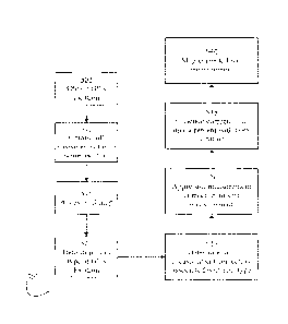
[0002] FIG. 1 is a top view of an embodiment agricultural planter.
[0003] FIG. 2 is a side elevation view of an embodiment of a planter row unit.
[0004] FIG. 3 schematically illustrates an embodiment of a soil monitoring
system.
[0005] FIG. 4 illustrates an embodiment of a soil characteristic map.
[0006] FIG. 5 illustrates an embodiment of a process for correcting a soil
measurement based on
soil type.
[0007] FIG. 6 illustrates an embodiment of a process for correcting a soil
reflectance
measurement based on soil type.
[0008] FIG. 7 illustrates an embodiment of a process for correcting a soil
reflectance
measurement using a soil measurement map.
[0009] FIG. 8 illustrates an embodiment of a process for correcting a soil
reflectance
measurement based on a second soil characteristic measurement.
[0010] FIG. 9 illustrates an embodiment of a process for correcting a soil
reflectance
measurement based on a soil type and a second soil characteristic measurement.
[0011] FIG. 10 illustrates an embodiment of a process for correcting a soil
reflectance
measurement based on a second soil reflectance measurement.
1
CA 02912403 2015-11-12
WO 2014/186810 PCT/US2014/038677
[0012] FIG. 11 illustrates an embodiment of a process for correcting a soil
reflectance
measurement made at multiple wavelengths using a second soil reflectance
measurement made at
multiple wavelengths.
[0013] FIG. 12 illustrates an embodiment of a soil moisture map.
[0014] FIG. 13 illustrates an embodiment of an electrical conductivity sensor.
DESCRIPTION
Soil Monitoring System
[0015] Referring now to the drawings, wherein like reference numerals
designate identical or
corresponding parts throughout the several views, FIG. 1 illustrates a tractor
5 drawing an
agricultural implement, e.g., a planter 10, comprising a toolbar 14
operatively supporting
multiple row units 200. An implement monitor 50 preferably including a central
processing unit
("CPU"), memory and graphical user interface ("GUI") (e.g., a touch-screen
interface) is
preferably located in the cab of the tractor 5. A global positioning system
("GPS") receiver 52 is
preferably mounted to the tractor 5.
[0016] Turning to FIG. 2, an embodiment is illustrated in which the row unit
200 is a planter row
unit. The row unit 200 is preferably pivotally connected to the toolbar 14 by
a parallel linkage
216. An actuator 218 is preferably disposed to apply lift and/or downforce on
the row unit 200.
A solenoid valve 390 is preferably in fluid communication with the actuator
218 for modifying
the lift and/or downforce applied by the actuator. An opening system 234
preferably includes
two opening discs 244 rollingly mounted to a downwardly-extending shank 254
and disposed to
open a v-shaped trench 38 in the soil 40. A pair of gauge wheels 248 is
pivotally supported by a
pair of corresponding gauge wheel arms 260; the height of the gauge wheels 248
relative to the
opener discs 244 sets the depth of the trench 38. A depth adjustment rocker
268 limits the
upward travel of the gauge wheel arms 260 and thus the upward travel of the
gauge wheels 248.
A depth adjustment actuator 380 is preferably configured to modify a position
of the depth
adjustment rocker 268 and thus the height of the gauge wheels 248. The
actuator 380 is
preferably a linear actuator mounted to the row unit 200 and pivotally coupled
to an upper end of
the rocker 268. In some embodiments the depth adjustment actuator 380
comprises a device
2
such as that disclosed in International Patent Application No.
PCT/US2012/035585. An
encoder 382 is preferably configured to generate a signal related to the
linear extension of the
actuator 380; it should be appreciated that the linear extension of the
actuator 380 is related to
the depth of the trench 38 when the gauge wheel arms 260 are in contact with
the rocker 268.
A downforce sensor 392 is preferably configured to generate a signal related
to the amount of
force imposed by the gauge wheels 248 on the soil 40; in some embodiments the
downforce
sensor 392 comprises an instrumented pin about which the rocker 268 is
pivotally coupled to
the row unit 200, such as those instrumented pins disclosed in Applicant's co-
pending U.S.
Patent Application No. 12/522,253 (Pub. No. 1JS2010/0180695.).
[0017] Continuing to refer to FIG. 2, a seed meter 230 such as that disclosed
in Applicant's co-
pending International Patent Application No. PCIAJS2012/0301 92, is preferably
disposed to
deposit seeds 42 from a hopper 226 into the trench 38, e.g., through a seed
tube 232 disposed
to guide the seeds toward the trench. In some embodiments, the meter is
powered by an
electric drive 315 configured to drive a seed disc within the seed meter. In
other embodiments,
the drive 315 may comprise a hydraulic drive configured to drive the seed
disc. A seed sensor
305 (e.g., an optical or electromagnetic seed sensor configured to generate a
signal indicating
passage of a seed) is preferably mounted to the seed tube 232 and disposed to
send light or
electromagnetic waves across the path of seeds 42. A closing system 236
including one or
more closing wheels is pivotally coupled to the row unit 200 and configured to
close the trench
38.
[0018] 'Fuming to FIG. 3, a depth control and soil monitoring system 300 is
schematically
illustrated. The monitor 50 is preferably in electrical communication with
components
associated with each row unit 200 including the drives 315, the seed sensors
305, the UPS
receiver 52, the downforce sensors 392, the valves 390, the depth adjustment
actuators 380, the
depth actuator encoders 382 (and in some embodiments actual depth sensors 385
such as those
described in applicant's co-pending U.S. Provisional Patent Application No.
61/718073), and
the solenoid valves 390. In some embodiments, particularly those in which each
seed meter
230 is not driven by an individual drive 315, the
3
Date Recue/Date Received 2020-10-04
monitor 50 is also preferably in electrical communication with clutches 310
configured to
selectively operably couple the seed meter 230 to the drive 315.
10019] Continuing to refer to FIG. 3, the monitor 50 is preferably in
electrical communication
with a cellular modem 330 or other component configured to place the monitor
50 in data
communication with the Internet, indicated by reference numeral 335. Via the
Internet
connection, the monitor 50 preferably receives data from a soil data server
345. The soil data
server 345 preferably includes soil map files (e.g., shape files) associating
soil types (or other
soil characteristics) with GPS locations. In some embodiments, soil map files
are stored in the
memory of the monitor 50. An exemplary soil map 400 is illustrated in FIG. 4.
The soil map
400 comprises a soil type map in which soil type polygons 402-1, 402-2, 402-3,
402-4 within a
field boundary 404 are associated with soil types 412, 414, 410, 412
respectively.
[0020] Returning to FIG. 3, the monitor 50 is also preferably in electrical
communication with
one or more temperature sensors 360 mounted to the planter 10 and configured
to generate a
signal related to the temperature of soil being worked by the planter row
units 200. In some
embodiments one or more of the temperature sensors 360 comprise thermocouples
disposed to
engage the soil as disclosed in Applicant's co-pending U.S. provisional patent
application no.
61/783,591 ("the '591 application"); in such embodiments the temperature
sensors 360
preferably engage the soil at the bottom of the trench 38. In other
embodiments, one or more of
the temperature sensors 360 may comprise a sensor disposed and configured to
measure the
temperature of the soil without contacting the soil as disclosed in
International Patent
Application No, PCT/U52012/035563.
[0021] Referring to FIG. 3, the monitor 50 is preferably in electrical
communication with one or
more moisture sensors 350 mounted to the planter 10 and configured to generate
a signal related
to the temperature of soil being worked by the planter row units 200. In some
embodiments, the
moisture sensor 350 comprises a reflectance sensor such as that disclosed in
U.S. Patent no.
8,204,689 ("the '689 application"). In such embodiments, the moisture sensor
350 is preferably
mounted to the shank 254 of the row unit 200 and disposed to measure the soil
moisture at the
bottom of the trench 38, preferably at a
4
Date Recue/Date Received 2020-10-04
position longitudinally forward of the seed tube 232. The monitor 50 is
preferably in electrical
communication with one or more second-depth moisture sensors 352. The second-
depth
moisture sensor 352 preferably comprises a reflectance sensor such as that
disclosed in the '689
application, disposed to measure soil moisture at a depth at which consistent
moisture reading is
expected. In some embodiments the second-depth moisture sensor 352 is disposed
to measure
soil moisture at a greater depth than used for planting, such as between 3 and
6 inches and
preferably approximately 4 inches below the soil surface. In other embodiments
the second-
depth moisture sensor 352 is disposed to measure soil moisture at a lesser
depth than used for
planting, such as between 0.25 inch and 1 inch and preferably approximately
0.5 inch below the
soil surface. The second-depth moisture sensor 352 is preferably disposed to
open a trench
laterally offset from the trenches 38 opened by the row units 200.
[0022] Referring to FIG. 3, the monitor 50 is preferably in electrical
communication with one or
more electrical conductivity sensors 365. The electrical conductivity sensor
365 preferably
comprises one or more electrodes disposed to cut into the soil surface such as
the sensors
disclosed in U.S. Patents Nos. 5,841,282 and 5,524,560. Another embodiment of
the electrical
conductivity sensor 365 is illustrated in FIG_ 13_ The electrical conductivity
sensor 365
preferably includes one or more conductive opener discs 1330 disposed to cut
into the soil. The
discs 1330 are preferably rollingly mounted to a support 1340 about a bearing
1332. The
bearing 1332 is preferably in electrical contact with the opener discs 1330
but electrically
isolated from the support 1340, e.g., by being mounted within an insulating
material. The
bearing 1332 is preferably in electrical communication with the monitor 50 via
an electrical lead
1334. One or more gauge wheels 1320 are preferably rollingly mounted to the
support 1340 and
disposed to ride along the soil surface 40, setting the depth of a trench 39
opened by the opener
discs 1330. The support 1340 is preferably mounted to the toolbar 14 by a
parallel arm
arrangement 1316. The opener discs 1330 are preferably biased into engagement
with the soil by
a spring 1318 mounted to the parallel arm arrangement 1316. In still another
embodiment of the
electrical conductivity sensor 365, the opener discs 244 of the row unit 200
are rollingly mounted
to the shank 254 by a shaft; the shaft is preferably in electrical contact
with the opener discs 244
but electrically isolated from the shank 254, e.g., by being mounted within an
insulating material.
The shaft is preferably in electrical communication with the monitor 50.
Date Recue/Date Received 2020-10-04
CA 02912403 2015-11-12
WO 2014/186810 PCMJS2014/038677
[0023] Referring to FIG. 3, the monitor 50 is preferably in electrical
communication with one or
more pH sensors 355. In some embodiments the pH sensor 355 is drawn by a
tractor or by
another implement (e.g., a tillage implement) such that data is stored in the
monitor 50 for later
use. In some such embodiments, the pH sensor 355 is similar to that disclosed
in U.S. Patent No.
6,356,830. In some embodiments, the pH sensor 355 is mounted to the toolbar
14, preferably at
a position laterally offset from the row units 200.
Moisture Measurement Methods
[0024] Turning to FIG. 5, a process 500 for correcting a soil measurement with
a soil map is
illustrated. At step 505, the monitor 50 preferably determines the GPS
location of the planter 10.
At step 510, the monitor 50 preferably obtains a soil measurement near the
obtained GPS
location. At step 515, the monitor 50 preferably accesses a soil map such as
the soil type map
400 described herein and illustrated in FIG. 4. At step 520, the monitor 50
preferably determines
a soil characteristic such as a soil type at the GPS location, e.g., by
determining the soil type
associated with the GPS location within the soil type map 400. At step 525,
the monitor 50
preferably determines a soil measurement correction associated with the soil
characteristic (e.g.,
soil type) at the GPS location. For example, the monitor 50 may have a table
stored in memory
including multiple soil measurement corrections, each associated with a soil
characteristic (e.g.,
soil type). At step 530, the monitor 50 preferably applies the soil
measurement correction to the
soil measurement, e.g., by adding the soil measurement correction to the soil
measurement. At
step 535, the monitor 50 preferably associates the corrected soil measurement
with the CPS
location, e.g., by storing the corrected soil measurement in a data array
along with the GPS
location. At step 540, the monitor 50 preferably displays a map of the
corrected soil
measurement.
[0025] Turning to FIG. 6, a process 600 for correcting a reflectance-based
moisture
measurement with a soil map is illustrated. At step 605, the monitor 50
preferably determines
the GPS location of the planter 10. At step 610, the monitor 50 preferably
obtains a soil
reflectance measurement (i.e., a reflectance value, measured as a percentage)
near the obtained
GPS location using the moisture sensor 350. At step 615, the monitor 50
preferably accesses a
soil map such as the soil type map 400 described herein and illustrated in
FIG. 4. At step 620,
6
CA 02912403 2015-11-12
WO 2014/186810 PCMJS2014/038677
the monitor 50 preferably determines a soil characteristic such as a soil type
at the GPS location,
e.g., by determining the soil type associated with the GPS location within the
soil type map 400.
At step 625, the monitor 50 preferably determines a soil reflectance
measurement correction
associated with the soil characteristic (e.g., soil type) at the GPS location.
For example, the
monitor 50 may have a table stored in memory including multiple soil
reflectance measurement
corrections, each associated with a soil characteristic (e.g., soil type). In
one embodiment, the
monitor 50 determines a correction of 7% relative reflectance for reflectance
values measured in
soil classified as clay; a correction of -7% relative reflectance for
reflectance values measured in
soil classified as sand, sandy loam, or loamy sand; and a correction of 8%
relative reflectance for
reflectance values measured in soil classified as silt or silty loam.
[0026] Continuing to refer to FIG. 6, at step 630 the monitor 50 preferably
applies the soil
reflectance measurement correction to the soil measurement, e.g., by adding
the soil reflectance
measurement correction to the soil reflectance measurement. At step 632, the
monitor 50
preferably estimates a soil measurement (e.g., soil moisture) using the
corrected soil reflectance
measurement. In one such embodiment, the soil reflectance measurement is made
at a
wavelength of about 1600 nanometers and the monitor 50 estimates the soil
moisture M (in
percent water weight) based on the corrected soil reflectance R (measured as a
percentage) using
the equation:
M = 80 ¨
Where: R is the relative reflectance expressed as a percentage, and
M is the soil moisture content by weight, expressed as a percentage and
corresponding to the value calculated using dry sample weight Wd and
wet sample weight Ww in the following equation:
¨
¨ ___________________________________ X 100%
[0027] Continuing to refer to FIG. 6, at step 635 the monitor 50 preferably
associates the
estimated soil measurement (e.g., soil moisture) with the GPS location, e.g.,
by storing the
estimated soil measurement in a data array along with the GPS location. At
step 640, the
7
CA 02912403 2015-11-12
WO 2014/186810 PCMJS2014/038677
monitor 50 preferably displays a map of the estimated soil measurement, as
illustrated in
exemplary moisture map 1200 of FIG. 12. In the embodiment of FIG. 12, a single
moisture
sensor 350 is mounted to the toolbar 14 such that one of the images 1224,
1224, 1226 associated
with legend ranges 1212, 1214, 1216 is displayed along the entire width of the
planter 10 at each
longitudinal position corresponding to a corrected moisture measurement
determined as
described herein. In some embodiments, the monitor 50 also displays the
numerical value of the
corrected moisture measurement, preferably averaged over a distance (e.g., 50
feet) previously
traversed by the toolbar 14.
[0028] Turning to FIG. 7, a process 700 for correcting a reflectance-based
moisture
measurement made during an in-field operation using a previously created soil
measurement map
is illustrated. At step 705, the monitor 50 preferably determines the GPS
location of the planter
10. At step 710, the monitor 50 preferably obtains a soil reflectance
measurement near the
obtained GPS location using the moisture sensor 350. At step 715, the monitor
50 preferably
accesses a soil measurement map. The soil measurement map preferably comprises
a file
associating geo-referenced locations with soil measurements made either during
the planting
operation or during a previous operation. Each soil measurement spatially
represented in the soil
measurement map may comprise an electrical conductivity measurement made using
the
electrical conductivity sensor 365, a pH measurement made using the pH sensor
355, a second
soil reflectance measurement made at a different depth using the second-depth
moisture sensor
352, or another measurement of soil content or characteristics. At step 720,
the monitor 50
preferably identifies a soil measurement value associated with the GPS
location in the soil
measurement map; it should be appreciated that the GPS location will
correspond to a region of
the soil measurement map which is associated with a soil measurement value.
[0029] Continuing to refer to FIG. 7, at step 725 the monitor 50 preferably
determines a soil
reflectance measurement correction associated with the soil measurement
associated with the
GPS location. For example, the monitor 50 may have a table stored in memory
including
multiple soil reflectance measurement corrections, each associated with a soil
measurement
range. In one embodiment the soil measurement is electrical conductivity and
the monitor 50
determines a correction of 7% relative reflectance for reflectance values
measured in soil having
an electrical conductivity greater than 10 milliSiemens per meter (10 mS/m)
and a correction of -
8
CA 02912403 2015-11-12
WO 2014/186810 PCMJS2014/038677
7% relative reflectance for reflectance values measured in soil having an
electrical conductivity
less than 2 mS/m.
[0030] Continuing to refer to FIG. 7, at step 730 the monitor 50 preferably
applies the soil
reflectance measurement correction to the soil reflectance measurement, e.g.,
by adding the soil
reflectance measurement correction to the soil reflectance measurement. At
step 732, the
monitor 50 preferably estimates a soil measurement (e.g., soil moisture) using
the corrected soil
reflectance measurement; in some embodiments the step 732 is carried out as
described above
with respect to step 632 of process 600. At step 735, the monitor 50
preferably associates the
estimated soil measurement (e.g., soil moisture) with the GPS location, e.g.,
by storing the
estimated soil measurement in a data array along with the GPS location. At
step 740, the
monitor 50 preferably displays a map of the estimated soil measurement similar
to that illustrated
in FIG. 12.
[0031] Turning to FIG. 8, a process 800 for correcting an reflectance-based
moisture
measurement made during an in-field operation with another soil measurement
made during the
same in-field operation is illustrated. At step 805, the monitor 50 preferably
determines the GPS
location of the planter 10. At step 810, the monitor 50 preferably obtains a
soil reflectance
measurement near the obtained GPS location using the moisture sensor 350. At
step 815, the
monitor 50 preferably obtains a second soil measurement near the obtained GPS
location. The
second soil measurement may comprise an electrical conductivity measurement, a
pH
measurement, a second soil reflectance measurement made at a different depth
using the second-
depth moisture sensor 352, a second soil reflectance measurement made at a
different
wavelength using either the second-depth moisture sensor 352 or the moisture
sensor 350, or
another measurement of soil content or characteristics. At step 820, the
monitor 50 preferably
determines a soil reflectance measurement correction associated with the
second soil
measurement. For example, the monitor 50 may have a table stored in memory
including
multiple soil reflectance measurement corrections, each associated with a soil
measurement
range. In one embodiment, the second soil measurement is electrical
conductivity and the
correction is determined as described above with respect to step 720 of the
process 700. At step
830, the monitor 50 preferably applies the soil reflectance measurement
correction to the soil
reflectance measurement, e.g., by adding the soil reflectance measurement
correction to the soil
9
CA 02912403 2015-11-12
WO 2014/186810 PCMJS2014/038677
reflectance measurement. At step 832, the monitor 50 preferably estimates a
soil measurement
(e.g., soil moisture) using the corrected soil reflectance measurement; in
some embodiments the
step 832 is carried out as described above with respect to step 632 of process
600. At step 835,
the monitor 50 preferably associates the estimated soil measurement (e.g.,
soil moisture) with the
GPS location, e.g., by storing the estimated soil measurement in a data array
along with the GPS
location. At step 840, the monitor 50 preferably displays a map of the
estimated soil
measurement similar to that illustrated in FIG. 12.
[0032] Turning to FIG. 9, a process 900 for correcting a reflectance-based
moisture
measurement made during an in-field operation using a previously created soil
map as well as
another soil measurement made during the same in-field operation is
illustrated. At step 905, the
monitor 50 preferably determines the GPS location of the planter 10. At step
910, the monitor
50 preferably obtains a soil reflectance measurement near the obtained GPS
location using the
moisture sensor 350. At step 913, the monitor 50 preferably accesses a soil
type map such as the
soil type map 400 described herein and illustrated in FIG. 4. At step 914, the
monitor 50
preferably determines a soil characteristic such as a soil type at the GPS
location, e.g., by
determining the soil type associated with the GPS location within the soil
type map 400. At step
915, the monitor 50 preferably obtains a second soil measurement near the
obtained GPS
location. The second soil measurement may comprise an electrical conductivity
measurement, a
pH measurement, a second soil reflectance measurement made at a different
depth using the
second-depth moisture sensor 352, a second soil reflectance measurement made
at a different
wavelength using either the second-depth moisture sensor 352 or the moisture
sensor 350, or
another measurement of soil content or characteristics. At step 920, the
monitor 50 preferably
determines a soil reflectance measurement correction associated with the soil
characteristic (e.g.,
soil type) at the GPS location; in some embodiments, the step 920 is carried
out similarly to the
step 625 of the process 600. At step 922, the monitor 50 preferably applies
the soil reflectance
measurement correction determined at step 920 to the soil reflectance
measurement, e.g., by
adding the soil reflectance measurement correction to the soil reflectance
measurement. At step
924, the monitor 50 preferably determines a soil reflectance measurement
correction associated
with the second soil measurement. For example, the monitor 50 may have a table
stored in
memory including multiple soil reflectance measurement corrections, each
associated with a soil
measurement range. In some embodiments, the second soil measurement is
electrical
CA 02912403 2015-11-12
WO 2014/186810 PCMJS2014/038677
conductivity and the step 924 is carried out similarly to the step 720 of the
process 700. At step
926, the monitor 50 preferably applies the soil reflectance measurement
correction determined at
step 924 to the soil reflectance measurement, e.g., by adding the soil
reflectance measurement
correction to the soil reflectance measurement. At step 930, the monitor 50
preferably estimates
a soil measurement (e.g., soil moisture) using the soil reflectance
measurement corrected at steps
922 and 926. In some embodiments, the step 930 is carried out similarly to the
step 632 of the
process 600. At step 935, the monitor 50 preferably associates the estimated
soil measurement
(e.g., soil moisture) with the GPS location, e.g., by storing the estimated
soil measurement in a
data array along with the GPS location. At step 940, the monitor 50 preferably
displays a map of
the estimated soil measurement similar to that illustrated in FIG. 12.
[0033] Turning to FIG. 10, a process 1000 for correcting a first reflectance-
based moisture
measurement made at a first depth during an in-field operation using a second
reflectance-based
moisture measurement made at a second depth is illustrated. At step 1005, the
monitor 50
preferably determines the GPS location of the planter 10. At step 1010, the
monitor 50
preferably obtains a first soil reflectance measurement near the obtained GPS
location using the
moisture sensor 350. The soil reflectance measurement made at step 1010 is
made at a first
depth; in some embodiments, the first depth is the same or approximately the
same depth as the
seed trench 38 opened by a row unit 16 of the planter 10. At step 1015, the
monitor 50
preferably obtains a second soil reflectance measurement near the obtained GPS
location at a
second depth substantially different than the first depth. In some embodiments
the second depth
is between 3 and 6 inches and preferably approximately 4 inches. In other
embodiments, the
second depth is between V2 inch and 1 inch and preferably approximately 0.75
inch. The second
soil reflectance measurement is preferably made using a second-depth moisture
sensor 352. In
some embodiments, the second soil reflectance measurement is made using a
second-depth
moisture sensor mounted to the planter 10 such that the second soil
reflectance measurement is
made during the same in-field operation as the first soil reflectance
measurement. In other
embodiments, the second soil reflectance measurement is made during a prior in-
field operation;
for example, a second-depth moisture sensor 352 may be mounted to a toolbar
used for soil
tillage prior to planting.
[0034] Continuing to refer to FIG. 10, at step 1020, the monitor 50 preferably
determines a soil
11
CA 02912403 2015-11-12
WO 2014/186810 PCMJS2014/038677
reflectance measurement correction associated with the second soil reflectance
measurement
obtained at step 1015. For example, the monitor 50 may have a table stored in
memory
including multiple soil reflectance measurement corrections, each associated
with a soil
reflectance measurement range. In some embodiments, the second soil
reflectance measurement
is carried out at a depth (e.g., 4 inches) at which consistent and high
moisture is expected and the
correction C is calculated using the equation:
R,
_
¨
R _
Where: Ra is the value of the second soil reflectance measurement; and
Re is an empirically determined expected value of the second soil
reflectance measurement.
[0035] In some embodiments, the monitor 50 includes values of Re stored in
memory, each
corresponding to a soil type; in such embodiments the monitor 50 identifies
the soil type near the
GPS location and selects a value of Re corresponding to the soil type.
[0036] Continuing to refer to FIG. 10, at step 1025 the monitor 50 preferably
applies the soil
reflectance measurement correction obtained at step 1020 to the soil
reflectance measurement,
e.g., by multiplying the soil reflectance measurement correction by the soil
reflectance
measurement. At step 1030, the monitor 50 preferably estimates a soil
measurement (e.g., soil
moisture) using the corrected soil reflectance measurement; in some
embodiments, the step 1030
is carried out in a substantially similar to the step 632 of the process 600.
At step 1035, the
monitor 50 preferably associates the estimated soil measurement (e.g., soil
moisture) with the
GPS location, e.g., by storing the estimated soil measurement in a data array
along with the GPS
location. At step 1040, the monitor 50 preferably displays a map of the
estimated soil
measurement similar to that illustrated in FIG. 12.
[0037] Turning to FIG. 11, a process 1100 for correcting a moisture estimation
based on
reflectance measurements made at two wavelengths at a first depth during an in-
field operation
using a second reflectance-based moisture measurement made at a second depth
is illustrated. At
step 1105, the monitor 50 preferably determines the GPS location of the
planter 10. At step
12
CA 02912403 2015-11-12
WO 2014/186810 PCMJS2014/038677
1110, the monitor 50 preferably obtains a first short-wavelength (e.g.,
between 380 nm and 750
nm) soil reflectance measurement near the obtained GPS location using the
moisture sensor 350.
At step 1112, the monitor 50 preferably obtains a first long-wavelength (e.g.,
between 750 nm
and 3000 nm and preferably about 1600 nm) soil reflectance measurement near
the obtained GPS
location using the moisture sensor 350. The soil reflectance measurements made
at step 1110
and step 1112 are made at a first depth; in some embodiments, the first depth
is the same or
approximately the same depth as the seed trench 38 opened by a row unit 16 of
the planter 10.
[0038] Continuing to refer to FIG. 11, at step 1115, the monitor 50 preferably
obtains a second
short-wavelength (e.g., between 380 nm and 750 nm) soil reflectance
measurement near the
obtained GPS location using the moisture sensor 350. At step 1117, the monitor
50 preferably
obtains a second long-wavelength (e.g., between 750 nm and 2000 nm and
preferably about 1600
nm) soil reflectance measurement near the obtained GPS location using the
moisture sensor 350.
The soil reflectance measurements made at step 1115 and step 1117 are made at
a second depth.
In some embodiments the second depth is between 3 and 6 inches and preferably
approximately
4 inches. In other embodiments, the second depth is between 0.5 inch and 1
inch and preferably
approximately 0.75 inch. The second soil reflectance measurement is preferably
made using a
second-depth moisture sensor 352. In some embodiments, the second soil
reflectance
measurement is made using a second-depth moisture sensor mounted to the
planter 10 such that
the second soil reflectance measurement is made during the same in-field
operation as the first
soil reflectance measurement. In other embodiments, the second soil
reflectance measurement is
made during a prior in-field operation; for example, a second-depth moisture
sensor 352 may be
mounted to a toolbar used for soil tillage prior to planting.
[0039] Continuing to refer to FIG. 11, at step 1120 the monitor 50 preferably
estimates a soil
measurement (e.g., soil moisture) based on the first short-wavelength
measurement and the first
long-wavelength measurement. For a given mixture of soil and moisture, the
total reflectance
Rr(A) at a wavelength A may be related to the soil-based reflectance R.,,(A),
due to the soil
components and the moisture-based reflectance gm(A) due to moisture by the
equation:
R(A) = R,00 R,, (A) k
13
CA 02912403 2015-11-12
WO 2014/186810 PCMJS2014/038677
Where: k1 is an empirically determined constant, e.g., 2%.
[0040] The first short-wavelength total reflectance measurement RT(12) taken
at step 1112 is
preferably taken at relatively short wavelength A. (e.g., 600 nm) for which
the moisture-based
reflectance R,,(4) is expected to be an empirically determined constant value
k2 (e.g., 10%) so
that the soil-based reflectance it',(2.1;:) may be determined by the equation:
Rs(As) Rr(as) ¨
[0041] The first high-wavelength total reflectance measurement R.T() taken at
step 1112 is
preferably taken at a wavelength (e.g., 600 nm) at which the total reflectance
RT correlates
strongly (e.g., at an r-value greater than .8) with moisture and at which the
expected value of
R2(k) may be estimated by the relationship:
RA,R.z) =
Where: k3 is an empirically determined factor, e.g., 1.2.
[0042] Thus, the value of R(l) may be estimated using the relationship:
= R7($12) ¨ k2[RT(AJ ¨ ¨ k21
[0043] The monitor 50 preferably estimates the soil moisture M (in percent
water weight) using
the equation:
M = 80 ¨ 1,4R,0.)
[0044] Continuing to refer to FIG. 11, at step 1125 the monitor 50 preferably
determines a soil
reflectance measurement correction associated with the second soil reflectance
measurements
obtained at step 1115 and step 1117. In some embodiments, the monitor 50 first
calculates a
14
value of R,õ(21) calculated as the value R,0_,) was calculated above with
respect to step 1125,
but using the second-depth measurements taken at steps 1115 and 1117 rather
than the first-depth
measurements. A correction factor k..4 is calculated based on an expected
value E (e.g., 15%) of
(2i) at the second depth using the equation:
R
o:4 _____________________________________
[0045] The corrected moisture M is then calculated using the equation:
= 80¨ 1,4k4R,X41)
[0046] Continuing to refer to FIG. 11, at step 1130 the monitor 50 preferably
applies the soil
reflectance measurement correction obtained at step 1120 to estimated
moisture, e.g., by adding
the soil reflectance measurement correction to the estimated moisture. At step
1135, the monitor
50 preferably associates the estimated soil moisture with the GPS location,
e.g., by storing the
estimated soil measurement in a data array along with the GPS location. At
step 1140, the
monitor 50 preferably displays a map of the estimated soil measurement similar
to that illustrated
in FIG. 12.
Further Embodiments
[0047] In addition to reporting and mapping the moisture values measured as
described herein,
in some embodiments a trench depth is adjusted based on the moisture values as
described in the
591 application.
[0048] Where no wavelength or range of wavelengths is recited, the soil
reflectance
measurements taken herein may be taken using wavelengths in the visible (e.g.,
380 nm to 750
nm), near-infrared ("NIR") (e.g., 750 nm to 1400 nm), or short-wavelength
infrared (e.g., 1400
nm to 3000 nm) ranges. Additionally, the measurement may comprise a weighted
sum or
weighted average of reflectance values at multiple wavelengths. Where
reflectance
measurements are taken at two wavelengths at a single depth as recited herein,
such
Date Recue/Date Received 2020-10-04
CA 02912403 2015-11-12
WO 2014/186810 PCMJS2014/038677
measurements may be taken either by two similar devices disposed to measure
reflectance at the
same depth near the same location, or by rapidly changing the wavelength of
light imposed by a
single measurement device.
[0049] It should be appreciated that shifts and corrections applied herein to
a reflectance value
may instead be applied to the resulting estimated moisture value, and vice
versa.
[0050] It should be appreciated that although actual moisture values
calculated as described
herein may not be equivalent to lab-tested values determined for a sample of
the same soil, the
spatial variance in moisture in the field will still provide accurate and
important information to
the operator in making tillage, crop input and planting depth decisions.
Additionally, a
confidence value may be associated with the calculated moisture values such
that tillage, crop
input, and depth adjustment decisions may be made based on a desired
statistical confidence
(e.g., 95%) that the soil moisture is greater than or less than a threshold
value.
[0051] It should be appreciated that the systems and methods described herein
may be
implemented using other toolbars other than planter toolbars, e.g., tillage or
side-dress toolbars.
[0052] The foregoing description is presented to enable one of ordinary skill
in the art to make
and use the invention and is provided in the context of a patent application
and its requirements.
Various modifications to the preferred embodiment of the apparatus, and the
general principles
and features of the system and methods described herein will be readily
apparent to those of skill
in the art. Thus, the present invention is not to be limited to the
embodiments of the apparatus,
system and methods described above and illustrated in the drawing figures, but
is to be accorded
the widest scope consistent with the spirit and scope of the appended claims.
16