Note: Descriptions are shown in the official language in which they were submitted.
CA 02995999 2018-02-16
WO 2017/035476 PCT/US2016/049006
1
NODAL HYBRID GATHER
FIELD OF THE DISCLOSURE
[0001] The disclosure generally relates to seismic surveying and seismic
data processing
methods.
BACKGROUND OF THE DISCLOSURE
[0002] For many years seismic exploration for oil and gas has involved
the use of a source
of seismic energy and its reception by an array of seismic detectors,
generally referred to
as geophones on land, and hydrophones at sea. In land surveys, the source of
seismic energy
can be a high explosive charge electrically detonated in a borehole located at
a selected
point on the terrain, or a vibrator truck that creates a series of vibrations
or impacts of a
baseplate to the earth's surface. At sea, the most common source is an air
gun.
[0003] The acoustic waves generated in the earth by these various seismic
sources are
partially reflected from various earth layers and transmitted back from layer
boundaries
and reach the surface of the earth at varying intervals of time, depending on
the distance
and characteristics of the subsurface traversed. These returning waves are
detected by the
receivers, which function to transduce such acoustic waves into representative
electrical
signals.
[0004] Conventionally, an arrangement of receivers is generally laid out
along a line to
form a series of observation stations within a desired locality. The seismic
source applies
an acoustic signal to the earth, and the detected signals, which are reflected
from points
midway between the source and receiver, are recorded for later processing.
[0005] These recorded signals or "traces" are continuous electrical
analog signals
depicting amplitude versus time, and are generally quantized using digital
computers so
that each data sample point may be operated on individually.
[0006] The receiver arrangement is then moved along the line to a new
position where
some of the shot or receiver points may overlap, and the process repeated.
With enough
CA 02995999 2018-02-16
WO 2017/035476 PCT/US2016/049006
2
repeats, a seismic survey is obtained. If the ground and subsurface reflecting
layer are flat,
as previously mentioned a seismic shot yields data from midway between the
source and
receiver.
[0007] One of the techniques utilized in processing seismic data is to
combine traces
produced from two or more shots wherein the midpoint between the source and
the receiver
in each case is the same, although the offset, i.e., sources to receiver
distance, may be
different. When two or more traces belonging to a common midpoint (CMP) are
summed,
the technique is called common-midpoint stacking.
[0008] A single wave-producing activation of a source (regardless of the
source type),
called a "shot," results in generating a number of traces equal to the number
of receivers.
Aligning all of the recorded traces from a single shot in a side by side
display i.e. a "shot
gather" can produce a rudimentary two dimensional seismic section. The section
can be
improved, however, by the CMP stacking. Since sound traveling two different
paths gives
information from approximately the same subsurface point, two such traces
reflected from
a common point can be combined, i.e., summed, such that reflection amplitudes
are added
but the noise, which occurs at different times on the two traces, is not added
thus improving
the signal-to-noise ratio. The number of traces summed in an individual stack
is called the
multifold or simply the "fold."
[0009] More recently, seismic surveys involve receivers and sources laid
out in more
complex geometries, generally involving rectangular or non-orthogonal grids
covering an
area of interest so as to expand areal coverage and enable construction of
three-dimensional
(3D) views of reflector positions over wide areas.
[0010] A normal prior art three-dimensional survey geometry is shown in
FIG. 1, in which
a basic grid, indicated generally at 21, is defined for effective placement of
shotpoints that
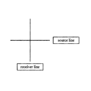
are designated as squares 24, and geophone receivers that are designated as
crosses 22. As
illustrated, the basic grid 21 is a square having a dimension dl that is equal
to twice the
desired reflection midpoint spacing, and that will provide an image having a
desired
resolution of subsurface features.
[0011] A plurality of geophone receiver lines 20a-20n each containing a
plurality of
equally spaced apart geophone receivers 22 is place in parallel on the earth's
surface. A
CA 02995999 2018-02-16
WO 2017/035476 PCT/US2016/049006
3
plurality of shotpoints 24 is placed along source or shot lines 26a -26n which
run
orthogonally to the receiver lines 20a -20n, thus providing a symmetrical
crossed array
geometry with geophone receivers 22 in lines 20a-20n and source stations 24 in
lines 26a
-26n spaced apart a distance equal to dl, and the lines 26a-26n spaced apart a
distance of
four times dl (4d1). This crossed-arrayed geometry produces subsurface spatial
resolution
in which midpoints are spaced apart by one-half of the distance dl in the
receiver line, and
one-half of the distance dl in the source line. For example, if receivers and
sources, as
shown in FIG. 1, are each spaced 165 ft. apart, reflection midpoints will be
spaced apart
by 82.5 ft. and four adjacent midpoints will form a square.
[0012] It is well known, however, to those skilled in the art that
improved surface sampling
resolution in a survey can be obtained with a source/receiver geometry that is
referred to
herein as "true 3D coverage." This geometry also uses CM? stacking in which
the
shotpoints and receivers are laid out in the generally rectangular areas
similar to the
arrangement shown in FIG. 1, but with closer spacing of the receiver lines 20
in the
shotpoint line direction. As used herein, a true 3D seismic source/receiver
geometry locates
a geophone receiver and/or a shotpoint at each intersection of the basic grid
21.
[0013] An example of true 3D seismic source/receiver geometry having a
geophone
receiver at each intersection of the basic grid 21, and having shotpoints
spaced apart at a
distance four times dl is illustrated in FIG. 2A and 2B. Using the same size
basic grid 21
as shown in FIG. 1, such a true 3D layout would include 400 geophone receivers
and 25
shotpoints covering a surface area 19 in FIG. 2A that is equal to the surface
area 19 shown
in FIG. 1. Once all of the receivers and shotpoints are in place, the shots
are sequentially
activated and a number of traces that is equal to the number of shots times
the number of
receivers are recorded to provide a single data set from which a display of a
seismic 2D
section, or a 3D volume could be produced. In this true 3D technique the
recorded traces
having common midpoints, which are sorted out later from the recorded traces,
are gathered
in a display, which yield greatly increased surface resolution compared to the
surface
resolution shown in FIG. 1.
[0014] In seismic acquisition and processing operations, it is well known
to those skilled
in the art that a frequency ambiguity called aliasing is inherent in sampling
systems, and
CA 02995999 2018-02-16
WO 2017/035476 PCT/US2016/049006
4
that aliasing occurs in a sampling process when there are fewer than two
samples per cycle.
Aliasing applies to both the time and space domains. The aliasing that is done
by the
separated elements of geophone receivers and shotpoints is called spatial
aliasing and
depends on the surface spacing of the shotpoints and receiver. The aliasing
that is done by
sampling an input signal is called frequency aliasing and is dependent on the
sampling
interval used to digitize input signals.
[0015] To avoid aliasing, filtering is commonly required. For example, an
alias filter
applied before sampling a geophone signal at a ground location removes certain
undesired
frequencies, likewise a velocity filter of a seismic gather attenuates certain
coherent arrivals
of waves, which sweep over the geophone receivers having certain apparent
receiver
velocities. Accordingly, an advantage of true 3D seismic source/receiver
layout geometry
is avoiding spatial aliasing.
[0016] There is a disadvantage to this kind of true 3D shooting, however,
in the excessive
amount of equipment required to occupy every surface location with a receiver
and/or a
source on a grid interval equal to twice the desired subsurface resolution.
Today, however,
a normal 3D seismic survey based on a layout geometry similar to FIG. 1 is an
accepted
part of the early data-acquisition process because the high resolution display
of 3D surveys
leads to an optimized appraisal of sites, refined reserve estimates, and more
efficient
development plans. Accordingly, the benefits of a 3D survey using source
receiver
geometry similar to that shown in FIG. 1, although having certain known
deficiencies,
usually outweigh the additional cost compared to a 2D survey.
Accordingly, if use of 3D seismic surveys is to continue to grow, a need
exists for new and
improved methods that simplify and/or provide economical alternatives that
reduce the
operational cost of obtaining a 3D seismic survey.
[0017] US6026058 by Phillips Petroleum attempted to solve some of these
issues by
applying what is called a "hybrid gather" method. In this method, full survey
data from a
crossed-array source/receiver layout geometry is assembled from a series of
hybrid gathers
that are centered at the intersections of the crossed-array source/receiver
lines.
[0018] A hybrid gather, as described in US6026058, is a side-by-side grid
display of
seismic traces corresponding to a gather center located within in a larger 3D
crossed-array
CA 02995999 2018-02-16
WO 2017/035476 PCT/US2016/049006
seismic grid layout and includes traces selected from sectional parts of the
larger layout.
Accordingly the hybrid gather is a singlefold CMP gather center about a
source/receiver
line intersection, which has a desired spatial resolution in both shot line
and receiver line
directions.
[0019] Steps in obtaining the hybrid gather include laying out the larger
than normal
crossline spacing 3-D crossed array source/receiver survey area, with a
selected dimension
d applied to the spacing between both the source lines and receiver lines and
a smaller
dimension di applied between sources and receivers in the respective source or
receiver
line. The dimensions d and di thus define the number of sources in a selected
source line,
and the number of receivers in a selected receiver line to be included in the
hybrid gather
corresponding to each hybrid gather center.
[0020] Next, a normal recording is made where a seismic source is
energized at each
shotpoint in the 3-D survey to induce seismic pulses into the earth, and the
reflected seismic
pulses generated by each of the geophone receivers are recorded for later
processing.
[0021] A series of hybrid gathers is then obtained by performing hybrid
gathers at each
intersection of the crossed array of source and receiver lines of the larger 3-
D survey area,
such that when the series of hybrid gathers is complete, traces from the
entire survey area
can be gathered by assembling the series of hybrid gathers. Thus the spatial
resolution
associated with the fully assembled gather is equal to the spatial resolution
of a true
source/receiver layout.
[0022] However, this method did not work well with a limited number of
receivers.
Conventional approaches as defined by US6026058 are fundamentally geared
around land
seismic data, where commonly there are more receivers than shots. Hybrid
gathers are best
when the station spacing between the shots and the receivers are the same
while the line
spacing is not critical as each hybrid gather is independent. On a
conventional land survey
the station spacings are commonly the same and normally relatively small
distances. In
the marine case though, placing marine receivers is quite expensive and each
unit is also
expensive so they are normally coarsely laid out. The shots on the other hand
tend to be
very cheap so they are quite densely laid out. These conditions result in poor
hybrid gather
formation by the conventional approach.
CA 02995999 2018-02-16
WO 2017/035476 PCT/US2016/049006
6
[0023] Thus, what is needed in the art are better methods of collecting
and processing
seismic datasets, so as to further reduce noise, improve efficiencies and
reduce costs.
SUMMARY OF THE DISCLOSURE
[0024] The disclosure relates to methods of collecting seismic data and
processing of that
data to acquire accurate images of the subsurface.
[0025] In particular, the disclosure relates to the combining of hybrid
gather processing
methods that are used with nodal surveys, preferably sparse nodal surveys. The
surveys are
either land or marine surveys, but the methods have particular applicability
in the offshore
environments.
[0026] One advantage of the present invention is that it provides
increased flexibility in
use of given equipment for field operations that obtain 3D seismic survey
data.
[0027] Another advantage is that we can gather partial data from a
section of a survey area
having source line and receiver line resolution that facilitates unaliased 3-D
digital filtering.
[0028] Another advantage is that we can have an early look at subsurface
features from
partial prestacked reconnaissance data having characteristics similar to 3D
processed data,
so as to guide further planning of a seismic survey program, and/or processing
of the
seismic data.
[0029] A further advantage is the ability to filter and remove source
generated noise
efficiently in the hybrid gather domain with simply designed filters. This
offers improved
resolution, data quality and better interpretations of the subsurface geology.
[0030] In more detail, the invention includes any one or more of the
following
embodiments, in any combination(s) thereof:
[0031] ¨A method of creating a hybrid gather for seismic data processing,
said method
comprising:
[0032] a) providing a first grid layout of seismic sources and second
grid of cable-
free node receivers over a subsurface reservoir;
CA 02995999 2018-02-16
WO 2017/035476 PCT/US2016/049006
7
[0033] b) actuating one or more seismic sources a plurality of times
according to said
first grid layout and collecting seismic data with said receivers;
[0034] c) determining an appropriate size of a hybrid gather from said
collected
seismic data;
[0035] d) collecting traces at each receiver for each shot that meets
the hybrid gather
size defined in step (c); and
[0036] e) sorting the collected traces into a hybrid gather, wherein
said hybrid gather
is used for filtering, processing or analysis of the collected seismic data.
[0037] A method of seismic data processing to provide a 3D image of a
reservoir, said
method comprising:
[0038] a) providing a first grid layout of seismic sources and a
second grid layout of
cable-free node receivers over a subsurface reservoir;
[0039] b) actuating one or more seismic sources a plurality of times
according to said
first grid layout and collecting seismic data with said receivers;
[0040] c) determining an appropriate size of a hybrid gather from the
collected
seismic data;
[0041] d) collecting traces at each node receiver for each shot that
meets the size
requirement defined in step (c);
[0042] e) sorting the gathering traces into a hybrid gather, wherein
said hybrid gather
is used for filtering, processing or analysis of the collected seismic data;
and
[0043] 0 imaging a 3D seismic map of the subsurface reservoir.
[0044] A method of seismic data processing to provide a 3D image of a
reservoir, said
method comprising:
[0045] a) obtaining seismic data from a sparse nodal seismic survey of
a subsurface
reservoir;
[0046] b) determining an appropriate size of a hybrid gather from said
seismic data;
CA 02995999 2018-02-16
WO 2017/035476 PCT/US2016/049006
8
[0047] c)
collecting traces at each node receiver for each shot that meets the size
requirement defined in step (b);
[0048] d)
sorting the gathering traces into a hybrid gather, wherein said hybrid gather
is used for filtering, processing or analysis of the collected seismic data;
and
[0049] e) imaging a 3D seismic map of the subsurface reservoir.
[0050]
¨A non-transitory machine-readable storage medium, which when executed by at
least one processor of a computer, performs the steps of any method herein
described.
[0051]
Any method herein described, including the further step of imaging a 3D
seismic
map of the subsurface reservoir.
[0052]
Any method herein described, wherein said receivers are sparsely positioned
such that the spacing between adjacent receivers in a line is less than one
half the spacing
between adjacent receiver lines.
[0053]
Any method herein described, wherein said receivers are ocean bottom node
receivers, or land node receivers.
[0054]
Any method herein described, wherein said sources or receivers or both are
uniformly placed on a grid.
[0055]
¨Any method herein described, wherein said sources or receivers or both are
not
uniformly placed on a grid.
[0056]
Any method herein described, wherein the receivers are not uniformly placed on
a grid, but said sources are uniformly placed on a grid.
[0057]
Any method herein described, wherein the sources, receivers or both are not
orthogonally laid out.
[0058]
¨Any method herein described, wherein the sources, receivers or both are
orthogonally laid out.
[0059]
By "obtaining" seismic data and such herein we do not mean to imply the
requirement of performing an actual seismic survey and collection of data,
which is
typically performed in advance of data processing and imaging, and usually by
different
parties. Merely obtaining a copy of the data will suffice.
CA 02995999 2018-02-16
WO 2017/035476 PCT/US2016/049006
9
[0060] By "gather" what is meant is a display of seismic traces that
share an acquisition
parameter, such as a common midpoint gather, which contains traces having a
common
midpoint. FIG. 2 shows some common gather patterns.
[0061] By "hybrid gather" what is meant is all recorded traces from a
typically
orthogonally intersecting pair of source and receiver line taking on the
properties of a series
of typically orthogonal common shot gathers and a series of common receiver
gathers,
defining a 3D volume centered at the intersection of the orthogonal source and
receiver
lines. While non-orthogonal hybrid gathers are possible, they are more
cumbersome, as
the source generated noise defines an ellipse instead of a circle in the
hybrid space.
Designing an elliptical filter for a non-orthogonal hybrid is much more
difficult then a
circular filter for an orthogonal hybrid.
[0062] A used herein a "hybrid gather survey" is a seismic survey
consisting of parallel
source lines intersecting a typically orthogonal set of parallel receiver
lines in a grid-like
manner in which a hybrid gather is formed with each intersection.
[0063] A 3D survey acquired with orthogonal source and receiver lines
generates a hybrid
gather at each intersection between a source line and a receiver line and thus
may be
considered a "hybrid gather survey." The hybrid gather survey consists of a
much smaller
number of receiver lines, more widely spaced, and widely spaced orthogonal
source lines
than a "true" 3D survey design.
[0064] By "supergather" what is meant is the merging of several adjacent
CMP gathers.
[0065] As used herein a "hybrid supergather" consists of all the CMP
gathers in an area
between two adjacent source lines and the area between two adjacent receiver
lines in a
hybrid gather survey. Inlines between two receiver lines are combined, while
crosslines
between two source lines are combined. The CMPs in this entire area act as one
supergather, with geometrical distribution of source-receiver offsets and
azimuth the same
as each hybrid gather. The subsurface CMP coverage, although not as small as a
single
CMP bin, is limited to the source line and receiver line spacing.
[0066] By "nodal survey" what is meant is a seismic survey that uses a
cable-free receiver
system, such as ZNodal 0, Z7000, Z30000, GSX or similar seismic recording
systems.
CA 02995999 2018-02-16
WO 2017/035476 PCT/US2016/049006
Such surveys are commonly used in marine environments, but can also be used
onshore in
the form of the ZLand , GSR , Unite , Iseis or similar. In addition to the
ocean bottom
node (OBN), such a system also includes recovery hardware like ropes and
transponders
or baseline or ultra-short baselines for node location and recovery. On the
source side we
normally would deploy a source like airgun arrays on each source vessel for
shot initiation,
[0067] By "sparse nodal survey" what is meant is that the receiver nodes
are located such
that the receiver station spacing is more than the half the line spacing
between receiver
lines. Thus, a station spacing of 50 m would become a sparse survey if the
line spacing is
less than 100 m. A 50 by 100 m spacing would be the turning point, not being
considered
sparse. A 100 by 100 m spacing would be sparse and be a square grid (if
orthogonal).
There are no examples where the receiver station spacing is greater than the
line spacing
because the identification of the lines and stations would flip once past the
equal point.
100681 Normally in a sparse nodal survey, the receiver station spacing is
commonly 250 m
to 400 m with current technologies for deployment of ROV placed nodes.
However, this
can vary with survey design, equipment and new processing methods.
[0069] A "bin" when used as a noun is a subdivision of a seismic survey.
The area of a
three-dimensional survey is divided into bins, which are commonly on the order
of 25 m
[82 ft] long and 25 m wide. Traces are assigned to specific bins according to
the midpoint
between the source and the receiver, reflection point or conversion point.
Bins are
commonly assigned according to common midpoint (CMP), but more sophisticated
seismic processing allows for other types of binning. Traces within a bin are
stacked to
generate the output trace for that bin. Data quality depends in part on the
number of traces
per bin, or the "fold." A "natural bin" is defined as being one half the
distance between
the nominal source stations and receiver stations respectively.
[0070] While other binning patterns are possible, as in superbins (a
summation of the
natural bins described above), or even hexagonal or random binning, they are
less
commonly seen. For the purpose of explanation of the invention we will assume
natural
bins are used, but this is not essential.
[0071] When used as a verb, "binning" is the sorting of seismic data into
small areas
according to the midpoint between the source and the receiver, reflection
point or
CA 02995999 2018-02-16
WO 2017/035476 PCT/US2016/049006
11
conversion point prior to stacking. Equal offset binning, equal area binning,
natural
binning are all methods can be used herein.
[0072] By "stacking" herein, what is meant is the adding together or
summing of traces
from different seismic records to reduce noise and improve overall data
quality because
real signals are added and incoherent noise usually cancels out. The number of
traces that
have been added together during stacking is called the "fold." The "stack" is
the added
together traces in the seismic record.
[0073] A "trace" as used herein refers to the seismic data recorded for
one channel or node.
A trace is a recording of the Earth's response to seismic energy passing from
the source,
through subsurface layers, and back to the receiver.
[0074] A "seismic record" as used herein refers to all traces recorded
from a single
shotpoint. Numerous seismic records are displayed together in a single seismic
section.
[0075] The use of the word "a" or "an" when used in conjunction with the
term
"comprising" in the claims or the specification means one or more than one,
unless the
context dictates otherwise.
[0076] The term "about" means the stated value plus or minus the margin
of error of
measurement or plus or minus 10% if no method of measurement is indicated.
[0077] The use of the term "or" in the claims is used to mean "and/or"
unless explicitly
indicated to refer to alternatives only or if the alternatives are mutually
exclusive.
[0078] The terms "comprise", "have", "include" and "contain" (and their
variants) are
open-ended linking verbs and allow the addition of other elements when used in
a claim.
[0079] The phrase "consisting of' is closed, and excludes all additional
elements.
[0080] The phrase "consisting essentially of' excludes additional
material elements, but
allows the inclusions of non-material elements that do not substantially
change the nature
of the invention.
[0081] The following abbreviations are used herein:
ABBREVIATION TERM
CIG Common-image gather
CMP Common-mid point
CA 02995999 2018-02-16
WO 2017/035476 PCT/US2016/049006
12
CRG Common-receiver gather
CSG Common-shot gather
KPSDM Kirchhoff Pre-Stack Depth Migration
KPSTM Kirchhoff Pre-Stack Time Migration
NAZ Narrow Azimuth
OBC Ocean Bottom cable
OBN Ocean-bottom node
OBS Ocean-bottom seismometer
RIM Reverse time migration
VSP Vertical seismic profile
WAZ Wide azimuth
BRIEF DESCRIPTION OF THE DRAWINGS
[0082] FIG. 1. A typical prior art seismic source/receiver layout
geometry.
[0083] FIG. 2A. A prior art true 3D source/receiver layout geometry.
[0084] FIG. 2B. Single-fold midpoint coverage from activation of a single
source of FIG.
2A.
[0085] FIG. 3. Common gather types.
[0086] FIG. 4A. A cross-spread of intersecting source and receiver lines
is shown. The
CMPs of this spread lead to the areal hybrid gathers.
[0087] FIG. 4B. A cross-spread of two intersecting receiver lines with a
source at their
intersection (circle). This results in two 2D shot records.
[0088] FIG. 5 A typical hybrid gather layout.
[0089] FIG. 6 A simplified schematic of a marine nodal survey.
[0090] FIG. 7. A sparse nodal survey, showing gaps in coverage. Shots are
shown as red
dots, live nodes are shown as yellow triangle, and dead node is shown as red
triangle.
[0091] FIG. 8A-B. Ray paths of down-going (A) wave and mirror imaged down-
going (B)
wave. Down-going wave can be imaged as primaries recorded on a sea surface
twice as
high. The sea surface acts like a mirror for primary reflections. The down-
going multiple
is an up-going primary reflected downward at the sea surface.
[0092] FIG. 9A-B. Illumination of the up-going (A) wave and down-going
(B) wave. It
is clear that up-going wave has narrow illumination than down-going wave. Red
circles are
shows illuminated area.
CA 02995999 2018-02-16
WO 2017/035476 PCT/US2016/049006
13
[0093] FIG. 10A-B. Examples of a sparse nodal survey with hybrid gather.
DETAILED DESCRIPTION
[0094] In the following description numerous details are set forth to
provide an
understanding of the present disclosure. However, it will be understood by
those of
ordinary skill in the art that the present disclosure may be practiced without
these details
and that numerous variations or modifications from the described embodiments
may be
possible.
[0095] When geophysicists speak about pre-stack data, they are usually
talking about a
particular class of gather. A gather is a collection of seismic traces that
share some common
geometric attribute. The term gather usually refers to a common image point
(CIP) or
common mid-point (CMP) gather. Gathers are sorted from field records in order
to examine
the dependence of amplitude, signal to noise, move-out, frequency content,
phase, and
other seismic attributes, on offset, incidence angle, azimuth, and other
geometric attributes
that are important for data processing and imaging. See e.g., FIG. 3 for some
common
gather types.
[0096] A hybrid gather, by contrast, is a type of cross-spread gather. A
cross-spread
typically refers to orthogonally intersecting source and receiver lines (FIG.
4A) or
orthogonally intersecting receiver lines, with a source at their intersection
(FIG. 4B). Both
of these seismic arrays form an X shape, hence the name "cross-spread."
Focusing on the
type of cross-spread with intersecting source and receiver lines, an areal
cross-spread
appears to be the same as a hybrid gather. They do, in fact, share the same
geometry, but
the hybrid gather is different because of the way in which gathers are
acquired. The single
shot into intersecting receiver lines yields two 2D profiles, and thus is not
the same as the
hybrid gather. The single shot into an areal receiver spread yields a
"teepee," but the
subsurface positions of the reflection points are distributed differently in
the hybrid gather.
Utilizing a cross-spread of source and receiver lines in a way which gathers
the same
information as a series of individual common shot lines, common receiver
lines, and a 3D
volume of the area can be called a hybrid gather. A 3D survey of orthogonal
source and
receiver lines yields a collection of overlapping hybrid gathers.
CA 02995999 2018-02-16
WO 2017/035476 PCT/US2016/049006
14
[0097] It should be noted that hybrid gathers can be collected on non-
orthogonal surveys
also. In this case the relationship between the source line and the receiver
line would not
be orthogonal but would be at some angle, for example 45 degrees to each other
in the case
of a 45 degree slash survey or the common zig-zag survey. There is no
particular reason
why the hybrid in this angled relationship would behave any differently than
an orthogonal
hybrid. The main difference is the ease of writing filters to take advantage
of the hybrid
gather. It is much easier to write an accurate filter in orthogonal space
because for example
source generated noise appears as circular noise train. At the same time, in a
non-
orthogonal hybrid gather, the same source generated noise would need to be
described by
an ellipse which is harder to parameterize accurately. So while there is
nothing preventing
one from acquiring a non-orthogonal survey and doing hybrid gathers, it is
more
complicated.
[0098] Hybrid gather sorting is applicable to 3D land, transition zone
and OBC/OBN
datasets having intersecting source and receiver line geometries. These
gathers are the
result of sorting the pre-stack data into a hybrid cross-spread domain by
selected traces
from a subset of receiver lines that intersect an individual source line. This
type of ensemble
forms a pseudo shot whose effective "source position" lies at the intersecting
point of the
source and receiver lines. A hybrid gather will be formed at each intersection
in the 3D
survey.
[0099] The advantage of such a sort is the unraveling of signal and noise
that is highly
aliased in a traditional domain. Hybrid sorting improves sampling in the cross-
receiver-
line direction and facilitates removal of aliased coherent and random noise
using true 3D
techniques.
[00100] Cross-line sorting allows 3D volumes of data to be constructed
using pre-stack data
from brick or cross-spread acquisitions. Once in the hybrid domain, processes
such as true
3D linear radon are much more effective because of the regularization of the
sampling and
reduction of aliased noise effects. The technique is particularly effective
for wide angle
geometries likely to appear in wide azimuth acquisition.
[00101] FIG. 5 shows a typical hybrid gather formation. In this case we
can see the impact
of a single shot into the receiver line and the CDP points that shot lays out.
By combining
CA 02995999 2018-02-16
WO 2017/035476 PCT/US2016/049006
the impact of all of the different shots in the shot line, we create a region
of single fold data
where each bin has one CDP point in the hybrid. This is a classical hybrid
gather all ready
to use in processing.
[00102]
Hybrid gathers have historically lagged because development of processing
procedures for hybrid gathers was needed to further the efficiency of their
application. U.S.
Patents US6430510, US6026058 and US6330512 have provided some of those
advances,
and this application takes the application on hybrid gather technology one
step further.
[00103]
This disclosure combines these hybrid gather methodologies with nodal type
surveys. From a quality control and survey design perspective, the weak link
in any seismic
acquisition project is the maze of cables that connects all the receivers or
geophones and
recording and monitoring equipment. Cables are susceptible to failure for a
variety of
reasons, and every failure leads to downtime and added survey cost while the
cable is
recovered and repaired.
[00104]
A simple solution is available¨eliminate the cables! That is the premise
behind
"nodal" seismic systems, currently being deployed on ocean bottoms and to a
greater extent
have taken over the land seismic business. Because they contain no cables or
wires, the
systems' self-contained receivers eliminate the need to troubleshoot for cable
problems.
Once the nodes are deployed, the seismic crew can begin immediate shooting.
[00105]
A marine nodal survey is depicted in FIG. 6. Offshore nodal surveys only
require
two vessels: a gunboat (seismic source) and a node deployment and retrieval
boat. In
shallow waters, the nodes are deployed by rope and retrieved using an acoustic
buoy
although there are many methods for deployment. Some vendors deploy on ropes,
while
others deploy with remotely operated vehicles (ROV's) or autonomous underwater
vehicles (AUV's).
[00106]
Three other factors make nodal surveys less expensive than ocean bottom cable
surveys. First, nodal surveys only require two vessels¨a node-handling vessel
and a dual-
source shooting vessel _______________________________________________________
and neither needs to be dynamically positioned. In contrast, OBC
surveys usually require a shooting vessel and two cable vessels, at least one
of which needs
to be dynamically positioned.
CA 02995999 2018-02-16
WO 2017/035476 PCT/US2016/049006
16
[00107] Second, the nodes and associated equipment weigh half as much and
take up less
space than the cables and equipment needed for OBC surveys. Since more
receivers will
fit in a given area and less equipment needs to be handled during deployment,
the vessels
and crews can be smaller. As a result, a nodal 3D marine survey typically
costs on the order
of 40 percent less than a comparable OBC survey.
[00108] Finally, nodal systems can be deployed in virtually any geometry
to meet
acquisition requirements, whether surveying around seafloor obstacles or
achieving high-
resolution densities and obtaining long offsets with rich azimuths. Unlike
cabled systems,
nodes do not require a fixed interval or a straight line between receivers. If
the crews need
to place a node on an incline or survey around an obstacle, they can. This
helps make
deployment more efficient.
[00109] The flexibility of nodal seismic acquisition has an even greater
benefit in that it
enables surveys to reduce or eliminate gaps in the data. If the survey
includes a coral reef,
an oyster bed with an uncooperative leaseholder, or any other area that is off
limits, the
seismic crew can surround it with nodes, without entering or damaging the off-
limit zone.
While there still might be a gap, it will typically be much smaller than the
one in a cabled
survey.
1001101 Even without filling in gaps, nodes achieve higher-quality seismic
data. Instead of
transmitting information through damage-prone cables, the nodes record and
store data on
internal circuitry that is protected by an aluminum housing wrapped in a high-
impact
plastic bumper. More often than not, this keeps the data cleaner than data
transmitted via
cables.
[00111] The disclosure thus combines nodal surveys with hybrid gathers,
thus allowing for
the greater flexibility and reduced noise of a nodal survey together with the
alias reduction
of a hybrid gather processing method.
[00112] While designing a nodal survey in the North Sea, we noted that one
could create
the conventional hybrid gather by assembling a grid of shots into a single
nodal receiver.
This gives us the same hybrid processing capability of the conventional cross
spread
hybrid. US6026058 etc. do not describe this possibility and thus misses the
upside of
reducing the source effort in a marine survey environment.
CA 02995999 2018-02-16
WO 2017/035476 PCT/US2016/049006
17
[00113] We are shooting more and more node surveys at ConocoPhillips, and
we believe
that offshore sparse node OBN surveys may be the standard in future ocean
bottom style
surveys, especially in deep water environments. In these deep environments the
weight of
the ropes to deploy the nodes becomes a limiting factor and adds significantly
to the
mechanical bulk on the boat. Also the ropes tend to be blown offline in the
currents so
accurate placement is hindered.
[00114] The technical and economic advantage to combined hybrid gather and
nodal-type
surveys is that it allows us to continue to use our hybrid gather technology
and processing
flows to their full advantage. This also allows us to design optimal surveys
at less cost by
shooting sparse nodal surveys instead of deploying the more cumbersome and
failure prone
OBC cables.
[00115] One economical and practical acquisition geometry for ocean-bottom
node survey
is that of using sparse node intervals with a dense grid of shots. However,
the sparse node
geometry provides poor illumination for shallow reflectors, which are
shallower under the
seabed than the node intervals. FIG. 7 shows illumination on the sea floor
with sparse
node intervals.
[00116] This problem can be overcome by separating the data from
hydrophone and
geophone into up-going (U) from down-going (D) waves. The OBN multiples (down-
going wavefield) can be used to have a better structural image of subsurface
from wider
angles. The multiples reflect from the same reflectors, which the primary
waves reflect
from. However, multiples take longer wave path and cover wider area than
primaries.
[00117] Another advantage of multiples over the primaries is that
multiples can provide
more information than primaries. This is because multiples consist of up-going
primaries
that reverberate once in the water layer.
[00118] Migration of the OBN data by using multiples (down-going receiver
ghosts) is
called mirror imaging because the sea surface takes the role as a mirror,
which reflects the
image of subsurface structure. FIG. 8 demonstrates the ray paths of down-going
wave and
mirror imaged down-going wave.
CA 02995999 2018-02-16
WO 2017/035476 PCT/US2016/049006
18
[00119] Imaging of multiples (down-going receiver ghosts) provides better
and extended
illumination of subsurface reflectors than imaging primaries. This is because
primaries
cannot reach the shadow zones to illuminate. However, multiples can penetrate
into the
earth to illuminate the shadow zones. FIG. 9 shows the illumination of up-
going wave and
down-going wave. It can be seen from figure that number of rays is the same in
both FIG.
9A and FIG. 9B, however in the FIG. 9B (mirror imaging) rays are distributed
over wider
area.
[00120] Combining sparse nodal surveys with hybrid gathers is shown in
FIG. 10A-B.
FIG. 10A, for example, is an example of a nodal hybrid gather. The grid of
sources in the
example are shown as squares and are arrayed at 50 m station spacing in both
in line and
cross line. The single nodal receiver is placed at the center of the grid of
sources. The
CMP points are shown as the small circular points while the larger light grey
box is the
zone of single fold data that represents the hybrid gather space. Comparing to
FIG. 5
shows the results are the same.
[00121] FIG 10B is a single hybrid gather showing a single source line and
receiver line
both with station spacing of 50 m and with the same CMP points as small
circular points
and the larger grey box is the zone of single fold coverage created in this
hybrid gather.
The resultant hybrid in both figures is the same, and both 10A and B
illustrate the invention
in a simplified folin.
[00122] Data processing proceeds generally as is described in US6430510,
US6026058 and
US6330512, but with modifications to account for the fact that each node must
be treated
independently from the rest and each node represents its own hybrid gather.
Generally
speaking the data processing includes the following steps:
[00123] During the survey design stage, the data must be adequately
sampled to avoid
aliasing. Thus, presurvey modeling and analysis are strongly recommended. The
risk
otherwise is to have the nodes laid out too coarse on the seabed or land and
have a situation
where there was insufficient sampling to develop useable signal to noise in
the final survey.
[00124] Once the sampling criteria have been established, an orthogonal
survey is preferred
for the sources, and the sampling criteria effectively fixes the geometry of
the survey and
the acquisitions parameters. It is possible to the hybrid gathers to have a
non-uniform line
19
and station spacing and to acquire the data in a non-orthogonal manner, but as
pointed out,
it is more difficult.
[00125] In the data collection phase, there are no particular requirements
beyond normal
quality control of the source and navigation. One needs to make sure that the
survey is put
in the right place and that the sources and receivers are basically working.
Beyond that the
hybrid gather application makes no particular requirements to the method,
which can
proceed according to any known or invented protocol.
[00126] Upon data recovery from the nodes, the data would be normally
processed and as
the need for hybrid type filtering or processing presented itself, hybrid
gathering would
occur. The processor would identify offset distance or size of the hybrid
gather required
and then sort out the appropriate shots into each receiver node that met the
offset
requirement. At that point the hybrid gather would be established and the
processing would
continue.
[00127] This method can be applied to new software or to any existing
software platform
for doing e.g., 2D, 3D, 4D and even 5D seismic processing and imaging provided
the
appropriate coding or module is applied thereto and otherwise consistent with
the
programming parameters. Exemplary software includes, e.g., Petrel E&P,
PetroSys,
Omega, GeoPro, SeisWare Seismic Software, Paradigm Echos seismic processing
and
imaging solutions, GeoCraft, and the like.
[00128] Further, the seismic processing and imaging software can be
combined with other
reservoir and geological modeling systems, such as geophysical model building,
rock
physics evaluation, and reservoir modeling, e.g., IBM System Blue Gene/P
Solution,
the JasonTM software suite, Jewel Suite, and the like.
[00129] A large list of free geophysics software is published at
en . wi kip edi a.org/wiki/Li st of_free_geophysi cs_software
[00130] Hardware may preferably include massively parallel and distributed
Linux clusters,
which utilize both CPU and GPU architectures. Alternatively, the hardware may
use a
LINUX OS, XML universal interface run with supercomputing facilities provided
by
Date Recue/Date Received 2022-06-08
20
Linux Networx, including the next-generation Clusterworx Advanced cluster
management
system.
[00131] Another system is the Microsoft Windows 7 Enterprise or Ultimate
Edition (64-bit,
SP1) with Dual quad-core or hex-core processor, 64 GB RAM memory with Fast
rotational
speed hard disk (10,000-15,000 rpm) or solid state drive (300 GB) with NVIDIA
Quadro
K5000 graphics card and multiple high resolution monitors, which we normally
use with
Gedco's VistaTM processing package.
[00132] Slower systems could be used but are less preferred since seismic
processing and
imaging is already compute intensive.
[00133] The methods discussed herein are understood to have additional
steps, that are well
known to practitioners in the art. Thus, migration, normal moveout, and the
like are not
detailed hereunder.
[00134] LIST OF REFERENCES
[00135] U56430510 Application of hybrid gathers for rapid determination of
seismic
acquisition parameters
[00136] US6026058 Method for sorting seismic data
[00137] US6330512 Hybrid gather ground-roll suppression
[00138] Perez A.M., Azimuthal Analysis of Hybrid Gathers, Master Thesis
2009
(University of Texas), online at
repositories.lib.utexas.edu/bitstream/handle/2152/E1D-
UT-2009-05-118/PEREZ-THESIS.pdf?sequence=2
[00139] Pacal FE., SEISMIC IMAGING WITH OCEAN-BOTTOM NODES (OBN):
NEW ACQUISITION DESIGNS AND THE ATLANTIS 4C OBN SURVEY, Masters
Thesis 2012 (University of Houston), online at agl.ulledu/pdf/theses/2012-
pacal.pdf.
[00140] Wei, L., et al., Imaging Quality with Sparse Acquisition Parameters
in Ocean
Bottom Node Survey, 75th EAGE Conference & Exhibition incorporating SPE
EUROPEC
2013, earthdoc. eage.org/publication/publicationdetails/?publication=69021
Date Recue/Date Received 2022-06-08
CA 02995999 2018-02-16
WO 2017/035476 PCT/US2016/049006
21
[00141]
Morton A. et al., Evaluation and impact of sparse-grid, wide-azimuth 4C-3D
node
data from the North Sea, 73rd SEG International Exposition & Annual Meeting -
Dallas,
Texas 26-31 October, 2003, online
at
cgg. comitechnicalDocuments/cggv_0000000697.pdf
[00142]
Olofsson B. et al., Decimation test on an ocean-bottom node survey:
Feasibility to
acquire sparse but full-azimuth data, Geoscience World 31(4): 457-464 (2012),
online at
tle.geoscienceworld.org/content/31/4/457.abstract
[00143]
Vermeer, G.J.0, Processing orthogonal geometry ¨ what is missing?, online at
3dsymsam.nl/lib/exe/fetch.php?media=processing orthogonal geometry. pdf