Note: Descriptions are shown in the official language in which they were submitted.
CA 03071530 2020-01-29
WO 2019/050545 PCT/US2017/050990
TOPOLOGICALLY CORRECT HORIZONS FOR COMPLEX FAULT NETWORK
BACKGROUND
[0001] For oil and gas exploration and production, determining a three-
dimensional model of
subsurface structures such as faults and horizons may be beneficial in
planning the placement
and operation of well installations. For example, a well installation and
operation may
comprise, in part, lowering multiple sections of metal pipe (i.e., a casing
string) into a
wellbore, and cementing the casing string in place. In some well
installations, multiple casing
strings are employed (e.g., a concentric multi-string arrangement) to allow
for different
operations related to well completion, production, or enhanced oil recovery
(EOR) options.
These operations may be time consuming and costly.
[0002] Reducing the cost and time associated with well installations is an
ongoing issue.
Efforts to mitigate cost may comprise determining the three-dimensional model
of faults and
horizons below the earth's surface. Such a model may be used to determine the
three-
dimensional distribution of rock properties such as porosity and permeability.
This
information may allow operators to place well installation and install casing
string in the
fewest areas to recover the largest amount of formation fluids possible.
BRIEF DESCRIPTION OF THE DRAWINGS
[0003] These drawings illustrate certain aspects of some examples of the
present disclosure,
and should not be used to limit or define the disclosure.
[0004] Figure 1 illustrates an example of a well measurement system;
[0005] Figure 2 illustrates an example of a drilling system;
[0006] Figure 3 illustrates a flow chart for creating a three-dimensional
model of geological
structure;
[0007] Figure 4 illustrates a flow chart for implementing steps within an
information handling
system;
[0008] Figure 5 illustrated the process of building a quotient space;
[0009] Figure 6 illustrates the quotient space;
[0010] Figure 7 illustrates z-sets of points of the quotient space;
[0011] Figure 8 illustrates a concept of the boundary surface for a fault
network;
1
CA 03071530 2020-01-29
WO 2019/050545 PCT/US2017/050990
[0012] Figure 9 illustrates an embedded quotient space;
[0013] Figure 10 illustrates a step of trimming the quotient space against the
fault network;
[0014] Figure 11 illustrates a base grid, pillars and volumes, entities needed
in construction
of a discretized quotient space;
[0015] Figure 12 illustrates cells of the discretized quotient space;
[0016] Figure 13 illustrates the discretized quotient space;
[0017] Figure 14 illustrates projection onto the discretized quotient space;
[0018] Figure 15 illustrates embedding of quotient space in the three-
dimensional space;
[0019] Figure 16 illustrates trimming against the fault network for a
discretized quotient
space;
[0020] Figure 17 illustrates how fault extensions split volumes;
[0021] Figure 18 illustrates key concepts related to construction of fault
extension curves;
[0022] Figure 19 illustrates the embedding of the quotient space constructed
with fault
extensions;
[0023] Figure 20 illustrates trimming of the quotient space constructed with
fault extensions;
[0024] Figure 21A compares the result for a synthetic fault network without
fault extensions;
[0025] Figure 21B compares the result for a synthetic fault network with fault
extensions;
[0026] Figure 22A illustrates an example of how fault extensions may be
implanted using test
surfaces;
[0027] Figure 22B illustrates another example of how fault extensions may be
implanted
using test surfaces;
[0028] Figure 22C illustrates another example of how fault extensions may be
implanted
using test surfaces;
[0029] Figure 23 illustrates an example of a three-dimensional geographical
model.
DETAILED DESCRIPTION
[0001] This disclosure may generally relate to methods for creating a three-
dimensional
model of a geological structure. Specifically, data recorded at the surface
from downhole tools
or data obtained from seismic surveys may provide data points for mapping a
geological
structure. Three-dimensional computer models of geological structures may be
used by the
2
CA 03071530 2020-01-29
WO 2019/050545 PCT/US2017/050990
energy industry to locate hydrocarbons beneath the earth's surface and
optimize their
extraction.
[0002] In order to be widely applicable, an information handling system used
to produce a
three dimensional model of geological structure should be able to handle a
variety of geologic
structures, such as different types of faults (normal, reverse, thrust and
strike-slip) and layers
of sedimentary or volcanic rocks with arbitrary geometry. Layers of rock are
commonly
modeled using horizons, which may be defined as surfaces approximating an
infinitesimally
thin geologic layer, or interfaces between layers. Geologic formations may be
identified as
volumes of rock enclosed by horizons and faults. Topological correctness of
horizon makes
this process simpler, more efficient and more reliable. For example, if
horizons have holes or
do not fully extend to meet the faults, geologic formations may be determined
incorrectly,
which may lead to suboptimal well placement, incorrect estimates of oil
reserves and may
adversely impact the economics of hydrocarbon extraction.
[0003] In contrast to most competing approaches that guarantee topological
correctness, it is
not based on a three-dimensional grid, which makes it efficient and less
memory intensive. At
the same time, it may accept any fault network with as the input. This makes
the modeling
process simpler for operators. In particular, faults may be modeled separately
before an
algorithm may be used to build faulted surfaces, with no geometric constraints
or additional
information required.
[0004] Figure 1 illustrates a cross-sectional view of a well measurement
system 100. As
illustrated, well measurement system 100 may comprise downhole tool 102
attached a vehicle
104. In examples, it should be noted that downhole tool 102 may not be
attached to a vehicle
104. Downhole tool 102 may be supported by rig 106 at surface 108. Downhole
tool 102 may
be tethered to vehicle 104 through conveyance 110. Conveyance 110 may be
disposed around
one or more sheave wheels 112 to vehicle 104. Conveyance 110 may include any
suitable
means for providing mechanical conveyance for downhole tool 102, including,
but not limited
to, wireline, slickline, coiled tubing, pipe, drill pipe, downhole tractor, or
the like. In some
embodiments, conveyance 110 may provide mechanical suspension, as well as
electrical
connectivity, for downhole tool 102. Conveyance 110 may comprise, in some
instances, a
plurality of electrical conductors extending from vehicle 104. Conveyance 110
may comprise
an inner core of seven electrical conductors covered by an insulating wrap. An
inner and outer
3
CA 03071530 2020-01-29
WO 2019/050545 PCT/US2017/050990
steel armor sheath may be wrapped in a helix in opposite directions around the
conductors.
The electrical conductors may be used for communicating power and telemetry
between
vehicle 104 and downhole tool 102. Information from downhole tool 102 may be
gathered
and/or processed by information handling system 114. For example, signals
recorded by
downhole tool 102 may be stored on memory and then processed by downhole tool
102. The
processing may be performed real-time during data acquisition or after
recovery of downhole
tool 102. Processing may alternatively occur downhole or may occur both
downhole and at
surface. In some embodiments, signals recorded by downhole tool 102 may be
conducted to
infoimation handling system 114 by way of conveyance 110. Information handling
system
114 may process the signals, and the information contained therein may be
displayed for an
operator to observe and stored for future processing and reference.
Information handling
system 114 may also contain an apparatus for supplying control signals and
power to
downhole tool 102.
[0005] Systems and methods of the present disclosure may be implemented, at
least in part,
with infoimation handling system 114. While shown at surface 108, information
handling
system 114 may also be located at another location, such as remote from
borehole 124.
Information handling system 114 may include any instrumentality or aggregate
of
instrumentalities operable to compute, estimate, classify, process, transmit,
receive, retrieve,
originate, switch, store, display, manifest, detect, record, reproduce,
handle, or utilize any
form of information, intelligence, or data for business, scientific, control,
or other purposes.
For example, an information handling system 114 may be a personal computer
116, a network
storage device, or any other suitable device and may vary in size, shape,
performance,
functionality, and price. Information handling system 114 may include random
access
memory (RAM), one or more processing resources such as a central processing
unit (CPU) or
hardware or software control logic, ROM, and/or other types of nonvolatile
memory.
Additional components of the information handling system 114 may include one
or more disk
drives, one or more network ports for communication with external devices as
well as various
input and output (I/O) devices, such as a keyboard 118, a mouse, and a video
display 120.
Information handling system 114 may also include one or more buses operable to
transmit
communications between the various hardware components. Furthermore, video
display 120
4
CA 03071530 2020-01-29
WO 2019/050545 PCT/US2017/050990
may provide an image to a user based on activities performed by personal
computer 116. For
example, producing images of geological structures created from recorded
signals. By way of
example, a three-dimensional model of the subsurface structure
[0006] Alternatively, systems and methods of the present disclosure may be
implemented, at
least in part, with non-transitory computer-readable media 122. Non-transitory
computer-
readable media 122 may include any instrumentality or aggregation of
instrumentalities that
may retain data and/or instructions for a period of time. Non-transitory
computer-readable
media 122 may include, for example, storage media such as a direct access
storage device
(e.g., a hard disk drive or floppy disk drive), a sequential access storage
device (e.g., a tape
disk drive), compact disk, CD-ROM, DVD, RAM, ROM, electrically erasable
programmable
read-only memory (EEPROM), and/or flash memory; as well as communications
media such
wires, optical fibers, microwaves, radio waves, and other electromagnetic
and/or optical
carriers; and/or any combination of the foregoing.
[0007] In examples, rig 106 includes a load cell (not shown) which may
detennine the amount
of pull on conveyance 110 at the surface of borehole 124. Information handling
system 114
may comprise a safety valve (not illustrated) which controls the hydraulic
pressure that drives
drum 126 on vehicle 104 which may reels up and/or release conveyance 110 which
may move
downhole tool 102 up and/or down borehole 124. The safety valve may be
adjusted to a
pressure such that drum 126 may only impart a small amount of tension to
conveyance 110
over and above the tension necessary to retrieve conveyance 110 and/or
downhole tool 102
from borehole 124. The safety valve is typically set a few hundred pounds
above the amount
of desired safe pull on conveyance 110 such that once that limit is exceeded;
further pull on
conveyance 110 may be prevented.
[0008] Downhole tool 102 may comprise a transmitter 128 and/or a receiver 130.
In
examples, downhole tool 102 may operate with additional equipment (not
illustrated, i.e.
shakers and equipment for producing shots) on surface 108 and/or disposed in a
separate well
measurement system (not illustrated) to record measurements and/or values from
formation
132. During operations, transmitter 128 may broadcast a signal from downhole
tool 102.
Transmitter 128 may be connected to information handling system 114, which may
further
control the operation of transmitter 128. Additionally, receiver 130 may
measure and/or
CA 03071530 2020-01-29
WO 2019/050545 PCT/US2017/050990
record signals broadcasted from transmitter 128. In examples, receiver 130 may
measure
and/or record signals from additional equipment (not illustrated, i.e. shakers
and equipment
for producing shots) on surface 108 and/or disposed in a separate well
measurement system
(not illustrated). Receiver 130 may transfer recorded information to
information handling
system 114. Information handling system 114 may control the operation of
receiver 130. For
example, the broadcasted signal from transmitter 128 may be reflected by
formation 132. The
reflected signal may be recorded by receiver 130. The recorded signal may be
transferred to
information handling system 114 for further processing. In examples, there may
be any
suitable number of transmitters 128 and/or receivers 130, which may be
controlled by
information handling system 114. Information and/or measurements may be
processed further
by information handling system 114 to determine properties of borehole 124,
fluids, and/or
folination 132.
[0009] As discussed below, methods may be utilized by information handling
system 114 to
produce two or three-dimensional models of a subsurface structure, such as
formation 132.
An image may generated that includes the two or three-dimensional models of
the subsurface
structure. These models may be used for well planning, (i.e. to design a
desired path of
borehole 124 (Referring to Figure 1)). Additionally, they may be used for
planning the
placement of drilling systems within a prescribed area. This may allow for the
most efficient
drilling operations to reach a subsurface structure. During drilling
operations, measurements
taken within borehole 124 may be used to adjust the geometry of borehole 124
in real time to
reach a geological target. Measurements collected from borehole 124 may also
be used to
refine a two or three-dimensional model of a subsurface structure, discussed
below. Figure 2
illustrates a drilling system 200. As illustrated, wellbore 202 may extend
from a wellhead 204
into a subterranean formation 206 from a surface 208. Generally, wellbore 202
may include
horizontal, vertical, slanted, curved, and other types of wellbore geometries
and orientations.
Wellbore 202 may be cased or uncased. In examples, wellbore 202 and may
include a metallic
material. By way of example, the metallic member may be a casing, liner,
tubing, or other
elongated steel tubular disposed in wellbore 202.
6
CA 03071530 2020-01-29
WO 2019/050545 PCT/US2017/050990
[0010] As illustrated, wellbore 202 may extend through subterranean formation
206. As
illustrated in Figure 2, wellbore 202 may extending generally vertically into
the subterranean
formation 206, however wellbore 202 may extend at an angle through
subterranean formation
206, such as horizontal and slanted wellbores. For example, although Figure 2
illustrates a
vertical or low inclination angle well, high inclination angle or horizontal
placement of the
well and equipment may be possible. It should further be noted that while
Figure 1 generally
depicts a land-based operation, those skilled in the art may recognize that
the principles
described herein are equally applicable to subsea operations that employ
floating or sea-based
platforms and rigs, without departing from the scope of the disclosure.
[0011] As illustrated, a drilling platform 209 may support a derrick 210
having a traveling
block 212 for raising and lowering drill string 214. Drill string 214 may
include, but is not
limited to, drill pipe and coiled tubing, as generally known to those skilled
in the art. A kelly
216 may support drill string 214 as it may be lowered through a rotary table
218. A drill bit
220 may be attached to the distal end of drill string 214 and may be driven
either by a
downhole motor and/or via rotation of drill string 214 from surface 208.
Without limitation,
drill bit 220 may include, roller cone bits, PDC bits, natural diamond bits,
any hole openers,
reamers, coring bits, and the like. As drill bit 220 rotates, it may create
and extend wellbore
202 that penetrates various subterranean formations 206. A pump 222 may
circulate drilling
fluid through a feed pipe 224 to kelly 216, downhole through interior of drill
string 214,
through orifices in drill bit 220, back to surface 208 via annulus 226
surrounding drill string
214, and into a retention pit 228.
[0012] With continued reference to Figure 2, drill string 214 may begin at
wellhead 204 and
may traverse wellbore 202. Drill bit 220 may be attached to a distal end of
drill string 214 and
may be driven, for example, either by a downhole motor and/or via rotation of
drill string 214
from surface 208. Drill bit 220 may be a part of bottom hole assembly 230 at
distal end of
drill string 214. Bottom hole assembly 230 may further include a dielectric
tool 232, wherein
dielectric tool 232 comprises a tool body. As will be appreciated by those of
ordinary skill in
the art, bottom hole assembly 230 may be a measurement-while drilling (MWD) or
logging-
while-drilling (LWD) system.
7
CA 03071530 2020-01-29
WO 2019/050545 PCT/US2017/050990
[0013] Without limitation, bottom hole assembly 230 may be connected to and/or
controlled
by infoimation handling system 114, which may be disposed on surface 208.
Without
limitation, information handling system 114 may be disposed down hole in
bottom hole
assembly 230. Processing of information recorded may occur down hole and/or on
surface
208. Processing occurring downhole may be transmitted to surface 208 to be
recorded,
observed, and/or further analyzed. Additionally, information recorded on
information
handling system 114 that may be disposed down hole may be stored until bottom
hole
assembly 230 may be brought to surface 208. In examples, information handling
system 114
may communicate with bottom hole assembly 230 through a communication line
(not
illustrated) disposed in (or on) drill string 214. In examples, wireless
communication may be
used to transmit information back and forth between information handling
system 114 and
bottom hole assembly 230. Information handling system 114 may transmit
information to
bottom hole assembly 230 and may receive as well as process information
recorded by bottom
hole assembly 230. In examples, a downhole information handling system (not
illustrated)
may include, without limitation, a microprocessor or other suitable circuitry,
for estimating,
receiving and processing signals from bottom hole assembly 230. Downhole
information
handling system (not illustrated) may further include additional components,
such as memory,
input/output devices, interfaces, and the like. In examples, while not
illustrated, bottom hole
assembly 230 may include one or more additional components, such as analog-to-
digital
converter, filter and amplifier, among others, that may be used to process the
measurements
of bottom hole assembly 230 before they may be transmitted to surface 208.
Alternatively,
raw measurements from bottom hole assembly 230 may be transmitted to surface
208.
[0014] Any suitable technique may be used for transmitting signals from bottom
hole
assembly 230 to surface 208, including, but not limited to, wired pipe
telemetry, mud-pulse
telemetry, acoustic telemetry, and electromagnetic telemetry. While not
illustrated, bottom
hole assembly 230 may include a telemetry subassembly that may transmit
telemetry data to
surface 208. Without limitation, an electromagnetic source in the telemetry
subassembly may
be operable to generate pressure pulses in the drilling fluid that propagate
along the fluid
stream to surface 208. At surface 208, pressure transducers (not shown) may
convert the
8
CA 03071530 2020-01-29
WO 2019/050545 PCT/US2017/050990
pressure signal into electrical signals for a digitizer (not illustrated). The
digitizer may supply
a digital form of the telemetry signals to information handling system 114 via
a
communication link 236, which may be a wired or wireless link. The telemetry
data may be
analyzed and processed by information handling system 114.
[0015] As illustrated, communication link 236 (which may be wired or wireless,
for example)
may be provided that may transmit data from bottom hole assembly 230 to an
information
handling system 114 at surface 108. Information handling system 134 may
include a personal
computer 116, a video display 120, an keyboard 118 (i.e., other input
devices.), and/or non-
transitory computer-readable media computer media 122 (e.g., optical disks,
magnetic disks)
that can store code representative of the methods described herein. In
addition to, or in place
of processing at surface 208, processing may occur downhole.
[0016] As illustrated in Figure 3, information handling system 114 (Referring
to Figure 1 or
Figure 2) may process data to create a three-dimensional computer model of
geological
structures. Inputs 300 may be fed into an algorithm 302 to create a three-
dimensional model
of horizons 314. A horizon is a surface approximating an infinitesimally thin
geologic layer,
or an interface between layers in the earth. Inputs 300 may consist of an area
of interest 304,
a fault network 306, a set of upper and lower bounds 308, and shape controls
310. Shape
controls 310 may include point constraints 312. Inputs 300 to algorithm 302
may be obtained
from raw geological data that may be known to one of ordinary skill in the
art. A number of
operations may be applied to the raw data to obtain inputs 300 to algorithm
302. In particular,
raw geological data may be expressed in an arbitrary coordinate system or
transformed using
a nonlinear transformation, for example to undo the effect of extreme folding
and/or other
deformation of the earth's crust in area of interest 304. Raw data of
questionable quality may
be removed. Additional data processing may be used to minimize the impact of
measurement
noise on the output.
[0017] A first input into information handling system 114 (referring to Figure
1 or Figure 2)
may be area of interest 304. Area of interest 304 defines a finite two-
dimensional region over
which a subsurface structure, such as formation 132 (Referring to Figure 1),
is to be modeled.
Area of interest 304 may be specified manually by the operator and/or be
computed
9
CA 03071530 2020-01-29
WO 2019/050545 PCT/US2017/050990
automatically, for example as the convex hull of the horizontal coordinates of
the available
data for a region and/or seismic survey.
[0018] A second input into information handling system 114 (referring to
Figure 1 or Figure
2) may be fault network 306. Fault network 306 may be a union of surfaces in
the three-
dimensional space, and may be represented as a triangle mesh with no self-
intersections. Such
a mesh is defined as a set of triangles such that any two triangles are either
disjoint and/or
meet at a common edge and/or vertex. Alternatively, fault network 306 may be
represented as
a union of curved surfaces. The relationship of each of the output horizons
314 with fault
network 306 and area of interest 304 may be summarized as follows. Each
horizon is a
manifold with a boundary. Its boundary points are contained in fault network
306 or
correspond to the boundary of area of interest 304. Hence, each of the output
horizons 314
may be described as a manifold surface terminating at fault network 306 or
over the boundary
of region of interest 304, or surface defined over area of interest 304 that
may have
discontinuities only along fault network 306.
[0019] A third input into information handling system 114 (referring to Figure
1 or Figure 2)
may comprise a set of upper bounds and lower bounds 308. Upper and lower
bounds 308 may
be specified as sets of points in a three-dimensional space. Each upper and
lower bound 308
is associated with a specific output horizon 314. Any of the output horizons
314 is not allowed
to pass directly above any of its associated upper bounds, or directly below
any of its
associated lower bounds. Point A is directly above (respectively, below) a
point B if A is
above (below) B and the vertical line segment AB does not intersect fault
network 306. Upper
and lower bounds 308 may be determined automatically based on fault extensions
discussed
below or may be specified by an operator.
[0020] A fourth input in information handling system 114 (referring to Figure
1 or Figure 2)
may comprise shape controls 310. Shape controls 310 provide surface modeling
constraints
and objectives and importance measures for each objective. Shape controls 310
may include
point constraints 312. Point Constraints 312 are points in the three-
dimensional space. Each
point constraint is associated with a particular horizon, and each of the
output horizons passes
through or close to its associated data points. Shape controls 310 may also
include any other
CA 03071530 2020-01-29
WO 2019/050545 PCT/US2017/050990
modeling objectives. Examples of such modeling objectives include minimization
of
thickness variation of a layer between two horizons over a certain area,
smoothness of the
output horizons or minimum and maximum distance constraints between two
horizons. Shape
controls 310 may also provide importance weights of different modeling
objectives that are
necessary to generate a precise mathematical formula or optimization problem
that determines
three-dimensional model of output horizons 314.
[0021] Inputs 300 fed into algorithm 302 may be processed and produce three-
dimensional
models of output horizons 314. Each of the output horizons is a manifold with
a boundary. As
described above, the boundary points of any output horizon 314 are located
either on fault
network 306 or over the boundary of area of interest 304. Additionally, any
vertical line
segment that does not intersect fault network 306, intersects any of the
output horizons 314 at
no more than one point. A vertical line segment is a line segment parallel to
the z-axis. The
union of any of the output horizons 314 and fault network 306 splits a part of
three-
dimensional space enclosed by area of interest 304 into a part above the
horizon and a part
below the horizon. The union of sets is defined as the set that contains all
elements belonging
to any of these sets and no other elements.
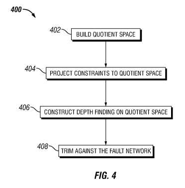
[0022] As illustrated in Figure 4, algorithm 302 (Referring to Figure 3) may
take inputs 300
(Referring to Figure 3) and produce three-dimensional models of output
horizons 314
(Referring to Figure 3) through flow chart 400. Flow chart 400 may comprise
building a
quotient space 402, projecting constraints into the quotient space 404,
construction of depth
functions 406, and/or trimming against fault network 408.
[0023] Inputs 300 (Referring to Figure 3) may be processed to form a quotient
space.
Building quotient space 402 may be performed as disclosed below. A two-
dimensional variant
of this step is illustrated in Figures 5 and 6. Referring to Figure 5, a three-
dimensional space
may be cut along fault network 306. Then, any vertical segment 502 that (1) is
located within
area of interest 304, (2) does not cross the cut and (3) starts and ends on
the cut or at infinity,
may be collapsed to a single point. In what follows, vertical segments
satisfying these three
properties are identified as maximal fault-avoiding vertical segments.
Collapses preserve
topology, thus, points in quotient space resulting from collapsing close
segments are
11
CA 03071530 2020-01-29
WO 2019/050545 PCT/US2017/050990
considered close in quotient space. It should be noted however, points of the
quotient space
originating from segments 502 on a different side of a fault are not
considered close. In Figure
6, the topological structure of quotient space is illustrated by line 600. In
most practical cases,
quotient space 600 includes several manifold pieces that may be joined
together along curves.
The points where quotient space 600 bifurcates in Figure 6 are two-dimensional
counterparts
of these curves.
[0024] Each point P of quotient space represents vertical line segment 502
(Referring to
Figure 5) in a three-dimensional space consisting of all points that were
collapsed into P during
construction. All the collapsed points have identical x- and y- coordinates
(x,y). Thus, each
point P of quotient space has well-defined x- and y- coordinates, equal to x-
and y- coordinates
of any point in the three-dimensional space collapsed into P. In what follows,
these x- and y-
coordinates are depicted as x(P) and y(P). The z-coordinate of P is not well
defined, since the
points collapsed into P have different z coordinates. However, P has its
associated set of z-
coordinates, in this case the range extending from the minimum to the maximum
z-coordinate
of a point collapsed into P. P represents vertical line segment 502 including
points with x- and
y- coordinates equal to x- and y- coordinates associated with P and z-
coordinates in the set of
z-coordinates associated with P. The set of z-coordinates of P is denoted by z-
set(P). These
concepts are illustrated in Figure 7, where the (x,y)-coordinates of the
points P 1 , P2, P3 and
P4 are (10,19), (10,33), (10,49) and (10,65) and their z-sets are (-G0,-F00),
[-50,+00), [-55,-33]
and (-00,-14], respectively.
[0025] Any point Q-----(x,y,z) of a three-dimensional space located outside
fault network 306
(Referring to Figure 3) may be projected onto quotient space 600 (Referring to
Figure 6). The
projection of Q is the point of quotient space 600 that Q was collapsed to
during construction.
[0026] If the point Q----(x,y,z) is on fault network 306, the projection of Q
onto quotient space
600 may not be well defined. Such a point Q may be split into several points
when the space
is cut along fault network 306 during building quotient space 402, and the
resulting points
may be collapsed to different points of quotient space 600. In order to
resolve this ambiguity,
fault network 306 may be considered as an infinitesimally thin volume. A
closed manifold
surface representing the boundary of that volume may be built as illustrated
in Figure 8, in
12
CA 03071530 2020-01-29
WO 2019/050545 PCT/US2017/050990
which thin lines 802 represent fault network 306 (Referring to Figure 4) and
thick line 804 is
used to show the boundary of the infinitesimally thin volume. In what follows,
the boundary
of the infinitesimally thin fault network volume is called boundary surface
804. Boundary
surface 804 may be represented as a mesh of triangles or surface patches. For
any point on
boundary surface 804 the projection onto quotient space 600 is well defined.
If fault network
306 (referring to Figure 3) is represented by a triangle mesh with no self-
intersections,
boundary surface 804 may be constructed so that for each triangle of fault
network 306 there
are precisely two corresponding triangles in boundary surface 804, each of the
two
representing a different side of the original fault network triangle.
[0027] Once the quotient space 600 (Referring to Figure 6) has been built,
upper and lower
bounds 308 and point constraints 312 (Referring to Figure 3) are projected to
the quotient
space 600 (referring to Figure 6) through project constraints to quotient
space 404 (referring
to Figure 4). During this process, upper bounds and lower bounds 308 and point
constraints
312 are transformed into scalar inequality or equality constraints on quotient
space 600. Upper
and lower bounds 308 and point constraints 312 may be specified as points in a
three-
dimensional space or points on boundary surface 804 (referring to Figure 8).
The
transformation maps any upper or lower bound 308 or point constraint P into
point (P',z),
where P' is the result of projection of P to quotient space 600 described
above and z is the z-
coordinate of P.
[0028] For the step construct depth functions 406 (referring to Figure 4),
shape controls 310
(Referring to Figure 3) and upper and lower bounds 308 (Referring to Figure 3)
are combined
to construct a scalar depth function on quotient space 600 (Referring to
Figure 6) for each of
the horizons. In what follows, the value of the depth function corresponding
to a horizon H at
a point P of the quotient space 600 is denoted by depth(H,P). At minimum, each
of the depth
functions is required to be continuous and to obey upper and lower bounds 308
for its
respective horizon. Construct depth functions 406 may be implemented through
an
optimization algorithm that would minimize an objective function subject to
point constraints
312 (Referring to Figure 3). The objective function may be a weighted
combination of terms
provided by shape controls 310. For example, terms that promote smoothness of
depth
13
CA 03071530 2020-01-29
WO 2019/050545 PCT/US2017/050990
functions, decrease variation of the vertical distance between the output
horizons, or keep the
output surface close to point constraints 312 may be included. The constraints
for the
optimization problem include the inequality constraints derived from upper and
lower bounds
308 through projecting constraints to quotient space 404. For any projected
upper bound (P',z)
associated with a horizon H, depth(H,P') is required to be less than or equal
to z. For any
projected lower bound (P',z) associated with a horizon H, depth(H,P') is
required to be greater
than or equal to z. Any number of additional constraints may be specified, as
long as they do
not render the optimization problem infeasible. For example, an output horizon
may be forced
to precisely pass through its associated point constraint P. by constraining
the depth at P' to
be equal to z for the projected point constraint (P',z). One may also add
constraints on the
difference of depths of different horizons, for example to impose minimum and
maximum
bound on thickness of the layer between two horizons, or to prevent horizons
from crossing.
[0029] Referring to Figure 4, trimming against fault network 408 may follow
after
constructing depth functions 406. For each horizon H, quotient space 600
(Referring to Figure
6) may be embedded into the three-dimensional space by mapping a point P of
the quotient
space into (x(P), y(P), depth(H,P)). An example of an embedding 900 for the
two-dimensional
version of quotient space 600 (referring to Figure 6) is given in Figure 9.
Note that the
embedding 900 may have branching points and may have self-intersections that
need to be
removed to form a valid output satisfying the conditions discussed above.
Trimming against
fault network 408 removes images of points P of quotient space 600 such that
depth(H,P) does
not belong to z-set(P). In Figure 10, parts of the embedding in Figure 9
removed by trimming
against fault network 408 are shown as dotted lines 1000. The two-dimensional
counterpart
of the output surface is shown as solid black line 1002.
[0030] For any horizon H, the depth function implicitly defines the continuous
signed vertical
distance function to the horizon, defined for all points of the three-
dimensional space that do
not belong to fault network 306. The signed vertical distance function may be
evaluated at a
point P---(x,y,z) as follows. First, P is projected to a point P' in quotient
space 600 as described
above. The signed vertical distance value is defined as z-depth(H,P'); it is
positive above the
horizon and negative below the horizon.
14
CA 03071530 2020-01-29
WO 2019/050545 PCT/US2017/050990
[0031] The signed vertical distance function to a horizon H is also well-
defined and
continuous on the boundary surface 804 described above. The definition follows
the steps
described above. The signed vertical distance value at a point P on boundary
surface 804 is z-
depth(H,P'), where z is the z-coordinate of the point of fault network 306
corresponding to P
and P' is the projection of P onto quotient space 600.
[0032] The ideas described above may be implemented in a number of ways. In
particular, a
discretized version of quotient space 600 (Referring to Figure 6) may be used
instead of the
exact version. This makes algorithm 302 (Referring to Figure 3) easier to
implement without
compromising the desired properties of three-dimensional models of output
horizons 314.
Discretized quotient space requires base grid as an additional input into
algorithm 302. Base
grid may be an arbitrary two-dimensional grid, such as a triangle mesh, a
polygonal mesh or
a regular rectangular grid. Figures 3 and 4 still apply to discretized version
of algorithm 302,
with only one difference: base grid is an additional input to algorithm 302,
in addition to area
of interest 304, fault network 306, upper and lower bounds 308 and shape
controls 310
(Referring to Figure 3).
[0033] The two-dimensional variants of the key concepts behind the discretized
version of
quotient space are illustrated in Figure 11. The line segments 1108 between
black points 1110
are the counterparts of two-dimensional cells of the base grid 1102. Pillars
1104 are defined
as two-dimensional cells of the grid extruded along the z-axis. For any given
pillar 1104,
volumes 1106 in pillar 1104 are defined as connected components of the
complement of fault
network 306 in pillar 1104. Pillar boundaries 1112 are shown as dotted lines.
Volumes 1106
are pieces that result from cutting a pillar 1104 along fault network 306.
While there are many
possible digital representations of volumes 1106, it may be convenient to use
a variant of the
boundary representation for this purpose. For example, a volume V may be
represented by a
sub-mesh of fault network mesh that contains the boundary of V inside the
interior of its pillar.
Intuitively, the triangles of the sub-mesh define cuts that need to be applied
to cut V out of its
pillar. These triangles may also be oriented so that their normal vectors face
away from V to
simplify further processing.
CA 03071530 2020-01-29
WO 2019/050545 PCT/US2017/050990
[0034] Building discretized quotient space may proceed as follows. First, all
volumes 1106 in
all pillars 1104 (referring to Figure 11) are computed, as described above.
Then, for any two-
dimensional cell C of the base grid 1102, a copy of C is created for each
volume in the pillar
corresponding to C. Next, the cell copies are glued together along edges as
follows. Consider
two two-dimensional cells Cl and C2 of base grid 1102, meeting at an edge E,
and their copies
D1 and D2 representing volumes 1006 in pillars 1004 over Cl and C2
(respectively). The
copies D1 and D2 are glued along the edge corresponding to E if their
corresponding volumes
1106 intersect along pillar boundaries 1112. Intersections of volumes 1106
across fault
network 306 are not sufficient to trigger a gluing operation. The two-
dimensional counterpart
of this process is illustrated in Figures 12 and 13. The copies of cells of
the base grid
corresponding to volumes are shown as horizontal line segments 1200 in Figure
12. For
illustration purposes, horizontal line segments 1200 are placed so that they
are contained in
their corresponding volumes if possible. The cell copy Q4 corresponds to the
small triangular
volume in second pillar from the left. The gluing criteria described earlier
cause endpoints of
the following pairs of cell copies to be identified: Q1 , Q3; Q3, Q6; Q6, Q8;
Q6, Q4; Q8, Q7;
Q7, Q5; and Q5, Q2. For example, endpoints of cell copies Q4 and Q7 are not
identified
because their corresponding volumes are not adjacent along pillar boundary
1112, but Q4 and
Q6 are glued because they are. Since volumes corresponding to Q4 and Q1 do not
meet at all,
they are not glued together. After all the gluing operations are executed, a
discretized quotient
space is formed, illustrated in Figure 13 as the dashed line 1300.
[0035] Cells of the discretized quotient space are in one-to-one
correspondence with the
volumes 1106. Also, recall that each cell of discretized quotient space is a
copy of a two-
dimensional cell of a base grid 1102 (Referring to Figure 11). Therefore, each
point P of
discretized quotient space 1300 has a well-defined x- and y- coordinates. If P
is in a cell C of
the discretized quotient space that is a copy of a cell CO of base grid 1102,
then x- and y-
coordinates of P are inherited from CO.
[0036] After building a discretized variant of quotient space 402 (Referring
to Figure 4), point
constraints 312 and upper and lower bounds 308 (Referring to Figure 3) are
processed by the
step project constraints to quotient space 404 (Referring to Figure 4), which
may be
discretized. Algorithm 302 (Referring to Figure 3) proceeds in the following
steps to find a
projection of a point P=(x,y,z) onto the discretized quotient space 1300
(Referring to Figure
16
CA 03071530 2020-01-29
WO 2019/050545 PCT/US2017/050990
13). First, pillar 1104 (Referring to Figure 13) containing P is determined by
finding two-
dimensional cell of base grid 1102 containing the point (x,y). Next, the
volume V containing
P is found among the volumes in that pillar. This volume is denoted by V. The
projection of
P onto discretized quotient space 1300 belongs to cell of discretized quotient
space 1300
corresponding to V, and has x- and y- coordinates equal to (x,y). Figure 14
shows a two-
dimensional example. The circles 1400 show points to be projected, the disks
1402 are
resulting projected points and arrows 1404 represent projection mapping. If
point P is on fault
network 306, additional information may need to be specified to make
projection mapping
well defined. For example, point P may be specified as a point on the boundary
surface 804
(referring to Figure 8). Point constraint 312 or upper and lower bound 308
p=(x,y,z) is mapped
into (P',z) where P' is the projection of P onto discretized quotient space
1300.
[0037] Next, the step to construct a continuous depth functions 406 (Referring
to Figure 4),
whose goal is to determine a depth function on the discretized quotient space
for each of the
horizons, may be processed in any number of ways. For example, the depth
functions may be
computed by solving a quadratic programming problem defined by the shape
controls 310
(referring to Figure 3). As an objective function, one may use a combination
of thin plate
spline energy to promote smoothness, energy terms that decrease variation of
thickness
between horizons to promote conformance, or the data fit objective to keep the
output horizon
close to the point constraints. As constraints, one uses the upper and lower
bounds 308
(Referring to Figure 3). More precisely, for any lower bound (P',z), mapped to
the discretized
quotient space 1300 as described above, and associated with horizon H the
constraint
depth(H,P')>=z is added. Similarly, for any upper bound (P',z) associated with
a horizon H
one adds the constraint depth(H,P')<=z. The quadratic program may also impose
minimum
or maximum thickness constraints on pairs of horizons. It may also incorporate
other
constraints or objectives defined by the shape controls 310. A multiresolution
solver may be
used to find depth functions in an efficient manner. A depth function for any
of the horizons
may be represented by values at vertices of the discretized quotient space
1300. Values at any
other point of discretized quotient space 1300 may be obtained using an
interpolation scheme.
For example, linear interpolation if the base mesh is a triangle mesh or
bilinear interpolation
if it is a regular rectangular grid.
17
CA 03071530 2020-01-29
WO 2019/050545 PCT/US2017/050990
[0038] After depth functions on discretized quotient space 1300 are
determined, discretized
quotient space 1300 may be embedded into three-dimensional space, using the
depth values
as the z-coordinates for each of the horizons. A possible embedding of the
discretized quotient
space 1300 shown in Figure 13 is shown as thin lines in Figure 15. In the step
trimming against
the fault network 408 (Referring to Figure 4), to trim, every cell of in the
embedded discretized
quotient space is interested with its corresponding volume. The result of
trimming against the
fault network 408 is the union of all the intersections over all cells of
embedded discretized
quotient space. In Figure 16, the intersections of cells of embedded
discretized quotient space
that are inside their corresponding volumes are shown as thick solid black
lines 1600. The part
of embedding of the discretized quotient space that is trimmed away is shown
as thin dashed
lines 1602.
[0039] The relationship between discretized quotient space 1300 (Referring to
figure 13) and
quotients space 600 (Referring to Figure 6) may be summarized as follows. The
essential part
of discretized quotient space 1300 may be obtained by collapsing subsets of
vertical lines to
a single point. These subsets may be defined as intersections of volumes and
vertical lines.
Hence, the sets of points that are collapsed to a single point when
discretized quotient space
1300 is built are not maximal fault-avoiding vertical segments, but unions of
maximal fault-
avoiding segments that are contained in the same volume and in the same
vertical line. With
this interpretation, the description of the steps of the version of the
algorithm based on non-
discretized version of quotient space 600 apply verbatim to the version of
algorithm 302
(Referring to Figure 3) based on discretized quotient space 1300. Note that
discretized
quotient space 1300 built as described above may contain points that have
empty z-set, but
these points technically do not contribute to the output surface (all are
trimmed away in
trimming against fault network 408). These points are added only for
convenience. One reason
to add them may be to produce a more regular polygonal model of quotient space
600 (in this
case, with all cells being copies of the cells of base grid 1102, referring to
Figure 11). Another
reason may be to enable the user to specify constraints that may not be
directly interpreted as
projections of three-dimensional points to quotient space 600 when
constructing depth
functions as described above. For example, one may provide a user interface
where the user
is allowed to drag data points or constraints in a three-dimensional space,
and the process may
be internally interpreted as moving the points along a branch of quotient
space 600 in a
18
CA 03071530 2020-01-29
WO 2019/050545 PCT/US2017/050990
continuous manner. When the dragged points reach the boundary of the branch of
quotient
space 600, that branch may be extended by adding points with an empty z-set to
accommodate
such data points or constraints.
[0040] The quality of three-dimensional models of horizons 314 (Referring to
Figure 3) may
be improved using fault extensions. Conceptually, fault extensions are
vertical surfaces
extending up from upward extension curves and down from downward extension
curves. The
extension curves are specified in the boundary surface 804 (Referring to
Figure 8) of the fault
network 306 (Referring to Figure 3) so that their projections to quotient
space 600 (discretized
or not) are well-defined. Fault extensions may split some of the volumes for
the original fault
network 306 into smaller ones. If the fault extensions are specified, the
extended fault network,
the union of the original fault network and the extensions, is used in all
steps of algorithm 302
(Referring to Figure 3), instead of the original fault network 306. Each of
the horizons may
use different fault extensions, and therefore quotient spaces used to
construct each of the
output horizons 314 (referring to Figure 3) may be different.
[0041] In order to make it easier to control the relationship of the output
horizons 314
(Referring to Figure 3) and the fault extensions, it may be convenient to
carefully restrict the
fault extensions as described below. Consider the downward extension curves.
As discussed
above, these curves are defined on the boundary surface 804. This means that
each point of
these curves may be assigned to a specific volume 1106 (Referring to Figure
11). Split the
curves into shorter segments such that each segment is contained in the same
volume 1106.
For each segment S contained in the volume V, intersect the union of vertical
rays going down
from a point in S with V. This is the contribution of S to the downward fault
extensions. The
union of all contributions of all segments S described above is the downward
extension.
Upward extensions are defined in an analogous way. The extended fault network
is the union
of the original fault network and downward and upward extensions described
above. A two-
dimensional example illustrating these concepts is shown in Figure 17. The
dotted lines
represent the pillar boundaries 1112. The thick lines are boundary surface
804, with space left
between lines representing one side of fault 1700 and the other for
illustration purposes.
Upward extensions 1702 originate from points 1704 shown as solid squares.
Downward
extensions 1706 originate from points 1708 shown as hollow squares. The
general rule is that
extension is active only inside volume containing the point it originates
from. Note that these
19
CA 03071530 2020-01-29
WO 2019/050545 PCT/US2017/050990
points are counterparts of extension curve segments contained in a single
volume in the three-
dimensional case. For point A, the extension is the entire vertical half-line
extending to plus
infinity. For B, the extension terminates at the first intersection of the
vertical ray starting at
B and extending vertically up. Thus, the extension is a single bounded line
segment. Point C
the extension consists of three segments, two bounded and one extending to
minus infinity.
These segments are intersections of the vertical ray extending down from C and
the volume
containing C. The extension defined by point D is empty, since the ray
starting at D and
extending downward leaves D's volume immediately and never enters it again.
Finally,
extension of E consists of a bounded and an unbounded segments
[0042] Since fault extensions are not a part of original fault network 306
(Referring to Figure
3), one may require that they do not interact with output horizons 314. This
requirement may
be enforced using upper and lower bounds 308 (Referring to Figure 3) as
follows. Any point
on an upward extension curve used for a horizon H may become an upper bound
associated
with H. Analogously, any point on a downward extension curve for a horizon H
may become
a lower bound associated with H. This prevents the extensions from trimming
the embedded
discretized quotient space 1300 (referring to Figure 9) in the step trimming
against fault
network 408 (Referring to Figure 4) of algorithm 302 (referring to Figure 3).
In practical
scenarios, the set of upper and lower bounds 308 may be reduced to an
equivalent finite one.
For example, in the discretized variant of algorithm 302, if the base mesh is
a triangle mesh,
the depth function uses linear interpolation, fault network 306 is a triangle
mesh, and the
extension curves are polygonal lines, then it suffices to include only
vertices of the extension
curves and points on the extension curves that project to an edge of the base
grid (under
projection along z) in the set of upper and lower bounds 308. The set of upper
and lower
bounds 308 may also be transformed to a stronger set of constraints, that is
easier to deal with
or may be imposed more efficiently. For example, upper and lower bounds 308
may be
transformed into box constraints, defined as constraints that involve only one
variable.
[0043] Upward and downward extension curves may be defined in many possible
ways. They
may be specified by the user or determined automatically from a first
estimate. A hybrid
approach is also possible, in which the extensions are determined
automatically and then
edited by the users to provide them with more control over the relationship
between output
horizons 314 and fault network 306 (referring to Figure 3).
CA 03071530 2020-01-29
WO 2019/050545 PCT/US2017/050990
[0044] Fault network limits are defined as the topological boundary of fault
network 306
(Referring to Figure 3). Fault network 306 is a union of manifold surfaces
with a boundary.
Fault network limit is the union of all boundaries of faults that are not
contained in any other
fault. If fault network 306 is represented as a triangle mesh with no self-
intersections, its limit
consists of all edges that have precisely one incident triangle. If the
boundary surface 804 is
built so that each of its triangles represents a side of a fault network
triangle as described
above, each limit edge of the fault network has precisely one corresponding
edge in the
boundary surface. In what follows, these edges of the boundary surface are
referred to as limit
edges. A dead end is a vertex of the boundary surface that has precisely one
incident limit
edge. These concepts are illustrated in Figure 18, which shows fault network
306 consisting
of two roughly rectangular faults 1800 and 1802 meeting at dashed line 1804.
Thick solid
black line following the boundaries of the faults is the fault network limit
1806. Note that
dashed line 1804 does not belong to the fault network limit 1806: while it is
contained on the
boundary of the fault 1802, it is also contained in the fault 1800. The small
squares 1808 and
1810 represent the two dead ends present in this fault network 306, referred
to as upper dead
end 1808 and lower dead end 1810.
[0045] To determine the extension curves automatically, the steps build
quotient space 402,
project constraints to quotient space 404 (Referring to Figure 4) and
construct depth functions
on the quotient space of algorithm 302 for fault network 306 (Referring to
Figure 3) with no
extensions may be utilized. The resulting depth function on quotient space 600
(Referring to
Figure 6), or discretized quotient space 1300 (referring to Figure 13) for
each horizon H is
called first estimate of H. As described above, the depth function defines a
signed vertical
distance function from H on boundary surface 804 (Referring to Figure 8). The
upward
extension curves for H may be selected from the subset of boundary surface 804
consisting of
points with positive signed vertical distance values. The downward extension
curves may be
selected from the subset of boundary surface 804 consisting of points that
have negative
signed vertical distance values. This ensures that the upper and lower bounds
308 (Referring
to Figure 8) generated from the fault extensions as described above are not
contradictory.
[0046] The main goal of fault extensions is to prevent leakage of the data
across the faults,
(i.e. prevent points on one side of the fault from having excessive influence
on the shape of
the surface on the other side of the fault). There are a number of possible
ways to construct
21
CA 03071530 2020-01-29
WO 2019/050545 PCT/US2017/050990
the upward and downward extension curves. Algorithms to build the extension
curves may be
based on the following design criteria. First, the points on the limit edges
of boundary surface
804 (Referring to Figure 8) that have signed vertical distance value greater
than or equal to a
positive user-defined threshold may be included in the set of upward extension
curves.
Analogously, the points on the limit edges of boundary surface 804 that have
signed vertical
distance value less than or equal to a negative threshold may be included in
the downward
extension curves. The motivation is to increase the distance between points on
one side of a
fault to points on the other side of the fault in discretized quotient space
1300 (Referring to
Figure 13) to reduce leakage. Second, extension curves should stay as far away
as possible
from points of boundary surface 804 with signed vertical distance value of
zero. This is meant
to prevent the lower and upper bounds 308 related to extensions, described
above, from
influencing the output surface's shape in a perceptible manner. Third, the
union of all upward
extension curves should have as few endpoints as possible, and the union of
downward
extension curves should have as few endpoints as possible. An endpoint of a
union of curves
may be defined as an endpoint of one of the curves that is not on another
curve. The third
criterion promotes extensions that cut all the way through a pillar 1104
(Referring to Figure
11) (and therefore also volume 1106 they are contained in) rather than
stopping in the middle
of it.
[0047] Figure 19 shows the discretized quotient space, as dashed black lines
1900, for fault
network 306 and base grid used in Figures 11-13, but this time with
extensions, upward from
the solid black square 1902 and downward from hollow square 1904. The
extensions 1906
split two of the volumes that are present in Figure 11 into two distinct
volumes. They also
cause the discretized quotient space to be split into three connected
components. Figure 20
shows the results for step trimming against the fault network 408 (referring
to Figure 4)
applied to the fault network with extensions. Note that in this case,
extensions prevent leakage
that may be seen in Figure 16.
[0048] A possible way to generate extensions in a way consistent with the
design criteria
described above may proceed in the following way. First, determine all points
on limit edges
of the boundary surface 804 consistent with the first design criterion above.
These points may
be used as the initial set of upward and downward extension curves. Then,
determine all dead
ends, on the boundary surface 804 (referring to Figure 8), that have signed
vertical distance
22
CA 03071530 2020-01-29
WO 2019/050545 PCT/US2017/050990
value less than zero. These dead ends will be called lower dead ends.
Similarly, determine
upper dead ends, the dead ends with the signed vertical distance value greater
than zero. Once
the lower and upper dead ends are found, connect them to the initial downward
and upward
extension curves (respectively) using paths in the boundary surface 804 that
are as short as
possible and stay away from points of the boundary surface 804 with signed
vertical distance
value of zero. These paths are added to the set of downward and upward
extension curves
(respectively). If the fault network 306 (referring to Figure 3) is
represented as a triangle, the
paths may be found using the Dijkstra's algorithm with edge weight that is
proportional to the
edge length but inversely proportional to the minimum absolute value of the
signed vertical
distance function for that edge. Edges that contain a point with signed
vertical distance value
of zero are not used. This edge weight promotes short paths that tend to stay
far away from
the first estimate. In Figure 18, the upper dead end 1808 and lower dead ends
1810 are shown
as the solid square and the hollow square, respectively. Thin wiggly curves
are possible
upward extension 1812 and downward extension 1814 curves found using the
shortest path
algorithm. They connect the dead ends to fault network limit 1806 of fault
network 306.
[0049] Overall, building quotient space 402, projecting constraints to
quotient space 404, and
constructing depth functions on the quotient space 406 (Referring to Figure 4)
of algorithm
302 (Referring to Figure 3) may be used to obtain first estimates for each of
the horizons. For
each horizon, fault extensions may be deteitnined from its first estimate and
lower and upper
bounds 308 may be generated from the extension curves. Then, building quotient
space 402,
projecting constraints to quotient space 404, constructing depth functions on
quotient space
406, and/or trimming against fault network 408 may be run with fault network
306 augmented
with the fault extensions and upper and lower bounds generated from the
downward and
upward extension curves, as described above, to obtain the final result. Since
fault extensions
may be different for each horizon, the quotient space used to model each of
the horizons may
be different. The upper and lower bounds ensure that the output horizons do
not intersect their
corresponding fault extensions and therefore each of them satisfies the
conditions described
earlier, for fault network 306 without extensions.
[0050] In examples, fault extensions reduce the impact of data across a fault
on the result.
This may dramatically improve the quality of the result. Figures 21a and 21b
illustrate the
23
CA 03071530 2020-01-29
WO 2019/050545 PCT/US2017/050990
result without and with fault extensions (respectively) for a synthetic V-
shaped fault network
2100.
[0051] In a practical implementation, one does not necessarily have to compute
an explicit
representation of the extended fault network. The most important effect that
extensions have
is that they split some of the original volumes into smaller ones. These
splits may be defined
implicitly to gain the advantages provided by fault extensions in a simpler
manner. An
example implementation is described below. For each volume V for fault network
306 without
extensions, some number of upper and lower test surfaces is specified. The
volumes resulting
from splitting with extensions are defined by volume code. Volume code of a
point P is the
binary code whose i-th entry is the parity of the number of intersections of
the vertical ray
starting at P with the i-th test surface. The ray extending upward is used for
lower test surfaces
and the ray extending downward is used for the upper test surfaces. Points
that have the same
volume code are considered to belong to the same volume for the extended fault
network.
Suitable test surfaces may be obtained by a combination of cutting the
bounding surface of
the volume V along the extension curves and a volume capping technique to
handle test
surfaces bounded by both upward and downward extension curves. Volumes
obtained in this
manner may not be identical to volumes obtained using explicit extensions.
Examples of test
surfaces in the two-dimensional setting can be found in Figure 22(A-C). Each
of the subfigures
shows a pillar 1104, bounded a pillar boundary shown by the dotted vertical
lines 1112, and
the part of fault network 306 inside or near the pillar, identified solid
black line 2202. In (a),
there is an upward extension 2204 starting at the solid black square. In this
case, one may use
the dashed line as upper test surface 2206. That leads to different volume
codes in the two
volumes that exist in pillar 1104 for the extended fault network. Similarly,
in (b), a lower test
surface 2208 shown as the dashed line may be used to correctly define volumes
for the
extended fault network. In case (c), there is a connected component of fault
network 306 with
extensions going in opposite directions starting in that component. Upper test
surface that
reproduces the volumes for the extended fault network in this case may consist
of the part of
the fault inside the pillar 2210 and a 'cap' at minus infinity 2212.
[0052] In examples with several horizons, each horizon may use different fault
extensions.
This means that the depth functions for two surfaces S and S' are generally
defined on
different quotient spaces. In order to specify conformance relation between a
first discretized
24
CA 03071530 2020-01-29
WO 2019/050545 PCT/US2017/050990
quotient space Q and a second discretized quotient space Q', one may compute
the multi-
valued correspondence between Q and Q'. A cell C of Q is in correspondence to
a cell C' in
Q' if and only if the volume represented by C intersects the volume
represented by C', and
the two volumes belong to the same pillar. This defines the multi-valued cell-
to-cell
correspondence. The motivation behind this particular way to determine the
correspondence
is to capture all possible interactions between signed vertical distances
between two surfaces:
intersecting volumes represent cells of the quotient spaces that may be used
to evaluate the
signed vertical distance from the same point in the three-dimensional space to
both S and S'.
The multivalued correspondence between cells may naturally be transferred to
vertices. Two
vertices, one in Q and one in Q', are in correspondence if they originate from
the same base
grid node and have incident cells that are in correspondence. Note that one
may also define
the correspondence described above in a more general way. Points P of a
quotient space Q
and P' of a quotient space Q' correspond to each other if the sets of three-
dimensional points
collapsed to P and P' are not disjoint.
[0053] To enforce the minimum thickness of c between two horizons H and H',
constraints
of the form depth(H,V)-depth(H',V')>=c, or depth(H',V')-depth(H,V)>=c
(depending on the
surface order) may be utilized for every pair of corresponding vertices V and
V' of the
discretized quotient spaces used to model H and H' (respectively). Maximum
thickness
between two horizons can be imposed in a similar way. Squares of finite
differences of the
left hand sides of these constraints along the x- and y- directions may also
be added to the
objective function to promote preservation of thickness between surfaces
linked by
conformance relations.
[0054] Figure 22 illustrates a three-dimensional geological structure
containing six horizons
constructed with non-crossing constraints (zero minimum thickness), and with
data fit,
smoothness and thickness preservation terms used as objectives.
[0055] Three-dimensional models of geological structure may be utilized to
plan the location
of drill sites, which may drill into formation 132 (Referring to Figure 1).
For example, drill
sites that may recover the most fluid and be the most effective may be
determine from the
three-dimensional models of the geological structure. This may reduce cost and
waste when
drilling into formation 132.
CA 03071530 2020-01-29
WO 2019/050545 PCT/US2017/050990
[0056] This method and system may include any of the various features of the
compositions,
methods, and system disclosed herein, including one or more of the following
statements.
[0057] Statement 1: An efficient and general method for modeling a three-
dimensional
geological structure, comprising: selecting input data from well measurement
systems,
seismic surveys or other sources; inputting the input data into an information
handling system;
building a quotient space; projecting constraints to the quotient space;
constructing depth
functions on the quotient space; trimming against a fault network; and
producing a three-
dimensional Model of horizons.
[0058] Statement 2: The method of statement 1, wherein the input data
comprises an area of
interest, a fault network, upper and lower bounds and shape controls.
[0059] Statement 3: The method of statement 1 or statement 2, wherein the
shape controls
comprises a plurality of point constraints.
[0060] Statement 4: The method of any previous statement, wherein the
producing a three-
dimensional geological structure comprises a plurality of surfaces.
[0061] Statement 5: The method of any previous statement, wherein the building
a quotient
space comprises collapsing unions of vertical line segments that start and end
at the fault
network or at infinity to a single point.
[0062] Statement 6: The method of any previous statement, wherein projecting
constraints to
the quotient space comprises finding a union of vertical intervals collapsed
to a single point
of the quotient space containing a constraint point.
[0063] Statement 7: The method of any previous statement, wherein constructing
depth
functions on the quotient space comprises an optimization algorithm combining
objectives
and constraints provided by a shape controls and a constraints obtained by
projecting
constraints to the quotient space.
[0064] Statement 8: The method of any previous statement, wherein the trimming
against the
fault network comprises selecting points of the quotient space with a depth
value within their
z-coordinate set and mapping these points into a three-dimensional space.
[0065] Statement 9: The method of any previous statement, further comprising
adding
extensions to the fault network.
26
CA 03071530 2020-01-29
WO 2019/050545 PCT/US2017/050990
[0066] Statement 10: The method of any previous statement, wherein an upper
and a lower
bounds prevent an output surface from being trimmed by a fault extension.
[0067] Statement 11: The method of any previous statement, further comprising
using
correspondence between a plurality of quotient spaces from the fault network
with different
extensions to enforce minimum or maximum thickness constraints for a layer
between two
horizons.
[0068] Statement 12: The method of any previous statement, wherein the input
data comprises
an area of interest, a fault network, upper and lower bounds and shape
controls, wherein the
shape controls comprising a plurality of point constraints; wherein the
building a quotient
space comprises collapsing unions of vertical line segments that start and end
at the fault
network or at an infinite point to a single point and projecting constraints
to the quotient space
comprising finding a point on the quotient space from the collapsing unions of
vertical line
segments; wherein the constructing a smooth depth function on the quotient
space comprises
an optimization algorithm combining objectives; wherein the trimming against
the fault
network comprises selecting points of the quotient space with a depth value
within a z-
coordinate set and mapping the z-coordinate set in a three-dimensional space;
and further
comprising adding extensions to the fault network, wherein the upper and a
lower bound
prevent an output surface from being trimmed by a fault extension.
[0069] Statement 13: A geological modeling system for producing a three-
dimensional
geological structure comprising: a downhole tool, wherein the downhole tool
comprises: at
least one receiver; and at least one transmitter; a conveyance, wherein the
conveyance is
attached to the electromagnetic logging tool; and an information handling
system, wherein the
information handling system is configured to select an input data; build a
quotient space;
project constraints to the quotient space; construct depth functions on the
quotient space; trim
against a fault network; and produce a three-dimensional model of a geological
structure.
[0070] Statement 14: The system of statement 13, wherein the input data
comprises an area
of interest, a fault network, upper and lower bounds and shape controls.
[0071] Statement 15: The system of statement 13 or statement 14, wherein the
shape controls
comprise a plurality of point constraints.
27
CA 03071530 2020-01-29
WO 2019/050545 PCT/US2017/050990
[0072] Statement 16: The system of statements 13 ¨ statement 15, wherein the
produce a
three-dimensional geological structure comprises a plurality of surfaces.
[0073] Statement 17: The system of statements 13 ¨ statement 16, wherein the
build a quotient
space comprises collapsing unions of vertical line segments that start and end
at the fault
network or at infinity to a single point.
[0074] Statement 18: The system of statements 13 ¨ statement 17, wherein
project constraints
to the quotient space comprises find a union of vertical line segments
collapsed to a single
point of the quotient space containing a constraint point.
[0075] Statement 19: The system of statements 13 ¨ statement 18, wherein the
construction
of depth functions on the quotient space comprises an optimization algorithm
combining
objectives and constraints provided by a shape control and constraint obtained
by projecting
constraints to the quotient space.
Statement 20: The system of statements 13 ¨ statement 19, wherein the trim
against the fault
network comprises select points of the quotient space with a depth value
within a z-coordinate
set and mapping these points into the three-dimensional model of a geological
structure.
[0076] The preceding description provides various examples of the systems and
methods of
use disclosed herein which may contain different method steps and alternative
combinations
of components. It should be understood that, although individual examples may
be discussed
herein, the present disclosure covers all combinations of the disclosed
examples, including,
without limitation, the different component combinations, method step
combinations, and
properties of the system. It should be understood that the compositions and
methods are
described in terms of "comprising," "containing," or "including" various
components or steps,
the compositions and methods can also "consist essentially of' or "consist of'
the various
components and steps. Moreover, the indefinite articles "a" or "an," as used
in the claims, are
defined herein to mean one or more than one of the element that it introduces.
[0077] For the sake of brevity, only certain ranges are explicitly disclosed
herein. However,
ranges from any lower limit may be combined with any upper limit to recite a
range not
explicitly recited, as well as, ranges from any lower limit may be combined
with any other
lower limit to recite a range not explicitly recited, in the same way, ranges
from any upper
limit may be combined with any other upper limit to recite a range not
explicitly recited.
28
CA 03071530 2020-01-29
WO 2019/050545 PCT/US2017/050990
Additionally, whenever a numerical range with a lower limit and an upper limit
is disclosed,
any number and any included range falling within the range are specifically
disclosed. In
particular, every range of values (of the form, "from about a to about b," or,
equivalently,
"from approximately a to b," or, equivalently, "from approximately a-b")
disclosed herein is
to be understood to set forth every number and range encompassed within the
broader range
of values even if not explicitly recited. Thus, every point or individual
value may serve as its
own lower or upper limit combined with any other point or individual value or
any other lower
or upper limit, to recite a range not explicitly recited.
[0078] Therefore, the present examples are well adapted to attain the ends and
advantages
mentioned as well as those that are inherent therein. The particular examples
disclosed above
are illustrative only, and may be modified and practiced in different but
equivalent manners
apparent to those skilled in the art having the benefit of the teachings
herein. Although
individual examples are discussed, the disclosure covers all combinations of
all of the
examples. Furthermore, no limitations are intended to the details of
construction or design
herein shown, other than as described in the claims below. Also, the terms in
the claims have
their plain, ordinary meaning unless otherwise explicitly and clearly defined
by the patentee.
It is therefore evident that the particular illustrative examples disclosed
above may be altered
or modified and all such variations are considered within the scope and spirit
of those
examples. If there is any conflict in the usages of a word or term in this
specification and one
or more patent(s) or other documents that may be incorporated herein by
reference, the
definitions that are consistent with this specification should be adopted.
29