Sélection de la langue

Search

Sommaire du brevet 2205457 

Énoncé de désistement de responsabilité concernant l'information provenant de tiers

Une partie des informations de ce site Web a été fournie par des sources externes. Le gouvernement du Canada n'assume aucune responsabilité concernant la précision, l'actualité ou la fiabilité des informations fournies par les sources externes. Les utilisateurs qui désirent employer cette information devraient consulter directement la source des informations. Le contenu fourni par les sources externes n'est pas assujetti aux exigences sur les langues officielles, la protection des renseignements personnels et l'accessibilité.

Disponibilité de l'Abrégé et des Revendications

L'apparition de différences dans le texte et l'image des Revendications et de l'Abrégé dépend du moment auquel le document est publié. Les textes des Revendications et de l'Abrégé sont affichés :

  • lorsque la demande peut être examinée par le public;
  • lorsque le brevet est émis (délivrance).
(12) Brevet: (11) CA 2205457
(54) Titre français: METHODE DE RECONNAISSANCE AUTOMATIQUE DE FACIES SISMIQUES
(54) Titre anglais: AUTOMATIC SEISMIC PATTERN RECOGNITION METHOD
Statut: Durée expirée - au-delà du délai suivant l'octroi
Données bibliographiques
(51) Classification internationale des brevets (CIB):
  • G01V 01/28 (2006.01)
  • G01V 01/30 (2006.01)
(72) Inventeurs :
  • KESKES, NAAMEN (France)
(73) Titulaires :
  • ELF AQUITAINE PRODUCTION
(71) Demandeurs :
  • ELF AQUITAINE PRODUCTION (France)
(74) Agent: NORTON ROSE FULBRIGHT CANADA LLP/S.E.N.C.R.L., S.R.L.
(74) Co-agent:
(45) Délivré: 2003-11-18
(86) Date de dépôt PCT: 1996-09-11
(87) Mise à la disponibilité du public: 1997-03-27
Requête d'examen: 2000-12-13
Licence disponible: S.O.
Cédé au domaine public: S.O.
(25) Langue des documents déposés: Anglais

Traité de coopération en matière de brevets (PCT): Oui
(86) Numéro de la demande PCT: PCT/FR1996/001396
(87) Numéro de publication internationale PCT: FR1996001396
(85) Entrée nationale: 1997-05-16

(30) Données de priorité de la demande:
Numéro de la demande Pays / territoire Date
95/10962 (France) 1995-09-19

Abrégés

Abrégé français

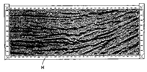
Elle est caractérisée en ce qu'elle consiste à: déterminer un nombre donné de faciès sismiques à reconnaître; prendre un ensemble de portions de trace sismique concernant ladite zone; définir un paramètre de reconnaissance de faciès commun à toutes les portions de trace et déterminer la valeur dudit paramètre pour chacune des portions de trace de l'ensemble; sélectionner des portions de trace parmi ledit ensemble; choisir un réseau neuronal unidimensionnel renfermant autant de cellules que de faciès à reconnaître, chaque cellule étant affectée d'une valeur du paramètre de reconnaissance; effectuer l'apprentissage du réseau neuronal à l'aide des portions de trace sélectionnées, de sorte qu'en fin d'apprentissage chaque cellule corresponde à un faciès à reconnaître, et que lesdits faciès soient ordonnés graduellement; présenter chaque portion de trace dudit ensemble à traiter au réseau neuronal classé et ordonnancé; et affecter à chacune des portions de trace présentée au réseau le numéro de la cellule la plus proche. Application notamment à la reconnaissance de faciès sismiques entre deux horizons pointés sur une section sismique.


Abrégé anglais


An automatic seismic pattern recognition method is characterised in that it
includes determining a given number of seismic patterns to be recognised;
providing a set of seismic trace portions for said region; defining a pattern
recognition parameter common to all the trace portions, and determining the
value of said parameter for each of the trace portions of the set; selecting
trace portions among said set; selecting a one-dimensional neural network
containing as many cells as there are patterns to be recognised, each cell
being assigned a value of the recognition parameter; submitting the neural
network to a learning process with the selected trace portions, so that at the
end of said process, each cell matches a pattern to be recognised, and that
said patterns are progressively ordered; presenting each trace portion of said
set to be processed to the classified and ordered neural network; and
attributing to each trace portion presented to the network the number of the
cell closest to it. The invention is particularly useful for recognising
seismic patterns between two horizons defined by plotting a seismic section.

Revendications

Note : Les revendications sont présentées dans la langue officielle dans laquelle elles ont été soumises.


9
The embodiments of the invention in which an exclusive property or privilege
is claimed
are defined as follows:
1. A method for automatic recognition of seismic facies which are at least one
of
between two horizons and about a horizon of a given geological area,
comprising the
steps of:
determining a given number of seismic facies to be recognized;
taking a set of seismic trace portions concerning said area;
defining a fades recognition parameter common to all said trace portions and
determining a value of said parameter for each of said trace portions of said
set;
selecting trace portions from said set;
choosing a one-dimensional neural network containing as many cells as facies
to be
recognized, each cell being assigned the value of the recognition parameter;
making the neural network learn from the selected trace portions so that, when
the
step of learning is complete, each cell corresponds to at least one of said
facies to be
recognized and said facies are gradually ordered;
presenting each trace portion of said set to be processed to the classified
and ordered
neural network, and
assigning a number of the nearest cell to each of the trace portions presented
to the
network.
2. The method of claim 1, wherein said neural network is an unsupervised
network.
3. The method of claim 2, wherein said unsupervised neural network is a one-
dimensional Kohonen topological map.
4. The method of claim 1, wherein said trace portions comprise the same number
of
samples and said recognition parameter is defined by said sequence of samples
comprised between the two horizons or about said horizon.
5. The method of claim 1, wherein an overall recognition parameter is
determined
which is common to all said trace portions.

10
6. The method of claim 1, wherein each cell corresponds to a class which is
assigned a color code, the different colors being gradually ordered in a given
range of
colors with a slight variation in shade between any two consecutive colors of
said range.
7. The method of claim 1, wherein said recognized seismic fades are
represented on
a map with their corresponding number.
8. The method of claim 6, wherein said recognized seismic facies are
represented on
a map with their corresponding color.
9. A method for automatically classifying seismic fades of a given geological
area
comprising the steps of:
determining a number of seismic fades to be classified;
obtaining a set of seismic trace portions from said geological area;
defining a seismic fades recognition parameter which is common to all said
seismic
trace portions;
determining values of said seismic fades recognition parameter for each of
said
seismic trace portions of said set;
selecting a subset of trace portions from said set of seismic trace portions;
obtaining a one-dimensional neural network having a number of cells equal to
said
number of seismic facies to be classified, each cell being assigned a cell
value
corresponding to one of said values of said seismic fades recognition
parameter;
automatically ordering said neural network cells such that differences between
adjacent cell values in said neural network are substantially minimized to
obtain ordered
cells;
assigning a classification indicia to each cell of said ordered cells;
comparing said values of said seismic fades recognition parameter of said
seismic
trace portions of said set with said cell values of said neural network; and
assigning each of said seismic trace portions said classification indicia of
said cell
corresponding therewith.
10. The method of claim 9, wherein said geological area comprises at least
several
hundred seismic traces.

11
11. The method of claim 9, wherein said geological area is bounded by two
horizons.
12. The method of claim 9, wherein said geologtical area is bounded by an area
about
an horizon of said area.
13. The method of claim 9, wherein the step of automatically ordering said
neural
network comprises the steps of:
assigning weights to said cells of said neural network in a random fashion;
for each seismic trace portions, locating a cell of said neural network most
nearly
corresponding thereto; and
changing the weights of said cells near said cell corresponding to said
seismic trace
portion.
14. The method of claim 13, wherein said steps correspond to the following
equation:
M j(t)=M j(t-1)+.function.[.epsilon.(t), d, .sigma.(t)] * [E i(t)-M j(t-1)]
where:
[.epsilon.(t), d, .sigma.(t)]= .epsilon.(t)*exp[(=d2/.sigma.2(t)];
d is the distance between cell M i and cell M j;
s(t) is the neighbor parameter; and
.epsilon.(t) is a gain factor.
15. The method of claim 14, wherein .epsilon.(t) is less than 1.
16. The method of claim 14, wherein .epsilon.(t) is about 0.7.
17. The method of claim 14, wherein the magnitudes of .epsilon.(t) and s(t)
decrease for
each iteration of locating said cell corresponding to said seismic trace
portions.

Description

Note : Les descriptions sont présentées dans la langue officielle dans laquelle elles ont été soumises.


CA 0220~4~7 1997-0~-16
AUTOMATIC SEISMIC PATTERN RECOGNITION METHOD
s
The present invention relates to a method of automatic recognition of
seismic facies between two horizons or about a horizon of a geological
area and particularly between two horizons or about a horizon defined on
a seismic section associated with said geological area.
At present, nearly all geological and geophysical interpretations
relative to seismic facies are carried out on an interpretation station and
belong to the specialized domain of seismic stratigraphy.
In seismic stratigraphy, it is customar,v to identify and to represent
on a map (mapping) the variations of seismic facies in a given slice of the
5 geological area to be surveyed, said slice being or not being between two
marked horizons.
A seismic facies unit is a group of seismic reflections of which the
configuration, external shape and internal parameters are different from
one facies unit to another, and even between two adjacent or consecutive
20 facies units.
The seismic facies units are usually defined by analyzing three
families of parameters:
the configuration of the reflections (parallel, divergent, sigmoid
etc.),
25 the external shape (concave upwards, convex upwards, draped etc.),
the internal parameters of the reflections (amplitude, frequency etc.).

CA 0220~4~7 1997-0~-16
The recognition of the seismic facies in a given geological area is
very important because it provides useful information, particularly about
the types of sedimentary deposit and the anticipated lithology.
To succeed in reco~ni7in~; the seismic facies of a given geological
area, it is therefore necessary to define each of them first by separately
analyzing at least each of the above-mentioned three families of
definitions, and then by m~king a synthesis of said studies in order to
gather the maximum of data or information about the seismic facies
present in said geological area.
o The cost of such a treatment and the means to be employed,
particularly the data processing means, are very high and out of all
proportion to the results obtained.
In fact, if the seismic facies which one wishes to recognize belong to
stratigraphic pinchouts and/or to turbiditic channels, it is very difficult to
15 discrimin~te between the anomalies when they appear on the usual seismic
sections, even if these anomalies are recognized by the well seismic
survey as being present in the area concerned, obviously provided that a
well is available in said area, which may not be the case.
In EP-O 561 492, a method is described for improving the well
20 logging by m~king use of neural networks. The particular network
described is a layered network. However, and from the statistical
standpoint, a layered network is a universal approximator of the
boundaries between classes, but, above all, a supervised network, that is
the quantity obtained in the output of the neural network is compared with
25 a quantity known and determined by other methods, until a coincidence or
quasi-coincidence is obtained between the quantities.

CA 0220~4~7 1997-0~-16
Since the topological maps due to Kohonen are used in other fields,
particularly in the medical field to determine models susceptible to imitate
a number of the functions of the brain by reproducing some of its basic
structures, geophysicists have attempted to apply them to the field of
5 geOphySlCS.
Particular applications are described in US-5 373 486, which deals
with the classification of seismic events by using Kohonen antagonistic
networks, in US-5 355 313, which describes the interpretation of
aeromagnetic data, and in US-5 181 171, which describes an interactive
lO neural network adapted to detect the first arrivals on the seismic traces.
It is an aim of the present invention to propose a method for
recogni7.ing seismic facies from a seismic section associated with a
geological area, and to do this automatically via an unsupervised neural
network.
The present invention relates to a method for reco~ni7.ing seismic
facies between two horizons or about a horizon of a geological area, and
consisting of:
determining a given number of seismic facies to be recogni_ed,
taking a set of seismic trace portions concerning said area,
20 defining a facies recognition parameter common to all the trace
portions and determining the value of said parameter for each of the trace
portions of the set,
selecting trace portions from said set,
choosing a one-dimensional neural network cont~ining as many cells
25 as facies to be recogni7.e~, each cell being assigned a value of the
recognition parameter,

CA 0220~4~7 1997-0~-16
effecting the learning of the neural network via the selected trace
portions, so that, when the learning process is complete, each cell
corresponds to a facies to be recognized, and so that said facies are
gradually ordered,
5 presenting each trace portion of said set to be processed to the
classed and ordered neural network, and
assigning the No. of the nearest cell to each of the trace portions
presented to the network.
One advantage of the present invention is that it is now possible to
10 identify, for example, a variation of seismic facies corresponding to a
stratigraphic pinchout or to lineaments which can be interpreted as faults.
According to another feature, the neural network is of the
unsupervised type and consists in particular of a one-dimensional Kohonen
topological map.
According to a further feature, the trace portions comprise the same
number of samples and the recognition parameter is defined by the
sequence of samples comprised between the two horizons or about said
horizon delimite~ on a seismic section.
According to a further feature, the trace portions are used to
20 determine an overall recognition parameter common to all the trace
portions.
According to a further feature, each facies is assigned a color code,
the different colors being gradually ordered in a given range of colors
with a slow variation of shade between any two consecutive colors of said
25 range.
According to a further feature, the seismic facies recognized are
represented on a map with their corresponding color.

CA 0220~4~7 1997-0~-16
A further advantage of the present invention resides in the fact that,
in accordance with the general knowledge about the geological area to be
surveyed and obtained by other means, it is possible to use attributes
associated with the seismic traces and which are derived either from the
5 sequence of samples between the top and the base of the trace element,
that is in fact between two horizons or about a horizon of said area, or
from the overall statistical parameters significant of the distribution of the
samples in the geological area concerned, said overall parameters being,
for example, the amplitude, frequency, interval velocity etc .
The above and other advantages and features of the present invention
will appear from a reading of the description of the method of the
invention, and from the appended drawings wherein;
Figure 1 is a seismic section on which a turbiditic channel is
delimited about a marked horizon,
' Figure 2 schematically represents a final topological map obtained
according to the invention,
Figure 3 schematically represents a map of the seismic facies
associated with the geological area corresponding to the set of seismic
trace portions processed.
The method of the present invention uses an unsupervised one-
dimensional neural network which comprises as many cells as seismic
facies to be recognized in a given geological area, between two horizons
or about a horizon, determined by picking a seismic section which
contains a large number of seismic traces, in the range of several hundred
traces at least, for example about horizon H in Figure 1. On said traces,
a set of seismic trace portions is delimited, which are bounded by said

CA 0220~4~7 1997-0~-16
horizons or about said horizon, these seismic trace portions being used to
prepare a topological map in the manner described below.
In another step, a seismic facies recognition parameter is defined,
said parameter being common to all the trace portions. In the case in
5 Figure 2, the parameter is defined by the shape of the signal. In the
example shown, there are fifteen signal shapes numbered from 0 to 14,
each one corresponding to a seismic facies. Obviously, two signal shapes
may be similar to one another: this would mean that the corresponding
seismic facies are similar in nature and/or continuous. The value of the
10 recognition parameter is determined, which, in the example of the signal
shape, is made up of the sequence of samples on the trace portion
concerned. Each trace portion is sampled in the same way, that is it
comprises the same number of samples, while the amplitude of the
samples may vary from one sample to another in the same sequence, or in
15 different sequences.
A number of trace portions are selected from the set of trace portions
to be processed, for example by selection one trace portion out of four, or
by m~kin~ a random or pseudo-random selection.
In a further step, the learning of the neural network is effected via
20 selected trace portions so that, when the learning process is complete,
each set corresponds to a facies to be recognized. This is shown in
Figure 2, in which the fifteen cells numbered from 0 to 14 correspond to
the given number of fifteen facies to be recogni7e~, each facies being
determined by the shape of the signal shown in one of the fifteen classes
25 corresponding to the fifteen facies to be recognized. To achieve the dual
objective of classing and ordering the classes among each other, the
following learning process is effected.

CA 0220~4~7 l997-0~-l6
Let E be the set of selected trace portions to be classed, and M the
set of cells of the topological map.
In a first learning phase, the weights of the cells of the topological
map are initi~li7ed in a random fashion.
In a second phase, a search is made in the topological map to find,
for each trace portion Ei Of the set E, the cell Mi nearest to Ei, and the
weights of the Mj cells belonging to the neighborhood of the Mi cell are
then updated.
This phase is represented by the following equation:
Mj(t) = Mj(t-l) + fl~(t), d, G(t)]*[Ei(t)-Mj(t-l)l
where: [E(t), d, c~(t)] = ~(t)* exp[(-d2/62(t)]
d is the distance between cell Mi and cell M
15 s(t) is the neighbor parameter
e(t) is a gain factor.
According to another feature of the invention, e(t) is smaller than 1,
and prerel~bly equal to 0.7 on the first iteration, e(t) and s(t) decreasing
after each cycle of presentation of the trace portions or iteration. The
20 iterations are considered to be completed when the desired convergence is
achieved, that is when a new presentation of the selected trace portions
does not modify or only slightly modifies the ordering of the cells.
When the le~rnin~ process is complete, all the trace portions to be
processed are presented to the topological map, in order to class them and
25 to order them with respect to the classes defined in said topological map.
Each trace portion presented to the topological map is assigned the
No. of the cell which corresponds to it, that is the cell of which the shape

CA 0220~4~7 1997-0~-16
of the signal is the nearest to the shape of the signal of said trace portion
presented.
Prior to said presentation of all the trace portions and in a preferred
embodiment of the invention, each class or cell of the topological map is
5 assigned a given color instead of a No. The fifteen cells numbered from
O to 14 on the topological map in Figure 2 can correspond to fifteen
dirrerelll colors, which range gradually, for example, from brown
(class O) to purple (class 14), the different tones of any given color
signifying that the corresponding classes are close to one another.
lO Figure 2 also shows, on the right, a trace portion C to be classed. If it is
presented to the topological map, it is classed in cell 7 or, if necessary, in
cell 6, which substantially corresponds to a facies that is similar to the one
defined by cell 7.
Figure 3 schematically represents the map of seismic facies of the
15 geographical area or layer surveyed, each seismic facies corresponding to
one of the classes O to 14 of the final topological map. It may be
observed that different classes are imbricated and/or included in other
classes. Numerals 100 to 114 correspond respectively to classes O to 14
of the topological map in Figure 2.

Dessin représentatif
Une figure unique qui représente un dessin illustrant l'invention.
États administratifs

2024-08-01 : Dans le cadre de la transition vers les Brevets de nouvelle génération (BNG), la base de données sur les brevets canadiens (BDBC) contient désormais un Historique d'événement plus détaillé, qui reproduit le Journal des événements de notre nouvelle solution interne.

Veuillez noter que les événements débutant par « Inactive : » se réfèrent à des événements qui ne sont plus utilisés dans notre nouvelle solution interne.

Pour une meilleure compréhension de l'état de la demande ou brevet qui figure sur cette page, la rubrique Mise en garde , et les descriptions de Brevet , Historique d'événement , Taxes périodiques et Historique des paiements devraient être consultées.

Historique d'événement

Description Date
Inactive : Périmé (brevet - nouvelle loi) 2016-09-11
Inactive : CIB de MCD 2006-03-12
Accordé par délivrance 2003-11-18
Inactive : Page couverture publiée 2003-11-17
Inactive : Taxe finale reçue 2003-06-16
Préoctroi 2003-06-16
Un avis d'acceptation est envoyé 2003-02-03
Lettre envoyée 2003-02-03
Un avis d'acceptation est envoyé 2003-02-03
Inactive : Approuvée aux fins d'acceptation (AFA) 2003-01-06
Modification reçue - modification volontaire 2002-08-19
Inactive : Dem. de l'examinateur par.30(2) Règles 2002-02-19
Lettre envoyée 2001-01-16
Exigences pour une requête d'examen - jugée conforme 2000-12-13
Toutes les exigences pour l'examen - jugée conforme 2000-12-13
Modification reçue - modification volontaire 2000-12-13
Requête d'examen reçue 2000-12-13
Lettre envoyée 1997-10-28
Inactive : Transfert individuel 1997-08-20
Inactive : CIB en 1re position 1997-07-28
Symbole de classement modifié 1997-07-28
Inactive : CIB attribuée 1997-07-28
Inactive : Lettre de courtoisie - Preuve 1997-07-14
Inactive : Notice - Entrée phase nat. - Pas de RE 1997-07-14
Demande reçue - PCT 1997-07-11
Demande publiée (accessible au public) 1997-03-27

Historique d'abandonnement

Il n'y a pas d'historique d'abandonnement

Taxes périodiques

Le dernier paiement a été reçu le 2003-08-26

Avis : Si le paiement en totalité n'a pas été reçu au plus tard à la date indiquée, une taxe supplémentaire peut être imposée, soit une des taxes suivantes :

  • taxe de rétablissement ;
  • taxe pour paiement en souffrance ; ou
  • taxe additionnelle pour le renversement d'une péremption réputée.

Les taxes sur les brevets sont ajustées au 1er janvier de chaque année. Les montants ci-dessus sont les montants actuels s'ils sont reçus au plus tard le 31 décembre de l'année en cours.
Veuillez vous référer à la page web des taxes sur les brevets de l'OPIC pour voir tous les montants actuels des taxes.

Titulaires au dossier

Les titulaires actuels et antérieures au dossier sont affichés en ordre alphabétique.

Titulaires actuels au dossier
ELF AQUITAINE PRODUCTION
Titulaires antérieures au dossier
NAAMEN KESKES
Les propriétaires antérieurs qui ne figurent pas dans la liste des « Propriétaires au dossier » apparaîtront dans d'autres documents au dossier.
Documents

Pour visionner les fichiers sélectionnés, entrer le code reCAPTCHA :


Pour visualiser une image, cliquer sur un lien dans la colonne description du document. Pour télécharger l'image (les images), cliquer l'une ou plusieurs cases à cocher dans la première colonne et ensuite cliquer sur le bouton "Télécharger sélection en format PDF (archive Zip)" ou le bouton "Télécharger sélection (en un fichier PDF fusionné)".

Liste des documents de brevet publiés et non publiés sur la BDBC .

Si vous avez des difficultés à accéder au contenu, veuillez communiquer avec le Centre de services à la clientèle au 1-866-997-1936, ou envoyer un courriel au Centre de service à la clientèle de l'OPIC.


Description du
Document 
Date
(aaaa-mm-jj) 
Nombre de pages   Taille de l'image (Ko) 
Dessin représentatif 2003-01-05 1 72
Abrégé 1997-05-15 1 30
Description 1997-05-15 8 317
Revendications 1997-05-15 2 57
Dessins 1997-05-15 3 174
Revendications 2002-08-18 3 115
Avis d'entree dans la phase nationale 1997-07-13 1 193
Courtoisie - Certificat d'enregistrement (document(s) connexe(s)) 1997-10-27 1 116
Rappel de taxe de maintien due 1998-05-11 1 111
Accusé de réception de la requête d'examen 2001-01-15 1 180
Avis du commissaire - Demande jugée acceptable 2003-02-02 1 160
PCT 1997-05-15 19 797
Correspondance 1997-07-13 1 31
Correspondance 2003-06-15 1 41
Taxes 2008-08-24 1 19