Sélection de la langue

Search

Sommaire du brevet 2590850 

Énoncé de désistement de responsabilité concernant l'information provenant de tiers

Une partie des informations de ce site Web a été fournie par des sources externes. Le gouvernement du Canada n'assume aucune responsabilité concernant la précision, l'actualité ou la fiabilité des informations fournies par les sources externes. Les utilisateurs qui désirent employer cette information devraient consulter directement la source des informations. Le contenu fourni par les sources externes n'est pas assujetti aux exigences sur les langues officielles, la protection des renseignements personnels et l'accessibilité.

Disponibilité de l'Abrégé et des Revendications

L'apparition de différences dans le texte et l'image des Revendications et de l'Abrégé dépend du moment auquel le document est publié. Les textes des Revendications et de l'Abrégé sont affichés :

  • lorsque la demande peut être examinée par le public;
  • lorsque le brevet est émis (délivrance).
(12) Brevet: (11) CA 2590850
(54) Titre français: PROCEDE POUR DETECTER ET NEUTRALISER DES OBJETS SOUS-MARINS
(54) Titre anglais: METHOD FOR DETECTING AND NEUTRALIZING SUBMARINE OBJECTS
Statut: Périmé et au-delà du délai pour l’annulation
Données bibliographiques
(51) Classification internationale des brevets (CIB):
  • B63G 7/00 (2006.01)
(72) Inventeurs :
  • BLOHM, CHRISTIAN (Allemagne)
  • NEUMEISTER, DIRK (Allemagne)
(73) Titulaires :
  • ATLAS ELEKTRONIK GMBH
(71) Demandeurs :
  • ATLAS ELEKTRONIK GMBH (Allemagne)
(74) Agent: SMART & BIGGAR LP
(74) Co-agent:
(45) Délivré: 2009-09-29
(86) Date de dépôt PCT: 2005-12-01
(87) Mise à la disponibilité du public: 2006-07-13
Requête d'examen: 2007-06-13
Licence disponible: S.O.
Cédé au domaine public: S.O.
(25) Langue des documents déposés: Anglais

Traité de coopération en matière de brevets (PCT): Oui
(86) Numéro de la demande PCT: PCT/EP2005/012790
(87) Numéro de publication internationale PCT: WO 2006072296
(85) Entrée nationale: 2007-06-13

(30) Données de priorité de la demande:
Numéro de la demande Pays / territoire Date
10 2004 062 122.5 (Allemagne) 2004-12-23

Abrégés

Abrégé français

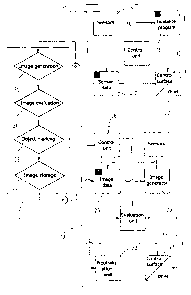
La présente invention concerne un procédé pour détecter et neutraliser des objets sous-marins, en particulier des mines, qui se trouvent dans une zone marine. Selon ce procédé, une image du fond marin en deux ou en trois dimensions est établie à l'aide d'un premier véhicule sous-marin automatique (12), au cours d'une mission d'exploration dans une partie de zone marine, au moyen de capteurs optiques et/ou acoustiques (14). Une fois la mission d'exploration terminée, cette image est analysée quant à la présence d'objets sous-marins. Au moins un objet sous-marin présent sur l'image est marqué, puis l'image présentant la marque d'objet est enregistrée en mémoire dans un second véhicule sous-marin automatique (13) qui est équipé de capteurs identiques (20) et également d'une unité de neutralisation (22).


Abrégé anglais


In a method for detection and neutralization of
underwater objects which are present in a sea region,
in particular mines, a two-dimensional or
three-dimensional image of the seabed is created by means of
an unmanned first underwater vehicle during a
reconnaissance mission in a sea region section by means
of optical and/or acoustic sensors, and this image is
evaluated for the presence of underwater objects, after
completion of the reconnaissance mission. At least one
underwater object which is present is marked in the
image, and the image which has been provided with the
object marking is stored in an unmanned second
underwater vehicle, which is equipped with the same
sensors and additionally with a neutralization unit.
During a neutralization mission by the second
underwater vehicle in the same sea region section,
image elements of the seabed are created continuously
by means of the sensors and are compared with the
stored image of the seabed. The second underwater
vehicle is guided to the marked underwater object on
the basis of the comparison data, and activates the
neutralization unit there.

Revendications

Note : Les revendications sont présentées dans la langue officielle dans laquelle elles ont été soumises.


-8-
CLAIMS
1. Method for detection and neutralization of
underwater objects which are present in a sea region,
in particular mines, using at least one unmanned
underwater vehicle which is equipped with optical
and/or acoustic sensors, characterized by the following
method steps:
- during a reconnaissance mission by the underwater
vehicle in a sea region section, a two-dimensional
or three-dimensional image of the seabed is
created by means of the sensors in the underwater
vehicle,
- after conclusion of the reconnaissance mission,
the image is evaluated for the presence of
underwater objects and at least one underwater
object that is present in the image is marked,
- the image that has been provided with at least one
underwater object marking is stored in at least
one second underwater vehicle, which is equipped
with the same sensors as the first underwater
vehicle and additionally with a neutralization
unit,
- during a neutralization mission by the second
underwater vehicle in the same sea region section,
image elements of the seabed are created
continuously by means of the sensors in the second
underwater vehicle, and are compared with the
stored image,
- the second underwater vehicle is guided to the
marked underwater object on the basis of the
comparison data, and

-9-
- the neutralization unit is activated at the
location of the underwater object.
2. Method according to Claim 1, characterized in that
the topography of the seabed and/or the bed
characteristic of the seabed down to a predetermined
bed depth are/is recorded as an image of the seabed.
3. Method according to Claim 2, characterized in that
at least one high-resolution camera is used as optical
sensors, and a short-range sonar and/or sediment echo
sounder or a parametric sonar is used as acoustic
sensors.
4. Method according to Claim 3, characterized in that
the short-range sonar is operated in the side-looking
mode or in the forward-looking mode.
5. Method according to one of Claims 1 to 4,
characterized in that an explosive charge which is
carried in the second underwater vehicle is used as the
neutralization unit.
6. The method according to Claim 5, characterized in
that the explosive charge is integrated in the second
underwater vehicle.
7. Method according to one of Claims 1 to 4,
characterized in that a tool which is arranged on the
second underwater vehicle is used as the neutralization
unit.
8. Method according to one of Claims 1 to 6,
characterized in that the first underwater vehicle is
remotely controlled or is operated autonomously during
the reconnaissance mission, and the at least second

-10-
underwater vehicle is operated autonomously during the
neutralization mission.

Description

Note : Les descriptions sont présentées dans la langue officielle dans laquelle elles ont été soumises.


CA 02590850 2007-06-13
`
204.10WO
23 Nov, 2005
- 1 -
ATLAS ELEKTRONIK GmbH
Bremen
METHOD FOR DETECTING AND NEUTRALIZING
SUBMARINE OBJECTS
The invention relates to a method for detection and
neutralization of underwater objects which are present
in a sea region, in particular mines, of the generic
type defined in the precharacterizing clause of Claim
1.
In a known method for detection and destruction of
mines (EP 0 535 044 Bl), an unmanned, remotely
controlled underwater vehicle, a so-called ROV, as well
as a remotely controlled search and mine destruction
unit, which is equipped with an explosive charge for
mine destruction, are used, and are connected to one
another by means of a glass fibre cable. The ROV is
connected via a further glass fibre cable to a surface
vessel which has a sonar system for detection and
location of mines. The mine and search unit is also
equipped with a transponder, acoustic sensors such as a
short-range sonar, with optical sensors such as a TV
camera with an illumination unit, and with sensors for
measurement of actual data for navigation, such as the
direction of travel, the angle with respect to the
horizontal plane, the distance from the seabed and the
diving depth. The transponder corresponds with an
acoustic positioning system (APS), whose hydrophones
are arranged on the ROV. The ROV has an ejection unit,
a so-called launcher, to which the search and mine
destruction unit is subject. The search and mine
destruction unit is guided by means of the APS by an
operator, who is positioned in the surface vessel, to
the sonar beam, which is directed at the mine, from the
mine hunting sonar. The search and mine destruction

CA 02590850 2009-04-02
31560-2
- 2 -
unit, whose transponder signals are displayed on the mine
hunting sonar together with the mine echo signals, is then
controlled towards the mine by the operator in the sonar
beam from the mine hunting sonar. The mine is checked by
means of the TV camera, and the search and mine destruction
unit is moved by the operator to a position with respect to
the mine which is advantageous for destruction, and is then
remotely detonated by the operator. The exploding explosive
charge of the search and mine destruction unit which, for
example, may be a shaped charge, causes the mine to be
detonated, with the search and mine destruction unit also
being destroyed.
The invention is based on the object of specifying
a method of the type mentioned initially, by means of which
a sea region, in particular a coastal region, can be
searched quickly and efficiently for underwater objects
-which are present, in particular mines, and can be cleared
of these objects.
In accordance with this invention there is
provided a method for detection and neutralization of
underwater objects which are present in a sea region, in
particular mines, using at least one unmanned underwater
vehicle which is equipped with optical and/or acoustic
sensors, characterized by the following method steps:
during a reconnaissance mission by the underwater vehicle in
a sea region section, a two-dimensional or three-dimensional
image of the seabed is created by means of the sensors in
the underwater vehicle; after conclusion of the
reconnaissance mission, the image is evaluated for the
presence of underwater objects and at least one underwater
object that is present in the image is marked; the image
that has been provided with at least one underwater object

CA 02590850 2009-04-02
31560-2
- 2a -
marking is stored in at least one second underwater vehicle,
which is equipped with the same sensors as the first
underwater vehicle and additionally with a neutralization
unit; during a neutralization mission by the second
underwater vehicle in the same sea region section, image
elements of the seabed are created continuously by means of
the sensors in the second underwater vehicle, and are
compared with the stored image; the second underwater
vehicle is guided to the marked underwater object on the
basis of the comparison data, and the neutralization unit is
activated at the location of the underwater object.
The method according to the invention has the
advantage that the reconnaissance mission and the
neutralization mission are carried out separately by an
unmanned underwater vehicle in each case, so that the
neutralization mission can be assigned to a very precisely
located object. If more than one object is found in the
reconnaissance image, neutralization missions can be carried
out in parallel by different underwater vehicles at the same
time, so that the time to clear the sea region is
considerably shortened. During the neutralization mission,
the shortest route to the assigned object can be found
quickly, and the assigned object can also be reliably
identified on the

CA 02590850 2007-06-13
204.10WO
23 Nov, 2005
- 3 -
basis of an image comparison between the stored image,
in which the assigned object is marked, with the image
elements which are produced continuously by the sensors
during the movement of the underwater vehicle. There is
no need for any navigation device, for example a
direct-reckoning navigator, to preset the track of the
underwater vehicle which is moving autonomously in the
neutralization mission. In particular, the underwater
vehicles for neutralization can operate well away from
any manned mission control centre, for example a
surface vessel for coordination of the missions to be
carried out, so that the mission control centre is not
subjected to any danger, in particular for mine
clearance purposes. The underwater vehicle can, in
particular, enter coastal regions without any problem
which cannot be approached and cleared by conventional
mine clearance vehicles.
Expedient embodiments of the method according to the
invention together with advantageous developments and
refinements of the invention are specified in the
further claims.
The invention will be described in more detail in the
following text on the basis of an exemplary embodiment
which is illustrated in the drawing. In this case, the
drawing shows block diagrams of the components which
are required for the method in a reconnaissance drone
and in a neutralization drone, as well as a procedure
of method steps which are carried out in a mission
control centre.
In the drawing, 11 denotes a mission control centre,
for example a surface vessel or a submarine, from which
the mine search and clearance in a sea region is
coordinated. The sea region being approached is
subdivided in the mission control centre 11 into

CA 02590850 2007-06-13
204.10WO
23 Nov, 2005
- 4 -
detection and clearance sections, referred to in the
following text as sea region sections, in which
reconnaissance and clearance missions are carried out
successively or in parallel. The mission control centre
11 itself remains well away from the sea region
assigned for clearance throughout the entire operation,
so that it is never endangered.
12 denotes a first unmanned, autonomously acting
underwater vehicle, which carries out a reconnaissance
mission and is referred to in the following text as a
reconnaissance drone. 13 denotes a second unmanned,
autonomously acting underwater vehicle, which carries
out a neutralization mission, that is to say mine
destruction in the case of the mine clearance operation
described here, and this is referred to in the
following text as a neutralization drone. The
reconnaissance drone 12 has optical and/or acoustic
sensors 14, such as a high-resolution camera or a
short-range sonar, which is operated in the side-
looking mode or in the forward-looking mode, or else a
parametric sonar or a sediment echo sounder, as well as
a sensor data memory 17 for storage of the data
produced by the sensors. The reconnaissance drone 12
normally has a drive and control-surface device 15,
which is controlled by means of a guidance program
that is stored in a guidance program memory 16. All of
the components are actuated in the correct sequence by
a central control unit 18.
The neutralization drone 13 has the same sensors 20 as
the reconnaissance drone 12, and likewise has a drive
and control-surface device 21 and, in addition, a
neutralization unit 22, for example an explosive charge
or mine destruction charge. The data produced by the
sensors 20 is supplied to an image generator 23, which
is followed by an evaluation unit 24 whose input side

CA 02590850 2007-06-13
204.10WO
23 Nov, 2005
- 5 -
is still connected to a memory 25 for image data
storage. All of the components in the neutralization
drone 13 are actuated in the correct sequence by a
central control unit 26.
Any mines in the assigned sea region are detected and
neutralized by these two unmanned, autonomously
operating underwater vehicles in accordance with the
following method:
The reconnaissance drone 12 and the neutralization
drone 13 are transported by the mission control centre
11, preferably in large numbers, and are used as
required. After definition of a sea region section, a
specific guidance program is stored in the guidance
program memory 16 in the reconnaissance drone 12, on
the basis of which the reconnaissance drone 12 is
intended to move systematically over the sea region
section. In order to carry out a reconnaissance
mission, the reconnaissance drone 12 is placed in the
water from the mission control centre 11 and moves
through the sea region section in accordance with the
predetermined guidance program. The sensors 14 scan the
seabed in the sea region section, and produce sensor
data continuously, from which a two-dimensional or
three-dimensional image of the seabed can be created.
If a short-range sonar or a high-resolution camera is
used as a sensor 14, then the resultant image shows the
topography of that sea region section. If a sediment
echo sounder or a parametric sonar is used as a sensor
14, then an image of the bed characteristic of the
seabed down to a bed depth which is predetermined by
the penetration depth of the sensors is created in
addition to the topography. All of the sensor data is
stored in the sensor data memory 17.

CA 02590850 2007-06-13
204.10WO
23 Nov, 2005
- 6 -
After completion of the reconnaissance mission, the
reconnaissance drone 12 returns to the mission control
centre 11 where the sensor data is read from the
control data memory 27, and the two-dimensional or
three-dimensional image of the seabed in the sea region
section is created from the sensor data (image
generation 30) . As already mentioned, the image shows
either the topography or the topography and the bed
characteristic of the seabed in the sea region section.
The generated image is now evaluated for the presence
of underwater objects, in the described exemplary
embodiment mines (image evaluation 31). One underwater
object is selected from the identified objects, and is
marked in the image (object marking 32). The image
provided with the object marking is written to the
image data memory 25 in the reconnaissance drone 12
(image storage 33). If the image contains a plurality
of underwater objects, then a further underwater object
can be marked in the image, and the image with this
object marking is written to the image memory 25 in a
second reconnaissance drone 12.
The neutralization drone 13 that has been prepared in
this way is placed in the water from the mission
control centre 11, and is started to carry out the
neutralization mission. During the neutralization
mission, image elements of the seabed are created
continuously in the neutralization drone 13 by means of
the sensors 20, for which purpose the sensor data
produced by the sensors 20 is supplied to the image
generator 23, in which image elements are created
continuously which correspond to those sections of the
image that is stored in the image data memory 25 which
the neutralization drone 13 is in each case moving
through. The image elements created in the image
generator 23 are continuously compared in the
evaluation unit 24 with the image stored in the image

CA 02590850 2007-06-13
204.10WO
23 Nov, 2005
- 7 -
data memory 25, and the comparison data is used to
determine guidance data, which is supplied to the
control-surface device 21. The neutralization drone 13
is guided to the underwater object by these guidance
signals.
When the neutralization drone 13 has arrived at the
underwater object, as is likewise identified by
comparison of the image element created by the image
generator 23 of the area surrounding the object with
the image stored in the image data memory 25, the
central control unit 18 activates the neutralization
unit 22, for example an integrated explosive charge,
which causes the mine to explode, and thus destroys it.
Alternatively, the neutralization unit in the
neutralization drone 13 may also be a tool which is
used, for example, to sever the tether of anchored
tethered mines, which then float up and can be cleared
on the water surface.
In a modification of the described exemplary
embodiment, the image generation process which is
carried out in the mission control centre 11 can be
carried out instead in the reconnaissance drone 12, so
that the reconnaissance drone 12 itself produces a two-
dimensional or three-dimensional image of the seabed of
the sea region section that has been moved over, and
the image then just has to be evaluated for the
presence of mines in the mission control centre 11.
Instead of the autonomously acting reconnaissance drone
12, it is also possible to use a reconnaissance drone
which is remotely guided from the mission control
centre 11, for example a wire-guided reconnaissance
drone, which, with the exception of the guidance
program memory, has the same components.

Dessin représentatif
Une figure unique qui représente un dessin illustrant l'invention.
États administratifs

2024-08-01 : Dans le cadre de la transition vers les Brevets de nouvelle génération (BNG), la base de données sur les brevets canadiens (BDBC) contient désormais un Historique d'événement plus détaillé, qui reproduit le Journal des événements de notre nouvelle solution interne.

Veuillez noter que les événements débutant par « Inactive : » se réfèrent à des événements qui ne sont plus utilisés dans notre nouvelle solution interne.

Pour une meilleure compréhension de l'état de la demande ou brevet qui figure sur cette page, la rubrique Mise en garde , et les descriptions de Brevet , Historique d'événement , Taxes périodiques et Historique des paiements devraient être consultées.

Historique d'événement

Description Date
Le délai pour l'annulation est expiré 2012-12-03
Lettre envoyée 2011-12-01
Accordé par délivrance 2009-09-29
Inactive : Page couverture publiée 2009-09-28
Inactive : Taxe finale reçue 2009-07-08
Préoctroi 2009-07-08
Lettre envoyée 2009-04-27
Exigences de modification après acceptation - jugée conforme 2009-04-27
Inactive : Taxe de modif. après accept. traitée 2009-04-02
Modification après acceptation reçue 2009-04-02
Un avis d'acceptation est envoyé 2009-01-27
Lettre envoyée 2009-01-27
Inactive : Approuvée aux fins d'acceptation (AFA) 2009-01-06
Inactive : Déclaration des droits - Formalités 2007-12-11
Inactive : Déclaration des droits - Formalités 2007-10-19
Inactive : Page couverture publiée 2007-09-05
Inactive : Décl. droits/transfert dem. - Formalités 2007-09-04
Lettre envoyée 2007-08-30
Inactive : Acc. récept. de l'entrée phase nat. - RE 2007-08-30
Inactive : CIB en 1re position 2007-07-11
Demande reçue - PCT 2007-07-10
Toutes les exigences pour l'examen - jugée conforme 2007-06-13
Exigences pour une requête d'examen - jugée conforme 2007-06-13
Exigences pour l'entrée dans la phase nationale - jugée conforme 2007-06-13
Demande publiée (accessible au public) 2006-07-13

Historique d'abandonnement

Il n'y a pas d'historique d'abandonnement

Taxes périodiques

Le dernier paiement a été reçu le 2008-11-20

Avis : Si le paiement en totalité n'a pas été reçu au plus tard à la date indiquée, une taxe supplémentaire peut être imposée, soit une des taxes suivantes :

  • taxe de rétablissement ;
  • taxe pour paiement en souffrance ; ou
  • taxe additionnelle pour le renversement d'une péremption réputée.

Les taxes sur les brevets sont ajustées au 1er janvier de chaque année. Les montants ci-dessus sont les montants actuels s'ils sont reçus au plus tard le 31 décembre de l'année en cours.
Veuillez vous référer à la page web des taxes sur les brevets de l'OPIC pour voir tous les montants actuels des taxes.

Historique des taxes

Type de taxes Anniversaire Échéance Date payée
Taxe nationale de base - générale 2007-06-13
Requête d'examen - générale 2007-06-13
TM (demande, 2e anniv.) - générale 02 2007-12-03 2007-11-27
TM (demande, 3e anniv.) - générale 03 2008-12-01 2008-11-20
2009-04-02
Taxe finale - générale 2009-07-08
TM (brevet, 4e anniv.) - générale 2009-12-01 2009-11-20
TM (brevet, 5e anniv.) - générale 2010-12-01 2010-11-18
Titulaires au dossier

Les titulaires actuels et antérieures au dossier sont affichés en ordre alphabétique.

Titulaires actuels au dossier
ATLAS ELEKTRONIK GMBH
Titulaires antérieures au dossier
CHRISTIAN BLOHM
DIRK NEUMEISTER
Les propriétaires antérieurs qui ne figurent pas dans la liste des « Propriétaires au dossier » apparaîtront dans d'autres documents au dossier.
Documents

Pour visionner les fichiers sélectionnés, entrer le code reCAPTCHA :


Pour visualiser une image, cliquer sur un lien dans la colonne description du document. Pour télécharger l'image (les images), cliquer l'une ou plusieurs cases à cocher dans la première colonne et ensuite cliquer sur le bouton "Télécharger sélection en format PDF (archive Zip)" ou le bouton "Télécharger sélection (en un fichier PDF fusionné)".

Liste des documents de brevet publiés et non publiés sur la BDBC .

Si vous avez des difficultés à accéder au contenu, veuillez communiquer avec le Centre de services à la clientèle au 1-866-997-1936, ou envoyer un courriel au Centre de service à la clientèle de l'OPIC.


Description du
Document 
Date
(aaaa-mm-jj) 
Nombre de pages   Taille de l'image (Ko) 
Revendications 2007-06-12 3 75
Dessins 2007-06-12 1 19
Description 2007-06-12 7 316
Abrégé 2007-06-12 1 32
Dessin représentatif 2007-09-03 1 9
Description 2009-04-01 8 351
Abrégé 2009-09-08 1 32
Accusé de réception de la requête d'examen 2007-08-29 1 177
Rappel de taxe de maintien due 2007-08-29 1 112
Avis d'entree dans la phase nationale 2007-08-29 1 204
Avis du commissaire - Demande jugée acceptable 2009-01-26 1 163
Avis concernant la taxe de maintien 2012-01-11 1 171
PCT 2007-06-12 4 158
Correspondance 2007-08-29 1 25
Correspondance 2007-10-18 2 55
Taxes 2007-11-26 1 35
Correspondance 2007-12-10 2 65
Correspondance 2009-07-07 1 38