Note : Les descriptions sont présentées dans la langue officielle dans laquelle elles ont été soumises.
CA 02873874 2016-01-29
Satellite and Acoustic Tracking Device
TECHNICAL FIELD
The present invention relates to a method and device for tracking movements of
marine
animals or objects in large bodies of water and across significant distances.
BACKGROUND
The whale shark (Rhincodon typus) is a slow-moving, filter feeding shark and
is the largest
fish species in existence. Whale sharks as large as 12.6 meters have been
measured, and the species is
thought to grow even larger. Despite their appeal, very little is known about
the basic biology and
ecology of whale sharks. For example, little is known about their growth
rates, maturation size or age,
reproductive output, lifespan, or locations of breeding or birthing grounds.
Estimates of global whale
shark populations are unreliable and range widely from about 25,000 to 500,000
individuals.
While whale sharks are often observed feeding near the ocean surface, they are
capable of
diving to depths of more than 1000 meters. Since they have gills, and do not
need to resurface for air,
they can remain at significant depths for extended periods of time. This makes
traditional scientific
methods of estimating population size based on observation unreliable.
Moreover, whale sharks reside
throughout the tropics, and may not be restricted to living near coral reefs
where observations can
yield reliable population estimates for other species. Such a large
geographical distribution
complicates estimating global population, which in turn prevents conservation
and management
agencies from developing effective plans.
Understanding the movement patterns of large migratory species, such as whale
sharks, great
white sharks, tuna, and whales, is a critical step toward implementing
effective management plans.
Obtaining information about the movements of these
1
CA 02873874 2014-11-17
WO 2014/028084
PCT/US2013/041622
species would open a window into behaviors never before observed and, through
effective management plans, could result in population gains that would allow
certain
species to escape their endangered or threatened statuses. Understanding
movements of
these species could also benefit local economies situated near migratory
pathways, which
could attract sustainable eco-tourism revenue, and a portion of that revenue
could be used
to sustain effective management plans.
SUMMARY
In general, an unmanned surface vessel for tracking an acoustic transmitter
attached to a marine animal or object is described. The unmanned surface
vessel may
include a surface vessel, which is configured to track and follow the movement
of an
acoustic transmitter attached to a marine animal or other object. A two-way
communication module may be attached to the vessel and the communication
module
may be configured to communicate with a remote communication station. In at
least one
embodiment, the communication module may be configured to transmit information
to
the remote communication station. A GPS receiver may be attached to the
vessel. The
GPS receiver may be configured to receive location-based information from a
global
positioning system. Additionally, an acoustic hydrophone may be attached to a
bottom
surface of the vessel. The acoustic hydrophone may be configured to receive an
acoustic
signal transmitted from the acoustic transmitter attached to the marine animal
or object.
In at least one embodiment, the acoustic hydrophone is part of a three-element
hydrophone array. Each hydrophone element may be coupled to an independent
amplifier circuit.
A propulsion system may be attached to the bottom surface of the vessel. The
propulsion system may be configured to enable the vessel to follow the
movement of the
acoustic transmitter. The propulsion system may also include at least one
thruster
attached to the bottom surface of the vessel. In at least one embodiment, the
surface
vessel may include a digital compass. Additionally, the surface vessel
includes an
accelerometer to determine the acceleration of the vessel. The surface vessel
may also
one or more sensors for determining water temperature, water salinity, water
clarity,
oceanographic current information, plankton concentration, water depth, water
conductivity, or oxygen concentration. The surface vessel may also include a
solar
2
CA 02873874 2014-11-17
WO 2014/028084 PCT/US2013/041622
charging system comprising a battery, a solar panel attached to a top surface
of the vessel,
and a charge controller electrically connected between the battery and the
solar panel.
DESCRIPTION OF DRAWINGS
FIG. 1 is a perspective view of an example vessel equipped with a solar panel,
thruster mount, and communication mast.
FIG. 2 is a perspective view of the example vessel of FIG. 1 with the solar
panel
removed to show tubes that house electronics and a rechargeable battery pack.
FIG. 3 is a top view of the vessel of FIG. 2 showing drain holes.
FIG. 4 is a bottom perspective view of a simplified vessel with an acoustic
hydrophone array mounted proximate the bottom surface of the vessel.
FIG. 5 is a bottom view of a vessel with an acoustic hydrophone array that has
three hydrophones and six sextants.
FIG. 6 is a bottom view of vessel with an acoustic hydrophone array showing
differing acoustic signal distances from an acoustic transmitter to each
hydrophone in an
array.
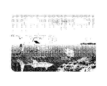
FIG. 7 is an example schematic for a circuit board for the vessel.
FIG. 8 is an existing approach for tracking a marine animal that requires
attaching
a satellite tag and an acoustic transmitter to the animal.
FIG. 9 is a simplified diagram of the vessel in the ocean.
FIG. 10 is a front perspective view of an example vessel.
FIG. 11 is a side perspective view of an example vessel.
FIG. 12 is an example acoustic transmitter.
FIG. 13 is an example independent amplifier circuit for a hydrophone.
FIG. 14 is an example schematic showing how hardware and software can
interface on the vessel.
DETAILED DESCRIPTION
Whale sharks can travel thousands of kilometers in a single year, but little
is
known about the details of their movements due to the shortcomings of existing
tracking
and tagging technologies. For example, a first existing tracking system relies
on a
satellite tag 805 attached to an animal, as shown in Fig. 8. Satellite tags
805 rely on the
3
CA 02873874 2014-11-17
WO 2014/028084 PCT/US2013/041622
Global Positioning System ("GPS"), which is a satellite-based navigation
system made up
of a network of 24 satellites placed into orbit by the U.S. Department of
Defense. GPS
satellites transmit two low power radio signals, designated as Li and L2.
Civilian GPS
uses the Li frequency of 1575.42 MHz in the UHF band. The radio signals can
pass
through clouds, glass, and plastic, but cannot pass through most solid
objects, such as
buildings or mountains. When passing through liquids, such as seawater, the
radio
signals are heavily attenuated. Therefore, satellite tags only function when
the marine
animal is at the ocean surface, making the satellite tags suitable for air-
breathing
mammals, such as whales and dolphins that surface frequently, but not suitable
for whale
sharks that remain below the surface for extended periods of time. Even for an
air-
breathing mammals, the satellite tags only provides information periodically
when the
animals surface. Consequently, small-scale movements cannot be tracked.
Another
down side of satellite tags is that they experience high failure rates in the
field, including
detaching from the whale shark or failing to transfer data when the fish
surfaces. Also,
retrieving the satellite tag from the whale shark after a study is complete
can be difficult,
so reusing the costly satellite tag is not always an option.
Each satellite tag 805 contains a GPS receiver that must acquire satellite
information very rapidly as the animal momentarily surfaces and must then
transmit
location information to a remote communication station or store the
information in a local
memory. This approach requires specially designed components, such as a GPS
receiver
and communication hardware that are more sophisticated than components found
in low-
cost, portable GPS receivers commonly used in automobiles. Not surprisingly,
satellite
tags 805 are expensive and typically cost thousands of dollars each.
A second existing tracking system requires an acoustic tag to provide details
about
small-scale movements at a resolution of about 100 meters. Like satellite
tags, acoustic
tags 810 must be attached to the animal, as shown in Fig. 8. Acoustic tags 810
are
generally used to monitor marine creatures living or moving in deep water or
salt water
habitats and can be used to track a wide variety of marine inhabitants, such
as salmon,
trout, plaice, cod, crabs, sea turtles, and many others. One downside of this
system is that
it requires a fixed underwater listening station equipped with hydrophones.
While this
technology is useful for monitoring a whale shark within a limited area, such
as near a
coral reef, it is not useful for monitoring large-scale movements outside of
that area, such
as monitoring a migration. Operating and maintaining this type of acoustic
tracking
4
CA 02873874 2014-11-17
WO 2014/028084 PCT/US2013/041622
system can be tedious. For instance, data must be retrieved from the
individual listening
stations, which are often located off the coasts of remote destinations that
can be difficult
to travel to by vehicle. In addition, the listening stations require periodic
maintenance
that must be conducted underwater by a diver. The costs associated with
retrieving the
data and maintaining the listening stations can quickly add up.
The method and system described herein for tracking marine animals or objects
incorporate the advantages of the preexisting tracking systems in a new way
that
overcomes at least the various shortcomings described above. The method and
system
can provide unprecedented insight into the behavior and movement patterns of
marine
animals, which will improve understanding of these animals and, subsequently,
improve
conservation efforts.
Radio waves are commonly used when tracking land animals. But salt water
presents unique challenges when tracking marine animals. As noted above, radio
waves
are readily attenuated by seawater, making them a poor choice for sending
messages
through water. Sound waves, on the other hand, are not impeded by seawater and
can
actually travel faster in water than in air, allowing for near real-time
listening over long
distances when using proper equipment. Therefore, acoustic signals provide a
useful
approach for tracking marine animals in real-time.
An acoustic telemetry system can include an acoustic transmitter for
transmitting
a sound wave, a hydrophone for listening for the sound wave transmitted by the
acoustic
transmitter, and a receiver for acquiring an electrical signal from the
hydrophone in
response to the sound wave. In reef-based telemetry systems, the hydrophone
can be
configured to listen to the sound waves, and the resulting electrical signal
can either be
stored in memory or converted into a radio signal for rapid transmission
through the air to
a receiver located on shore. To overcome the limitations of these fixed
position systems,
the acoustic telemetry system can be incorporated into a non-fixed, unmanned
surface
vessel that includes a propulsion system which allows it to follow a marine
animal or
object of interest across considerable distances.
The unmanned surface vessel for tracking marine animals can be configured to
track and follow the movement of an acoustic transmitter attached to a marine
animal.
Often these acoustic transmitters are simply referred to as "tags." The vessel
can
automatically track the location of the marine animal beneath the surface of
the ocean
while remaining on the ocean surface. The vessel can determine the location,
speed, and
5
CA 02873874 2014-11-17
WO 2014/028084
PCT/US2013/041622
heading of the animal, and from that information, determine how best to follow
and track
the animal in a way that conserves the vessel's stored energy while also
ensuring that the
animal's position does not exceed the range of the acoustic tracking system,
which could
result in losing track of the animal.
As shown in Fig. 1, the vessel 100 can be an autonomous, rugged, and
relatively
small vessel. The vessel can have a length of less than 10 meters, more
preferably less
than 5 meters, and even more preferably about 2 meters. With respect to the
lengths
listed above, the vessel can have a width of less than 5 meters, more
preferably less than
2.5 meters, and even more preferably about 1 meter. As shown in Figs. 2 and 3,
the
vessel can include one or more watertight compartments 205 for housing the
various
systems described herein, including electronics and a rechargeable battery
pack. In one
example, the vessel can be a fully sealed, watertight, self-powered, unmanned
vessel that
is capable of multi-day missions at sea.
To facilitate draining, the vessel can include one or more drain holes 305
extending from the top surface 105 to the bottom surface of the vessel 110, as
shown in
Fig. 3. The drain holes 305 allow the vessel to be self-draining and eliminate
any need
for a bilge pump. The drain holes 305 also provide pathways for wires and
facilitate
wiring of the various sensors, modules, and systems described herein.
To allow the vessel to track and follow the animal or object across the open
ocean, the vessel can include a propulsion system that contains a power
supply. The
propulsion system can include a steering system that is separate or integral.
For instance,
in one integrated configuration, the vessel can include two thrusters attached
to the
bottom surface of the vessel. The thrusters can be mounted directly to the
bottom surface
110 of the vessel or mounted within a thruster housing 125 attached to the
bottom surface
110 of the vessel, as shown in Fig. 1. The thrusters can be arranged in
parallel and
oriented with their discharge openings directed toward the stern of the
vessel. The
thrusters can be offset from each other by any suitable distance. By
controlling the
relative discharge from each thruster, the boat can be propelled forward and
steered right
or left. In an alternate configuration, the vessel can include a single
thruster with a rudder
positioned proximate the discharge opening. By adjusting the rudder, the
direction of the
discharge is altered, resulting in a change in the vessel's heading, similar
to the operation
of a personal watercraft. In another example, as shown in Figs. 10 and 11,
each thruster
1010 can be attached to a mount 1015 extending downward from the vessel. Each
6
CA 02873874 2014-11-17
WO 2014/028084 PCT/US2013/041622
thruster 1010 can be mounted outward from the side of the vessel to provide
stability and
to decrease the turning radius of the vessel. In one example, the thrusters
1010 can be
configured to propel the vessel at a speed up to about 4 knots.
To allow the vessel to engage in extended deployments requiring continuous
operation, it is desirable to include an energy recovery system aboard the
vessel. While
this system can take any suitable form, one low cost option is a solar
charging system,
which can easily be configured to replenish the vessel's stored energy. The
solar
charging system can include one or more solar panels 120 attached to the top
surface 105
of the vessel 100, as shown in Fig. 1, and a charge controller connected
between the
battery and the solar panel 120. In another example, the solar panels can be
mounted
below the surface of the water to provide cooling and to prevent the glass
surface from
fouling. For example, the solar panels can be mounted beneath the vessel at a
depth of 0
to 15 centimeters below the water surface. More preferably, the solar panels
can be
mounted beneath the vessel at a depth of 5 to 10 centimeters below the water
surface.
Energy can be stored in any suitable form, such as a battery. In one example,
the
battery can be a lithium polymer battery. The battery can be subdivided into a
plurality of
banks to provide flexibility in charging and discharging the battery. For
example, smart-
charging strategies can be used to improve battery life. Having a plurality of
battery
banks introduces redundancy into the storage system, so in the event that one
battery bank
fails, other banks will remain functional.
The vessel can include a system to harness wind energy. For instance, the
vessel
can include a sail that is deployable and retractable based on wind
conditions, such as
wind speed and wind direction. For example, if wind speed is suitable, the
sail can
deploy from a sail mast extending from the vessel or from the top surface of
the vessel
itself. However, if wind speed becomes unsuitable, the sail can retract to
prevent the
vessel from capsizing. Alternately, the vessel can include a wind turbine
configured to
charge the battery. The wind turbine can be attached to the top surface of the
vessel and
can have fixed or variable pitch blades. The wind turbine can be retractable
to prevent
damage to the turbine during inclement weather and to prevent the wind turbine
from
functioning as a sail, which could cause the vessel to capsize amid heavy
winds.
Power usage can be carefully controlled to prevent expending all available
stored
energy. The system can take into account various sources of information when
determining how best to follow and track the marine animal or object. If
characteristics
7
CA 02873874 2014-11-17
WO 2014/028084 PCT/US2013/041622
of the animal's movements are known (e.g. the animal commonly travels a
certain
distance and then rests), that information can be used to improve the vessel's
tracking
efficiency. In one example, if the animal is traveling at a certain speed, the
vessel can
travel at a slower speed to conserve energy with the expectation that the
animal will
eventually stop to rest, and the vessel will then catch up to the animal. This
approach
requires that the vessel continuously monitor the location of the animal to
ensure that the
animal is not approaching the limits of the vessel's sensors, which could
result in losing
track of the animal.
The vessel can take into account weather when selecting a speed at which to
propel the vessel. If several sunny days are forecast, and it is anticipated
that ample solar
energy will be collected in upcoming days, the vessel can be less concerned
with energy
conservation and can pursue the animal more aggressively. Also, the vessel can
increase
the frequency at which it transmits information to the remote communication
station.
Conversely, if several overcast days are forecast, and it is anticipated that
very little solar
energy will be collected, the system can be more conservative in its energy
usage.
Likewise, the frequency of routine functions can be decreased, and the
propulsion system
can be used only when necessary. Also, certain portions of the vessel, such as
sensors
and data loggers, can be temporarily deactivated until sufficient energy
stores are once
again achieved. It is also possible that a backup battery is activated if the
primary battery
is completely depleted.
The vessel can take oceanographic current information into account when
selecting a course to pursue the animal. This can allow the system to reduce
power
consumption by accounting for the direction and magnitude of ocean currents.
For
example, the system can determine if an indirect route will be faster and will
consume
less power than a direct route where the system is forced to work against
prevailing
currents. To further harness ocean currents, the vessel can include an
underwater sail.
The underwater sail can be retractable when not needed. The underwater sail,
like a
rudder, can lend stability to the vessel, and can be deployed during heavy
winds to
decrease the likelihood of capsizing. To further enhance stability, the vessel
can include
stabilizers 1005, as shown in Figs. 11 and 12. In one example, the stabilizers
1005 can be
positively buoyant and can be positioned at each corner of the vessel.
Acoustic hydrophones typically include a piezoelectric transducer that
generates
electricity when subjected to a pressure change. Since sound waves represent a
pressure
8
CA 02873874 2014-11-17
WO 2014/028084 PCT/US2013/041622
change, the piezoelectric transducer converts the sound waves transmitted by
the acoustic
transducer into an electrical signal. Through well-known methods, the
electrical signals
acquired from the various hydrophones can be used to determine the location of
the
acoustic transducer relative to the hydrophone array. The vessel can then
propel itself to
reduce the distance between itself and the acoustic transducer.
To determine the location of the animal relative to the position of the
vessel, the
vessel 100 can include at least one hydrophone attached to the vessel in any
suitable way.
For instance, the hydrophone can be submerged in the water beneath the vessel
or
attached to or disposed within the hull of the vessel and exposed to the
water. In one
example, the hydrophone 405 can be part of a hydrophone array 410, such as
three
hydrophones positioned in a triangular array on the bottom of the vessel 100,
as shown in
Figs. 4-6. Each hydrophone 405 can be connected to an independent amplifier
circuit
1305, as shown in Fig. 13, that is configured to process or amplify the
signal. When the
hydrophones 405 are arranged in a proper hydrophone array 410, the approximate
direction of an acoustic transducer 605 relative to the array 410 can be
determined by a
microprocessor, as shown in Fig. 6.
In one example, the vessel can use a hydrophone array 410 that produces a
sextant, as shown in Figs. 4-6. The acoustic transmitter ("tag") 605 can
transmit an
acoustic signal ("ping") that can be detected by the individual hydrophones
405 at
differing times depending on the location of each hydrophone relative to the
location of
the acoustic transmitter 605. The hydrophones 405 can be connected to a
microprocessor
that can resolve the order in which the acoustic signal reaches each
hydrophone. Based
on this sequential order of receipt, the location of the tag 605 relative to
the sextant can be
determined. In the example shown in Fig. 6, the acoustic signal would first be
heard by a
first hydrophone 610, then by a second hydrophone 615, and finally by a third
hydrophone 620. As shown in Table 1, this sequence corresponds with sextant A,
which
indicates that the acoustic signal is originating from a location within
sextant A.
Table 1
Element Sequence Origin Sextant
1, 2, 3 A
2, 1, 3 B
2, 3, 1 C
9
CA 02873874 2014-11-17
WO 2014/028084 PCT/US2013/041622
3, 2, 1 D
3, 1, 2 E
1, 3, 2 F
In this example, the vessel could power the thrusters to align the vessel's
heading with the
location where the acoustic signal is originating from, and the vessel could
continue
tracking the target animal or object. This process of heading correction can
be
continuously or periodically repeated to allow for accurate tracking. The
microprocessor
can be configured to receive inputs from any of the systems or sensors
described herein to
further enhance the accuracy of tracking and to do so in an efficient manner.
Once the direction of travel of the animal or object is determined, the vessel
can
respond accordingly. The vessel can also calculate the distance from the
acoustic
transducer 605 to the hydrophone array. Knowing this distance allows the
vessel to
respond in a more sophisticated manner, since over time, the velocity of the
animal can be
determined from the distance information, which dictates how aggressively the
vessel
should pursue the animal.
Any suitable type of hydrophone, or an equivalent device, can be used to
facilitate
tracking. Likewise, if an improvement over existing hydrophones is discovered,
that
device could also be used with the vessel. In one example, the hydrophone 405
can be a
focused transducer with a spherical body around the hydrophone to focus the
signals
being transmitted from the acoustic transmitter 605 attached to the animal
The vessel can include a two-way communication module attached to the vessel
100, and the communication module can be configured to transmit and receive
communication signals to and from, respectively, a remote communication
station. The
communication module can be attached to the vessel 100 or to a mast 130
extending
upwardly from the top surface 105 of the vessel to improve the module's
ability to
reliably transmit and receive information, as shown in Fig. 1. In one example,
the mast
130 can extend about 50 centimeters above the vessel. Elevating the
communication
module above the ocean surface can help overcome signal attenuation caused by
swells or
wind-generated waves. Although the communication module, as with all other
electrical
components aboard the vessel, can be contained within one or more watertight
cases or
compartments, elevating the communication module above the vessel can further
protect
CA 02873874 2014-11-17
WO 2014/028084
PCT/US2013/041622
the module by reducing exposure to the corrosive effects of seawater
perpetuated by
continuous submersion.
The communication module can incorporate UHF, GSM, and/or satellite
communication systems. Each of these systems is well-developed and reliable,
and
incorporating redundant communication systems can further enhance reliability.
Having
redundant systems, while not necessary, can provide more options when
selecting a
suitable channel or frequency on which to transmit and receive signals. Also,
depending
on the location of the vessel relative to the remote communication station and
the amount
of stored energy, the vessel can select an appropriate mode of communication
to optimize
the likelihood of successful communication while also minimizing power
consumption.
A user at the remote communication station, which can be located on shore, on
an ocean-
going vessel, or on any type of aircraft, can transmit high-level commands to
the
communication module, thereby enabling on-the-fly changes to the vessel's
mission.
Such changes can allow the user to instruct the vessel to avoid certain
dangers, such as
passing ships or inclement weather. The vessel can also be instructed to
return home if a
problem is detected that cannot be resolved remotely or if the vessel loses
track of the
animal or object it is tracking.
In addition to receiving commands and information form the remote
communication station, the vessel can also transmit information to the remote
communication station. For example, the communication module can transmit real-
time
updates and status reports based on information acquired from the various
sensors, such
as water temperature and oceanographic current information, and from various
onboard
systems, such as the propulsion and energy storage systems. One sample
transmission
from the vessel to the remote communication station can include information
such as
battery charge level, vessel speed versus time, animal location versus time,
animal speed
versus time, animal depth versus time, and GPS coordinates of the vessel
versus time.
To improve long-distance communications between the vessel and the remote
communication station, a communication relay can be used. The communication
relay
can be positioned at any point between the vessel and the remote communication
station.
For instance the communication relay can be onboard an ocean-going vessel or
on any
type of aircraft, such as a drone or high altitude balloon. The communication
relay can
increase the effective range of the vessel and decrease power consumption
associated
with transmitting and receiving signals long distances to the remote
communication
11
CA 02873874 2014-11-17
WO 2014/028084 PCT/US2013/041622
station. A communication relay can be particularly useful when the vessel is
deployed in
harsh or distant locations, such as the Arctic Ocean, where remote
communication
stations cannot easily be established.
The vessel can include various oceanographic sensors. For example, the vessel
can include one or more sensors for determining water surface temperature,
water
salinity, water clarity, oceanographic current information, plankton
concentration, water
depth, water conductivity, or oxygen concentration. A similar set of remote
sensors can
be attached to the acoustic transmitter, and remote sensor information can be
transmitted
to the vessel and received by the hydrophone. The vessel can thereby acquire
information
about conditions proximate the acoustic transducer, which is attached to the
animal and
likely well below the ocean surface. This can provide useful information about
the
animal's behavior and preferences.
The vessel can include one or more circuit boards 705, as shown in Fig. 7. In
one
example, the circuit board 705 can have a size of less than about 2 x 2
inches. The circuit
board can be housed in a watertight compartment 205, as shown in Fig. 2, and
located
under the solar panel 120. The circuit board can include various control and
processing
systems dedicated to the various components of the vessel. In one example, a
primary
control board can receive and process data from a plurality of other circuit
boards on the
vessel. More specifically, the primary board can acquire and process sensor
information,
propulsion system information, and battery charge information, and output real-
time data
that can be stored in memory or transmitted to the remote communication
station. The
circuit board can rely on locally stored software. The vessel can also rely on
the remote
communication station to process data from the vessel and to determine mission
commands, and those commands can then be transmitted to the vessel and
executed. By
outsourcing certain computations to the remote communication station, the
vessel can
conserve energy.
The vessel 100 can include a navigation module, which can include, for
example,
a digital compass, a GPS receiver, and/or an accelerometer. The navigation
module can
include one or more of these navigation components integrated into a circuit
board. The
navigation module can enable the vessel to determine orientation, rate of
movement, and
acceleration of the vessel. The navigation module can communicate with the
hydrophone
array 410 to determine the direction and distance of the acoustic transmitter
605 relative
to the hydrophone array.
12
CA 02873874 2016-01-29
The vessel can include a central control module that integrates the various
components and
systems and enables communication between the various components and systems.
For instance, the
central control module can allow receive information about position,
orientation, and velocity from the
navigation module, which can allow the propulsion system to be controlled
accordingly. Likewise, the
central control module can allow the communication module to receive
information from the
navigation module and the propulsion system, which can then be transmitted to
the remote
communication station. The user at the remote communication station can then
review the
information and issue new commands to the vessel as needed. Alternately,
calculations can be
completed onboard the vessel, and the vessel can autocorrect its mission based
on a host of factors and
sensor information discussed herein.
The system and method disclosed herein are not limited to tracking whale
sharks and can be
used to track any type of marine animal, object, underwater vessel, or human.
It can also be used for
monotonous tasks such as ocean floor mapping or measuring sea temperature and
salinity. It can also
be used for dangerous activities, such as nocturnal or military operations.
The system and method
disclosed herein have wide applicability in many markets including, for
example, environmental
management and conservation programs, eco-tourism, recreation, public and
private research, and
defense.
The system and method disclosed herein can be used as a safety device for
tracking scuba
divers beneath the ocean surface. For example, a scuba diver can carry an
acoustic transmitter, and the
vessel can track the scuba diver's movements making it easier for a dive boat
operator to track the
location of the diver. To enhance the vessel's visibility, the vessel can
include a brightly colored flag
or light attached to a mast or its top surface. The communication module on
the vessel can be used to
relay information between the diver and the dive boat operator.
In another example, the vessel can serve as a research tool for a scuba diver.
For instance, the
scuba diver can have an underwater research device configured to communicate
acoustically with the
unmanned surface vessel. The underwater research device can include a tablet
computer, or other
electronic device, housed in a waterproof case as described in U.S. Patent
Publication No.
20130027849, filed July 28, 2011, and International Publication No.
WO/2013/015818, filed on
August 1, 2011. In one example, the underwater research device can include a
communication device
that includes an acoustic transmitter and a
13
4. CA 02873874 2016-01-29
hydrophone that are compatible with the unmanned surface vessel's acoustic
transmitter and
hydrophone array.
The underwater research device can include a component, such as an acoustic
transmitter, for
sending underwater acoustic communications. A message, such as a call, text
message, email, data, or
file can be encoded by a microprocessor into an acoustic wave that can be
transmitted by the
underwater research device's acoustic transmitter through the water to the
unmanned surface vessel's
hydrophone array. In response to receiving the acoustic wave, the hydrophone
array on the surface
vessel can output an electrical signal that can be decoded by a microprocessor
and stored or
transmitted to the remote communication station. The underwater research
device can include a
component, such as a hydrophone, for receiving underwater acoustic
communications from the
unmanned surface vessel's acoustic transmitter.
The system can be configured to track more than one animal simultaneously,
such as several
fish within a school of fish, so that if one fish is lost, the system can
continue tracking the remaining
fish. To accommodate this, the system can employ code division multiple access
(CDMA), similar to
that found in cell phones, to allow for simultaneous detection of several
unique individuals on a single
acoustic frequency.
Details of one or more embodiments are set forth in the accompanying drawings
and
description. Other features, objects, and advantages will be apparent from the
description, drawings,
and claims. Although a number of embodiments of the invention have been
described, it will be
understood that various modifications may be made. The scope of the claims
should not be limited by
particular embodiments set forth herein, but should be construed in a manner
consistent with the
specification as a whole. It should also be understood that the appended
drawings are not necessarily
to scale, presenting a somewhat simplified representation of various features
and basic principles of
the invention.
14