Note : Les descriptions sont présentées dans la langue officielle dans laquelle elles ont été soumises.
CA 03095070 2020-09-24
WO 2019/185434 PCT/EP2019/057032
1
APPARATUS FOR WEED CONTROL
FIELD OF THE INVENTION
The present invention relates to an apparatus for weed control, to a system
for
weed control, to a method for weed control, as well as to a computer program
element and a
computer readable medium.
BACKGROUND OF THE INVENTION
The general background of this invention is weed control. Certain industrial
areas and areas around railway tracks need to have the vegetation controlled.
For railways,
such control improves visibility from the perspective of people on the train
such as the driver
and improves visibility from the perspective of people working on the tracks.
Such control
can lead to improved safety. Additionally, vegetation can disrupt or damage
tracks and
associated signaling and communication lines. Control of the vegetation is
then required to
mitigate this. Vegetation control, also called weed control, can be very time
and resource
consuming, especially if carried out manually. A weed sprayer train, with a
herbicide
contained in chemical tanks on the train can be sprayed onto the track and
surrounding area to
control the vegetation. However, such weed control can be expensive, and the
general public
increasingly wishes to see a reduction in environmental impact.
SUMMARY OF THE INVENTION
It would be advantageous to have improved apparatus for weed control.
The object of the present invention is solved with the subject matter of the
independent claims, wherein further embodiments are incorporated in the
dependent claims. It
should be noted that the following described aspects and examples of the
invention apply also
for the apparatus for weed control, the system for weed control, the method
for weed control,
and for the computer program element and the computer readable medium.
According to a first aspect, there is provided an apparatus for weed control,
comprising:
- an input unit;
- a processing unit; and
- an output unit.
CA 03095070 2020-09-24
WO 2019/185434 -2-
PCT/EP2019/057032
The input unit is configured to provide the processing unit with a least one
sensor data of an environment. The processing unit is configured to analyse at
least some of
the at least one sensor data to determine at least one ground property for
each of a plurality of
locations of the environment. The processing unit is configured to determine a
power setting
.. for activation of at least one electrode based weed control unit for each
of the plurality of
locations. Determination of the power setting for activation of the electrode
based weed
control unit comprises utilization of the at least one ground property
associated with that
location. The output unit is configured to output information useable to
activate the at least
one electrode based weed control unit.
In other words, sensor data of an environment have been acquired. There are a
number of electrode based weed control units that can each, through the use of
two electrodes,
apply a voltage between the electrodes in order that current flows from one
electrode to the
other via the ground and any local vegetation at that position. In doing so,
weeds can be
controlled or killed. However, depending on the ground properties at different
locations in the
environment, such as the ground being wet, or dry, or compacted, or crumbly,
or stony, or
having voids, or having significant vegetation root content, or being of
different soil types that
can have different electrical conduction properties, the configuration of an
electrode based
weed control unit can be required to be different in order to operate in an
optimum manner.
Thus, in some situations the ground can be more conductive than in other
situations, such as
when wet compared to dry or depending upon the type of soil and even if there
are particular
plant roots present that can provide conductive pathways. Thus, the voltage
between
electrodes and/or the current to be applied through the ground needs to be
varied in order to
provide for optimum weed control at that position. Similarly, if the ground is
crumbly or has
voids, the required optimum configuration is different to that when the ground
is compacted.
Furthermore, even if the ground is dry, different soil types such as peaty in
comparison to clay
type soils require different optimum configuration settings for an electrode
based weed
control unit. Also, whether the ground has significant vegetation root matter,
especially long
tap roots, can again change the way the current flows through the ground and
the optimum
.. configuration settings need to be varied accordingly. Therefore, sensor
data is acquired of the
environment, enabling ground properties to be determined, thereby enabling the
electrode
weed control units to be correctly configured in order to operate in an
optimum manner.
CA 03095070 2020-09-24
WO 2019/185434 -3-
PCT/EP2019/057032
In this manner, weeds that are present at different locations can be optimally
controlled, because an electrode based weed control unit is operating in an
optimum manner,
which takes into account the ground properties at a particular location.
In an example, the at least one sensor data comprises at least one image. The
processing unit is configured to analyse the at least one image to determine
at least one
activation location of the plurality of locations for activation of the at
least one electrode
based weed control unit.
In other words, an image or images of an environment have been acquired.
There is an electrode based weed control unit or a number of electrode based
weed control
units that can activate to pass current through the ground at a high potential
at one or more
locations determined from image analysis of those image(s), and where the
electrode weed
control technology is optimally configured for activation at that location. In
this manner,
weeds can be killed or controlled.
In this way, weeds in the environment can be controlled in areas on the basis
of
image analysis, enabling the high voltage electrodes to be applied (activated)
only where
required, and where for each application area the optimum configuration of the
electrode
based weed control unit is provided. For example, in areas of the environment
such as
concrete areas, tarmac areas, at locations of metal and or wooded railway
track sleepers, at the
location of the metal railway track, it can be determined that the electrodes
should not be
activated because weeds cannot or generally do not grow in these areas. In
this way, less
power is used and the environmental impact is reduced. Also, a determination
can be made of
areas of the environment, such as where there is sensitive equipment, that can
be imaged and
identified and where the electrodes are not activated in order not to damage
such equipment.
Also, if for example an animal was determined to be in the path of the high
voltage weed
killing device, image processing can identify the animal (such as a badger,
rabbit, dog, cat)
and the electrodes not activate, and the activation system even be raised
above the animal, in
order that the animal is not killed or harmed.
Also, it can be determined on the basis of image analysis where the electrodes
should be activated in addition to or in contrast to determining where they
should not be
activated, such as determining a location or locations of weeds and the
electrodes activated at
that location. Again, this enables the electrodes to be activated only where
required, with cost,
time and environmental impact advantages accruing.
CA 03095070 2020-09-24
WO 2019/185434 -4-
PCT/EP2019/057032
Thus, the apparatus can determine how to configure the electrodes for
different
locations based on ground properties, and the electrodes can then be primed to
activate, but
are only activated at particular locations on the basis of image processing of
image data.
In an example, analysis of the at least one image to determine the at least
one
.. activation location comprises a determination of at least one location of
vegetation.
In other words, image processing can be used in order to determine the areas
of
vegetation in the acquired imagery, from which a decision can be made to
activate the
electrode based weed control unit at that location. In this manner, the
electrodes can be
activated only at areas and around areas of vegetation. Thus, weeds in an area
can be
controlled through the targeted application of electrical power through the
plants and the
ground and hence through the plants' roots in order to control and kill weeds,
but application
is conducted only where there is vegetation, however the activation is at a
level that is
optimised for the ground conditions at that activation location.
In an example, determination of the power setting for activation of the at
least
one electrode based weed control unit for the activation location comprises
utilization of the
determined at least one location of vegetation.
In other words, a power setting for the electrode based weed control unit can
account for ground conditions, such as soil type, conductivity etc., and
additionally this power
setting can be further adjusted to account for vegetation that has been
detected via image
processing analysis. Thus, the apparatus can determine in effect a baseline
power setting that
accounts for the ground type, and prime the electrode based weed control unit
to operate at for
example a particular voltage and current, but the unit is not activated until
vegetation is
detected. But, when vegetation is detected a slight adjustment of the voltage
and/or power
settings can then be made to account for the vegetation, such as the size or
density of the
vegetation, and the unit can then be activated more rapidly because the
adjustments do not
have to be too large. Then, the electrode based weed control unit is operating
in a
configuration that is optimum with respect to vegetation being present at a
particular location
that accounts for the ground properties at that location. Thus, the power
setting to kill a
particular sized clump of weeds in clay can be different to that required to
kill the same sized
clump of weeds in a sandy soil, and if in an adjacent location (for either
clay or sandy
conditions) a smaller clump of weeds is found, again and appropriate
adjustment of the power
settings can be made, that can be different to that for the larger clump of
weeds.
In an example, analysis of the at least one image to determine the at least
activation location comprises a determination of at least one type of weed.
CA 03095070 2020-09-24
WO 2019/185434 -5-
PCT/EP2019/057032
In an example, determination of the power setting for activation of the at
least
one electrode based weed control unit for the activation location comprises
utilization of the
determined at least one type of weed.
In other words, the appropriate power setting for the electrode based weed
control unit can be selected to account for the type or types of weeds to be
controlled, as well
as the ground conditions where that particular type of weed is found.
To put this another way, image processing can be used to determine a type of
weed and its location, with sensor data used to determine a ground property
that provides a
first level of power setting, with the specific weed determined then
augmenting that first
power setting to provide a second power setting that is optimum for killing
that specific weed
at that specific location, accounting for the soil/ground conditions at that
location. The
location can be the location within the imagery. The location can be an actual
geographical
location. The location can be within the imagery and be able to be referenced
to a position of
the at least one electrode based weed control unit.
In an example, analysis of the at least one image comprises utilisation of a
machine learning algorithm.
In an example, the at least one ground property comprises one or more of: a
measure of ground moisture; a measure of ground texture; a measure of ground
conductivity;
a measure of ground temperature; a measure of ground hardness; a measure of
plant root
occurrence; a measure of ground type; a measure of salinity.
In an example, the at least one sensor data was acquired by at least one
sensor,
and wherein the input unit is configured to provide the processing unit with
at least one
location associated with the at least one sensor when the at least one sensor
data was acquired.
The location can be a geographical location, with respect to a precise
location
on the ground, or can be a location on the ground that is referenced to a
position or positions
of electrode based weed control units. In other words, an absolute
geographical location can
be utilized or a location on the ground that need not be known in absolute
terms, but that is
referenced to a location of the electrode based weed control units. Thus, by
correlating an
image with the location where it was acquired, electrical power can be
accurately applied to
that location.
In an example, the at least one sensor comprises one or more of: a camera; a
ground moisture sensor; a ground texture sensor; an electrical conductivity
sensor; a soil
insertion sensor; an electromagnetic induction sensor; a temperature sensor; a
ground
hardness sensor; a root occurrence sensor; a ground type sensor; a salinity
sensor; at least one
CA 03095070 2020-09-24
WO 2019/185434 -6-
PCT/EP2019/057032
reflectance sensor configured to operate in one or more of the visible, the
infrared, the near
infrared, the mid infrared, the far infrared.
According to a second aspect, there is provided a system for weed control,
comprising:
- at least one sensor;
- an apparatus for weed control according to the first aspect; and
- at least one electrode based weed control unit.
The at least one sensor is configured to acquire the at least one sensor data
of
the environment. The at least electrode based weed control unit is mounted on
a vehicle. The
apparatus is configured to activate the at least one electrode based weed
control unit.
In this way, a vehicle can move around an environment and control weeds
within that environment using one or more electrode based weed control units
at locations
where the power setting has been adjusted to take into account the ground
conditions at the
different locations. In this way, sensor data can be acquired by one platform,
for example one
or more drones that fly over an environment. That information is sent to an
apparatus, that
could be in an office. The apparatus determines the configuration for the
electrodes at
different locations within the environment. This information, can be provided
in a feature map
and/or weed control map, that is provided to a vehicle that moves around that
environment,
and at specific parts of the environment the electrodes are activated at the
correct power
setting. Alternatively, this could be occurring for one vehicle that acquires
the data, processes
the data, and that has the electrode systems on the vehicle, and the vehicle
determines the
optimum power settings as it travels around the environment that accounts for
the local
ground conditions and properties.
In an example, the apparatus is mounted on the vehicle; and wherein the at
least one sensor is mounted on the vehicle.
In this manner, the system can operate in real time or quasi real time, by
acquiring imagery, analysing it to determine what power setting to use where,
and then
activating the appropriate electrode based weed control unit at the required
specific location.
In an example, the at least one sensor comprises one or more of: a camera; a
ground moisture sensor; a ground texture sensor; a ground conductivity sensor;
an
electromagnetic induction sensor; a ground temperature sensor; a soil
insertion sensor; a
ground hardness sensor; a root occurrence sensor; a ground type sensor; a
salinity sensor, a
reflectance sensor.
CA 03095070 2020-09-24
WO 2019/185434 -7-
PCT/EP2019/057032
According to a third aspect, there is provided a method for weed control,
comprising:
a) providing a processing unit with a least one sensor data of an
environment;
b) analysing by the processing unit at least some of the at least one
sensor data to
determine at least one ground property for each of a plurality of locations of
the environment;
d) determining by the processing unit a power setting for activation of at
least one
electrode based weed control unit for each of the plurality of locations,
wherein determination
of the power setting for activation of the electrode based weed control unit
comprises
utilization of the at least one ground property associated with that location;
and
e) outputting by an output unit output information useable to activate the
at least
one electrode based weed control unit.
According to another aspect, there is provided a computer program element for
controlling an apparatus according to the apparatus of the first aspect and/or
system according
to the second aspect, which when executed by a processor is configured to
carry out the
method of the third aspect.
Advantageously, the benefits provided by any of the above aspects equally
apply to all of the other aspects and vice versa.
The above aspects and examples will become apparent from and be elucidated
with reference to the embodiments described hereinafter.
CA 03095070 2020-09-24
WO 2019/185434 -8-
PCT/EP2019/057032
BRIEF DESCRIPTION OF THE DRAWINGS
Exemplary embodiments will be described in the following with reference to
the following drawings:
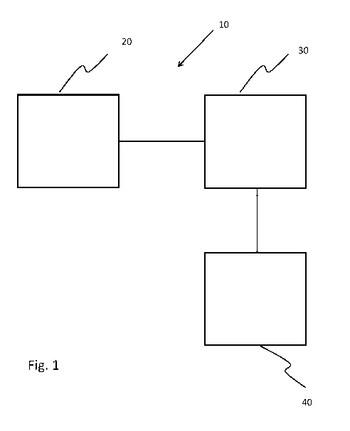
Fig. 1 shows a schematic set up of an example of an apparatus for weed
.. control;
Fig. 2 shows a schematic set up of an example of a system for weed control;
Fig. 3 shows a method for weed control;
Fig. 4 shows a schematic set up of an example of a system for weed control;
Fig. 5 shows a schematic set up of an example of a system for weed control;
Fig. 6 shows a schematic set up of an example of a part of a system for weed
control;
Fig. 7 shows a schematic set up of more detail of a section of the part of the
system for weed control shown in Fig. 6; and
Fig. 8 shows a schematic representation of a railway track and surrounding
.. area.
DETAILED DESCRIPTION OF EMBODIMENTS
Fig. 1 shows an example of an apparatus 10 for weed control. The apparatus 10
comprises an input unit 20, a processing unit 30, and an output unit 40. The
input unit 20 is
.. configured to provide the processing unit 30 with a least one sensor data
of an environment.
The processing unit 30 is configured to analyse at least some of the at least
one sensor data to
determine at least one ground property for each of a plurality of locations of
the environment.
The processing unit 30 is configured also to determine a power setting for
activation of at
least one electrode based weed control unit for each of the plurality of
locations.
.. Determination of the power setting for activation of the electrode based
weed control unit
comprises utilization of the at least one ground property associated with that
location. The
output unit 30 is configured to output information useable to activate the at
least one electrode
based weed control unit.
In an example, the apparatus is operating in real-time, where sensor data are
.. acquired and immediately processed and one, or more than one, electrode
based weed control
unit is configured and activated.
In an example, the apparatus is operating in quasi real time, where sensor
data
are acquired of an environment and immediately processed to determine the
correct
configuration of the electrode based weed control units. That information can
later be used by
CA 03095070 2020-09-24
WO 2019/185434 -9-
PCT/EP2019/057032
an appropriate system (or systems) that travel(s) within the environment and
activates the
electrode based weed control units at particular parts of that environment.
Thus for example, a
first vehicle, such as a car, train, lorry or unmanned aerial vehicle (UAV) or
drone equipped
with one or more sensors can travel within an environment and acquire sensor
data. This
sensor data can be immediately processed to determine ground properties around
an
environment, from which the configuration of the electrode weed control units
can be
determined for different locations in the environment. Later, a vehicle
equipped with an
electrode based weed control unit or units can travel within the environment
and activate the
electrodes at different specific areas of the environment, where the electrode
weed control
units are appropriately configured for the different locations.
In an example, the apparatus is operating in an offline mode. Thus, sensor
data
that has previously been acquired is provided later to the apparatus. The
apparatus then
determines what the configuration of the electrode based weed control units
should be at
different locations in the environment. This information is then used later by
one or more
vehicles that then travel within the area and activate their electrode weed
control units,
appropriately configured, to specific parts of the environment.
In an example, the output unit outputs a signal that is directly useable to
activate the at least one electrode based weed control unit.
According to an example, the at least one sensor data comprises at least one
image. The processing unit is configured to analyse the at least one image to
determine at
least one activation location of the plurality of locations for activation of
the at least one
electrode based weed control unit.
According to an example, analysis of the at least one image to determine the
at
least one activation location comprises a determination of at least one
location of vegetation.
According to an example, determination of the power setting for activation of
the at least one electrode based weed control unit for the activation location
comprises
utilization of the determined at least one location of vegetation.
According to an example, analysis of the at least one image to determine the
at
least activation location comprises a determination of at least one type of
weed.
According to an example, determination of the power setting for activation of
the at least one electrode based weed control unit for the activation location
comprises
utilization of the determined at least one type of weed.
CA 03095070 2020-09-24
WO 2019/185434 -10-
PCT/EP2019/057032
According to an example, analysis of the at least one image comprises
utilisation of a machine learning algorithm.
In an example, the machine learning algorithm comprises a decision tree
algorithm.
In an example, the machine learning algorithm comprises an artificial neural
network.
In an example, the machine learning algorithm has been taught on the basis of
a plurality of images. In an example, the machine learning algorithm has been
taught on the
basis of a plurality of images containing imagery of at least one type of
weed. In an example,
the machine learning algorithm has been taught on the basis of a plurality of
images
containing imagery of a plurality of weeds.
According to an example, the at least one ground property comprises one or
more of: a measure of ground moisture; a measure of ground texture; a measure
of ground
conductivity; a measure of ground temperature; a measure of ground hardness; a
measure of
plant root occurrence; a measure of ground type; a measure of salinity.
According to an example, the at least one sensor data was acquired by at least
one sensor. The input unit is configured to provide the processing unit with
at least one
location associated with the at least one sensor when the at least one sensor
data was acquired.
In an example, the location is an absolute geographical location.
In an example, the location is a location that is determined with reference to
the
position or positions of the electrode based weed control units. In other
words, an image can
be determined to be associated with a specific location on the ground, without
knowing its
precise geographical position, but by knowing the position of the electrode
based weed
control units with respect to that location at the time the image was
acquired, the required
power can then be applied at a later time at that location by moving the
appropriate electrode
based weed control unit to that location, for example through movement of a
vehicle to which
the electrode based weed control unit is attached. Thus, for example one or
more sensors can
be mounted on a vehicle, such as a train, forward of the position where
electrodes for
controlling weeds are mounted. Knowledge of the distance between these
mounting positions,
and a speed of the train, enables sensor data to be acquired at a location and
then at an
appropriate time later depending upon the speed of the train, the electrodes
can be activated at
the same location where the sensor data was acquired.
In an example, a GPS unit is used to determine, and/or is used in determining,
the location of the at least one sensor when specific sensor data were
acquired.
CA 03095070 2020-09-24
WO 2019/185434 -11-
PCT/EP2019/057032
In an example, an inertial navigation unit is used alone, or in combination
with
a GPS unit, to determine the location of the at least one sensor when specific
data were
acquired. Thus for example, the inertial navigation unit, comprising for
example one or more
laser gyroscopes, is calibrated or zeroed at a known location and as it moves
with the at least
one sensor the movement away from that known location in x, y, and z
coordinates can be
determined, from which the location of the at least one sensor when sensor
data were acquired
can be determined.
In an example, image processing of acquired imagery is used alone, or in
combination with a GPS unit, or in combination with a GPS unit and inertial
navigation unit,
to determine the location of the at least one sensor when specific data were
acquired. Thus
visual markers can be used alone, or in combination with GPS derived
information.
According to an example, the at least one sensor comprises one or more of: a
camera; a ground moisture sensor; a ground texture sensor; an electrical
conductivity sensor;
a soil insertion sensor; an electromagnetic induction sensor; a temperature
sensor; a ground
hardness sensor; a root occurrence sensor; a ground type sensor; a salinity
sensor; at least one
reflectance sensor configured to operate in one or more of the visible, the
infrared, the near
infrared, the mid infrared, the far infrared.
Fig. 2 shows an example of a system 100 for weed control. The system
comprises at least one sensor 110, an apparatus 10 for weed control as
described with respect
to an example or combination of examples described above with reference to
Fig. 1. The
system 100 also comprises at least one electrode based weed control unit 120.
The at least one
sensor 110 is configured to acquire the at least one sensor data of the
environment. The at
least electrode based weed control unit 120 is mounted on a vehicle 130. The
apparatus 10 is
configured to activate the at least one electrode based weed control unit 120.
According to an example, the apparatus is mounted on the vehicle, and the at
least one sensor is mounted on the vehicle.
In an example, the vehicle is a train.
In an example, the vehicle is a lorry or truck or Unimog.
In an example, the input unit is configured to provide the processing unit
with
at least one location associated with the at least one sensor when the at
least one sensor data
was acquired. In an example, the location is a geographical location.
CA 03095070 2020-09-24
WO 2019/185434 -12-
PCT/EP2019/057032
According to an example, the at least one sensor comprises one or more of: a
camera; a ground moisture sensor; a ground texture sensor; a ground
conductivity sensor; an
electromagnetic induction sensor; a ground temperature sensor; a soil
insertion sensor; a
ground hardness sensor; a root occurrence sensor; a ground type sensor; a
salinity sensor, a
reflectance sensor.
In an example, the moisture sensor comprises a frequency domain
reflectometer or time domain transmission or time domain reflectometer ¨ in
this way a probe
or probes can be inserted into the ground and from signal frequency or speed
of propagation
signatures the dielectric constant of a volume element of the ground can be
determined, from
which the moisture content can be determined.
In an example, the moisture sensor comprises a ground resistance sensor
determining the resistance between two electrodes or probes inserted into the
ground, from
which the moisture content can be determined in addition to the ground
resistance and
conductivity itself.
In an example, the ground texture and hardness is determined from the force
required to insert one or more probes into the ground.
In an example, the ground temperature is measure using a temperature probe
that is inserted into the ground.
In an example, the root occurrence sensor comprises a camera that acquires
images, the analysis of which can be used to determine the types of weed
present and their
ground density from which the expected occurrence of roots and the types of
roots in the
ground can be determined.
Additionally, a reflectance signal from the ground, which could be
spectrographically interrogated, can be analysed to provide information
regarding the ground
properties.
In this manner, one or more sensors or probes can be pushed into the ground,
or otherwise acquire data at that position, and the ground properties
determined. This can
occur in real time, where the sensors or probes are mounted on the vehicle
ahead of the
electrode based weed control units, and are continuously pushed into the
ground pulled out
.. and then pushed into the next section of ground as the vehicle moves
forward, and/or image
or reflectance sensor data acquired. The ground properties are then
determined, and the
electrode based weed control units can be correctly configured, such that if
they are required
to be activated at any position they are already correctly primed to do so in
an optimum
manner.
CA 03095070 2020-09-24
WO 2019/185434 -13-
PCT/EP2019/057032
Fig. 3 shows a method 200 for weed control in its basic steps. The method 200
comprises:
in a providing step 210, also referred to as step a), providing a processing
unit
with a least one sensor data of an environment;
in an analyzing step 220, also referred to as step b), analysing by the
processing
unit at least some of the at least one sensor data to determine at least one
ground property for
each of a plurality of locations of the environment;
in a determining step 230, also referred to as step d), determining by the
processing unit a power setting for activation of at least one electrode based
weed control unit
for each of the plurality of locations, wherein determination of the power
setting for activation
of the electrode based weed control unit comprises utilization of the at least
one ground
property associated with that location; and
in an outputting step 240, also referred to as step e), outputting by an
output
unit output information useable to activate the at least one electrode based
weed control unit.
In an example, the at least one sensor data comprises at least one image, and
wherein the method comprises step c), analysing 250 by the processing unit the
at least one
image to determine at least one activation location of the plurality of
locations for activation
of the at least one electrode based weed control unit.
In an example, step c) comprises determining at least one location of
vegetation.
In an example, step d) comprises utilizing the determined at least one
location
of vegetation.
In an example, step c) comprises determining at least one type of weed.
In an example, step d) comprises utilizing the determined at least one type of
weed.
In an example, step c) comprises utilising a machine learning algorithm.
In an example, the at least one ground property comprises one or more of: a
measure of ground moisture; a measure of ground texture; a measure of ground
conductivity;
a measure of ground temperature; a measure of ground hardness; a measure of
plant root
occurrence; a measure of ground type; a measure of salinity.
In an example, the at least one sensor data was acquired by at least one
sensor,
and wherein the input unit is configured to provide the processing unit with
at least one
location associated with the at least one sensor when the at least one sensor
data was acquired.
CA 03095070 2020-09-24
WO 2019/185434 -14-
PCT/EP2019/057032
In an example, the at least one sensor comprises one or more of: a camera; a
ground moisture sensor; a ground texture sensor; an electrical conductivity
sensor; a soil
insertion sensor; an electromagnetic induction sensor; a temperature sensor; a
ground
hardness sensor; a root occurrence sensor; a ground type sensor; a salinity
sensor; at least one
reflectance sensor configured to operate in one or more of the visible, the
infrared, the near
infrared, the mid infrared, the far infrared.
The apparatus, system and method for weed control are now described in more
detail in conjunction with Figs. 4-8, which relate to weed control in the
environment of a
railway track, with the vegetation control technology (also called weed
control technology) in
the form of a number of electrode based weed control units being mounted on
part(s) of the
train.
Fig. 4 shows an example of a system 100 for weed control. Within the system
several drones have sensors 110 in the form of cameras. The drones fly along a
railway track.
The cameras acquire imagery of the environment of the railway track, with this
being the
ground between the track and the ground to the sides of the track. The
environment being
imaged is that that is required to have weeds controlled. There need not be
several drones, and
one drone with one camera 110 can acquire the necessary imagery. Indeed, the
imagery could
have been acquired by a camera 110 or cameras 110 that were hand held by
personnel visiting
the railway track environment, by a plane, satellite or by a train that has
run along the railway
track for example. The imagery acquired by the cameras 110 is at a resolution
that enables
vegetation to be identified as vegetation and indeed can be at resolution that
enables one type
of weed to be differentiated from another type of weed. The acquired imagery
can be colour
imagery but need not be. The imagery acquired by the drones is transmitted to
an apparatus
10. The imagery can be transmitted to the apparatus 10 as soon as it has been
acquired by the
cameras 110, or can be transmitted at a later time than when it was acquired,
for example
when the drones have landed. The drones can have Global Positioning Systems
(GPS) and
this enables the location of acquired imagery to be determined. For example
the orientation of
cameras 110 and the position of the drone when imagery was acquired can be
used to
determine the geographical footprint of the image at the ground plane. The
drones can also
have inertial navigation systems, based for example on laser gyroscopes. In
addition to being
used to determine the orientation of the drone and hence of the camera,
facilitating a
determination of when on the ground the imagery has been acquired, the
inertial navigation
CA 03095070 2020-09-24
WO 2019/185434 -15-
PCT/EP2019/057032
systems can function alone without a GPS system to determine the position of
the drone, by
determining movement away from a known or a number of known locations.
Continuing with Fig. 4, a vehicle shown at the right of the picture is
travelling
along the railway track. This vehicle has a sensor or number of sensors 110.
These sensors are
used to determine the ground properties at different locations along the
railway track. As the
vehicle moves along, a number of sensors 110 in the form of probes are pushed
into the
ground, extracted and then pushed back into the ground at the next location as
the vehicle has
moved forward slightly. At the same time, a sensor 110 in the form of a
radiation reflectance
monitor determines the reflectance of the ground. As the probes are pushed
into the ground
the force required to push them a certain distance into the ground is measured
¨ alternatively a
constant force can be applied and the distance the probes are forced into the
ground measured.
In this way, a hardness of the ground at different locations can be
determined. The
conductivity of the ground between two probes is measured, and at least one of
the probes has
a thermometer to measure the ground temperature, and at least one of the
probes has a salinity
probe to measure ground salinity. A time domain transmission technique using
two probes is
used to determine a dielectric constant for ground at a location, from which
the moisture
content in the ground can be inferred. However, any of frequency domain
reflectometer or
time domain transmission or time domain reflectometer ¨ where a probe or
probes are
inserted into the ground and from signal frequency or speed of propagation
signatures the
dielectric constant of a volume element of the ground can be used, from which
the moisture
content can be determined. From the image data as acquired by sensors 110 in
the form of
cameras carried by drones, as discussed above weeds can be identified and the
expected root
growth determined; for example certain roots can aid the transmission of
electricity through
the ground and this ground property can be taken into account when configuring
the electrode
based weed control unit for activation. Ground induction probing using sensors
110 pushed
into the ground and spectral reflectance data using sensors 110 that acquire
reflectance data
from the ground is also acquired, and all this data constitutes ground
properties at that probed
location. These ground properties then mean that an electrode based weed
control unit needs
to be adjusted, in terms of voltage and/or current, in order to operate in an
optimum manner.
Offline testing is used to determine the optimum settings for this ground
property parameter
space and in effect forms a look-up table of settings. At each location, the
electrode based
weed control technology unit can then be appropriately configured to take into
account the
ground conditions at those locations, as determined from sensor based data
acquisition.
However, if there are no weeds at those locations, or it has been determined
through image
CA 03095070 2020-09-24
WO 2019/185434 -16-
PCT/EP2019/057032
analysis that there is sensitive equipment that would be damaged if a unit was
activated then
the units are not activated. The imagery acquired by the drones is however
analyzed to
determine the locations and identities of weeds at different locations, and
the electrode weed
control units are then activated at those locations. As discussed, at that
location the
operational characteristics of the electrode based weed control unit are
optimized for the
ground conditions at that location. However, when there is a weed present, the
configuration
may need to change slightly from this ground based optimum to take into
account the specific
type of weed and the size for example of a clump of weeds. Thus, information
relating to the
presence of a weed is not used only to activate the electrode based weed
control unit at that
.. location, but to further optimize the operational characteristics to
account for the weeds at that
location and to account for the ground conditions at that location.
In further detail, an input unit 20 of the apparatus 10 passes the acquired
imagery to a processing unit 30. Image analysis software operates on the
processor 30. The
image analysis software can use feature extraction, such as edge detection,
and object
detection analysis that for example can identify structures such as railway
tracks, sleepers,
trees, level crossings, station platforms. Thus, on the basis of known
locations of objects, such
as the locations of buildings within the environment, and on the basis of
known structure
information such as the distance between sleepers and the distance between the
railway
tracks, the processing unit can patch the acquired imagery to in effect create
a synthetic
representation of the environment that can in effect be overlaid over a
geographical map of
the environment. Thus, the geographical location of each image can be
determined, and there
need not be associated GPS and/or inertial navigation based information
associated with
acquired imagery. However, if there is GPS and/or inertial navigation
information available
then such image analysis, that can place specific images at specific
geographical locations
only on the basis of the imagery, is not required. Although, if GPS and/or
inertial navigation
based information is available then such image analysis can be used to augment
the
geographical location associated with an image. Thus for example, if on the
basis of GPS
and/or inertial navigation based information the centre of an acquired image
is deemed to be
located 22cm from the side edge and 67cm from the end of a particular railway
sleeper of a
section of railway, whilst from the actual acquired imagery, through the use
of the above
described image analysis, the centre of the image is determined to be located
25cm from the
edge and 64cm from the end of the sleeper, then the GPS/inertial navigation
based derived
location can be augmented by shifting the location 3cm in one direction and
3cm in another
direction as required.
CA 03095070 2020-09-24
WO 2019/185434 -17-
PCT/EP2019/057032
The processor 30 runs further image processing software. This software
analyses an image to determine the areas within the image where vegetation is
to be found.
Vegetation can be detected based on the shape of features within acquired
images, where for
example edge detection software is used to delineate the outer perimeter of
objects and the
outer perimeter of features within the outer perimeter of the object itself A
database of
vegetation imagery can be used in helping determine if a feature in imagery
relates to
vegetation or not, using for example a trained machine learning algorithm such
as an artificial
neural network or decision tree analysis. The camera can acquire multi-
spectral imagery, with
imagery having information relating to the colour within images, and this can
be used alone,
or in combination with feature detection to determine where in an image
vegetation is to be
found. As discussed above, because the geographical location of an image can
be determined,
from knowledge of the size of an image on the ground, the location or
locations of vegetation
to be found in an image can then be mapped to the exact position of that
vegetation on the
ground.
The processor 30 then runs further image processing software that can be part
of the image processing that determines vegetation location on the basis of
feature extraction,
if that is used. This software comprises a machine learning analyser. Images
of specific weeds
are acquired, with information also relating to the size of weeds being used.
Information
relating to a geographical location in the world, where such a weed is to be
found and
information relating to a time of year when that weed is to be found,
including when in flower
etc. can be tagged with the imagery. The names of the weeds can also be tagged
with the
imagery of the weeds. The machine learning analyser, which can be based on an
artificial
neural network or a decision tree analyser, is then trained on this ground
truth acquired
imagery. In this way, when a new image of vegetation is presented to the
analyser, where
such an image can have an associated time stamp such as time of year and a
geographical
location such as Germany or South Africa tagged to it, the analyser determines
the specific
type of weed that is in the image through a comparison of imagery of a weed
found in the new
image with imagery of different weeds it has been trained on, where the size
of weeds, and
where and when they grow can also be taken into account. The specific location
of that weed
type on the ground within the environment, and its size, can therefore be
determined.
The processor 30 has access to a database containing different weed types, and
the optimum mode of the electrode based weed control technology to be used in
controlling
that weed type, which has been compiled from experimentally determined data.
This
database can be the same database that accounts for configuration of the
electrode based weed
CA 03095070 2020-09-24
WO 2019/185434 -18-
PCT/EP2019/057032
control unit as a function of the ground properties, and provides a
juxtaposition of information
relating to different weeds in different ground types, For example, the
voltage and/or current
and indeed duration of application can vary to account for different weeds at
different
locations.
Thus, sensor data is acquired that enables an electrode based weed control
technology to be activated optimally to account for ground conditions and for
weeds at those
locations.
With continued reference to Fig. 4, following acquisition of all the sensor
data
from which a determination can be made, where electrode based weed control
units should be
activated to control weeds and what their specific configuration should be,
later a weed
control train 130 progresses along the railway track. The weed control train
has a truck that
contains a number of electrode based weed control units, with associated power
supplies. The
weed control train has a processor (not shown) which uses the above discussed
information of
where and in what manner the electrode based weed control units should be
activated. The
weed control train also has means to determine its geographical location,
which can be based
on one or more of GPS, inertial navigation, image analysis in order to locate
the position of
the weed control train and the specific locations of the units of the
electrode based weed
control technology. This means that when the weed control train passes through
the
environment the different units of the electrode based weed control technology
can be
activated at the specific locations of weeds, where the specific mode of the
weed control
technology activated at the location of the weed has been determined to be
optimal for that
task.
Fig. 5 shows another example of a system 100 for weed control. The system for
weed control of Fig. 5 is similar to that shown in Fig. 4. However, in Fig. 5
the weed control
train 130 has sensors 110 in the form of cameras, ground insertion probes and
ground
reflectance sensors as discussed above with respect to Fig. 4. The weed
control train 130 of
Fig. 5 also has an apparatus 10 as previously discussed. The cameras 110 on
the weed control
train 130 now acquire that imagery that was previously acquired by the drones,
and the probes
110 acquire the sensor data used to determine ground properties as discussed
above with
respect to Fig. 4. The processor 30 of the apparatus on the weed control train
130 processes
the acquired imagery to determine the location and type of weed, and the
ground properties
are determined to configure the electrode based weed control units for
activation along, where
the specific activation settings are further adjusted to take into account
weeds at specific
locations and the units are activated only where there are weeds. The exact
geographical
CA 03095070 2020-09-24
WO 2019/185434 -19-
PCT/EP2019/057032
location of the weed, and the exact location of particular ground properties,
are not then
required to be determined. Rather, on the basis of a relative spacing between
the sensors 110
themselves (cameras, ground insertion probes, and reflectance sensors) and
between the
sensors and the electrode based weed control units 120 housed in the truck of
the train 130
weeds can be located and identified along with the ground properties at that
location, and the
electrode based weed control units can be optimally configured to operate at
that location.
Then, from knowledge of the forward motion of the weed control train (its
speed), because
the distance between sensors 110 and units 120 are known, the units 120 can be
activated,
optimally configured, where weeds are located from the time taken to move the
units 120 to
.. specific locations where weeds have been identified as being located. In
this way, the weed
control train does not need to have a GPS and/or inertial navigation system or
image based
absolute geographical location determination means. Rather, to account for the
processing
required to determine the type of weed and its exact location within an image
and its exact
location on the ground ¨ within a train coordinate system ¨ and the time taken
to determine
the ground properties and time taken to configure the electrode based weed
control units
(leading to a total processing and configuration time) the sensors 110 must be
spaced from the
weed control technologies 120 by a distance that is at least equal to the
processing time
multiplied by the maximum velocity of the weed control train during weed
control. Thus for
example, if the total processing and configuration time takes 0.2s, 0.4s, or
0.8s for a train
travelling at 25m/s, with reference to Fig. 5 the sensors 110 must be spaced
forward of the
electrode based weed control technology units 120 by 5m, 10m or 20m for this
train velocity.
A reduction in train velocity enables the separation to be reduced. In
addition, the cameras
110 that are acquiring the imagery can have very short exposure times in order
that image
smear due to movement of the train during the exposure time is minimized. This
can be by
various means, including the use of cameras with short exposure times or short
pulsed
illumination via for example lasers or LEDs in combination with filters for
example.
However, the apparatus can use a GPS system and/or inertial navigation system
and/or image
analysis to determine an exact geographical location of weeds. This means that
a log of what
weeds have been controlled and how the electrode based weed control unit was
configured
.. can be saved where those weeds were located can be determined and saved, as
well as what
the ground properties were at those locations saved. Also, by generating an
exact
geographical location of the weeds, the electrode based weed control units 120
can have
associated location determining means, such as a GPS system and/or inertial
navigation
system and/or image based system that can be used to provide the exact
position of the units
CA 03095070 2020-09-24
WO 2019/185434 -20-
PCT/EP2019/057032
120. Thus, a front carriage of a train can have the sensors 110 that have
associated location
determining means such as GPS, and the data from which can be used to
determine the
location and type of weeds at exact known locations and the ground properties
at those
locations from which the units 120 can be optimally configured for activation
at those
locations. The last truck of a train could then have the electrode based weed
control units
housed within them. These latter trucks could be spaced from the front
carriage by many tens
if not hundreds of metres by load carrying trucks. The absolute separation of
the front carriage
to the rear carriages could then vary as the train goes up and down hill, but
because the trucks
with the weed control units know their exact locations as do the sensors, when
the units have
moved forwards to the position where a weed has determined to reside along
with a
determination of the ground properties at that location, the electrode based
weed control units
can activate at an optimal configuration at those exact locations to control
those weeds. The
electrode based weed control units extend laterally beneath and to the side of
the train, as
shown in Fig 6, in order to control weeds between the train tracks and to the
sides of the track
and up the banks if necessary.
Fig. 6 shows a rear view of the truck of a weed control train 130 as shown in
Figs 4-5, that has a number of high voltage electrode based weed control
technology units
120. Fig. 6 shows the rear view of this truck of the train, with the view
being that down the
railway track. Each electrode based unit is activating where a weed has been
determined to be,
at a voltage and current setting that takes into account the local ground
properties and the
specific weed and size of that weed. As discussed above, simple experiments
can be
performed for different weeds to determine the different voltages and power
levels and
duration of application required in order to kill different weed types,
enabling a database to be
constructed from which the mode of operation of the high voltage technology
can be selected.
Also, simple experiments can be performed to determine what the optimum
settings are for
the units as a function of different ground properties, again enabling a
database to be
constructed of settings. The units can then be set at a level appropriate for
the ground
conditions, and have that setting adjusted to take into account the weeds at
locations.
Continuing with Fig. 6, a number of separate electrode pairs of the weed
control technology extend laterally beneath the train and to the sides of the
train, with these
shown in greater detail in Fig. 7. Each electrode pair forms a separate
electrode based weed
control unit. The electrodes can also extend in a forward direction. When one
of these
electrode pairs passes over a weed that has been identified as one that should
be controlled by
CA 03095070 2020-09-24
WO 2019/185434 -21-
PCT/EP2019/057032
that high voltage based weed control the processor 30 activates the specific
pair or pairs of
electrodes at the specific location of the weed that is required to be
controlled by that high
voltage and power. In Fig. 6 there are two specific locations of such a weed,
one a large
clump to be found between the track that also extends to the right hand side
of the track and a
small clump to be found to the left of the tracks, and accordingly one
electrode pair has been
activated at the left hand side and a number activated beneath the train
extending to the right
hand side.
Fig. 7 shows more detail of the high voltage based weed control technology.
Pairs of electrodes are provided to form individual electrode based weed
control units, which
when activated cause electric current to flow from one electrode to the other
via the weed and
the ground including the weed's root. One sub-unit shown can have one
electrode pair or
indeed have a number of electrode pairs in order to provide for greater
resolution and a
smaller spatial extent of the application of such high voltage based weed
control. The high
voltage can be applied in a DC mode for a period of time or in an AC mode for
a period of
time.
Fig. 8 shows a representation of a railway environment, showing the railway
tracks and the ground to the side of the tracks. There are three different
areas of track with
different ground properties, shown as A, B, and C divided by dot-dash lines.
Area A is a
loamy soil type, and area B is also loamy type soil but is wetter than area A,
whilst area C is
more sandy with a large number of stones. If the electrode based voltage and
power setting
for area A is considered to be a baseline, then because the ground in area B
is more
conductive due to the presence of water the voltage and power setting for the
electrode based
weed control units can be lower than the baseline in area B. However, for the
sandy and stony
area C, the current cannot flow through the ground as efficiently as for a
dense ground
structure and as such the voltage and power setting for the electrode based
weed control unit
needs to be greater than the baseline.
Continuing with Fig. 8, a number of weeds are shown. A first type of weed
"Wl" exists in a small clump in areas A, B, and C. A second type of weed "W2"
only exists
in area B. For the first weed type "Wl", the setting for the electrode based
weed control unit
is different in each area (A, B, and C) because of the different ground
properties and the
optimized settings are respectively shown as 120a, 120c and 120d. In the
second area B, there
are two types of weed "Wl" and "W2". The ground properties are however the
same, leading
to a first degree or level of voltage/power being determined, which is then
adjusted to account
for the specific weeds being controlled. Therefore, in area B weed W1 is
controlled with
CA 03095070 2020-09-24
WO 2019/185434 -22-
PCT/EP2019/057032
optimized voltage and power setting 120c, whilst weed W2 is controlled with
optimized
voltage and power setting 120b. As discussed previously, voltage and power
settings, in an
optimized form, can different for the same weed type in ground of the same
ground properties
to account for the size of the clump, with a larger clump being controlled
with a higher level
of voltage/power. However, this has not been shown in Fig. 8 for purposes of
simplicity of
representation.
The above detailed examples have been discussed with respect to a railway,
however a weed control train, a truck or lorry or Unimog can have electrode
based weed
control units mounted on/within it that can use sensors to determine ground
properties and
types of weeds in order to control those specific weed types as discussed
above.
Image processing to enable analysis to determine a weed type
A specific example of how an image is processed, and determined to be
suitable for image processing in order that a type of weed can be determined
is now
described:
1. A digital image ¨ in particular a colored image ¨ of a weed is captured.
2. Areas with a predefined color and texture within the digital image are
contoured within a
boundary contour. Typically, one may expect one contoured area from one weed
plant.
However, there may also be more than one contoured area from different,
potentially not
connected leafs, from two weed plants, or the like. ¨ Such a detection or
determining
process detects boundaries of green areas of the digital image. During this
process at least
one contoured area ¨ e.g., one or more leafs, as well as one or more weed
plants ¨ may be
built comprising pixels relating to the weed within a boundary contour.
However, it may
also be possible, that the digital image has captured more than one leaf
and/or the stem.
Consequently, more than one contoured area may be determined.
3. Determining if the boundary contour covers a large enough area, and
determining a
sharpness (e.g. degree of focus) of the image data within the boundary
contour. This
firstly ensures that there will be sufficient image data upon which a
determination can be
made as to the type of weed, and secondly determines that a minimum quality of
the
digital image will be satisfied in order that the type of weed can be made.
4. If both criteria in 3) are satisfied, the digital image, and specifically
that within the
boundary contour is sent to the processing unit for image analysis by the
artificial neural
network to determine the type of weed as described above.
CA 03095070 2020-09-24
WO 2019/185434 -23-
PCT/EP2019/057032
In another exemplary embodiment, a computer program or computer program
element is provided that is characterized by being configured to execute the
method steps of
the method according to one of the preceding embodiments, on an appropriate
system.
The computer program element might therefore be stored on a computer unit,
which might also be part of an embodiment. This computing unit may be
configured to
perform or induce performing of the steps of the method described above.
Moreover, it may
be configured to operate the components of the above described apparatus
and/or system. The
computing unit can be configured to operate automatically and/or to execute
the orders of a
user. A computer program may be loaded into a working memory of a data
processor. The
data processor may thus be equipped to carry out the method according to one
of the
preceding embodiments.
This exemplary embodiment of the invention covers both, a computer program
that right from the beginning uses the invention and computer program that by
means of an
update turns an existing program into a program that uses invention.
Further on, the computer program element might be able to provide all
necessary steps to fulfill the procedure of an exemplary embodiment of the
method as
described above.
According to a further exemplary embodiment of the present invention, a
computer readable medium, such as a CD-ROM, USB stick or the like, is
presented wherein
the computer readable medium has a computer program element stored on it which
computer
program element is described by the preceding section.
A computer program may be stored and/or distributed on a suitable medium,
such as an optical storage medium or a solid state medium supplied together
with or as part of
other hardware, but may also be distributed in other forms, such as via the
intern& or other
wired or wireless telecommunication systems.
However, the computer program may also be presented over a network like the
World Wide Web and can be downloaded into the working memory of a data
processor from
such a network. According to a further exemplary embodiment of the present
invention, a
medium for making a computer program element available for downloading is
provided,
which computer program element is arranged to perform a method according to
one of the
previously described embodiments of the invention.
It has to be noted that embodiments of the invention are described with
reference to different subject matters. In particular, some embodiments are
described with
CA 03095070 2020-09-24
WO 2019/185434 -24-
PCT/EP2019/057032
reference to method type claims whereas other embodiments are described with
reference to
the device type claims. However, a person skilled in the art will gather from
the above and the
following description that, unless otherwise notified, in addition to any
combination of
features belonging to one type of subject matter also any combination between
features
relating to different subject matters is considered to be disclosed with this
application.
However, all features can be combined providing synergetic effects that are
more than the
simple summation of the features.
While the invention has been illustrated and described in detail in the
drawings
and foregoing description, such illustration and description are to be
considered illustrative or
exemplary and not restrictive. The invention is not limited to the disclosed
embodiments.
Other variations to the disclosed embodiments can be understood and effected
by those
skilled in the art in practicing a claimed invention, from a study of the
drawings, the
disclosure, and the dependent claims.
In the claims, the word "comprising" does not exclude other elements or steps,
and the indefinite article "a" or "an" does not exclude a plurality. A single
processor or other
unit may fulfill the functions of several items re-cited in the claims. The
mere fact that certain
measures are re-cited in mutually different dependent claims does not indicate
that a
combination of these measures cannot be used to advantage. Any reference signs
in the claims
should not be construed as limiting the scope.